
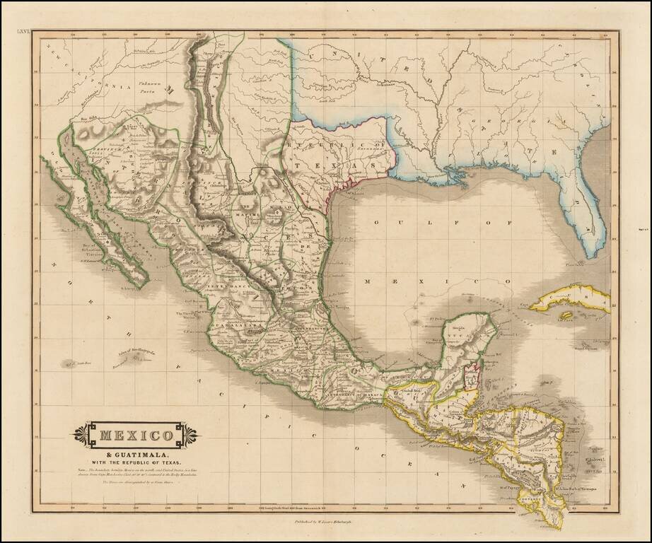
"Republic of Texas" in the Title of the Map Scarce map of Texas, Mexico, Upper California and contigous parts of the Southeastern US, naming the Republic of Texas. The present map is one of the only obtainable printed maps to name the "Republic of...
![Carte Des Etats-Unis Du Mexique…1838 [Republic of Texas]](/map/small/70909.jpg)
Fine example of Alexandre Emile Lapie's map of the Republic of Texas, New Mexico, Upper California and Mexico. One of the best large format maps of Mexico, Texas and Upper California to appear in a commercial atlas in the 1830s. Texas is clearly...
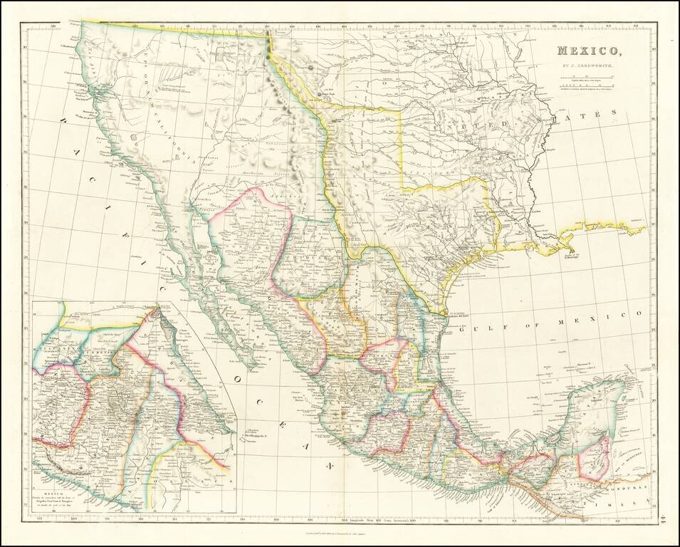
Mexico & The Republic of Texas Striking example of Arrowsmith's Map of Mexico, from the London Atlas, including the Republic of Texas in its largest configuration. The map provides a fantastic example of the Republic of Texas in earliest Republic...
![Mexique par Th. Duvotenay…1843 [Republic of Texas]](/map/small/67925.jpg)
Detailed map of Texas, Upper California, the Plains and Mexico, published in Paris. The map prominently shows the Republic of Texas, a mythological Lake Teguayo and pre-Fremont Western United States. Western border of Texas includes an odd eastern...
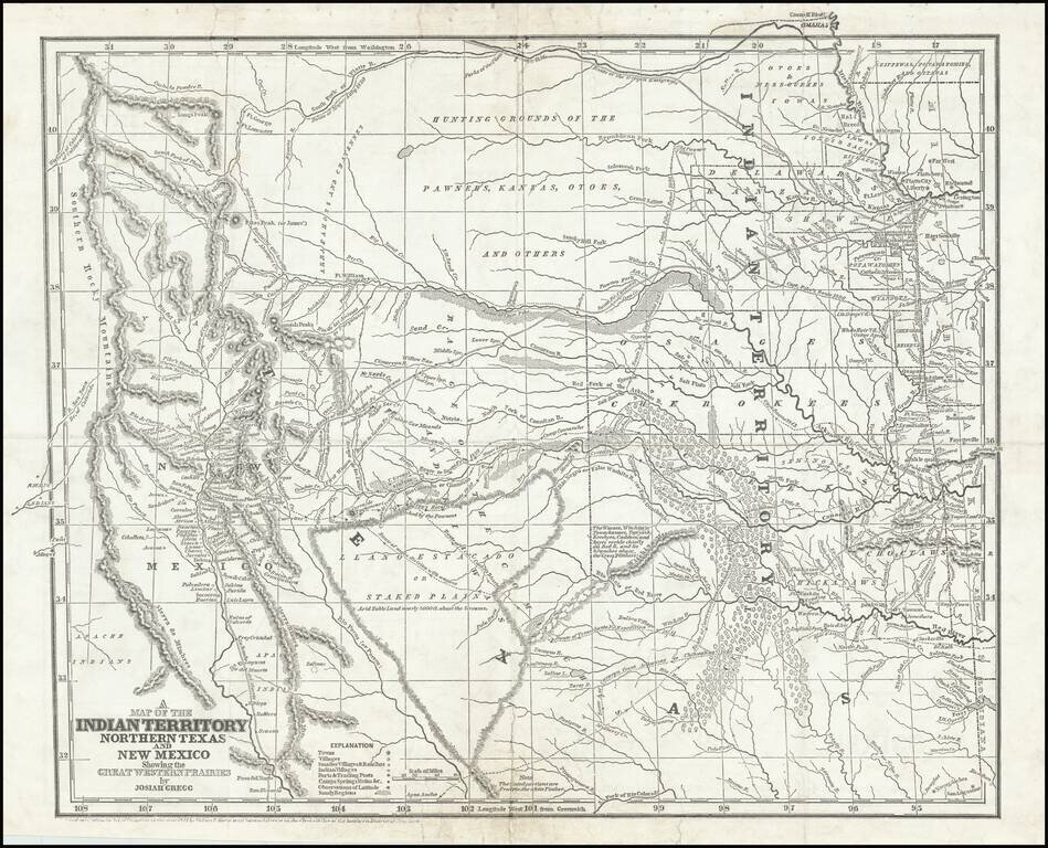
Josiah Gregg's Landmark Map of the Southwest & Northern Texas Fine example of Josiah Gregg's monumental map of Northern Texas & the Plains, from his monumental Commerce Of The Prairies, one of the classic accounts of the Transmississippi West...
Rare map showing the Republic of Texas (República de Tejas), one of only a few maps to specifically refer to Texas as "Republic of Texas," during the period between 1836 and 1845. The map was originally published in Sanchez de Bustamante's Nuevo...
![Mexico, Mittel-America, Texas [Republic of Texas]](/map/small/64181.jpg)
Nice example of Carl Flemming's detailed map of Texas and the Southwest, published shortly after Texas was annexed by the United States in 1845. The map was issued immediately after the annexation of Texas and prior to the creation of Utah and New...
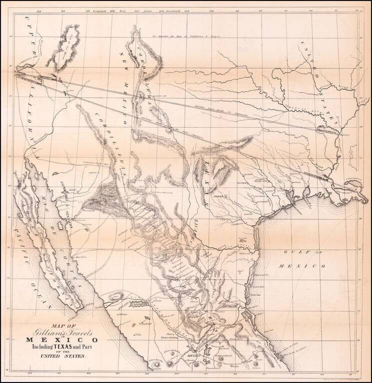
Transcontinental Railroad Routes To San Francisco in 1846! Scarce map of Texas, Upper California, Mexico and the Southwestern United States, prepared for Gilliam's Travels over the Table Lands and Cordilleras of Mexico during the Years 1843 and 44....

A German Map of the Republic of Texas Detailed map of the Republic of Texas at the start of the Mexican War. The massive stovepipe configuration is shown here, extending to Wyoming in the north, the Rio Grande in the west and the Red River and...

Including Manuscript Additions of the Overland Route To California and Other Important Points. Nice example of Mitchell's seminal map of Texas, Oregon, Upper California, Missouri Territory and a massive Indian Territory (covering most of Kansas and...
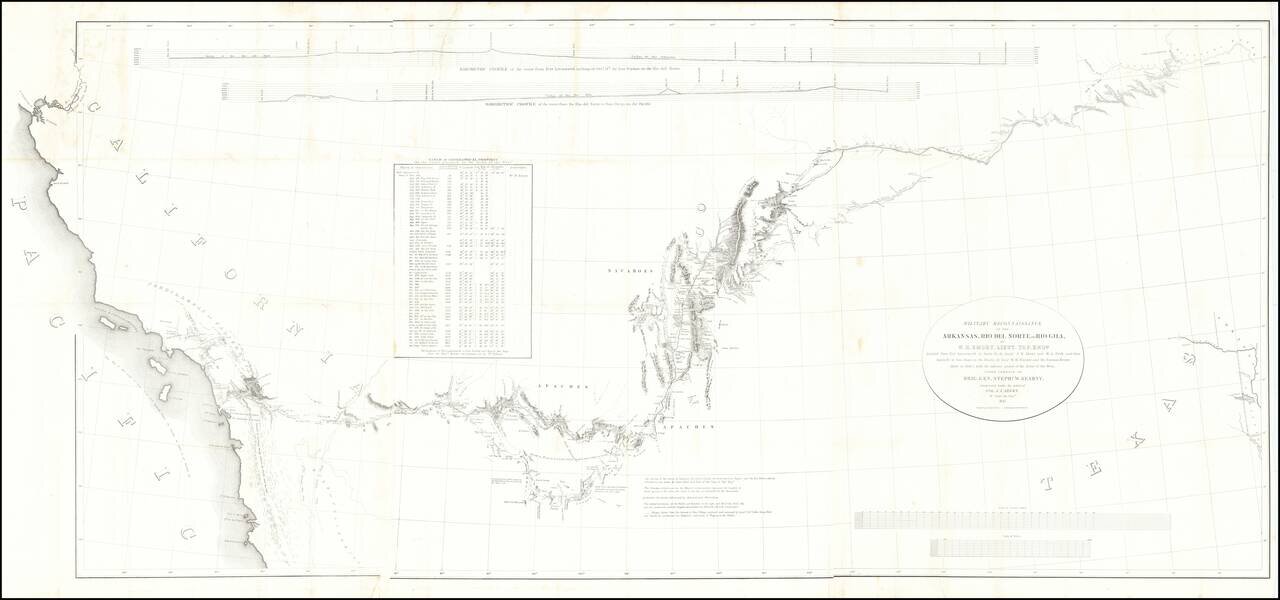
Fine example of the William Emory's milestone mapping of the Southwestern United State, from Ft. Leavenworth to the West Coast, from Emory's Notes of a Military Reconnaissance, from Fort Leavenworth, in Missouri, to San Diego, in California . . ., one...

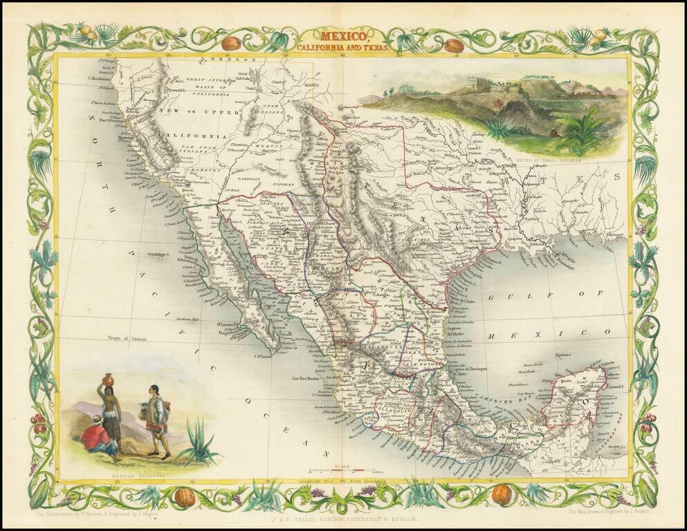
Excellent map of California, Mexico, Texas and the Southwest, published by A&C Black. The map covers all of Upper California and shows the missions, early forts and information immediately prior to the discovery of gold. Several settlement and...
![A New Map of Texas Oregon and California with the Regions adjoining Compiled from the most recent authorities... 1849 [Very Rare Variant Edition]](/map/small/60784.jpg)
Exceptionally Rare Gold Rush Variant of Mitchell's Famed Map of Texas, Oregon, and California. With Mitchell's Guide to California. Antique map of the American West by Samuel Augustus Mitchell. This is an example of the extremely rare 1849 edition,...
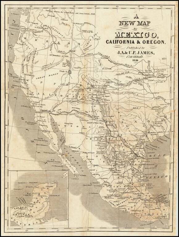
Scarce map of Texas and the West, published in Cincinnati. In Oregon Territory, a number of early American Forts are shown, along with Astoria and Oregon City. To the south, the Gold Region is shown in California, limited only to the area north of...
Rare variant edition of this decorative regional map of the Texas, California and the Southwest, featuring Texas in its Republic configuration, with Stovepipe reaching to Wyoming and Colorado. Upper California is shown with the Gold Regions...
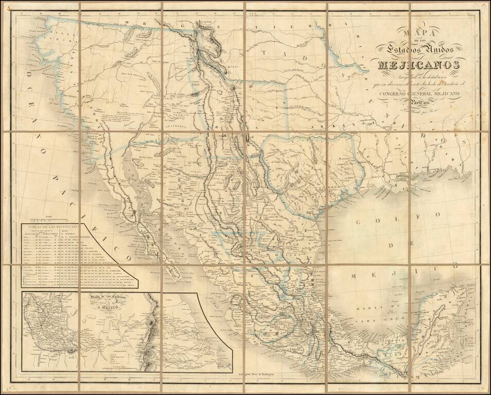
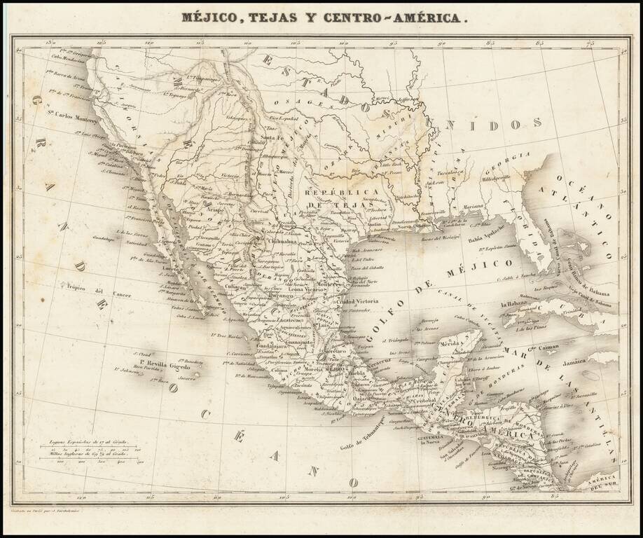
Rare second edition of the so-called Rosa map of Mexico, first published in Paris in 1837 and re-issued in 1851, at the request of the Congress of Mexico. Rosa's map is perhaps the rarest of the so-called Treaty Map sequence, which shaped the original...