
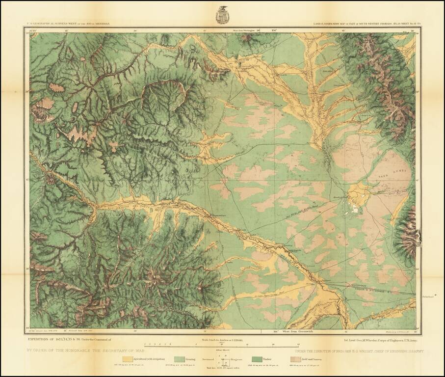
Detailed topographical map showing the region centered on Saguache County, Colorado. Shows towns, roads, mountains, rivers, lakes, hydrographical details, etc. The map was generated during the Wheeler Survey. The Wheeler Survey was a survey of a...
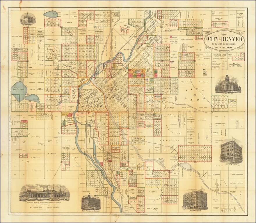
Rare Early Map of Denver Highly detailed map of the city of Denver, published by H.L. Thayer. The map is centered on the Platte River and includes the names of dozens of land owners, subdivisions and other details. In east Denver, the location of a...
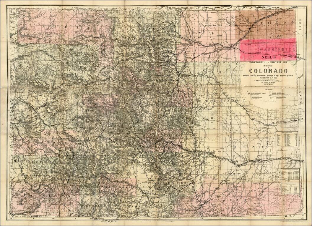
The rare 1885 edition of Nell's map of Colorado. A remarkably detailed map, certainly the most complete of Colorado to appear after statehood (1876). The map meticulously depicts the geographical and topographical details of the state, including...
The rare 1885 edition of Nell's map of Colorado. A remarkably detailed map, certainly the most complete of Colorado to appear after statehood (1876). The map meticulously depicts the geographicaland topographical details of the state, . including...
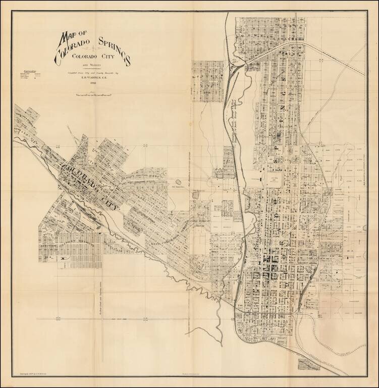
Unrecorded map of Colorado Springs, published by noted naturalist Edward Royal Warren in 1889. The map provides a meticulous view of the city, including early subdivision names, the location of major buildings, the location of the Colorado Midland...
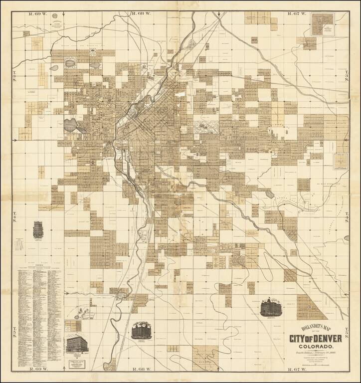
Fine separately issued map of Denver, published by Edward Rollandet in Denver. A fine large map, illustrating the early subdivisions in the city of Denver, with vignettes of the Windsor Hotel, Albany Hotel, Essex Building and Johnson Block. The map...
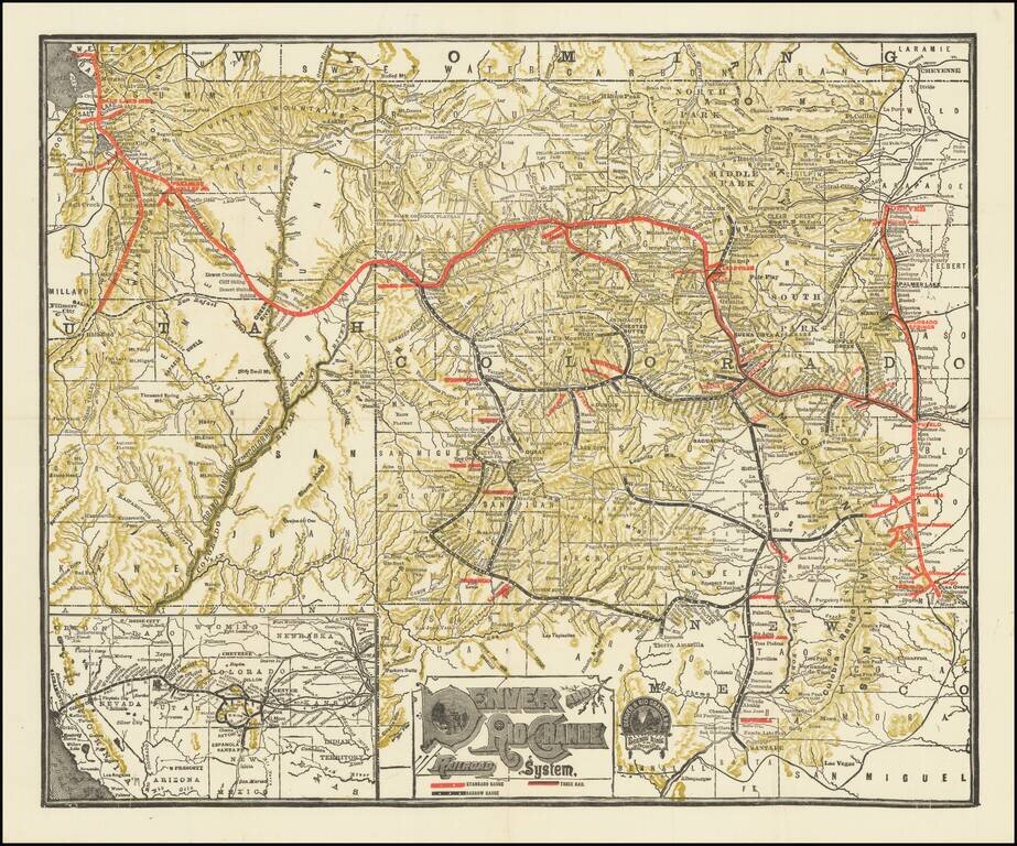
Detailed railroad map of Colorado and part of Utah. Promotional map for the Denver & Rio Grande Railroad. The border of Grand and Unitah Counties suggests a date of 1889 to 1890. The map was produced in numerous editions over the decades.
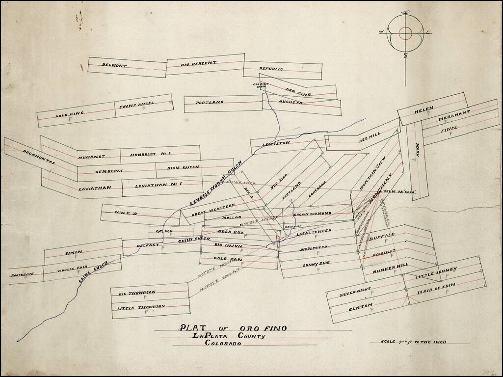
Hand drawn map of mining claims in the Oro Fino Mining District, in La Plata County, Colorado. The map is focused on the area around Gains Gulch and Leavenworth Gulch, extending north to Oro Fino Camp. Based upon the names of the claims, we date the...
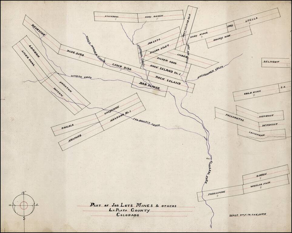
Hand drawn map of mining claims on or near Flagler's Fork and tributaries, in La Plata County, Colorado. The map is focused on the area Flagler's Fort and tributaries, including Fox Boulder Gulch, London Gulch, Miner Wonder Gulch, Stamboul Gulch and...
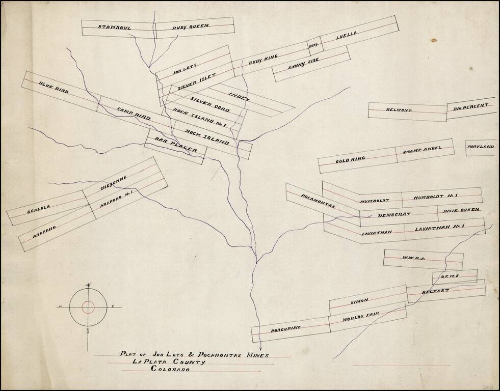
Hand drawn map of mining claims on or near Flagler's Fork and tributaries, in La Plata County, Colorado. The map is focused on the area Flagler's Fort and tributaries, including Fox Boulder Gulch, London Gulch, Miner Wonder Gulch, Stamboul Gulch and...
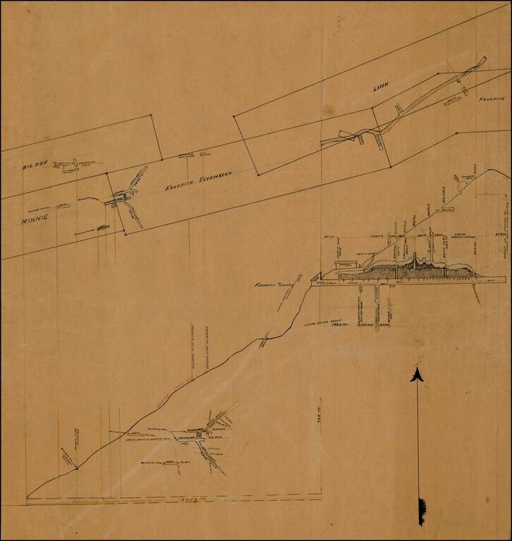
Elaborate set of drawings relating to a proposed tunnel on "Favorite Vein," one of a group of maps and plats from a mining collection relating to La Plata County, Colorado. Snow Slide Gulch, near Root Creek, appears on modern topographical maps in La...
Rare birdseye view of Colorado Springs, Colorado, published by Henry Wellge. A fine color chromolithographic view, illustrating the city in the foreground, with the Rocky Mountains in the distance, including a snow-capped Pikes Peak. The view shows...
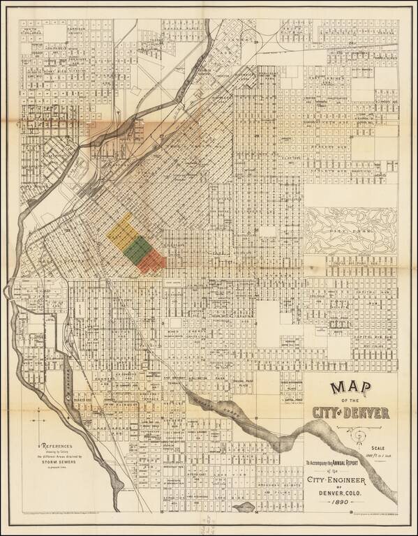
A Denver Rarity Rare large map of Denver, issued in 1890 by the City Engineer to illustrate the work on Denver's storm drain system. While the map is titled as accompanying and annual report, our research shows that it was likely only issued in 1890...
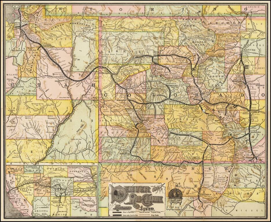
Detailed railroad map of Colorado and part of Utah. Promotional map for the Denver & Rio Grande Railroad. This map was revised several times over the decades.
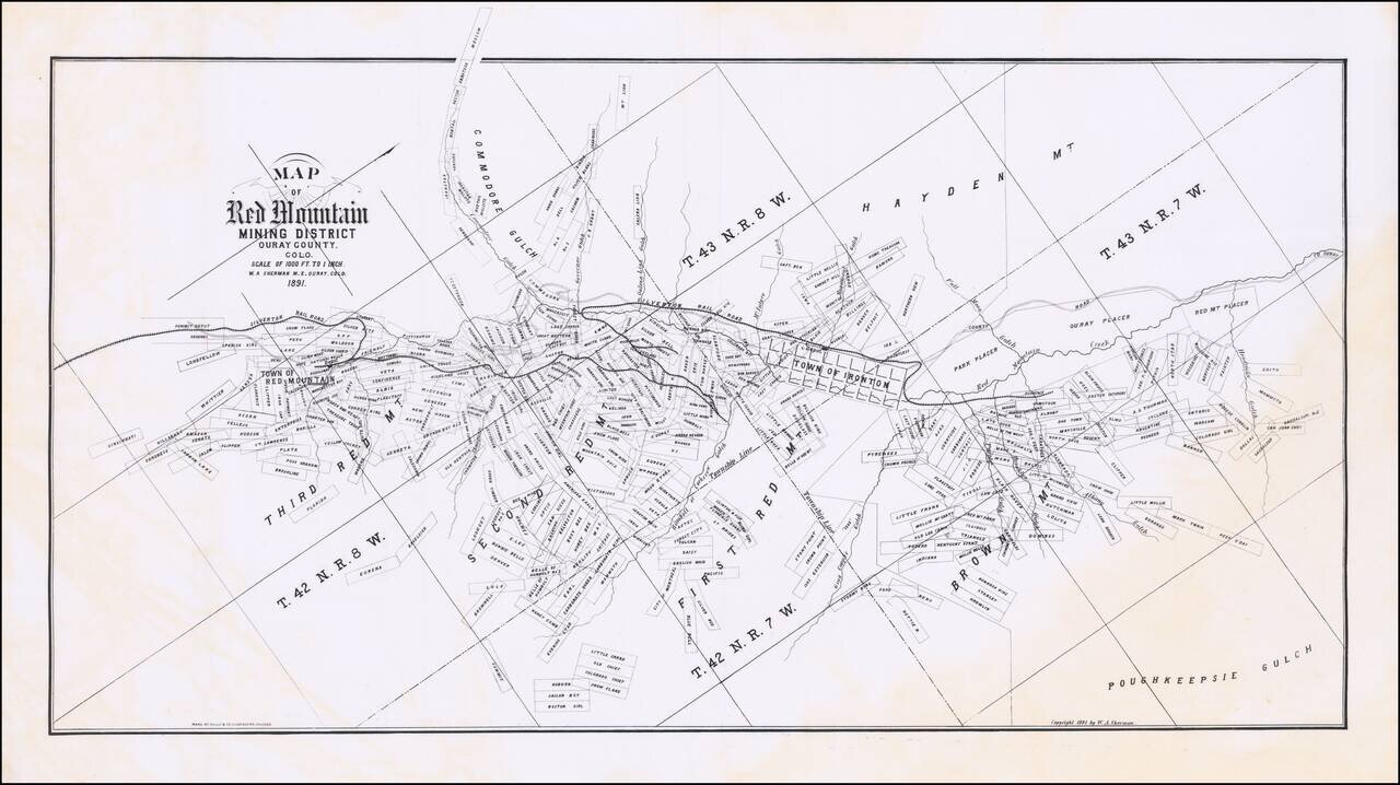
Nice example of W.A. Sherman's extremely rare promotional map showing the Red Mountain Mining District, in Ouray County, Colorado. Oriented with Northwest at the top. The map follows the course of the Silverton Railroad, from the Summit Depot Grounds,...
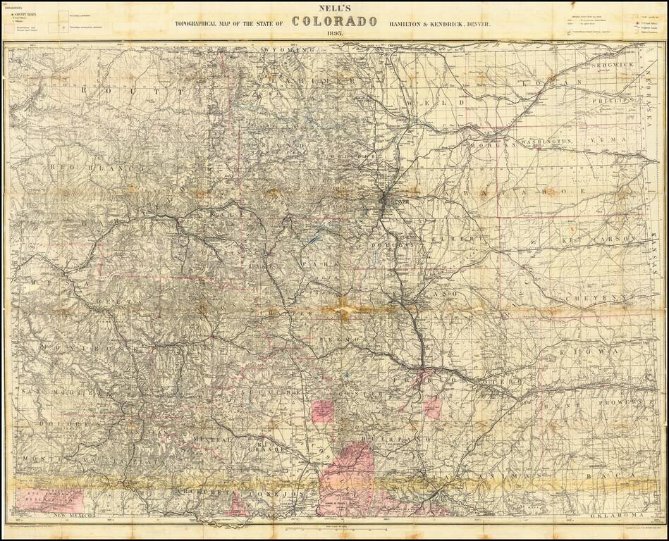
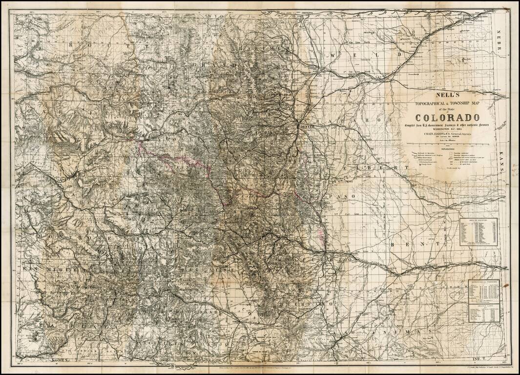
Scarce 1895 edition of Nell's map of Colorado. A remarkably detailed map, certainly the most complete of Colorado to appear after statehood (1876). The map meticulously depicts the geographical and topographical details of the state, including...