
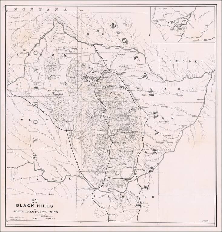
The First Book on Descriptive Mineralogy of the Black Hills with An Important Map Detailed map of the Black Hills region of western South Dakota and eastern Wyoming, between the North Fork and the South Fork of the Cheyenne River, published by Samuel...
![[Indian Territory [with Colorado on verso]](/map/small/69383.jpg)
Highly detailed map of Colorado [and Indian Territory on the back side], hand colored by counties and showing townships, towns, roads, mountains, rivers, lakes, mines, plateaus, railroads, etc. One of the most detailed maps of the period for each of...
![Colorado [with Indian Territory on verso]](/map/small/71186.jpg)
Highly detailed map of Colorado [and Indian Territory on the back side], hand colored by counties and showing townships, towns, roads, mountains, rivers, lakes, mines, plateaus, railroads, etc. One of the most detailed maps of the period for each of...
![[Utah] Amer. Sep. No. 47. Partie Du Mexique](/map/small/69341.jpg)
The Earliest Printed Map of the Utah Region Wonderfully detailed map of the region from Lake Timpanogos, Lake Teguayo and Rio de los Piramides Sulfareas in the West and extending into modern day Colorado and Wyoming, showing more detail than any other...
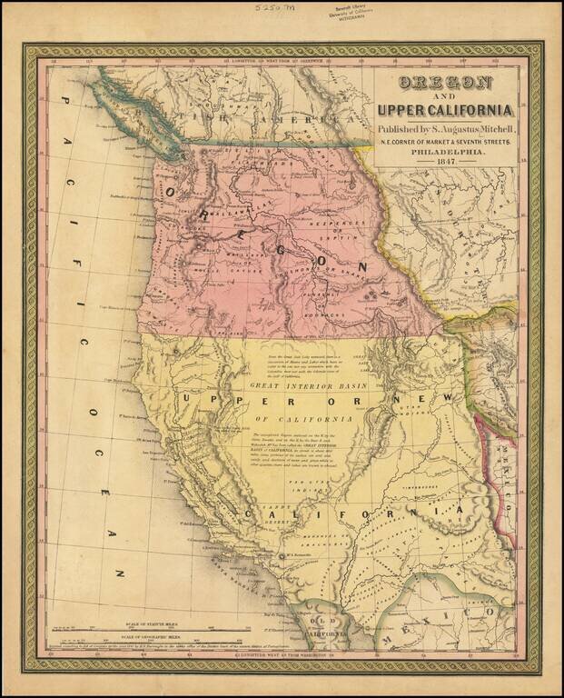
Rare 1847 edition of the best atlas map of the Western United States issued prior to the Civil War, reflecting Americans' contemporary knowledge of the West. The map shows the Spanish Trail, Lewis & Clark's Canoe Route, Oregon Trail, early roads,...
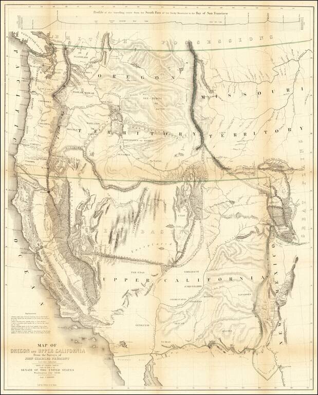
Nice example of Fremont's map of the region west of the Rocky Mountains, widely regarded as the most important and influential map the American West published in the middle of the 19th Century. This example includes the text of the Geographical Memoir...
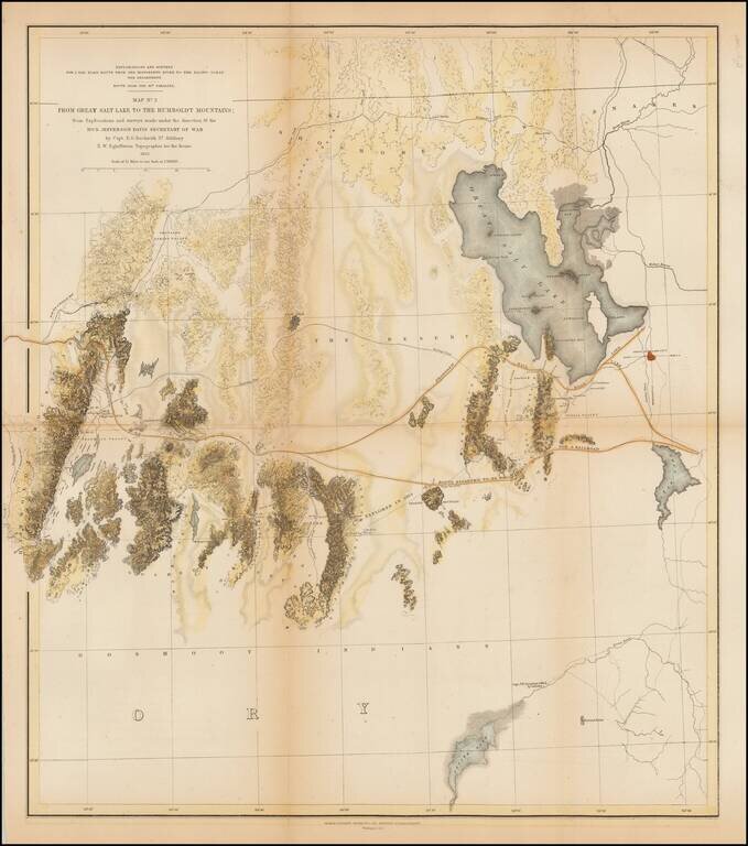
A detailed map showing the Great Salt Lake, Utah Lake and Sevier Lake, with the Humboldt Mountains at left edge. Includes the region from the Great Salt Lake and across the flats to the Humboldt range. Several proposed railroad routes noted, including...
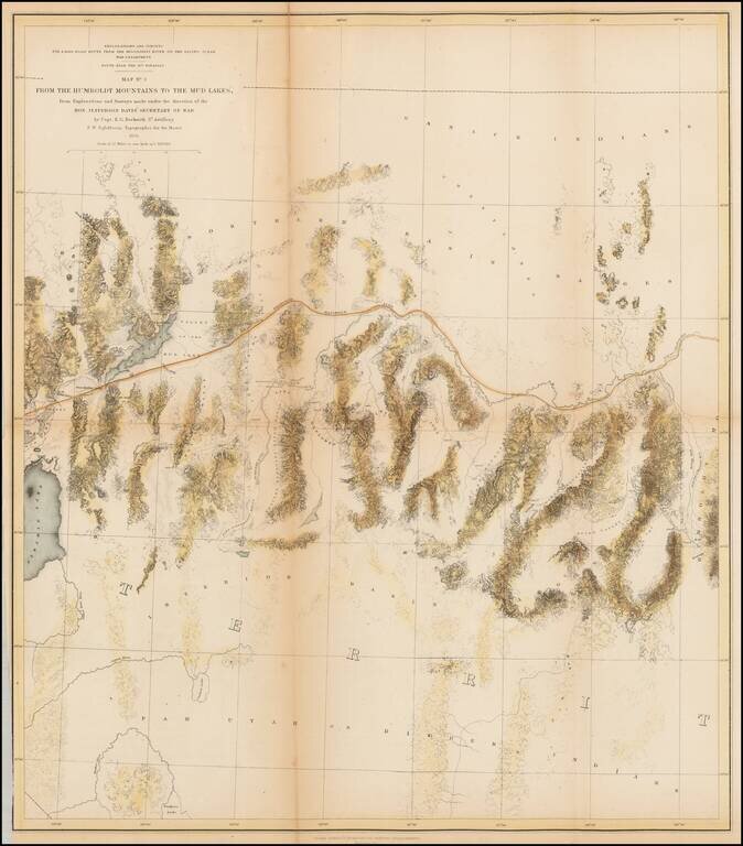
A detailed map of Northwestern Nevada, showing Pyramid Lake, the Carson River, Walker River and northern part of Walker Lake and extended East to the Elko area and the south fork of the Humboldt River. Wheat considers this an excellent map "due in...
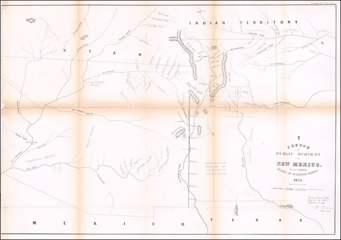
Interesting early map of New Mexico and Arizona, published by the General Land Office. The map extends from the confluence of the Colorado and Gila Rivers to Nicollet River in the northwest, the Rio Pecos in the southwest and Bent's Fort, the...
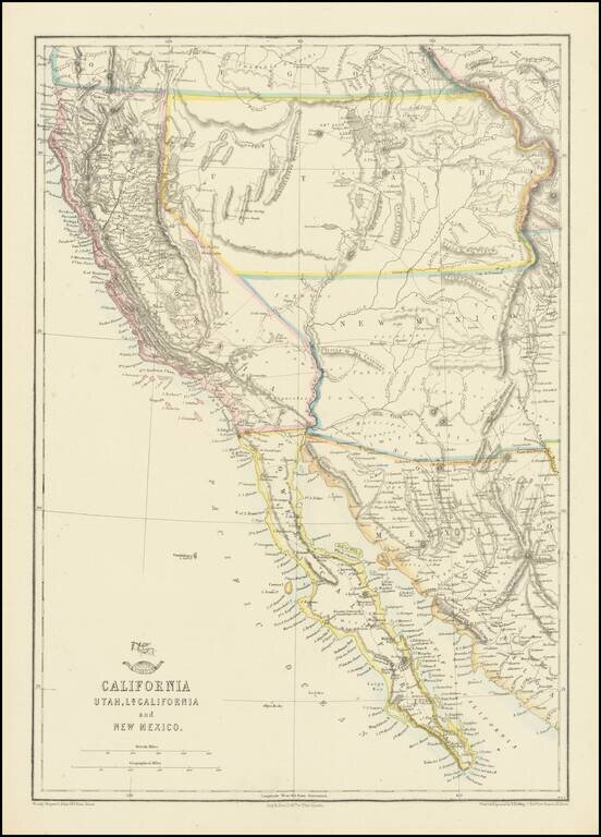
Nice example of the Ettling / Weekly Dispatch map of California and the Southwest, one of first atlas maps published in Europe to focus on the Territories of Utah and New Mexico. The map includes an excellent post Gadsden Purchase treatment of...
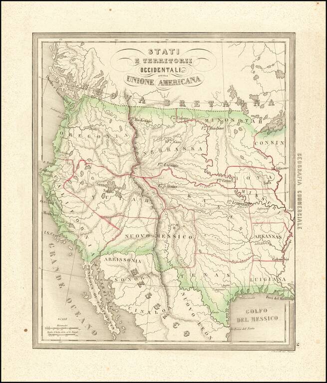
Rare and fascinating map of the Transmississippi West, from Marmocchi's Il Globo--Atlante di carte geografiche . . . , published in Genoa. The map is engraved by Bonatti in Turin. Despite the dating, the map show a pre-Gadsden Purchase border with...
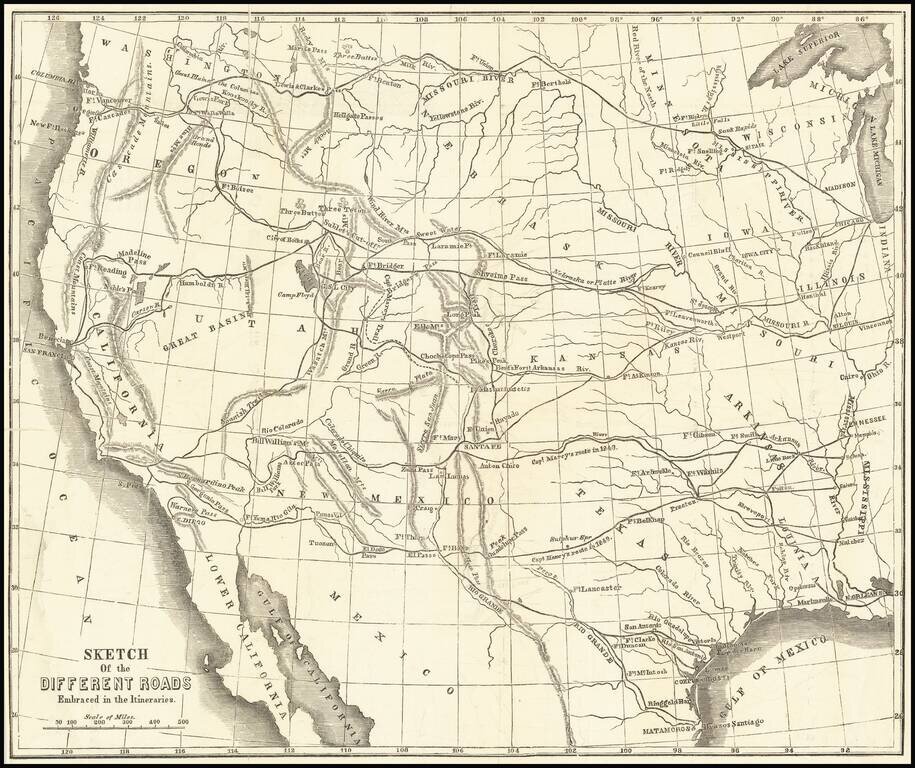
Scarce wood-engraved map of the overland routes to the West discussed in Marcy's The Prairie Traveler: A Hand-Book for Overland Expeditions, with Maps, Illustrations, and Itineraries of the Principal Routes Between the Mississippi and the Pacific...
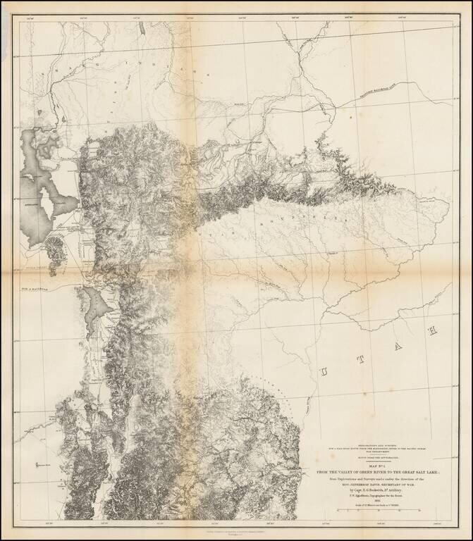
Finely detailed map of the area from Brown's Hole east of today's Vernal to the Great Salt Lake and south to below Fillmore. The map locates the Emigrant Road to California. Several Proposed Railroad lines are shown. One crosses the Green River near...
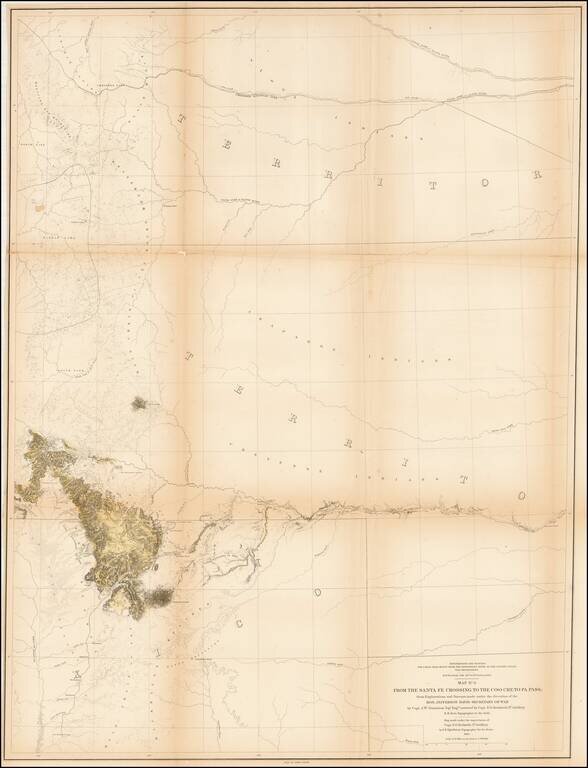
Detailed map showing parts of Wyoming, Colorado, New Mexico and South Dakota, extending west to Rocky Mountains, the Rio Grande River, San Luis Valley and Cheyenne area Shows the proposed raiload lin along the South Fork of the Platte River, extending...
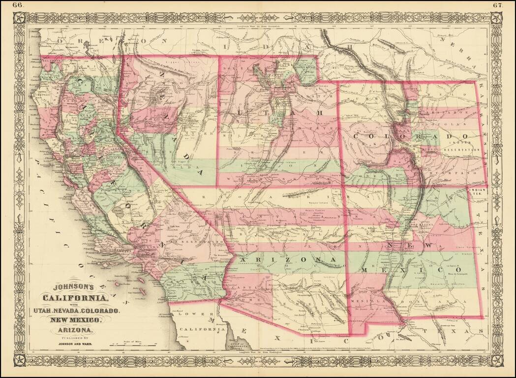
Interesting map of the southwest, hand colored by counties and showing a number of interesting territorial anomalies. Nevada has its lower corner truncated, leaving Las Vegas in Arizona. In each of the states and territories, the county configurations...
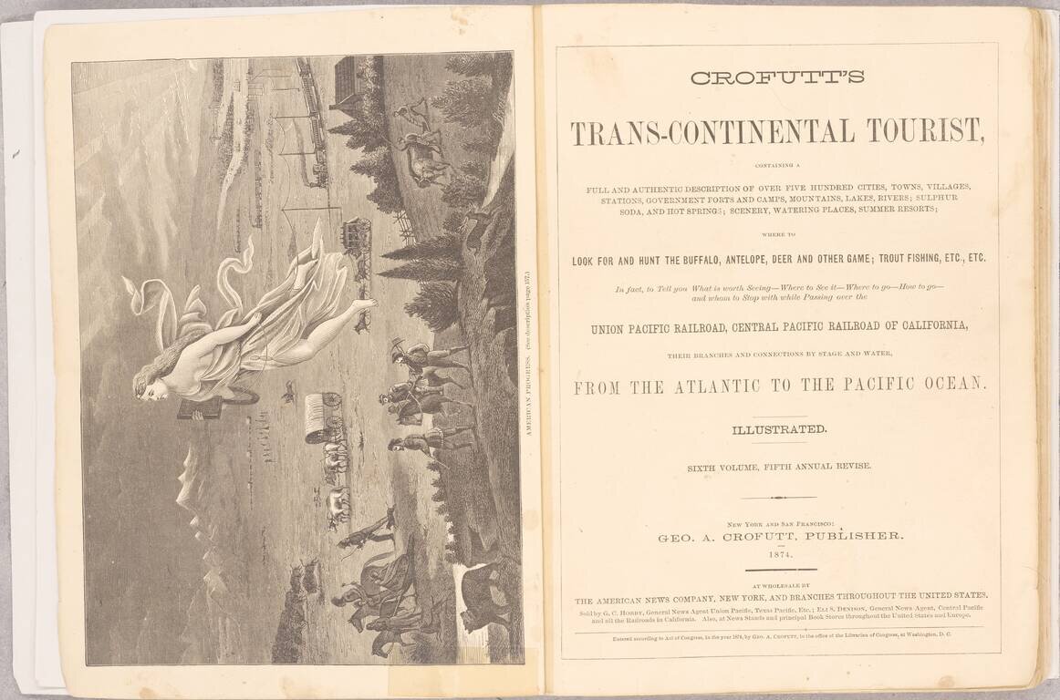
One of the Best Visual Records, In a Single Volume, of American Westward Expansion. This edition of Crofutt's Tourist is an extensive work, showing and describing many of the sites a traveler of the late 19th century would have visited in the US,...