
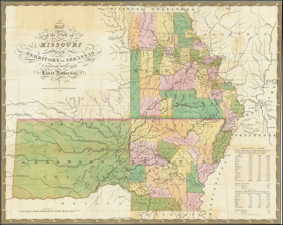
Nice example of the 1831 Mitchell edition of Finley's map of Arkansas and Missouri, being one of the earliest separately issued regional maps to show Arkansas in its double-width configuration (including most of Oklahoma). A number of counties in the...
![Americque Septentrionale Par le Sr. Sanson d'Abbeville Geographe du Roy . . . 1705 [Rare Peninsular California edition, with unusual Mississippi River depiction]](/map/small/61024.jpg)
Antique Map of North America -- California as an Island Old color example of Sanson's revised map of North America. In 1705, Pierre Moullart Sanson radically revised this map of North America, modifying perhaps the three most significant features of...
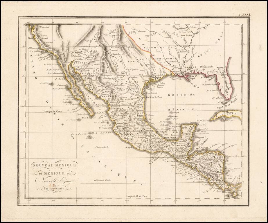
The West at the Time of the Louisiana Purchase Detailed map of Mexico and the American West, published in Paris. The map shows the limits of the United States at the Mississippi River, with Louisiana shown to the west, albeit somewhat vaguely. The...
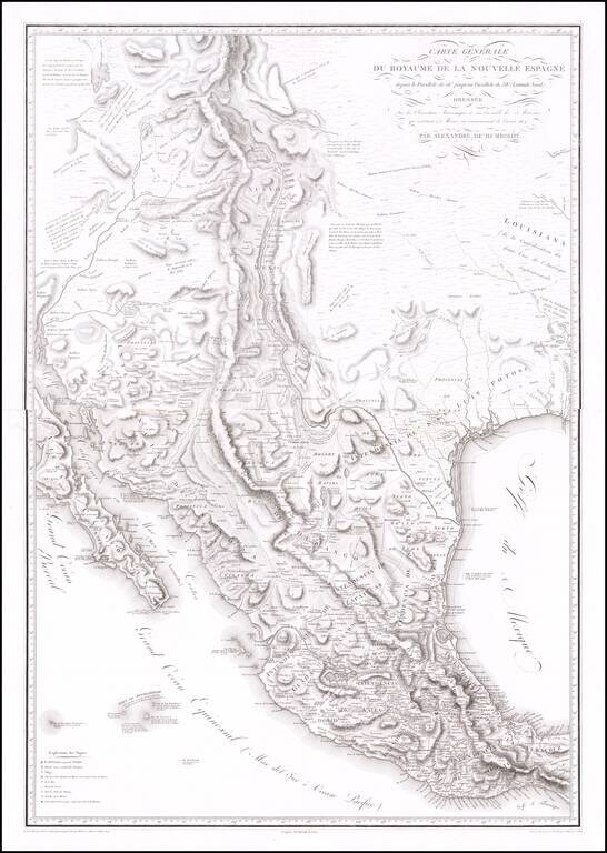
The Most Important Map of the Mexico From The Early 19th Century, By The Father of Modern Geography Nice example of Alexander von Humboldt's monumental 2-sheet map of New Spain. Humboldt's map of New Spain is the first modern geographical treatment...
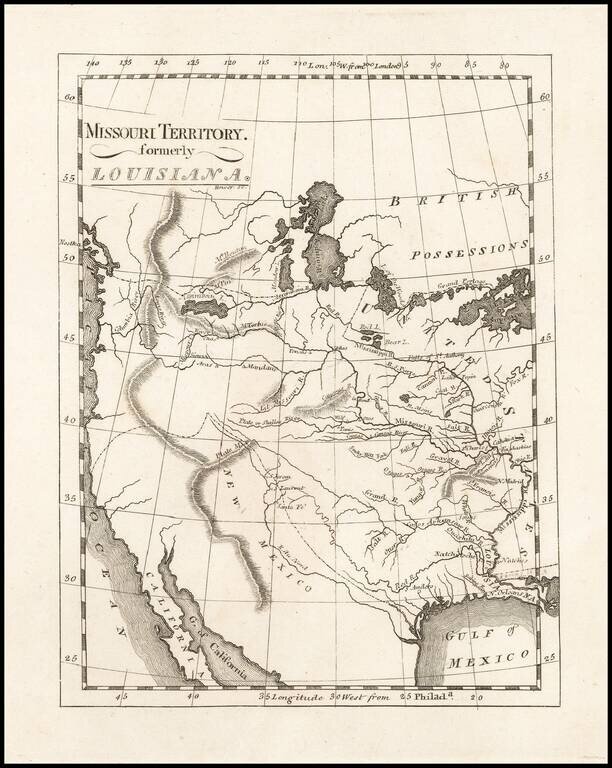
One of the Earliest Maps To Incorporate Lewis & Clark's Reports From Their Expedition Across America To The Pacific Reduced size example of Matthew Carey's map of Missouri Territory, published shortly after the return of Lewis & Clark and in...
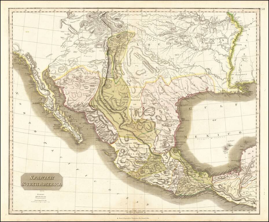
Large detailed English language map of Texas and the Southwest, published in Edinburgh by Thomson. The map is largely based upon the explorations of Humboldt and Long in the Rocky Mountains and the West. It includes extensive notes along the lower...
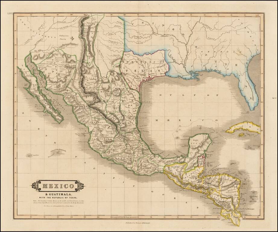
"Republic of Texas" in the Title of the Map Scarce map of Texas, Mexico, Upper California and contigous parts of the Southeastern US, naming the Republic of Texas. The present map is one of the only obtainable printed maps to name the "Republic of...
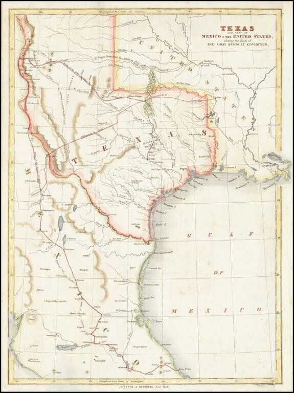
Map of the Republic of Texas, which appeared in Kendall's Narrative Of The Texan Santa Fe Expedition .... This map shows efforts of the Republic of Texas, under President Mirabeau Lamar, seeking to take control over Santa Fe and develop trade links...
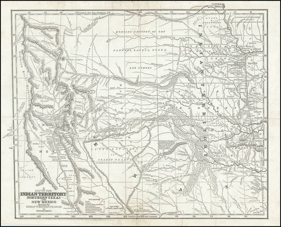
Josiah Gregg's Landmark Map of the Southwest & Northern Texas Fine example of Josiah Gregg's monumental map of Northern Texas & the Plains, from his monumental Commerce Of The Prairies, one of the classic accounts of the Transmississippi West...
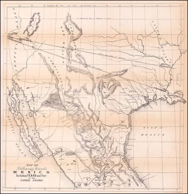
Transcontinental Railroad Routes To San Francisco in 1846! Scarce map of Texas, Upper California, Mexico and the Southwestern United States, prepared for Gilliam's Travels over the Table Lands and Cordilleras of Mexico during the Years 1843 and 44....

A German Map of the Republic of Texas Detailed map of the Republic of Texas at the start of the Mexican War. The massive stovepipe configuration is shown here, extending to Wyoming in the north, the Rio Grande in the west and the Red River and...

Including Manuscript Additions of the Overland Route To California and Other Important Points. Nice example of Mitchell's seminal map of Texas, Oregon, Upper California, Missouri Territory and a massive Indian Territory (covering most of Kansas and...
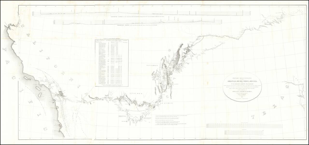
Fine example of the William Emory's milestone mapping of the Southwestern United State, from Ft. Leavenworth to the West Coast, from Emory's Notes of a Military Reconnaissance, from Fort Leavenworth, in Missouri, to San Diego, in California . . ., one...
An Extremely Rare German Emigrant Guide to California, Oregon, Texas, Iowa and the Midwest -- Especially So With All Maps & Plans Second extended German edition, adding the view of St. Louis and with the often missing maps of Iowa and the United...
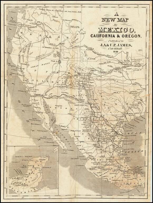
Scarce map of Texas and the West, published in Cincinnati. In Oregon Territory, a number of early American Forts are shown, along with Astoria and Oregon City. To the south, the Gold Region is shown in California, limited only to the area north of...
![Map Of Route pursued by U.S. Troops from Fort Smith, Arkansas, To Santa Fe, New Mexico, via south side of Canadian River In the Year 1849 Whilst serving as an Escort to a party of California Emigrants. . . . [bound with:] Map, No 2... [and:] Map, No. 3...](/map/small/70778.jpg)
Along the Canadian River, through the Texas Panhandle, to Santa Fe, New Mexico. Fine four-sheet map of the overland exploration and survey map, undertaken by the United States Troops at the start of the Gold Rush. In 1849, shortly after gold was...