Map size in jpg-format: 19.3002MiB
Click to open in high resolution (open in new tab).
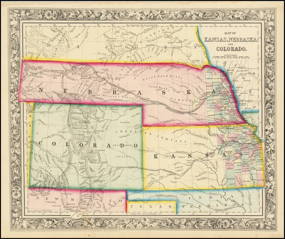
Excellent early map of the regional map of the Plains and Rocky Mountains, published by S.A. Mitchell Jr.
Kansas counties cover only the eastern third of the state. Nebraska counties cover only a very small fraction of the state, which stretches all the way to the western edge of the map. No counties have yet been delineated in Colorado. Denver City and a number of mining towns are shown, as are a number of Indian Tribes, forts, etc. The map predates the creation of Idaho and Wyoming.
The map shows early proposed railroads, forts, Indian tribes, rivers, mountains, etc. The plains region is still very much in transition, with the results of several major explorations commenced immediately after the civil war are not yet in evidence.
Decorative floral border. It also shows portions of New Mexico, Texas, and Indian Territory. A rare early edition, pre-dating the first Colorado Counties.
Samuel Augustus Mitchell Jr. inherited the Mitchell Company from his father in 1860. For over thirty years, the company had specialized in the production of school atlases and wall maps of America. They were one of the pioneers on engraving on steel plates. In 1860, Samuel Jr. released the New General Atlas, which had been compiled in house and replaced a previous atlas by Tanner. The elder Mitchell died in 1868 and Samuel Jr. continued the business until the 1890s. At its height, the Mitchell Company employed 250 people and sold 400,000 publications annually.
If you are a student, write to us in telegram: @antiquemaps and indicate what material you need and for what work you need a map in high detail. We are ready to provide material on special terms. For students only!