logo

1863. Ceded Part of Dakota Territory Showing Progress of US Land Survey during 1862 Under The Direction of Surveyor General G.D. Hill . . . 1864

  • Ceded Part of Dakota Territory Showing Progress of US Land Survey during 1862 Under The Direction of Surveyor General G.D. Hill . . . 1864

Ceded Part of Dakota Territory Showing Progress of US Land Survey during 1862 Under The Direction of Surveyor General G.D. Hill . . . 1864 information:

Year of creation: 
Resolution size (pixels): 
 1662x1721 px
Disk Size: 
 532216B
Number of pages: 
 1
Place: 
 Washington

Print information. Print size (Width x height in inches):
Printing at 72 dpi 
  23.08 х 23.9
Printing at 150 dpi 
 11.08 х 11.47
Printing at 300 dpi 
 5.54 х 5.74

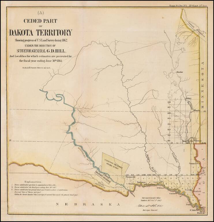
Interesting early map of part of Dakota Territory.

The map is focused on the township surveys and the various Indian reserves along the Missouri River, including the Yankton Reserve, Ft. Randall Military Reserve and Ponka Reserve, along with an Indian Reservation in the Northwest.

Nice early regional map.


Special conditions for students!

If you are a student, write to us in telegram: @antiquemaps and indicate what material you need and for what work you need a map in high detail. We are ready to provide material on special terms. For students only!

Item information:

Year of creation:
Size:
1662x1721 px
Disk:
532216B
Number of pages:
1
Place:
Washington
Author:
U.S. General Land Office Survey.
$9.99

Related item