
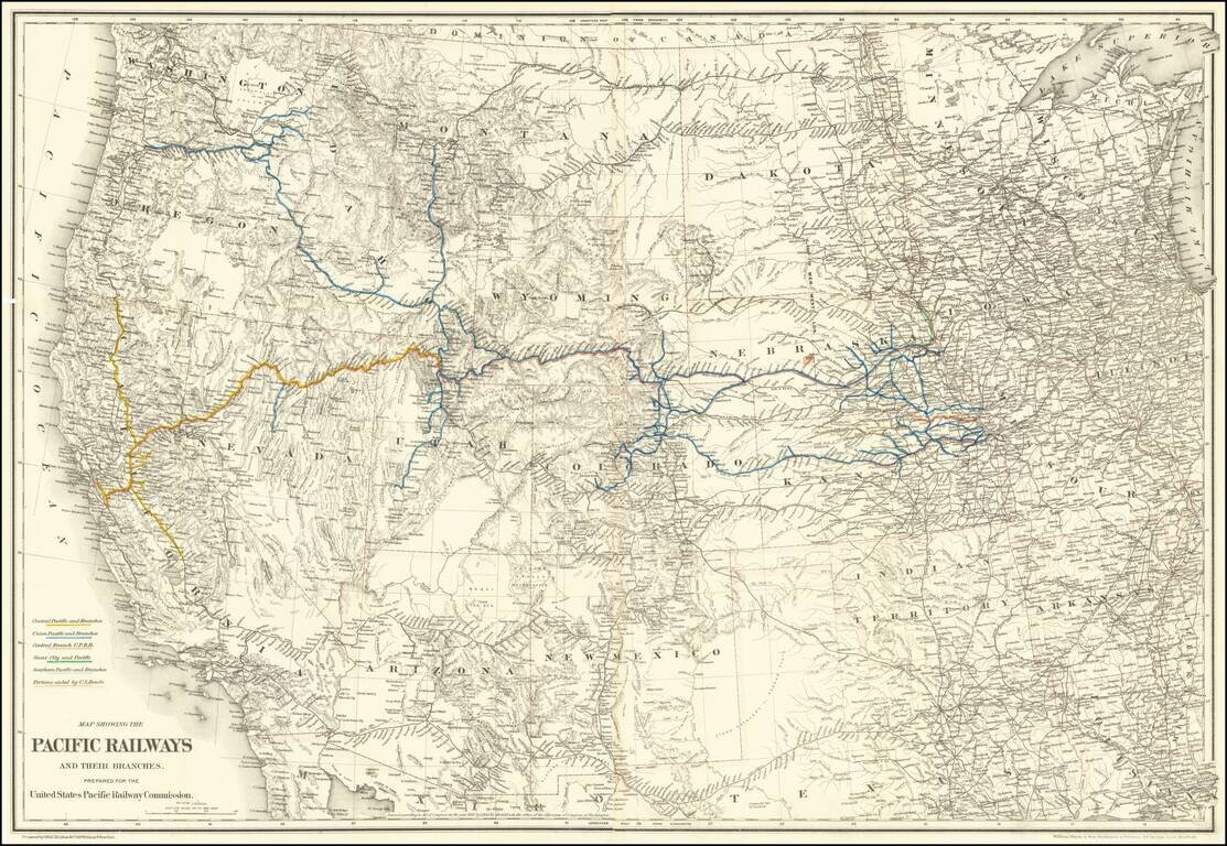
Mapping the Railroads of the Transmississippi West. Highly detailed map of the Western United States, illustrating the railroads in operation and under construction west of the Mississippi River. The key at the lower left identifies the Central...
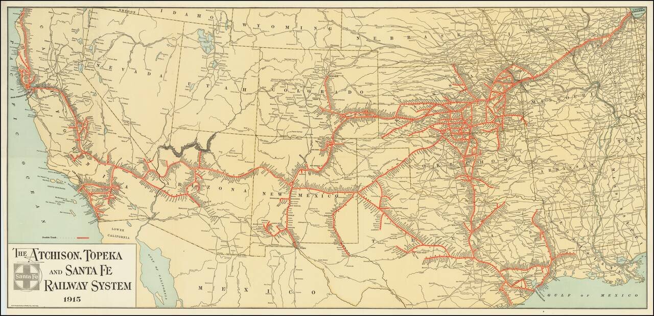
Fine example of The Atchison, Topeka and Santa Fe Railroad's general promotional map for 1915. Includes all the routes and train stations along the route in fine detail.
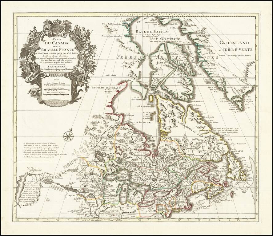
Fine example of Covens & Mortier's edition of De L'Isle's seminal map of Canada, the Great Lakes and Upper Midwest, and one of the most important and influential maps of Canada published in the 18th Century. De L'Isle's map is of seminal...
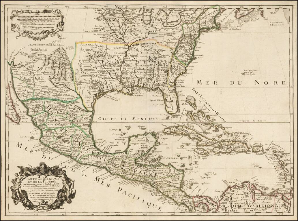
Rare Second State. Fine example of the second state of Guillaume De L'Isle's landmark map, the first printed map to accurately depict the course and mouth of the Mississippi River. De L'Isle's Carte du Mexique . . . is drawn from the reports brought...
![Carte De La Louisiane Et Du Cours Du Mississipi . . . Juin 1718 [1st State!]](/map/small/62086.jpg)
"The Mother and Main Source of All the Later Maps" of the Mississippi River and Interior Parts of the United States and The First Map to Name Texas First state of De L'Isle's seminal map, one of the most important and influential maps of the 18th...
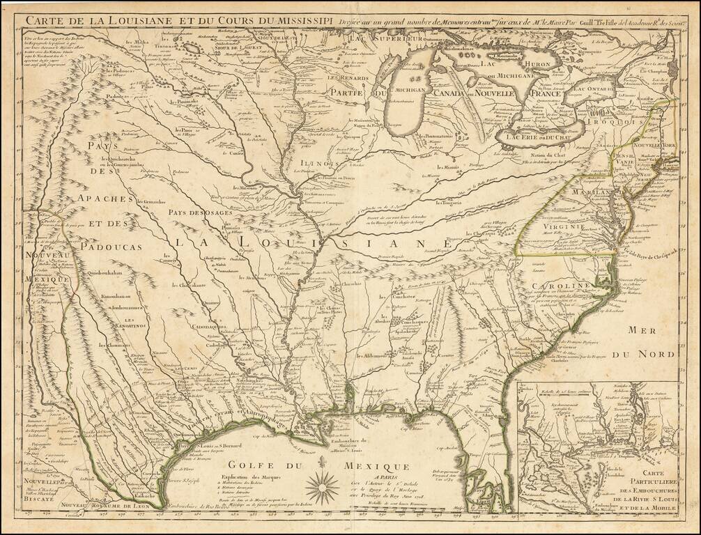
First Map To Name New Orleans -- "The Mother and Main Source of All the Later Maps" of the Mississippi River and Interior Parts of the United States and The First Map to Name Texas Second state of De L'Isle's seminal map, one of the most important and...
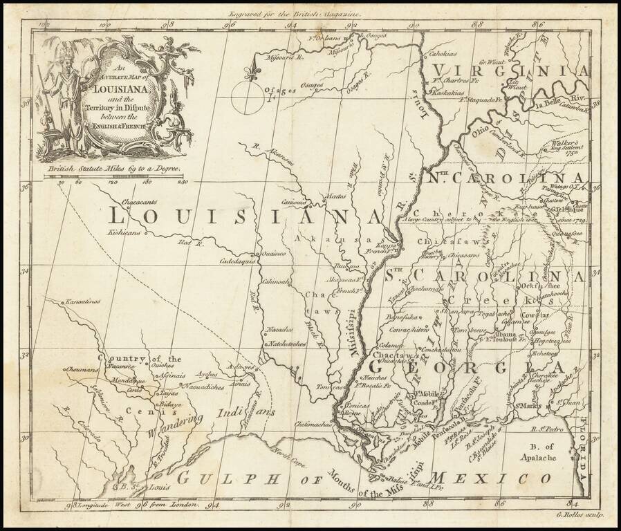
The "Territory In Dispute East" of The Mississippi River Rare map centered on the Mississippi River, showing the "Territory in Dispute" between France and England. The map is centered on the Mississippi River valley and the Gulf Coast, showing the...

Rare Dutch edition of this highly important map the region, from Pike's account of his expedition to the West . The map shows Pike's route through the region from the west of the Mississippi, from the Missouri River to the Red River, and extending...
An Early Louisiana Purchase Map Extremely rare little map centered on the Mississippi, apparently based upon the map used to illustrate Berquin-Duvallon's Vue de la Colonie Espagnole du Mississippi, ou des Provinces de Louisiane et Floride...
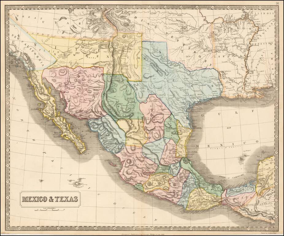
Rare map of Mexico, Texas and the Southwest, from an early edition of Philip's Imperial Atlas. This map is issued shortly before the Gadsden Purchase, and shows a very oddly configured Texas, bounded by a massive Indian Territory and New Mexico...
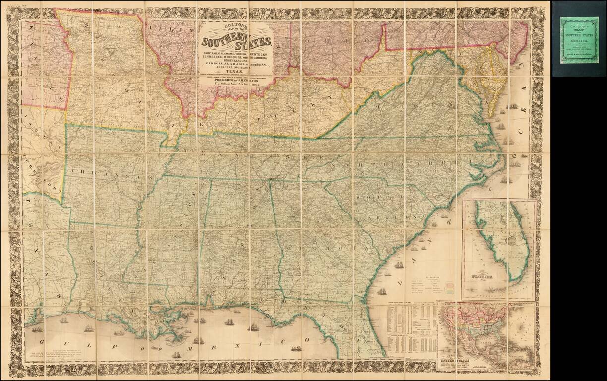
Second edition of Colton's detailed large format map of the Southern Plains and Midwestern States, at the outset of the American Civil War. Finely detailed map, one of the most commercially successful maps published by Colton during the 1860s.
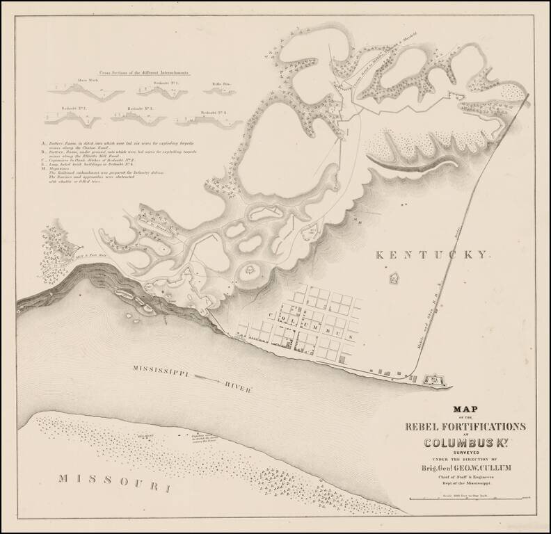
Rare plan showing the Rebel Fortifications at Columbus, Kentucky on the Mississippi River. Detail includes a town plan, tracks of the Mobile and Ohio R.R., Road to Elliott's Mill and Ft. Holt, Road to Blandville, Clinton Road to Milburn, Paducah &...

The Neutral Lands and the Race To Construct Railroad Lines from Northern Kansas to Indian Territory Unrecorded railroad map of Texas, the Southern and Mdiwestern States, published by the Missouri River, Fort Scott & Gulf Railroad and the...
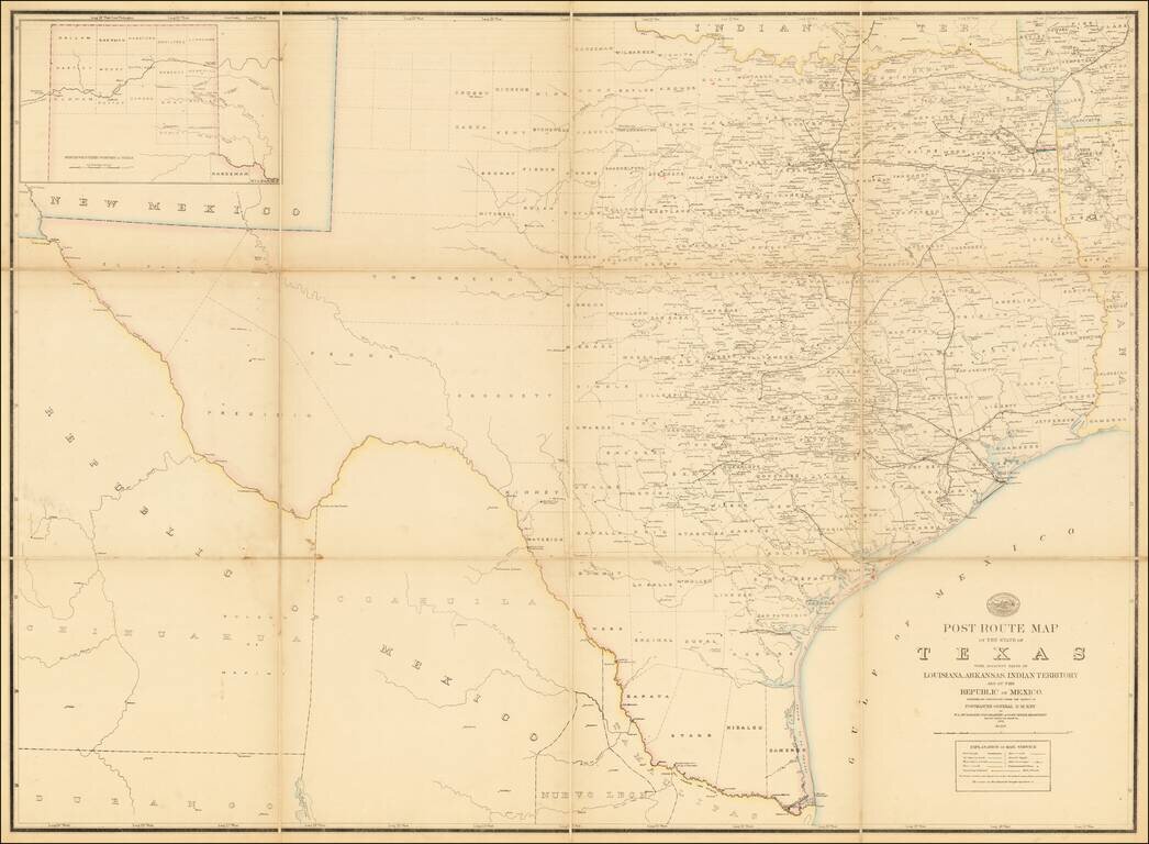
A Texas Sized Postal Map Without Post Routes! First state of this important early map showing the Official Post Offices and Postal Routes in Texas in the last decade of the 19th Century. The Key indicates that the map include Railroads, Mail...
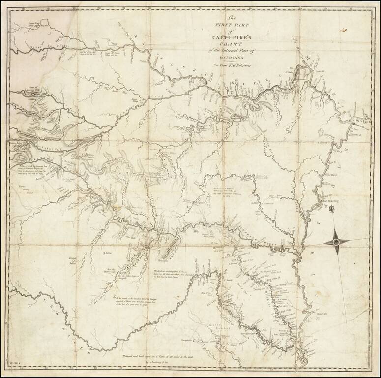
A Foundational American Map An exceptional Trans-Mississippi West map, showing the first portion of Zebulon Pike's exploration of the American Southwest. The map shows Pike's route through the region from the west of the Mississippi, from the...
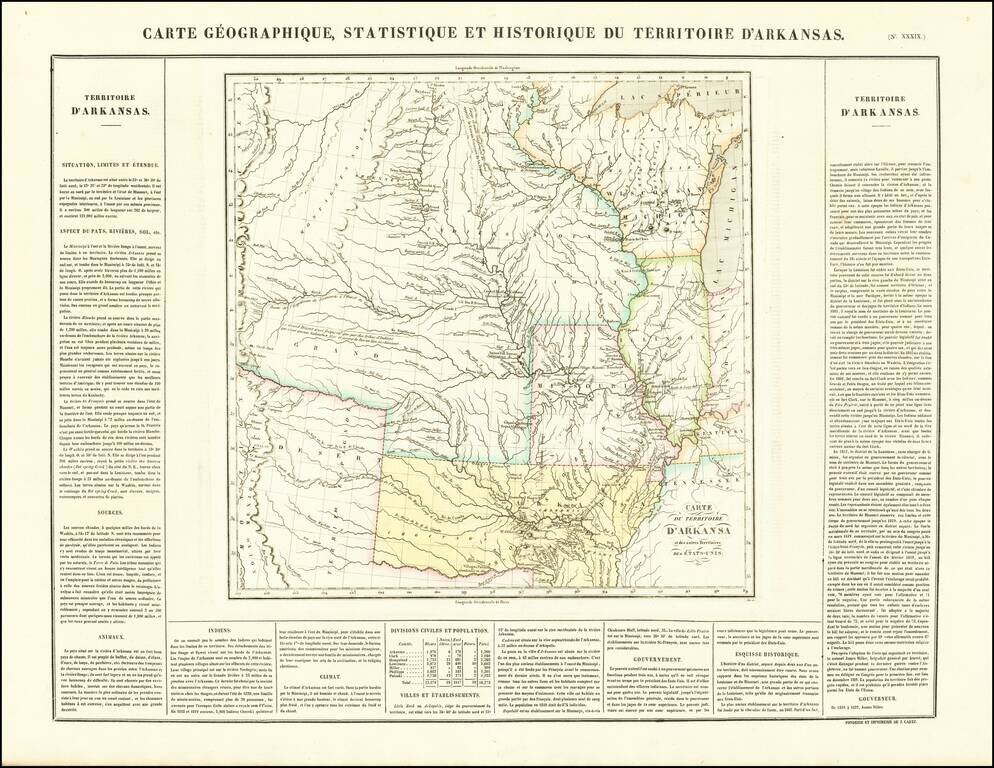
French edition of Stephen Long's seminal map of the region drained by the Arkansas, Kansas, Missouri and Mississippi Rivers, one of the most important maps of the American West. Stephen H. Long led a government expedition to the Rocky Mountains in...