Map size in jpg-format: 28.5484MiB
Click to open in high resolution (open in new tab).

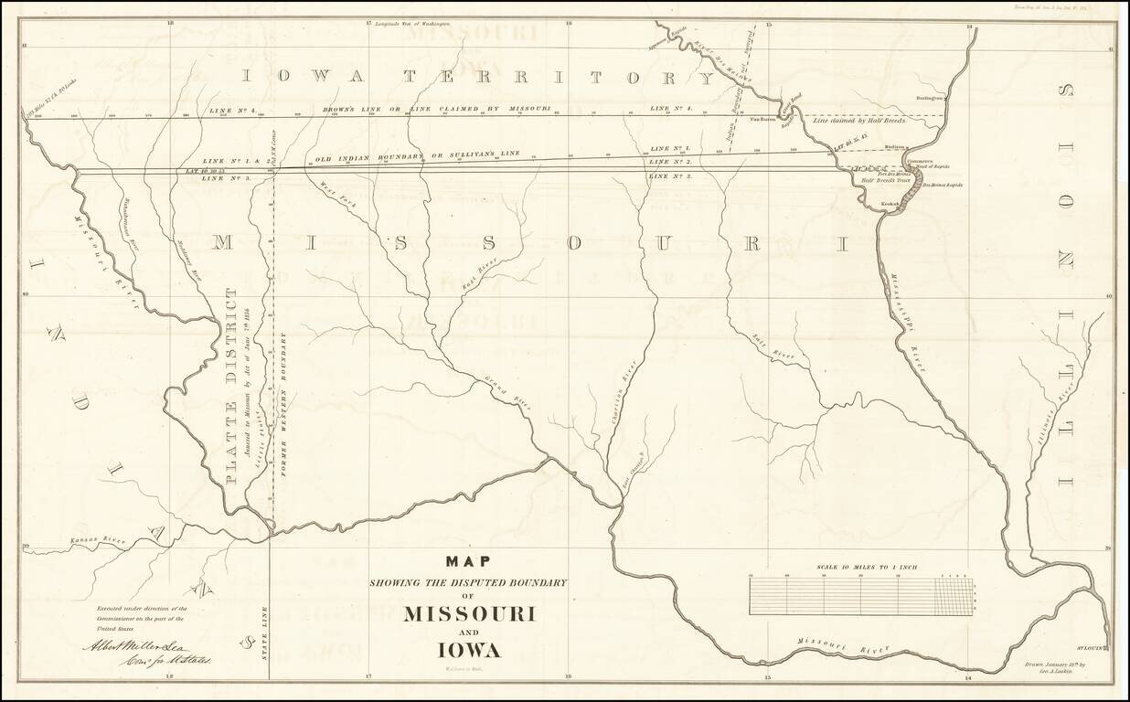
The Iowa-Missouri Boundary Dispute
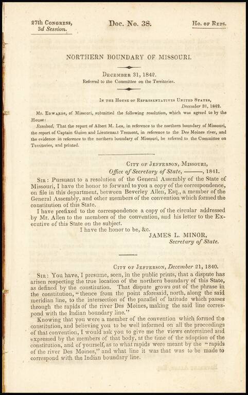
Detailed map illustrating the boundary dispute between Missouri and Iowa, drawn by George A. Leakin, accompanied by the report to the House of Representatives dated December 31, 1842, regarding the Northern Boundary Dispute of Missouri.
The map includes the northern half of Missouri. Shows four versions of disputed boundaries between Missouri and Iowa, including a related dispute over the Half Breeds boundary for a tract of land between the Mississippi and Des Moines Rivers.
Various versions of the two major lines, namely Brown's Line or Line claimed by Missouri and Old Indian Boundary or Sullivan's Line, are detailed. The Platt District annexation of 1836 is also delineated.
After several years of consideration of its Statehood, Congress finally decided that Iowa might be admitted as a state, but only if the boundaries were changed. These new boundaries were usually called the Nicollet boundaries, after a famous surveyor. According to the boundaries fixed by Congress, Iowa was to extend:
It was to be bounded on the south by Missouri and on the north by a line about forty-five miles north of the present boundary. These boundaries would have made Iowa much narrower than it is to-day. The people of Iowa did not like the new boundaries. They voted on the constitution twice, but would not accept it. At the May 4, 1846 convention in Iowa City, the Iowans drew up a constitution. As part of the process, Congress changed the boundaries to its modern configuration. The people of Iowa accepted the constitution with the new boundaries and began their state government. On December 28, 1846, President James K. Polk signed the bill which admitted Iowa as the twenty-ninth state in the Union.
If you are a student, write to us in telegram: @antiquemaps and indicate what material you need and for what work you need a map in high detail. We are ready to provide material on special terms. For students only!