Map size in jpg-format: 954838B
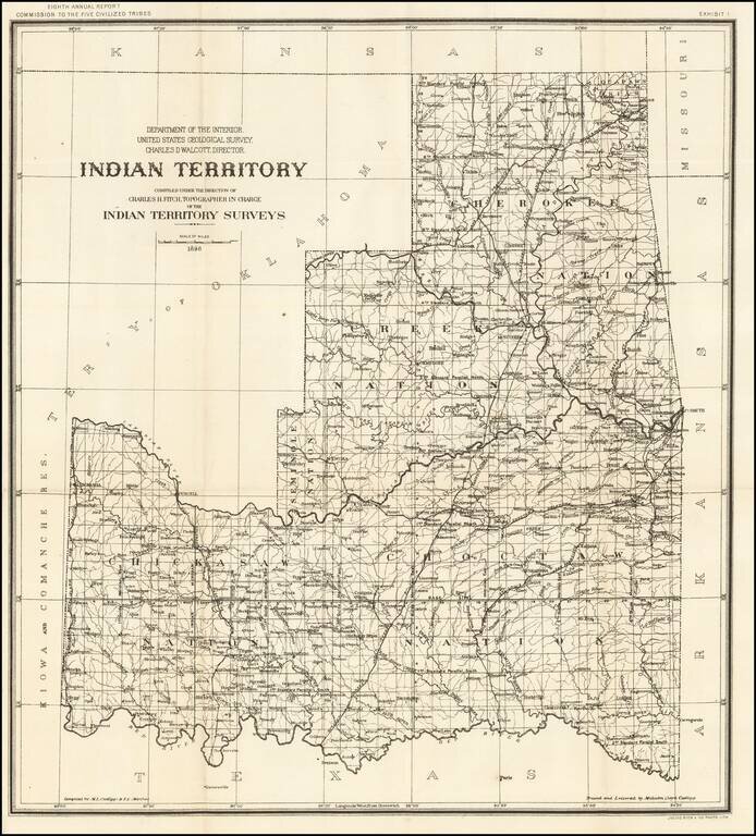
Detailed map of Indian Territory, during the short-lived period where Oklahoma was divided into two Territories, Oklahoma Territory and Indian Territory.
The map shows the progress of the Indian Territory survey in the first year of the survey.
The map would be updated annually for about the next 10 years.
If you are a student, write to us in telegram: @antiquemaps and indicate what material you need and for what work you need a map in high detail. We are ready to provide material on special terms. For students only!