
Rare old maps of the United States.
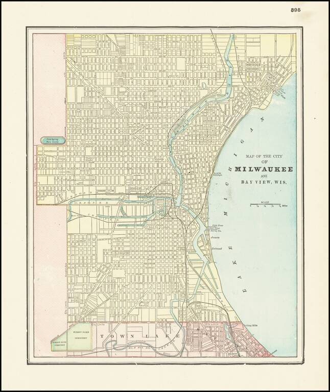
Detailed city plan of Milwaukee and environs by George Cram. The map show streets, buildings, train lines, public places, rivers etc.
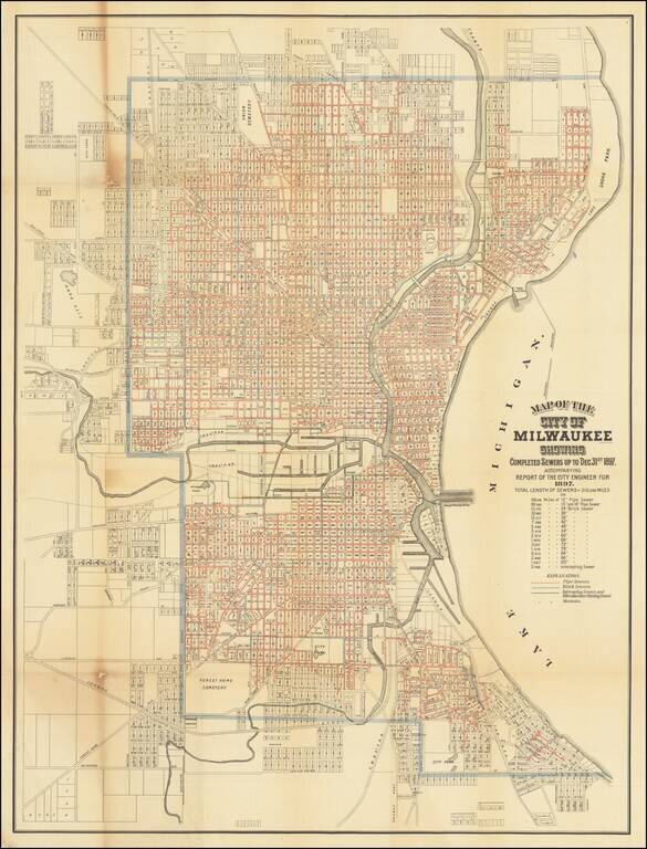
Rare map of the City of Milwaukee, published by the city to illustrate a report of the City Engineer. The map shows the progress of public works up to the end of 1897, showing sewers, intercepting sewers, manholes, block numbers, streets, railroads,...
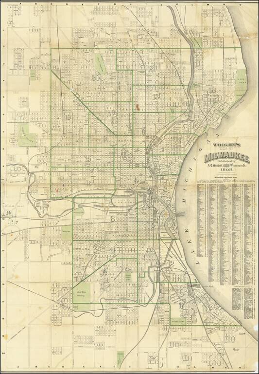
Large color-lithographed folding map of Milwaukee, published by Alfred G. Wright and printed by the Milwaukee Litho. & Engr. Co. in 1898. The map is one of the larger 19th-century maps of the largest city in Wisconsin. The map goes as far north as...
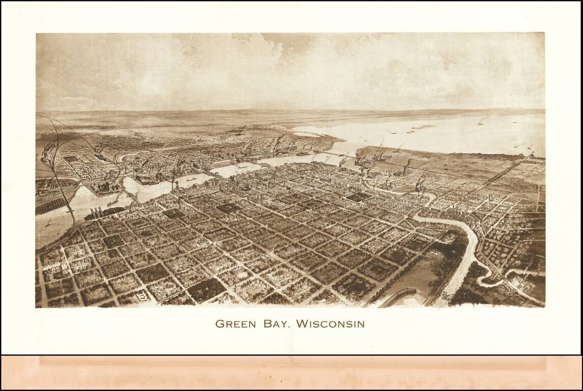
Rare view of Green Bay, published by Barnes-Crosby Company Barnes-Crosby Company Barnes-Crosby was best known for publishing an extensive fine lithograph stereoview series of United States scenes starting in the late 1890’s and continuing for...
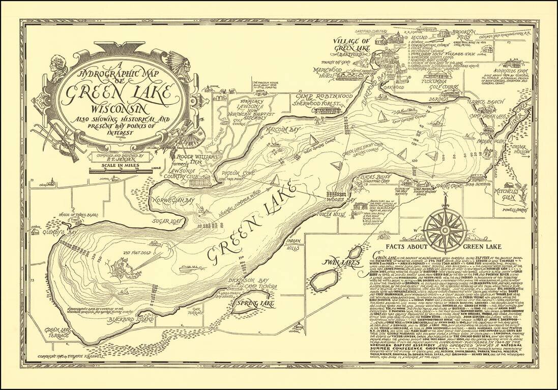
Scarce vintage pictorial map of Green Lake, Wisconsin, compiled and designed by P.T. Jensen and published by F. Clayce Kradwell in 1945. Green Lake is a large lake between Oshkosh and Wisconsin Dells. The Wisconsin Historical Society has a colored...
![[Ashland Wisconin]](/map/small/60288.jpg)
Lake Trout Trolling on Lake Superior! Detailed pictorial map of the area around Ashland, Wisconsin, published by the Ashland Chamber of Commerce. The focal point of the map is recreational activities, including hunting, fishing, skiing, boating,...

Fine map of the northern part of North America, intended to illustrate the probability of a water course from Hudson's Bay to the Northwest Coast, across the interior of North America. The map was prepared to illustrate the report of Meares expedition...
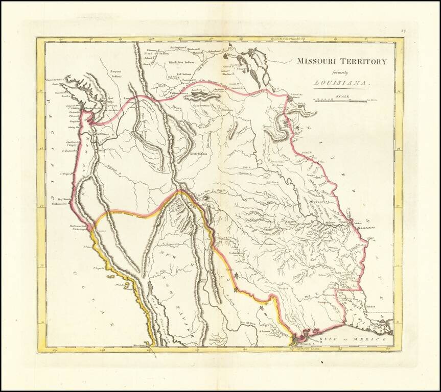
The First American Atlas Map of the Transmississippi West -- Based Upon Lewis & Clark's Reports Nice example of Mathew Carey's highly important map of Missouri Territory. Published shortly after the return of Lewis & Clark, Mathew Carey's...
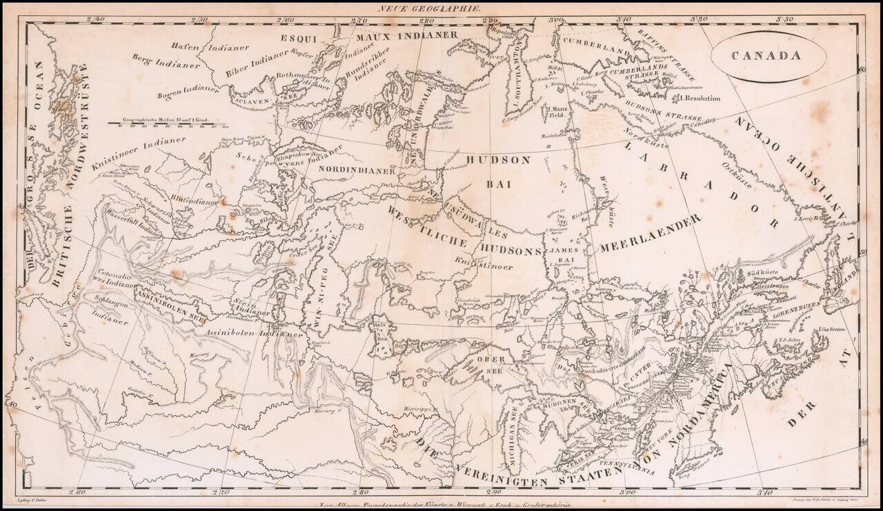
Rare early 19th Century map of Canada, from coast to coast, published in Germany. The map focuses on the drainages of the various rivers and lakes, centered on the Win-ni-peg See. Includes excellent treatment of the Lakes and Rivers. The map extends...
![[Western Territory]](/map/small/68666.jpg)
Antique Map of the Plains and Indian Territory, Extending the Rocky Mountains Rare and important map from the 1835 Dodge-Kingsbury expedition (only 500 copies printed). The map identifies place names as far west as Santa Fe New Mexico, Pike's Peak...
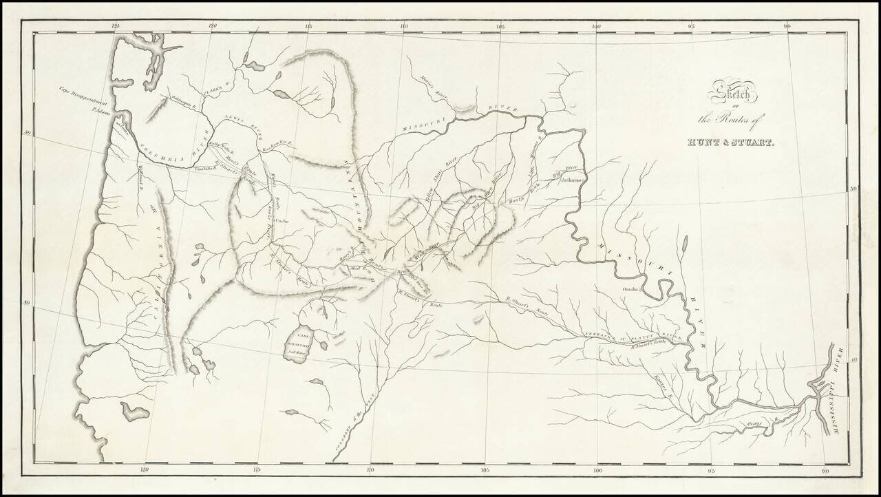
St. Louis to Astoria, Oregon in the 1810s—the Hunt and Stuart Expeditions Intriguing early map of the routes of Hunt and Stuart, two of the earliest American overland travelers, immediately following Lewis and Clark. The map illustrates Wilson...
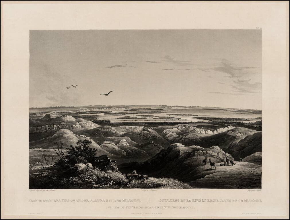
Finely executed view of the Junction of the Missouri and Yellowstone Rivers, from Maximilian, Prince of Wied's Travels in the Interior of North America, during the years 1832-1834, including blindstamp. The view provides a fine image of the confluence...
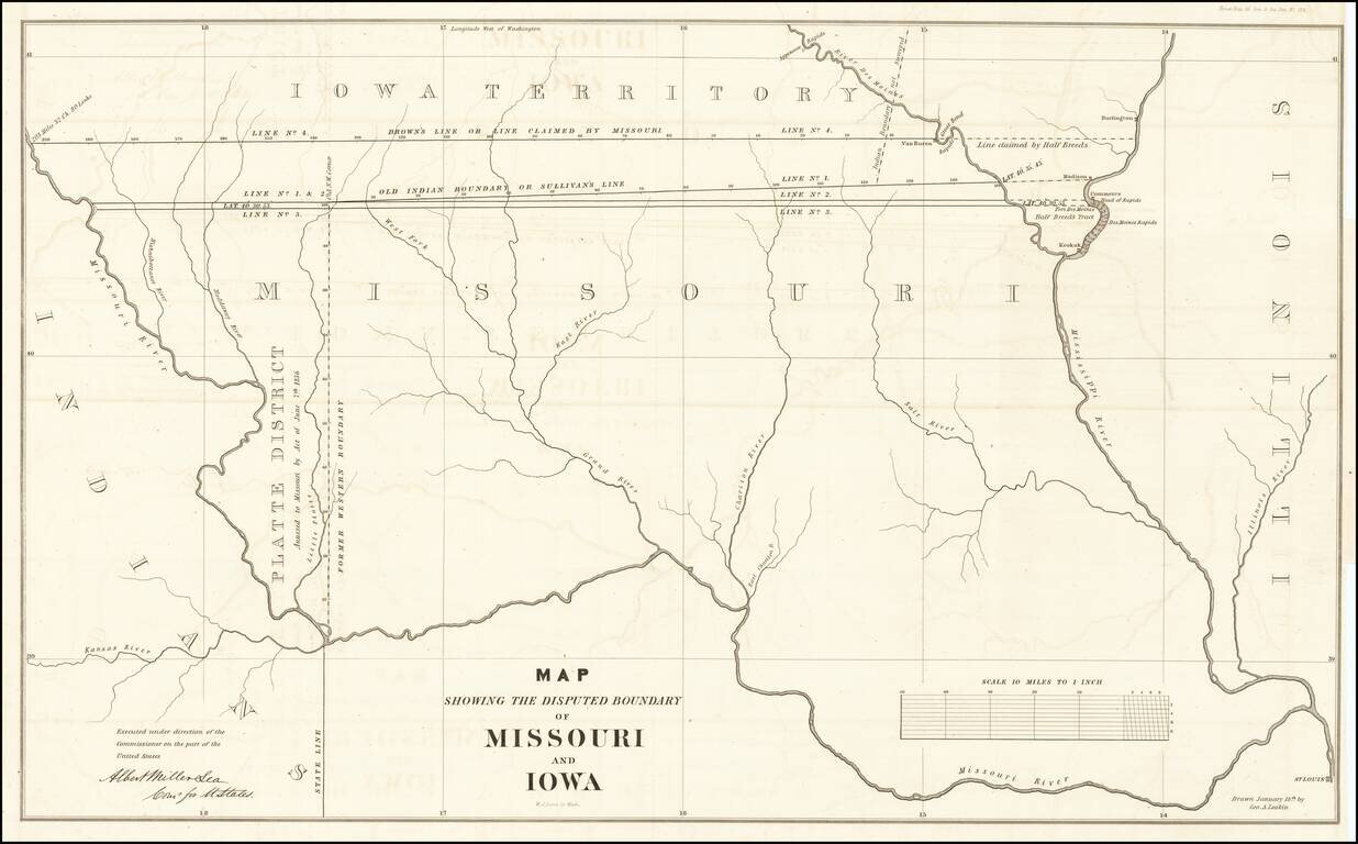
The Iowa-Missouri Boundary Dispute Detailed map illustrating the boundary dispute between Missouri and Iowa, drawn by George A. Leakin, accompanied by the report to the House of Representatives dated December 31, 1842, regarding the Northern Boundary...
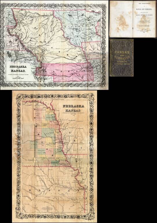
First edition of this fine early guide book to Kansas Territory and Nebraska Territory by Joseph F. Moffette, embellished with rare variant editions of two maps of Kansas and Nebraska, published by J.H. Colton & Company in New York. Pocket guide...
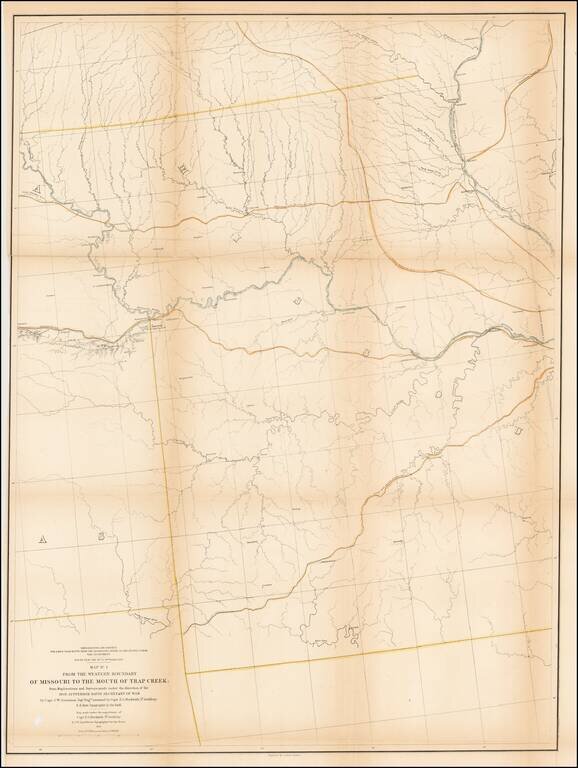
Detailed survey map of the region centered on the course of the Missouri River, published as part of the Surveys to find the most practicable routes from the Mississippi River to the Pacific Ocean. The present map is one of the first maps created by...
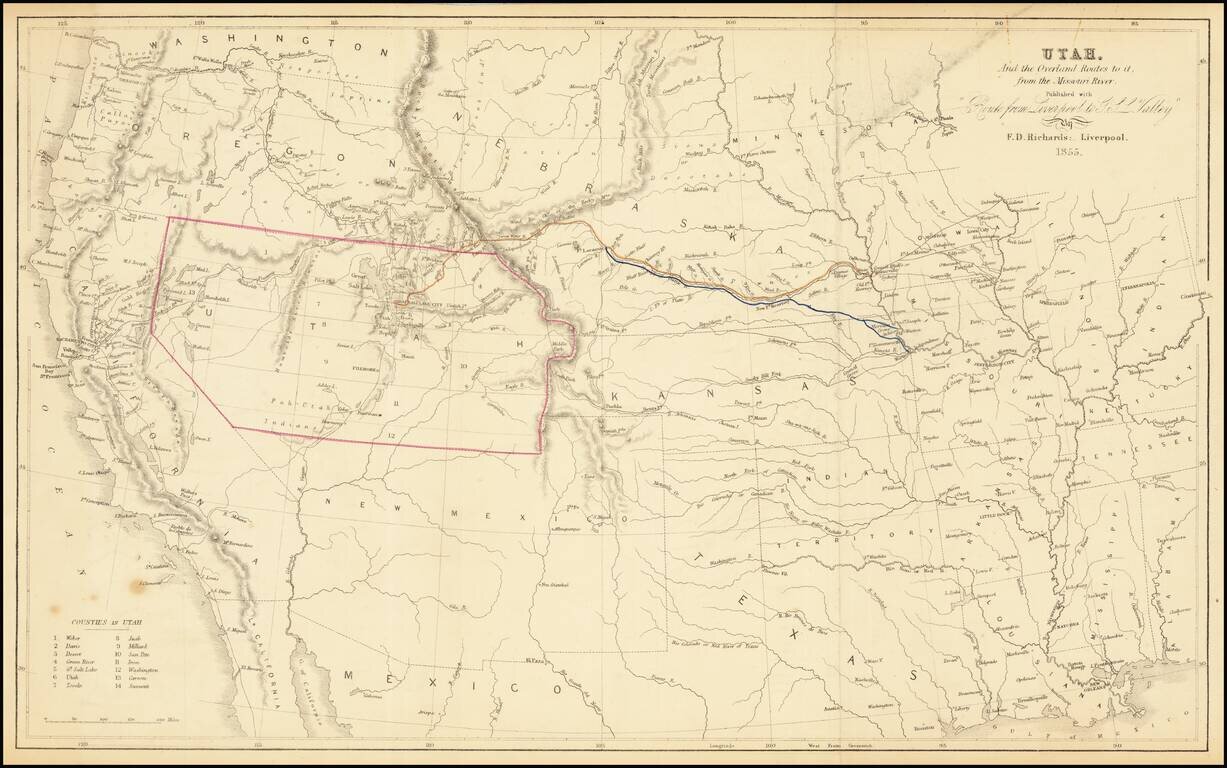
The Only Contemporary Map of the Mormon Trail. Rare hand-colored lithographed antique map of the American West focusing specifically on the routes by which Mormon's could reach Utah from points on the Missouri River. As such, it is the only...