logo

1903. Map of Chickasaw Nation, Indian Territory, Coal and Asphalt Segregation, 1903.

  • Map of Chickasaw Nation, Indian Territory, Coal and Asphalt Segregation, 1903.

Map of Chickasaw Nation, Indian Territory, Coal and Asphalt Segregation, 1903. information:

Year of creation: 
Resolution size (pixels): 
 2318x2504 px
Disk Size: 
 1.66107MiB
Number of pages: 
 1
Place: 
 Washington

Print information. Print size (Width x height in inches):
Printing at 72 dpi 
  32.19 х 34.78
Printing at 150 dpi 
 15.45 х 16.69
Printing at 300 dpi 
 7.73 х 8.35

An example of detailing the file of this map of in a printable high-resolution:

Click to open in high resolution (open in new tab).
Attention! this is just the central piece (central area 960x960 px) of the map file!
This is an example, so that you can see and study the level of detail of a given map. The entire Map will be fully available after payment!

Map of Chickasaw Nation, Indian Territory, Coal and Asphalt Segregation, 1903.

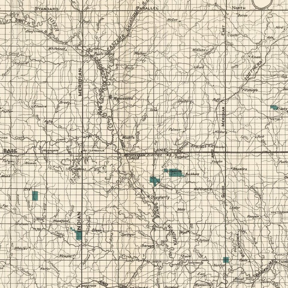
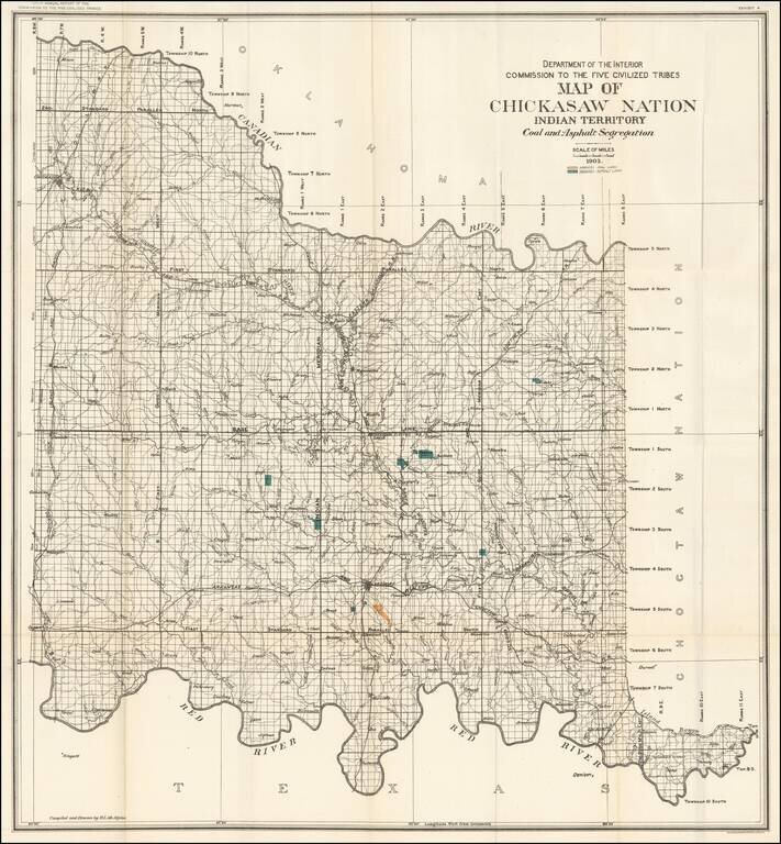
Large format map of the lands allocated to the Chickasaw Nation.

The map shows the coal and asphalt deposits in the Chickasaw nation. Also featured are towns, hydrography, and rail road lines.


Special conditions for students!

If you are a student, write to us in telegram: @antiquemaps and indicate what material you need and for what work you need a map in high detail. We are ready to provide material on special terms. For students only!

Item information:

Year of creation:
Size:
2318x2504 px
Disk:
1.66107MiB
Number of pages:
1
Place:
Washington
Author:
United States Department of the Interior.
$14.99

Related item