
Rare old maps of the United States.
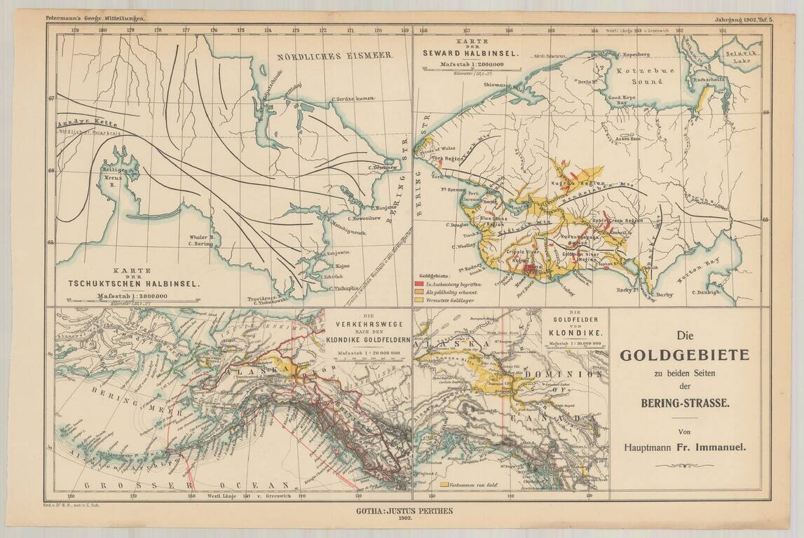
Fine set of four maps, highlighting the gold regions in Alaska and the Behring Straits, published by A.H. Petermann. The maps including the following: The Klondike Gold Region The Seward Peninsula Gold Region Routes to the Klondike Gold Fields...
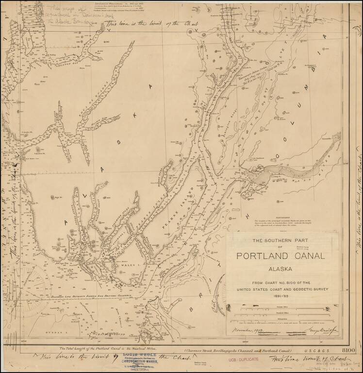
Original artwork for George Davidson's book on the Alaskan Boundary Dispute. The work consists of a US Coast and Geodetic Survey chart amended by George Davidson, for publication in "The Alaska Boundary," published in 1904. In addition to the...
![[To The Alaska Gold Fields] Map of Fairbanks Mining District](/map/small/65950.jpg)
Rare promotional map of Alaska and the Gold Regions, published by the Northern Navigation Company of San Francisco. The map identifies dozens of the most important towns in Alaska in Red. The "Winter Trail from Valdez to Fairbanks is shown, as are...
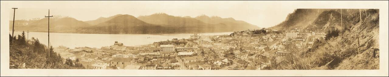
Fine panoramic photographic view of Juneau taken from the mainland with the city in the foreground and Douglas Island in the background. Sheelor, originally known for California scenic photography, went to Alaska and the Klondike where he photographed...
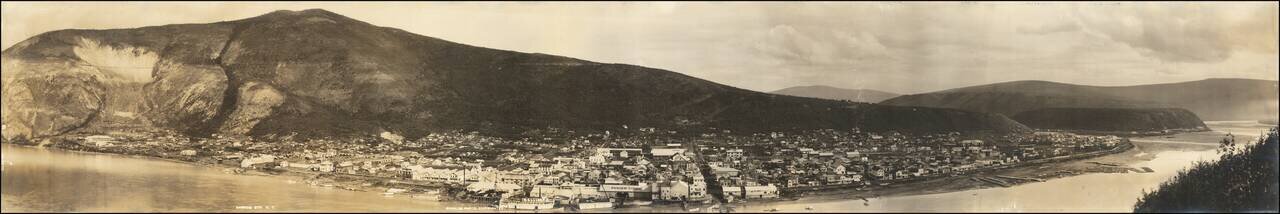
Panoramic photographic view of Dawson City in Yukon Territory, likely taken by Sheelor at the later end of the Klondike Gold Rush. Wonderful panorama of the town taken from a hill across the Yukon River. While at the time of this photo Dawson City...
![[Bering Land Bridge, Alaska] Teller-Kougarok Area Compliments of Lomen Commercial Company Nome, Alaska](/map/small/45000jc.jpg)
Detailed map of the Teller-Kougarok area of the Seward Peninsula, the westernmost point of the mainland of Alaska, just across the Bering Straits from Russia. The map is named for the town of Teller and the Kougarok River. The map was a promotional...
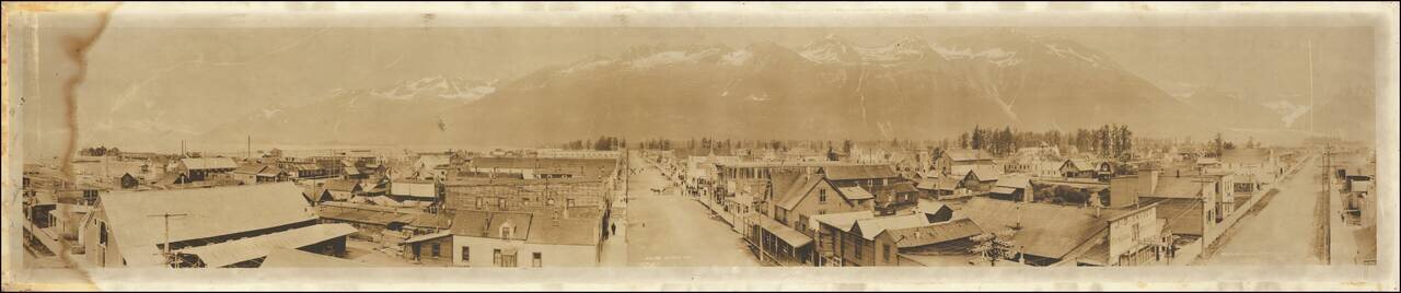
Panoramic photographic view of Valdez, Alaska, likely taken by Sheelor at the later end of the Klondike Gold Rush. The city was named in 1790 after the Spanish Navy Minister Antonio Valdés y Fernández Bazán. A former Gold Rush town, it is located...
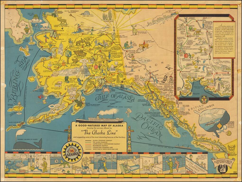
Nice example of the first edition of this decorative pictorial map of Alaska, first drawn by Edward Camy for the Alaska Steamship Company in 1934. A fine pictographic map of Alaska, with a large inset of the Alaska Railways Route from Seward to...
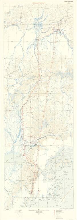
Rare Military Air Map for Alaska Rare oversized aeronautical map of Alaska, published by the United States Army Air Corps, Information Division. The map was issued very early in the Aeronautical history of Alaska. The first manned flight in Alaska...
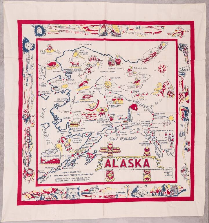
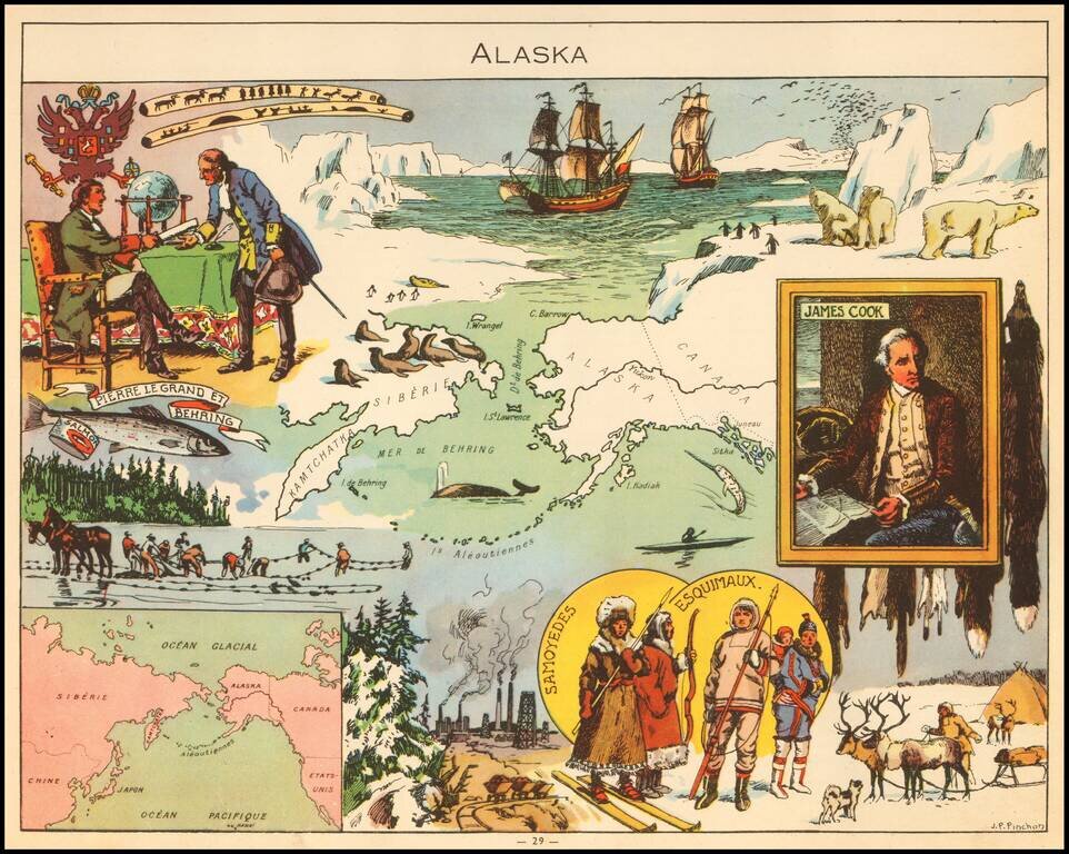
Large vintage pictorial map of Alaska printed on linen. The map is surrounded by a large decorative border featuring native Alaskans, landscapes, and wildlife. The map is not without humor; it describes whales as "portable geysers of Alaska". The...
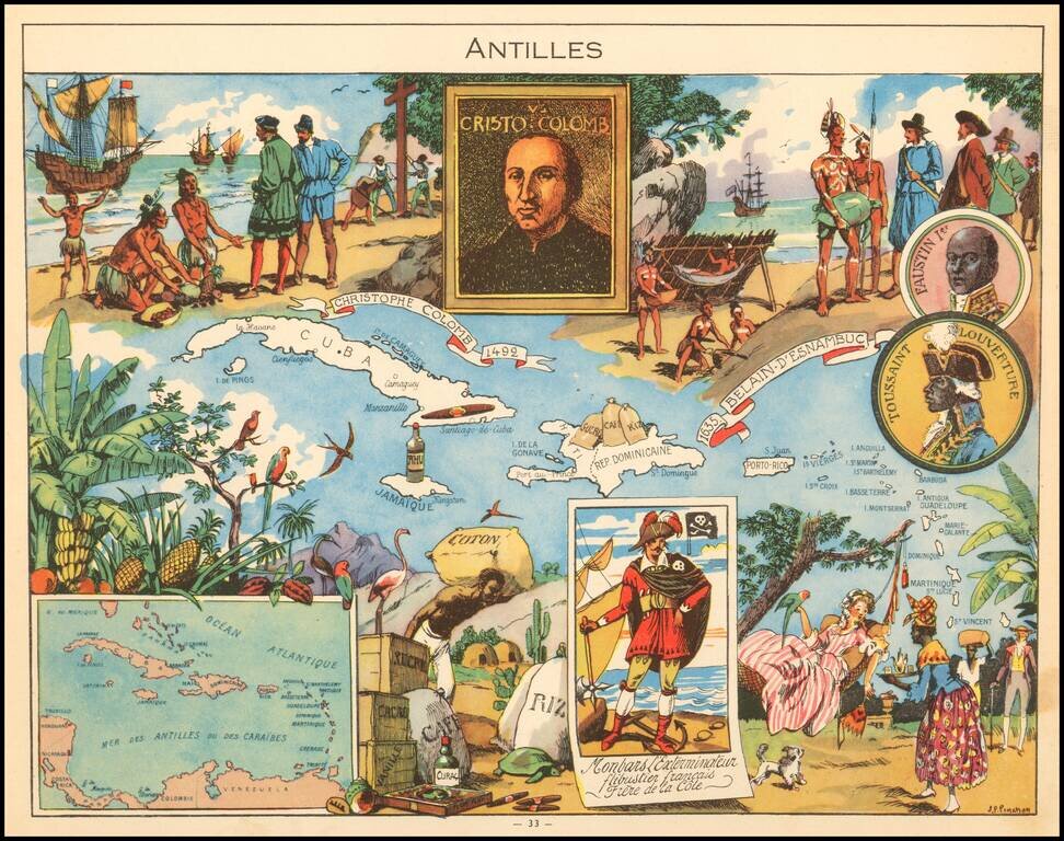
Decorative pictorial map of the Caribbean, published by Children's book artist JP Pinchon.
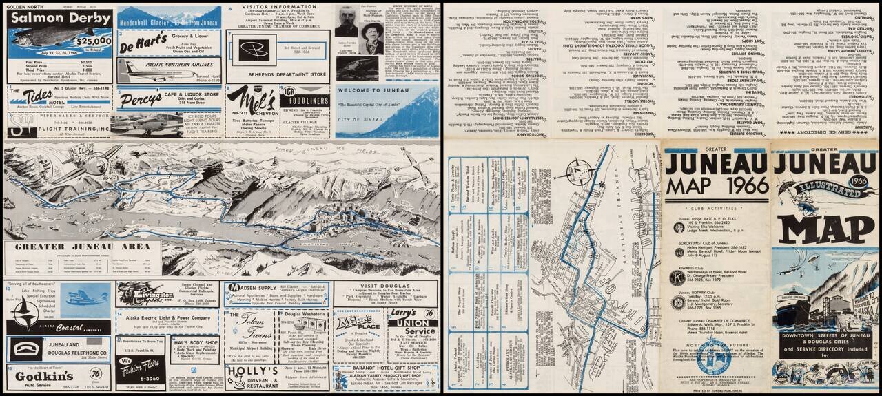
Decorative and detailed view of Juneau Alaska by Alaskan Artist Rudy J. Ripley, with a map of Juneau, local advertising and promotional information. The primary view shows the Gastinaeu Channel, Juneau and its Harbor and the surrounding mountainas and...
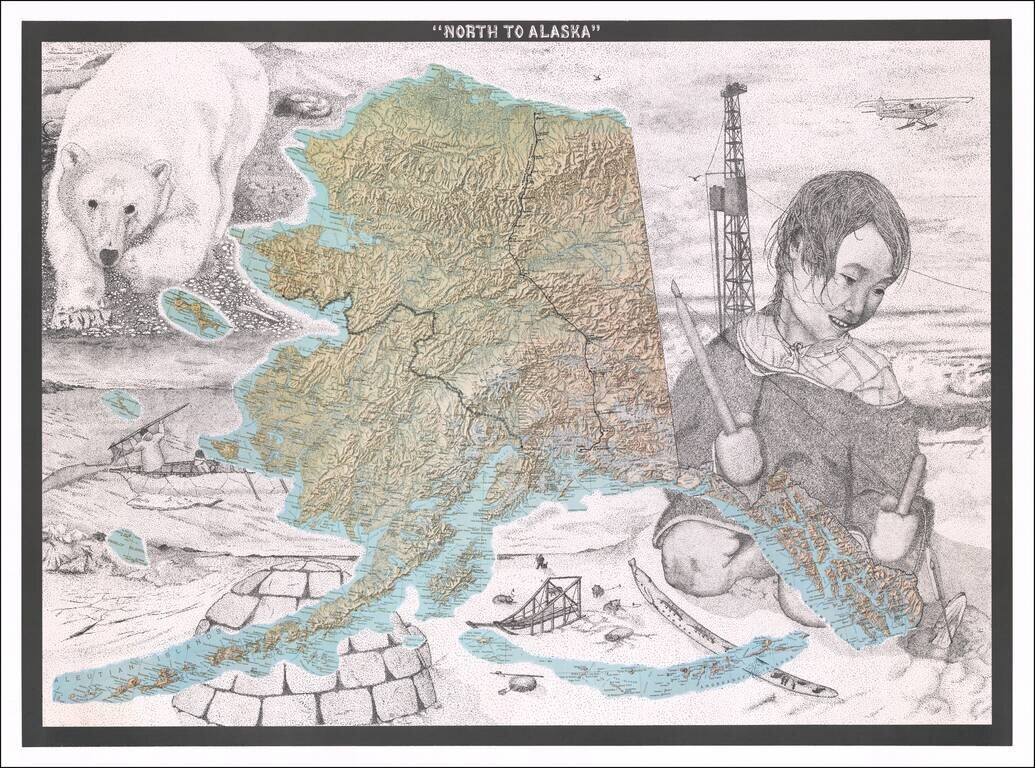
Fine Topographic Poster Map of Alaska with Images of Alaskan Life Detailed map poster depicting the topography of Alaska set amongst stippled drawings showing pictures of Alaska’s snowy landscape and life. This is the first time we have seen the...
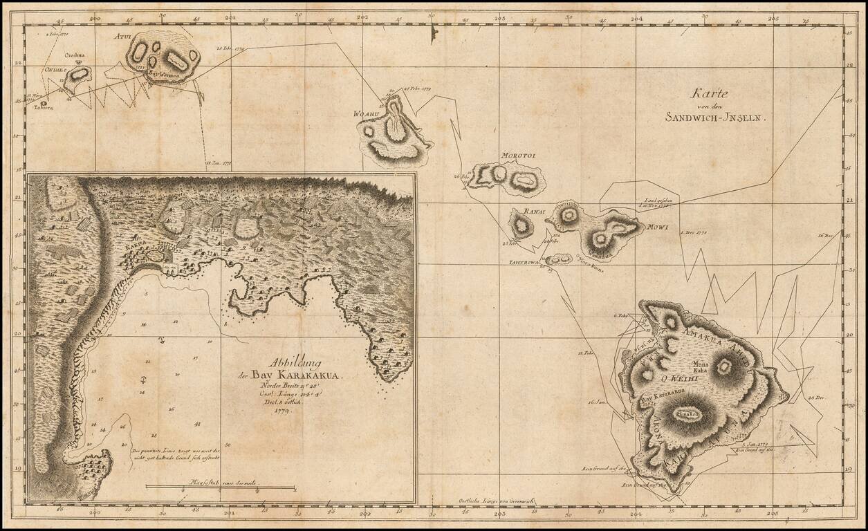
Rare German Edition First Map of Hawaii -- From The Explorations of Captain James Cook Nice example of this very rare German edition of the first map of the Hawaiian Islands, which appeared in the official account of Captain James Cook's Third...
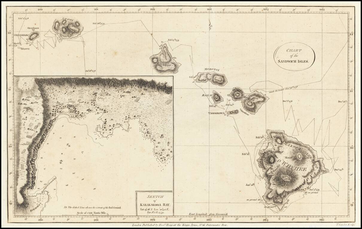
Nice example of the first map of the Hawaiian Islands, from Anderson's edition of the Journal for Cook's Third Voyage. Tracks Cook's route through the islands with dates of various observations and landfalls and provides an interesting topographical...