
Rare old maps of the United States.
![A Map of the Icy Sea in which the several Communications with the Land Waters and other new Discoveries are exhibited [Sea of the West]](/map/small/0054dg.jpg)
An interesting map on a north hemispheric projection, showing the regions then being actively explored by the Russians, French and English. The projection is based upon Phillipe Buache's work from the prior decade and illustrates one view of the...
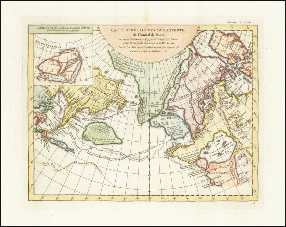
A fascinating map of the Northwest Coast, showing De L'Isle's conjectural northwest coast, based upon De Font and Russian Discoverers, including the Bay of the West. The map is part of the great mid-18th Century debate, spurred by the reports of...
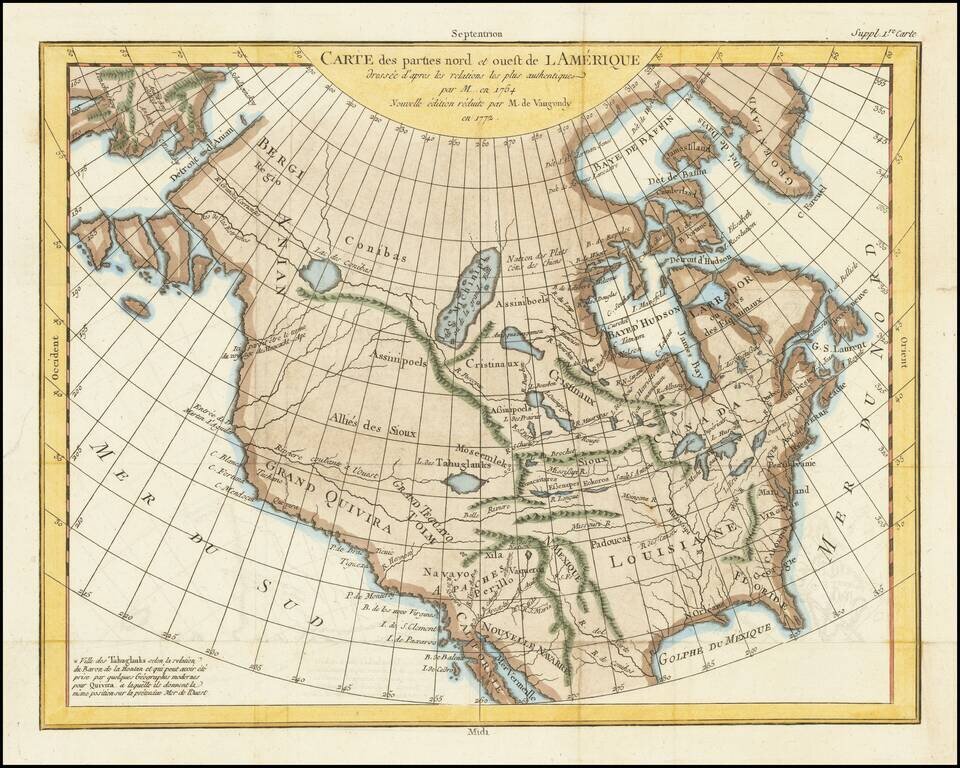
A fascinating map of North America, based upon a map by Thomas Engel. Engel's map of North America was issued in his Memoires Observations Geographiques in 1765, and provides a fascinating look at the watercourses across North America, with no less...

Rare Dutch Edition of Didier Robert De Vaugondy's Comparative Cartographic Gem -- The Final De Vaugondy Map In The Greatest Cartographic Debate of the 18th Century Didier Robert De Vaugondy's Nouveau System Geographique . . . represents the final...
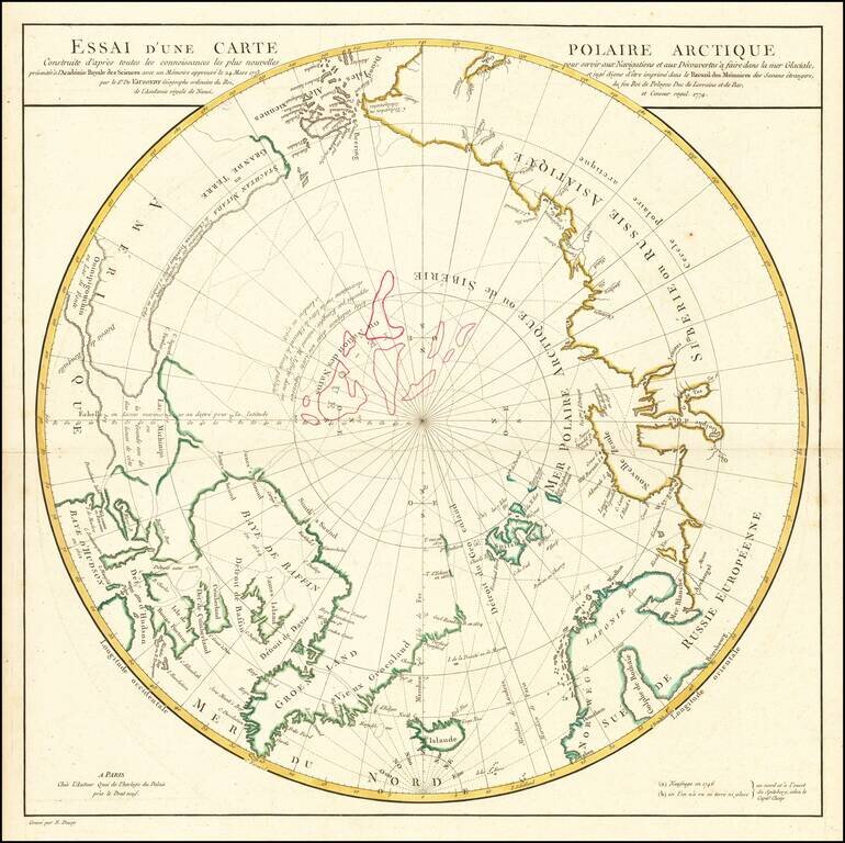
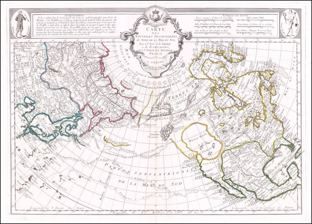
A Cartographic Landmark -- De Vaugondy's Presentation to the French Royal Academy on the Most Practicable Sailing Routes to the Pacific via the North Polar Regions Extremely rare polar map produced to illustrate a presentation made by Didier Robert...
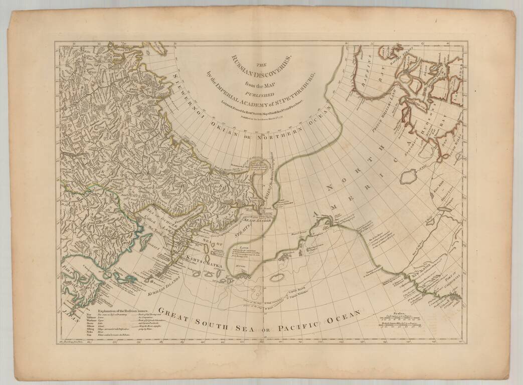
Fine English edition of Muller's map of the Northwest Coast of America and Northeast Coast of Asia, based upon reports from J.N. De L'Isle in St. Petersburg and others. Includes a massive conjectural land mass approximating the Alaskan Archipelago and...
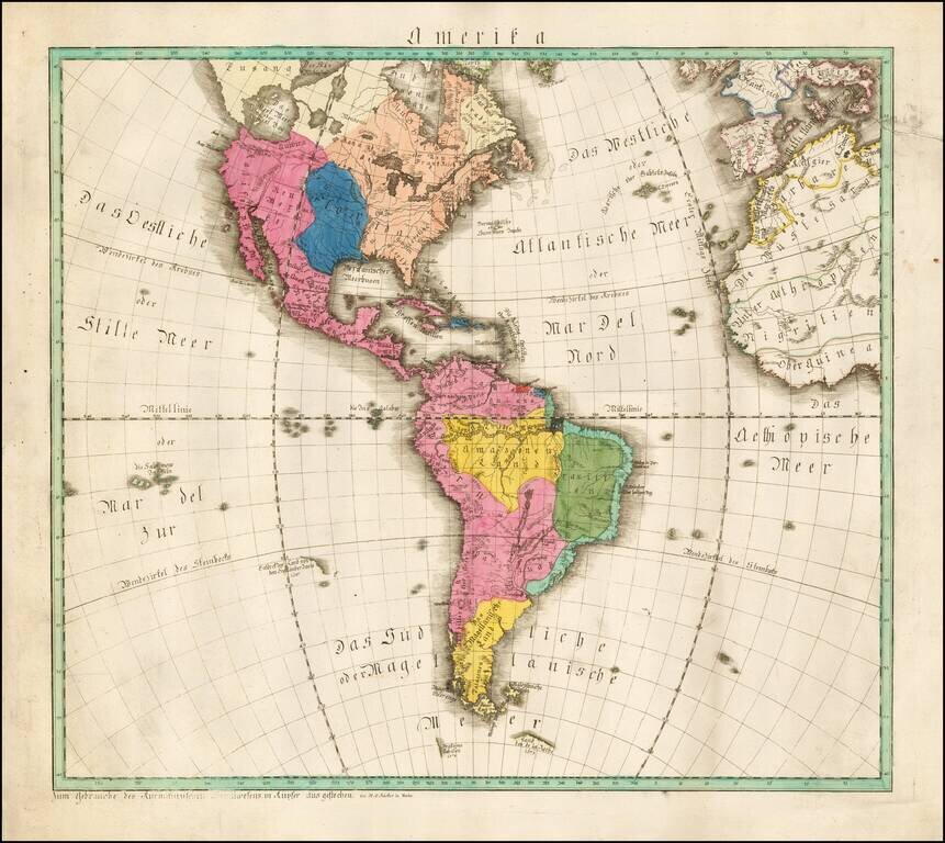
Extremely rare map of America, published in Mainz by W.C. Rucker. The map boldly shows the Bay of the West (Das West Meer oder West Bay). Louisiana is boldly depicted in blue, at a time when it was the only significant French territory the New...
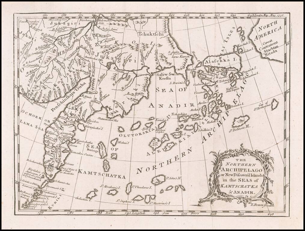
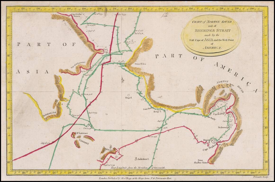
Rare early map depicting the Bering Strait and the newly discovered Aleutian Islands, shortly before the region was visited by Captain James Cook in 1778. In 1741, Vitus Bering, a Dane in the service of Russia, and Aleksei Chirikov, a Russian, sailed...
Santini's edition of Joseph De L'Isle's map of the Northern Pacific Ocean, North America and Asia. De L'Isle's map was a cartographic landmark, representing the most important advances in the mapping of this region prior to Cook. The map reported the...
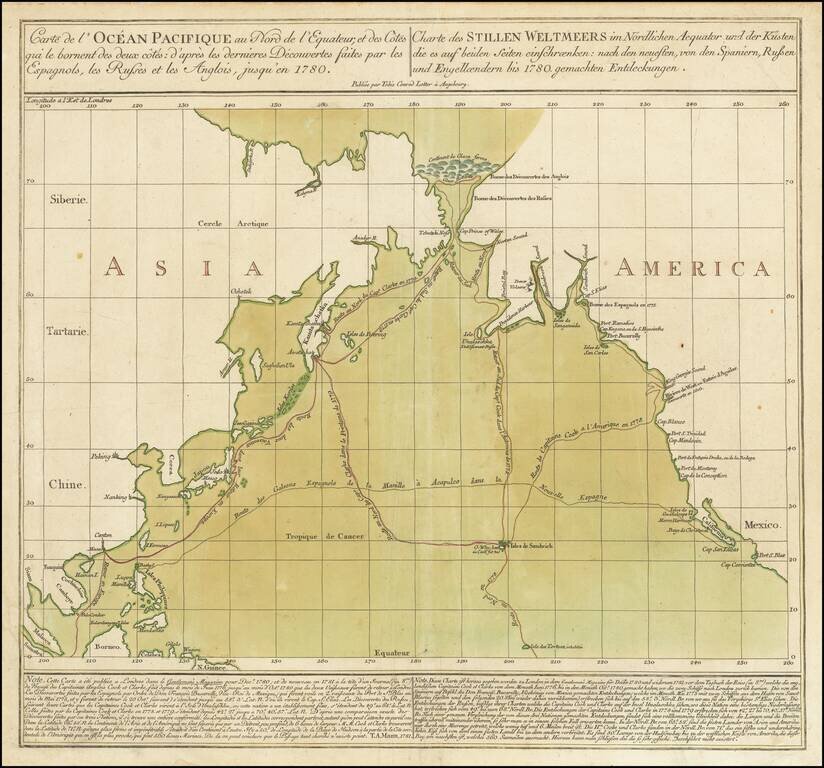
Striking Chart of the Northern Pacific, One of the Earliest to Show Hawai’i Rare chart of the Northern Pacific with the coasts of Asia and America, showing the voyage of the Spanish treasure galleons and Captain Cook’s third voyage. Based on...
Detailed charting of Cook's exploration of the Northwest Coast of America and the Northeast Coast of Asia. Includes daily tracks and a number of place names, showing the tracks of Cook's Voyage on a daily basis. Cook's Voyage to the region was one of...
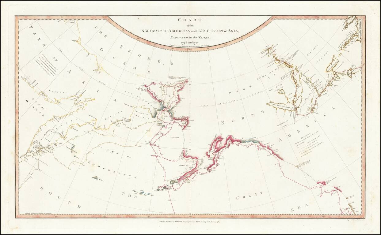
Fine, Famed Map of the North Pacific from Cook’s Third Voyage—First Edition! Rare, first edition of the so-called “lost” chart of Captain James Cook, published in 1784 by William Faden. The map illustrates in great detail the known and...
Striking Map of the North Pacific From Cook’s Third Voyage Account Fine example of the map of the Northern Pacific and contiguous coasts of America and Asia, from the official account of Captain James Cook’s third voyage, published in London in...
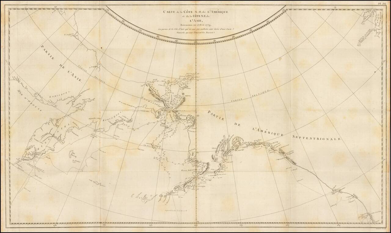
Finely engraved map of the North Pacific and contiguous coastlines of Alaska and Russia, published in the first French edition of the official account of James Cook's Third Voyage. The present map is of the utmost importance in the cartographic...
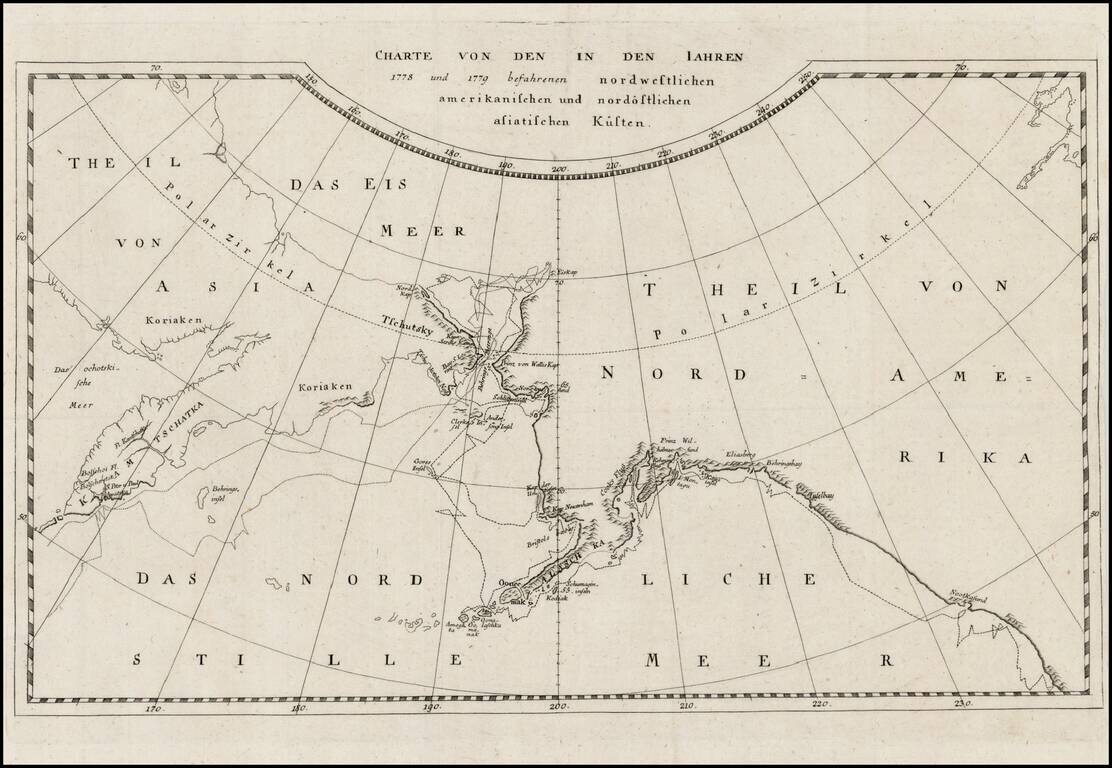
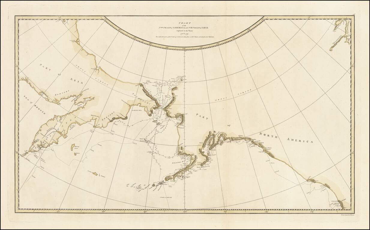
Rare map of the Northwest Coast of America and Northeast Coast of Asia, illustrating the tracks of Captain James Cook's Voyage in the region in 1778 and 1779. This edition of the map is apparently very rare. This is the first example we have ever seen.
![Naufrage De M.M. De Laborde Sur Les Canots De La Peyrouse Au Port Des Francois Dans La Californie . . . [Shipwreck of the Astrolabe's yawl at Port des Francais, Lituya Bay, Alaska]](/map/small/52480.jpg)
Rare copper engraving showing the shipwreck of two small boats that were part of the La Perouse Expedition, during their reconnaissance of Lituya Bay, near Juneau, Alaska. The view depicts a group of French crew members fight storm in small boats as...