
Rare old maps of the United States.
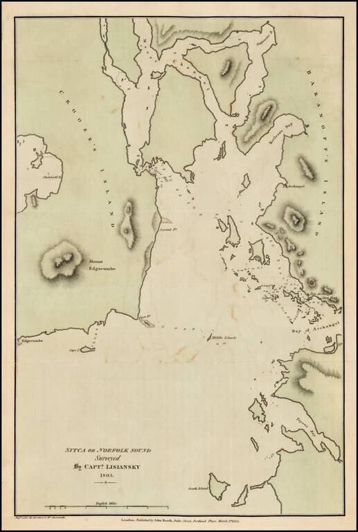
Fine example of the English edition of Lisiansky's map of the area around Sitka and Sitka Sound in Alaska, based upon the surveys of Captain Yuri Federovich Lisiansky in the region at the beginning of the 19th Century. The map is one of the earliest...
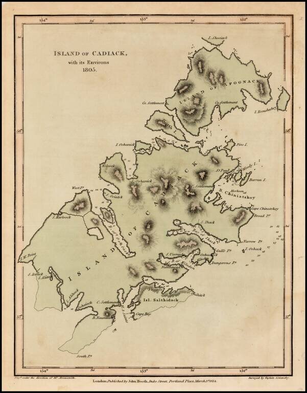
Fine example of the English edition of Lisiansky's map of Kodiak Island, in Alaska, based upon the surveys of Captain Yuri Federovich Lisiansky in the region at the beginning of the 19th Century. The map is one of the earliest obtainable maps of the...
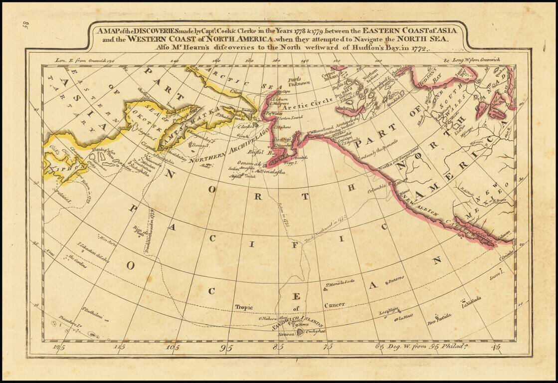
Outline color example of Carey's map of Cook's Discoveries in the Pacific and Hearn's discoveries west of the Hudson, in search of the Arctic Sea. This is one of the earliest appearances of a Cook map to be published in America. Excellent conjectural...
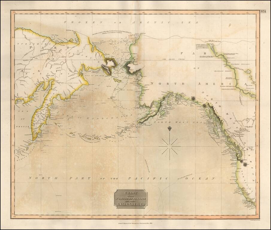
Scarce map of the NW Passage, the NW Coast of America and NE Coast of Asia. The map extensively tracks the voyages of Captain James Cook beyond the Bering Straits on a nearly daily basis in 1778 and 1779. In the Arctic Sea, a note regarding McKenzie's...
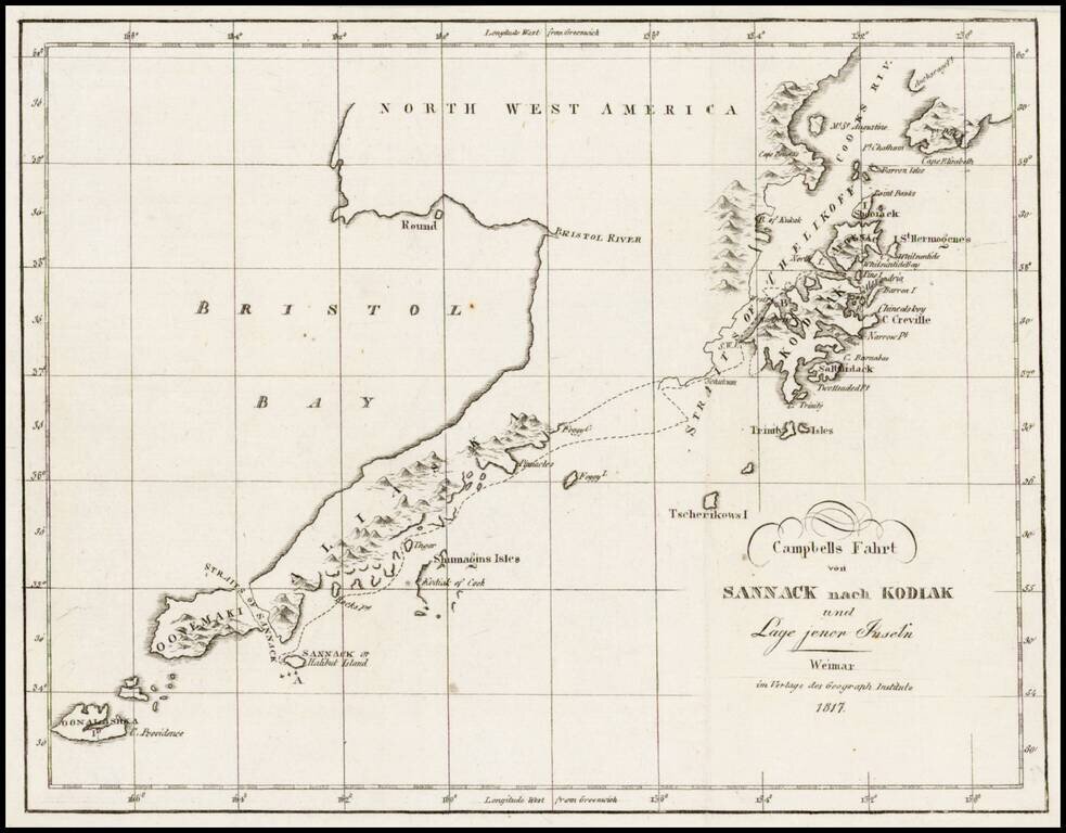
Rare map showing the tracks of Archibald Campbell's long boat trip from Sannack to Kodiak (then Russian America) in 1807. This map, showing the southwestern tip of Alaska and several Aleutian Islands, is from a German Serial containing numerous...
![Charte von Nord-America Prag 1818 [Rare Alaska Inset Map]](/map/small/62300.jpg)
Rare Czech map of North America, published in Neueste Lander und Boltersunde, in Prague. The map provides a fascinating depiction of the Transmississippi West, with unusual mountain ranges and a wishful but elusive search for a simple watercourse from...
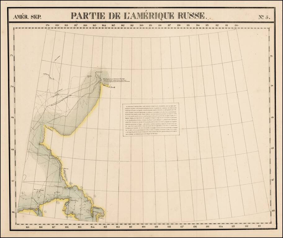
Large format map of the region, showing the Northern most known limits of Alaska. The northernmost named place is C. Glace de Cook. Cap Laburn is also shown, as is C. Mulgraves, and B. de Bonne Esperance. The primary feature on the map are the tracks...
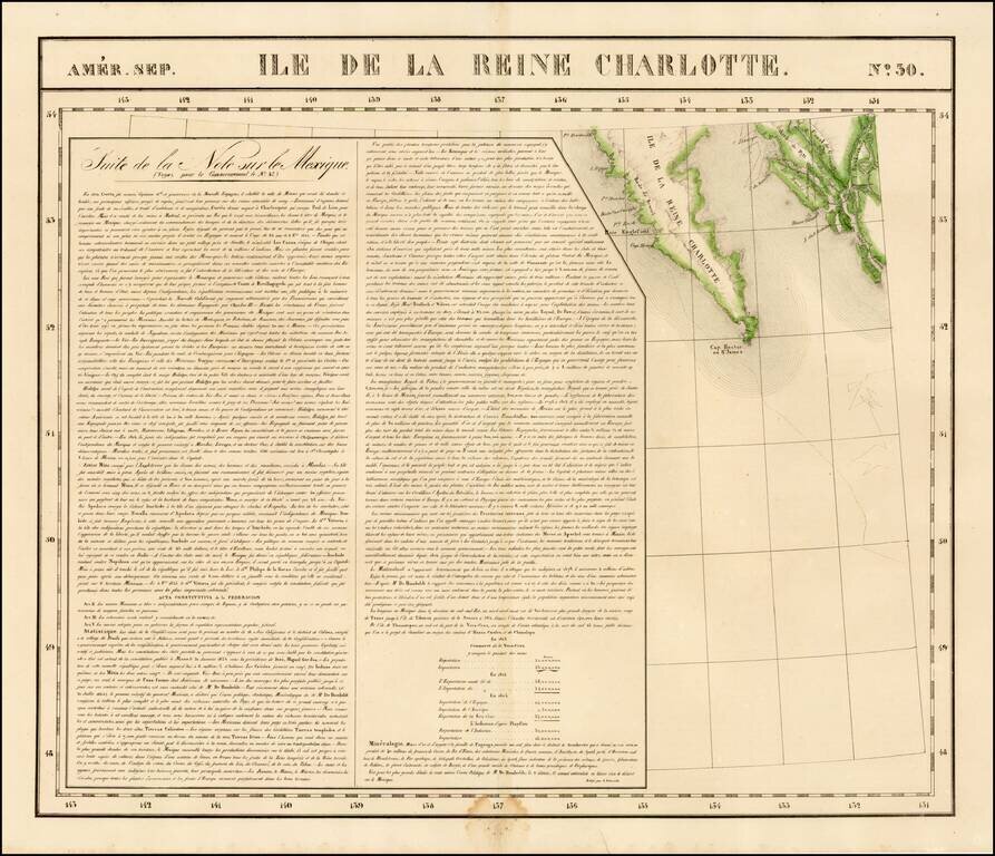
Highly detailed map of the southern portion of Queen Charlotte's Island and the continguous coastline of British Columbia, in the area of Canal de Grenville and Hawkesbury. Detailed and interesting map. From Vandermaelen's remarkable 6 volume atlas,...
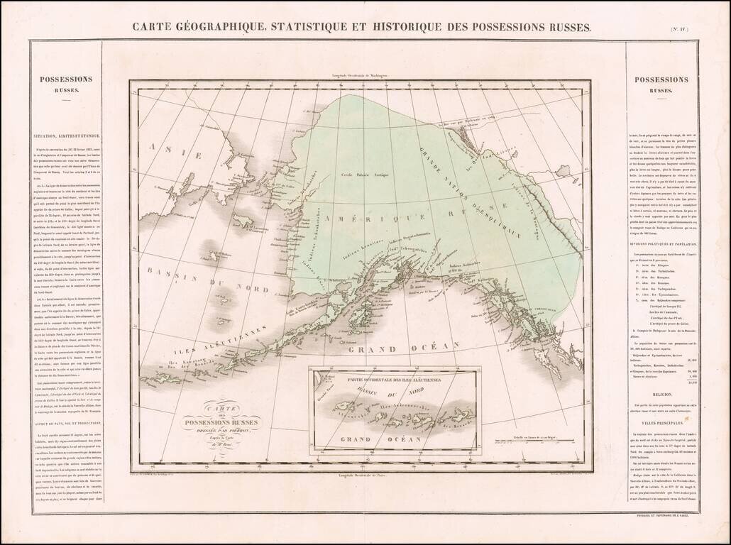
One of the Earliest Antique Maps of Alaska / Russian America -- 42 Years Prior to Its Acquisition by the US Scarce map of Russian America, being perhaps the first separate map of the region which would become Alaska. The region extends south to Queen...
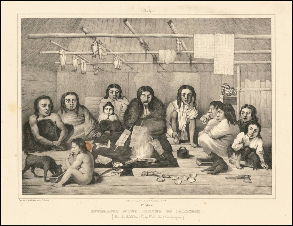
Beautiful antique lithograph of the interior of a Tlingit cabin, from an image drawn by Alexander Filippovich Postels near Sitka, which was then part of Russian America. The scene depicts 11 individuals sitting around a central fire, with fish cooking...
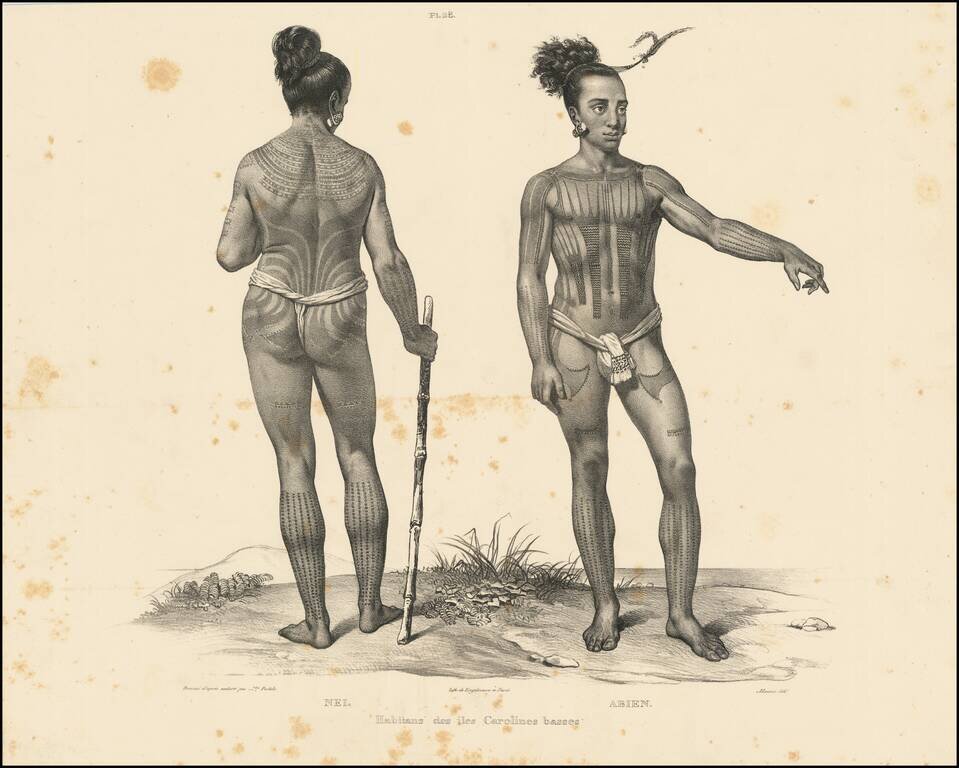
Beautiful antique lithograph of a tattooed Caroline Islander, from an image drawn by Alexander Filippovich Postels, during Fréderic Lütke's circumnavigation in the 1820s. The Caroline Islands are in the South Pacific, north of New Guinea, and were...
![[Map of Russian Possessions in North America] Карта Российскаго Владѣнія въ Сѣверной Америкѣ](/map/small/66569.jpg)
Extremely Rare Russian-Language Map of Russian America (Alaska). Detailed engraved map of Alaska, labeled "Russian Possessions", published in Saint Petersburg in 1836. This is one of very few contemporary Russian maps to focus specifically on Russian...
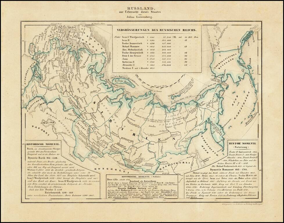
Interesting map of Russia, including Russian America, published in Freiburg in 1839. Includes historical text below the map, covering the history of Russia.
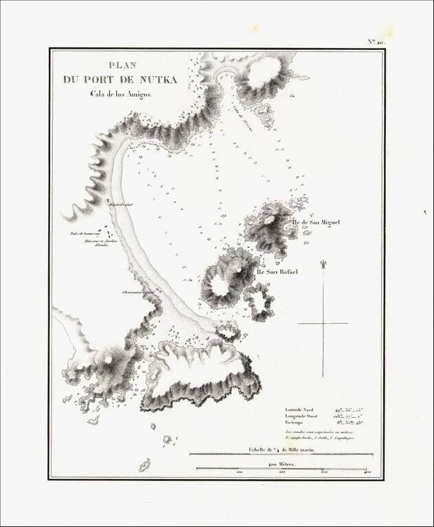
Detailed map of Nootka Bay, from Duflot de Mofras' momumental work. In 1839, Eugene Duflot de Mofras, was assigned to the embassy in Mexico City and instructed to visit the northwestern provinces of Mexico, report on potential commerce, observe U. S.,...
![Меркаторская Генеральная Карта, части Российскихъ Владеній въ Америкѣ (Mercator's [or Mercatorial] General Map, parts of Russian Possessions in America)](/map/small/55959.jpg)
"The First Printed Map of the Interior of Alaska Along the Lower Courses of the Yukon" (Streeter) Rare separately published example of Zagoskin's map of Alaska. According to the Streeter catalogue, “the map must be one of the first, if not the...
![[St. Lawrence Island, Alaska] Карта Острова св: Лаврентия исправленная колониальными мореходами [Map of the Island of St. Lawrence corrected by the colonial sailors.]](/map/small/59917.jpg)
The George Davidson Copy of Tebenkov's Map of St. Lawrence Island, Alaska Rare and remarkable map of St. Lawrence Island Alaska, compiled by Mikhail Dmitrievich Tebenkov, who in 1849 was serving as the Governor of American Russia. Mikhail Dmitrievich...