Map size in jpg-format: 10.427MiB
Click to open in high resolution (open in new tab).
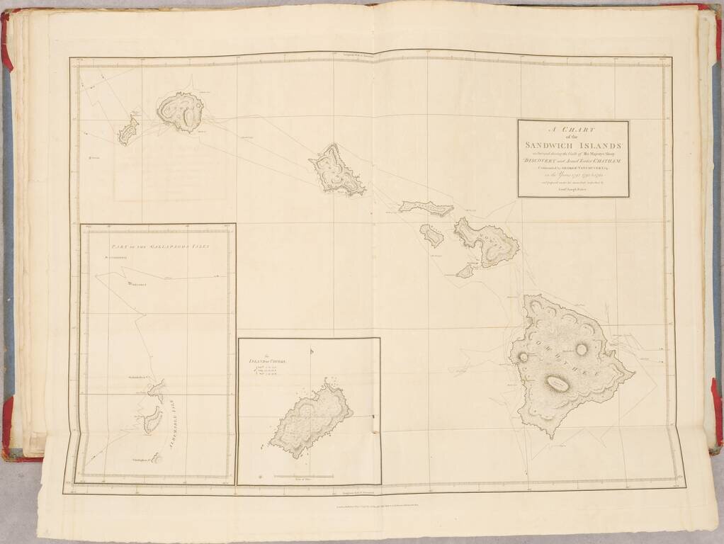
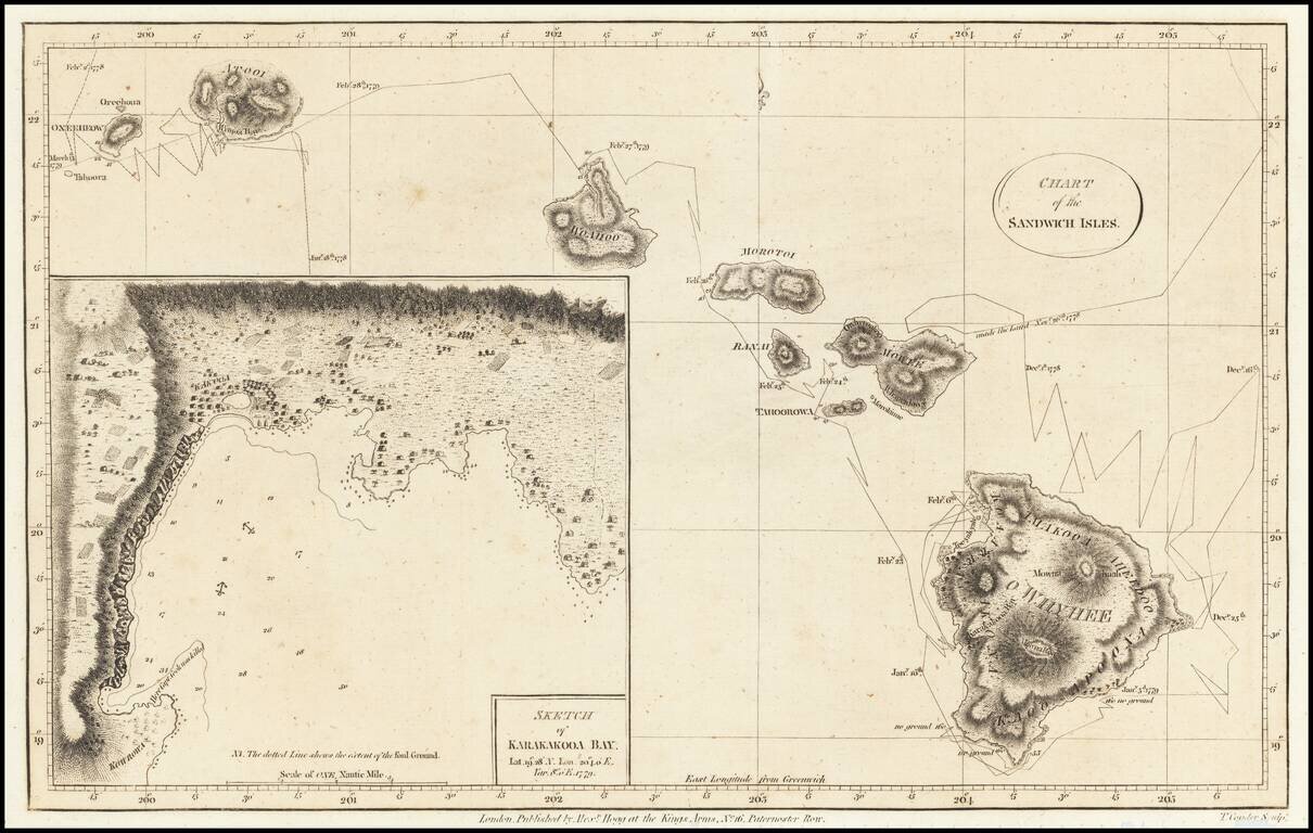
Nice example of the first map of the Hawaiian Islands, from Anderson's edition of the Journal for Cook's Third Voyage.
Tracks Cook's route through the islands with dates of various observations and landfalls and provides an interesting topographical image of the islands. Large inset of Karakakooa Bay, including soundings and anchorages.
If you are a student, write to us in telegram: @antiquemaps and indicate what material you need and for what work you need a map in high detail. We are ready to provide material on special terms. For students only!
![Map of Mexico, Central America, and the West Indies [Insets of Bermuda, Sandwich Islands, Jamaica and Panama Railroad]](/map/small/69133.jpg)