
Rare old maps of the United States.
![[Hawaiian Islands] Aloha Airlines The Spirit Moves Us . . .](/map/small/59216.jpg)
Fine early promotional map for Aloha Airlines.
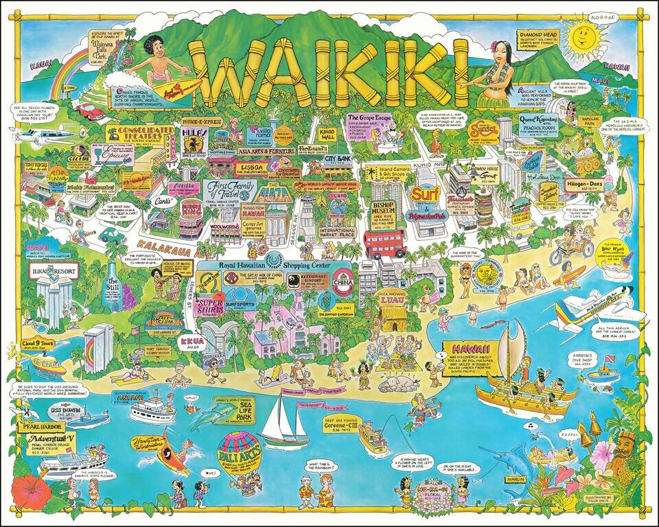
This is a pictorial tourist map of Waikiki, showing the many attractions of Honolulu. In addition to being a tourist map and advertising many of the businesses that operate in the area, the map delves into Hawaii's long history and culture, providing...
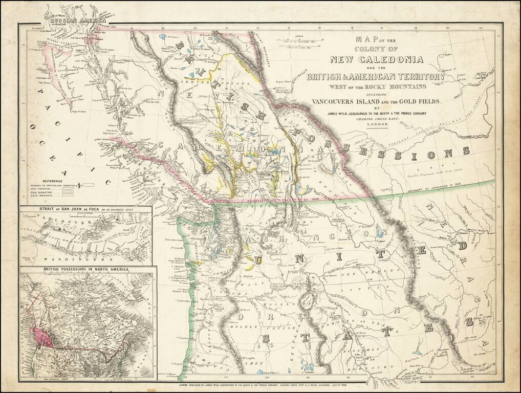
First State of this Exceptional Fraser Canyon Gold Rush Rarity One of the great early mappings of the Pacific Northwest, covering Oregon Territory, Washington Territory, and British Columbia (which was then still "New Caledonia") with information...
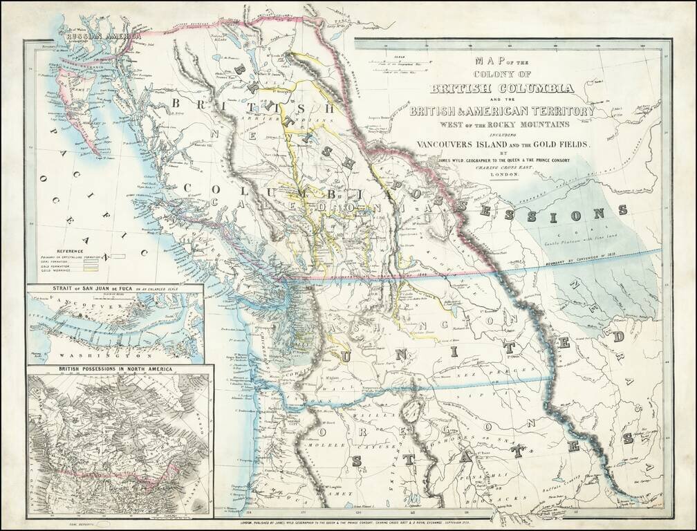
An Exceptional Fraser Canyon Gold Rush Rarity. One of the great early mappings of the Pacific Northwest, covering Oregon and Washington Territories, and British Columbia ("New Caledonia") with information derived from the Hudson Bay Company and Royal...
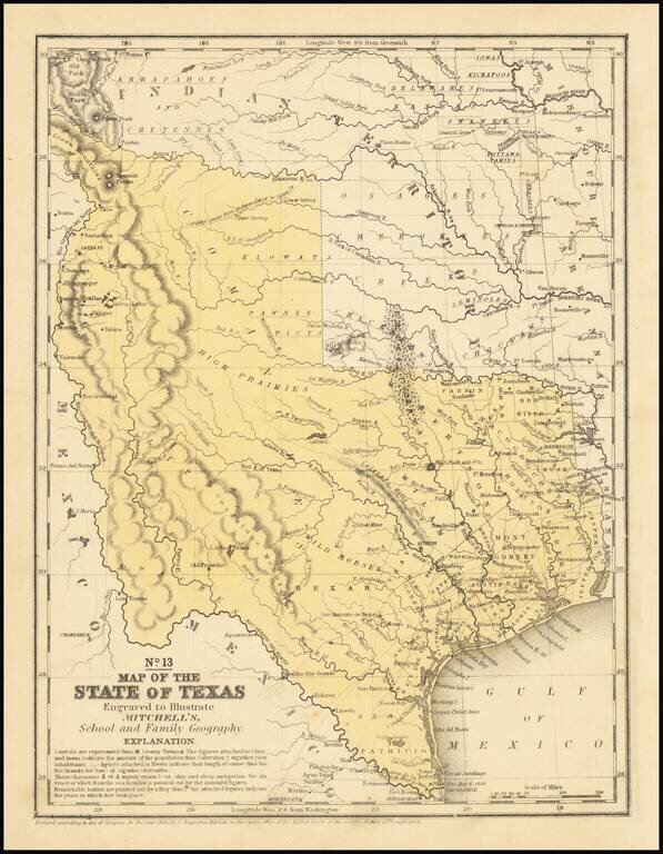
An interesting map of Texas published the year after the state's admission to the Union. In the North, several Indian Districts are shown, including the Comanches, Kiowas and Pawnee-Picts. A region named Wild Horses is shown, this nomenclature derives...
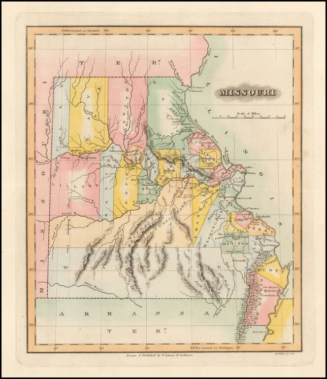
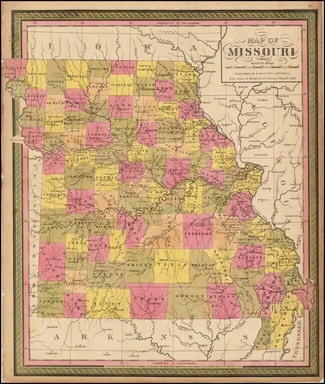
One of the Earliest Printed Maps of the State of Missouri Rare early map of Missouri just two years after statehood. Early state boundaries and most Western area are not yet partitioned into smaller counties. An Osage Boundary Line passes through...
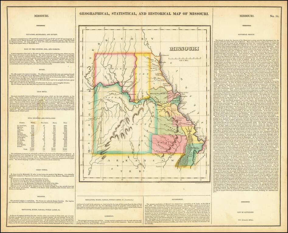
Nice example of the first printed map of Missouri as a state from the first edition of Carey & Lea's Atlas. Size includes text below map, which contains details concerning the topography, indigenous lands, rivers, chief towns, commerce,...
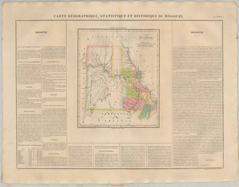
The First European Printed Map of Missouri . Fine example of Buchon's map of Missouri, the first map of Missouri published outside of America. Buchon's map appeared in his Atlas Geographique, Statistique, Historique et Chronologique ...., the first...
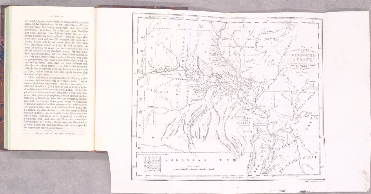
The Beginning of German Immigration to Missouri. Second and best edition. Gottfried Duden was among the first German immigrants to Missouri, having traveled there in 1824. He established a farm in the Missouri River valley between St. Louis and...
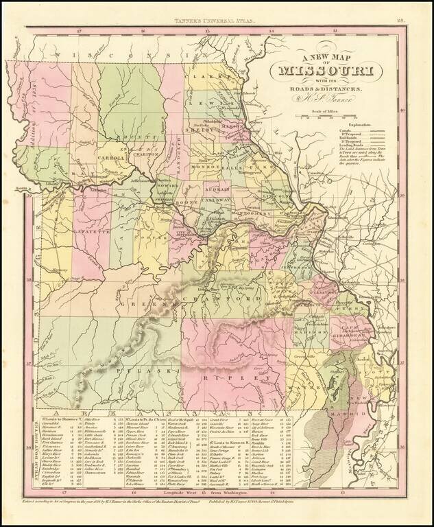
Detailed map of Missouri from Tanner's New Universal Atlas. Hand colored by county and showing towns, rivers, lakes, railroads, roads, etc. Table of Steam Boat routes and distances. Includes a number of ovesized counties, including Barry, Taney,...
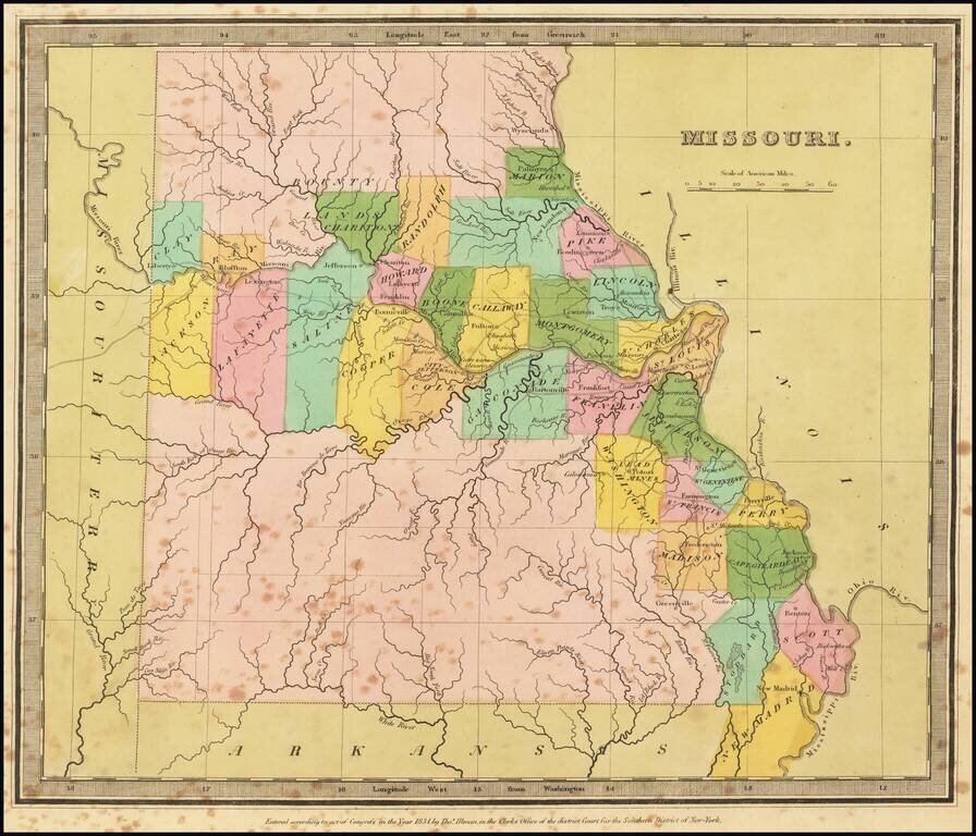
Striking full color example of the first edition of David Burr's map of Missouri, which appeared in his Universal Atlas. Includes fascinating primitive counties, large unnamed counties in the north and south, Bounty Lands above Chariton, etc. The...
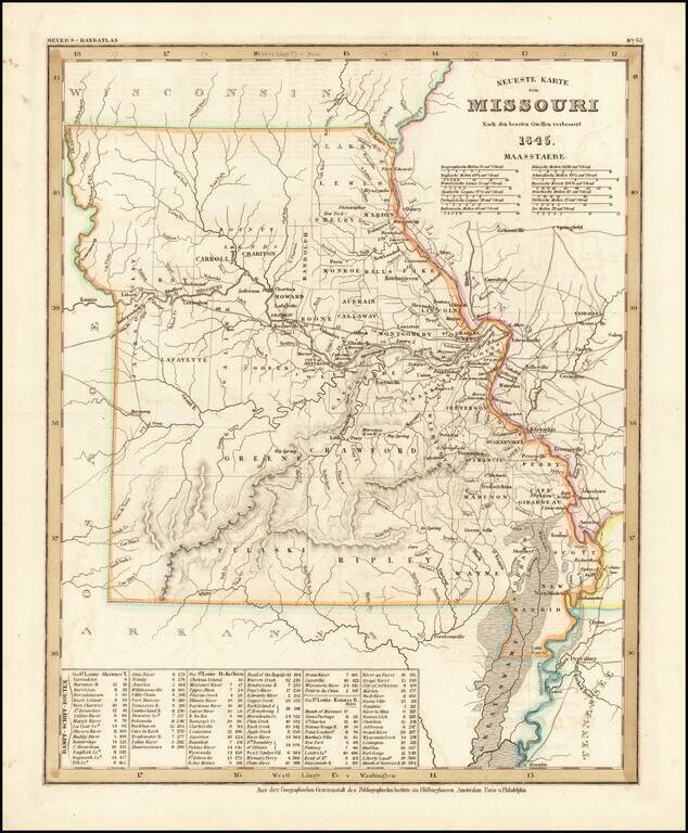
Elegantly engraved & detailed map, taken based upon Tanner's work in the early 1840s. Shows counties, towns, roads, mountain ranges, rivers etc. Includes a table of Distances and times for various steamship routes along several rivers.
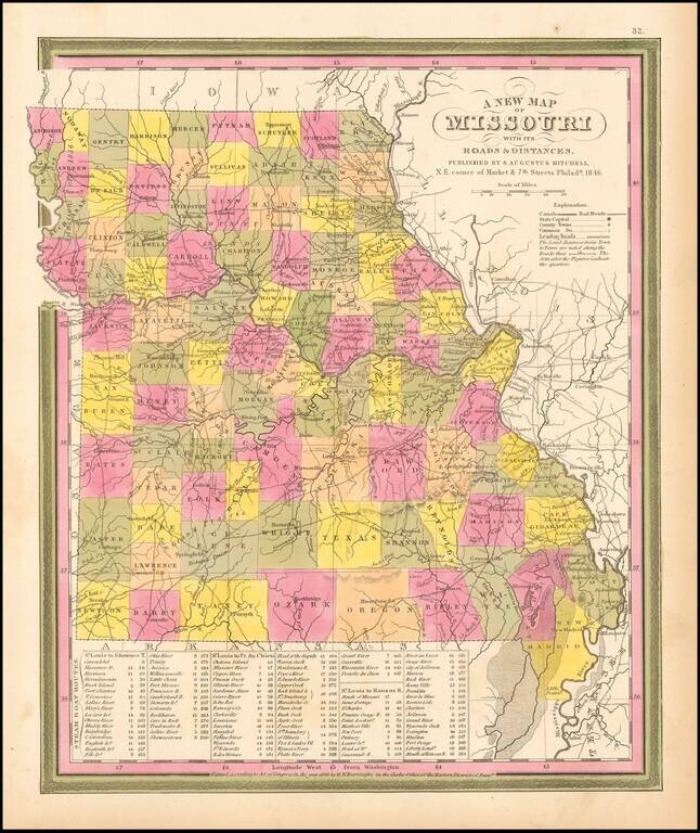
Detailed and interesting map from Mitchell's New Universal Atlas. Hand colored by county and showing towns, rivers, lakes, railroads, roads, etc. Table of Steam Boat routes and distances. Nice wide margins. Mitchell's pre-1850 maps are becoming...
Detailed map of Missouri, hand colored by counties, and showing towns, roads, rivers, mountains, lakes, forts, Post Offices and other details. From one of the leading map makers of the mid-19th Century.
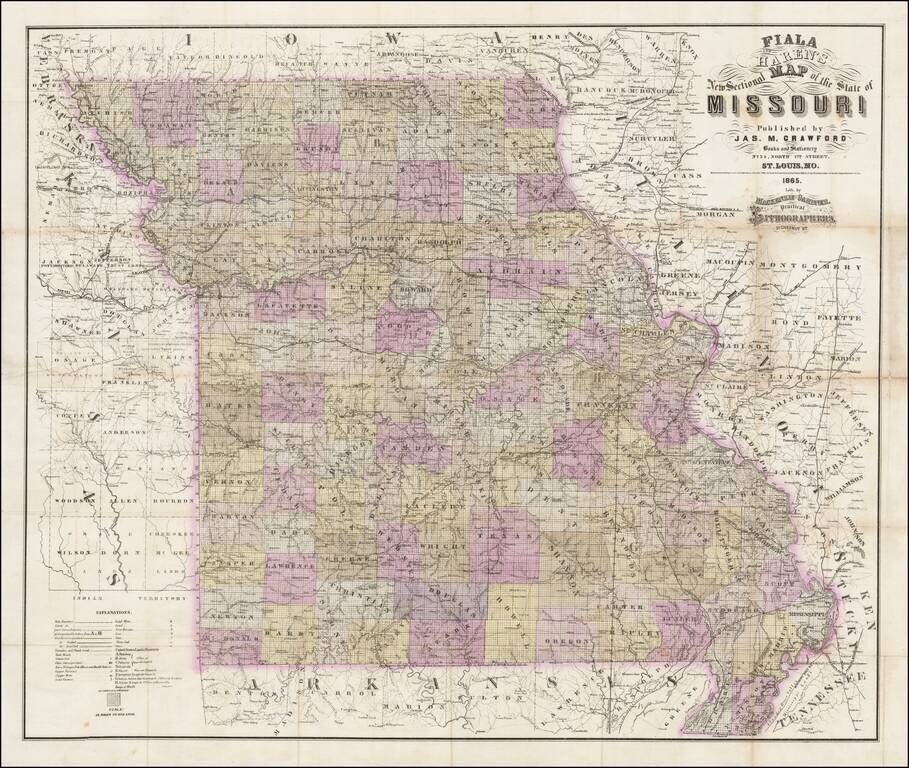
Rare separately published map of Missouri by Fiala and Haren, published in St. Louis by James M. Crawford. The map is hand colored by counties and subdivided by townships, with an extensive explanation of symbols at the bottom left corner. Among the...
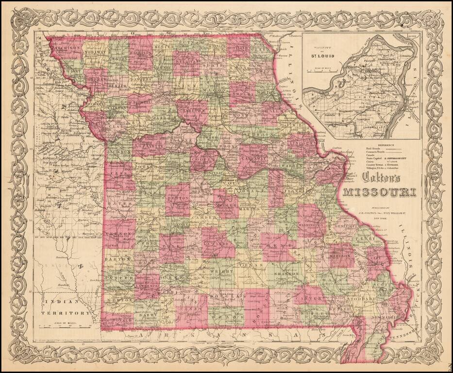
Detailed map of Missouri, colored by counties. Shows roads, railroads, towns, villages, post offices, rivers, lakes, stations and a host of other details. Inset of St. Louis vicinity in upper right corner. Decorative border. A terrific map, from JH...