
Rare old maps of the United States.
![Carte Des Parties Des Iles Sandwich . . . 1786 [with] Carte Des Iles Sandwich . . .](/map/small/52046.jpg)
The Second Mapping of Hawaii / With Comparision To Cook's First Chart Two fascinating charts of the Hawaiian Islands, illustrating the charting of the islands by La Perouse and the compilation of the data from La Perouse and Cook's explorations in the...
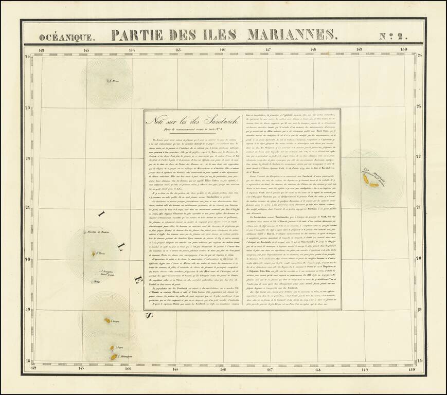
Interesting antique hand-colored lithographed map of the Marshall Islands, with a detailed description of Hawaii ("Note sur les iles Sandwich"). The map shows two "Iles Marshall" and speculates that they are probably the Jardine islands. The islands...
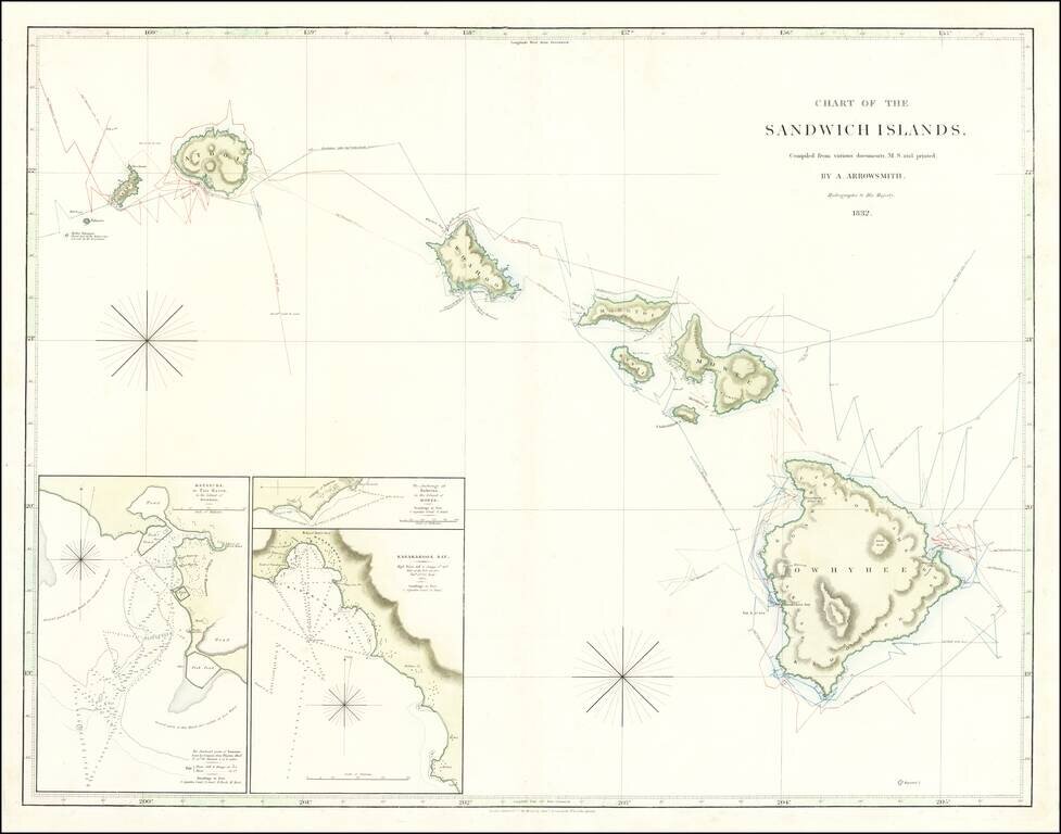
Hawaiian Rarity Rare sea chart of Hawaii, published by Aaron Arrowsmith (and his son Samuel), Hydrographer to the King and the most important English mapmaker of the 19th Century. The map is compiled from manuscript charts and other material this...
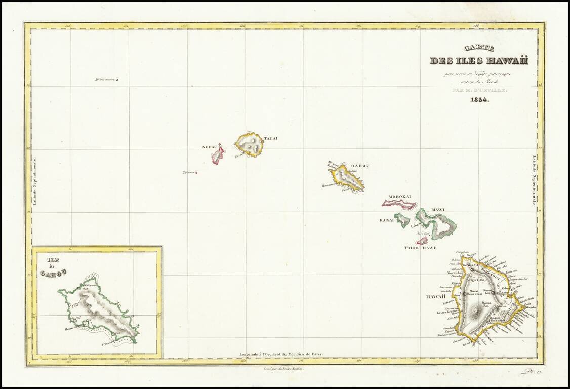
Interesting early map of Hawaii from D'Urville's Voyage pittoreque autour du Monde, one of the earliest printed maps to include the name Hawaii in its modern English spelling. The map is engraved by Ambrose Tardieu, and shows Nihau, Tauai, Oahou,...
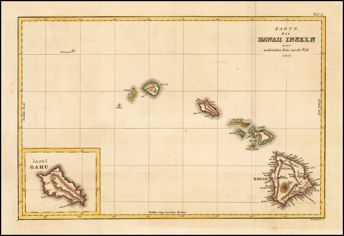
Rare German edition of this early map of Hawaii from D'Urville's Voyage pittoreque autour du Monde, one of the earliest printed maps to include the name Hawaii in its modern English spelling. The map is engraved by Ambrose Tardieu, and shows Nihau,...
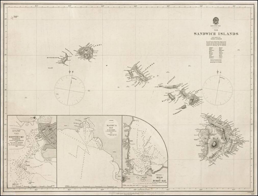
Highly Detailed and Scarce Admiralty Chart of Hawaii Fine, thorough chart of Hawaii first published in 1843 and revised to 1871. The present chart includes inset maps of "Hilo or Byron Bay" by C.R. Malden in 1825. It also includes Kairua Bay...
![[Hand Drawn Map of the Hawaiian Islands]](/map/small/62429.jpg)
Early Manuscript Chart of Hawai’i/Sandwich Islands with Ships’ Track Finely executed chart of the Hawai’ian Islands, drawn from contemporary sources, including the first Admiralty chart of the archipelago. Although intended as a nautical...
![Hawaiian Group or Sandwich Islands [with] New Zealand [and] Feejee Group, Society Island, Marquesas and Galapagos Islands](/map/small/71009.jpg)
First state (with the strapwork border and "No. 33") of Colton's early map of the Hawaiian Islands, New Zealand, Galapagos, Fiji, Society Islands, and Marquesas. Shows towns, rivers, lakes, mountains, islands, etc. A terrific regional map, from J.H....
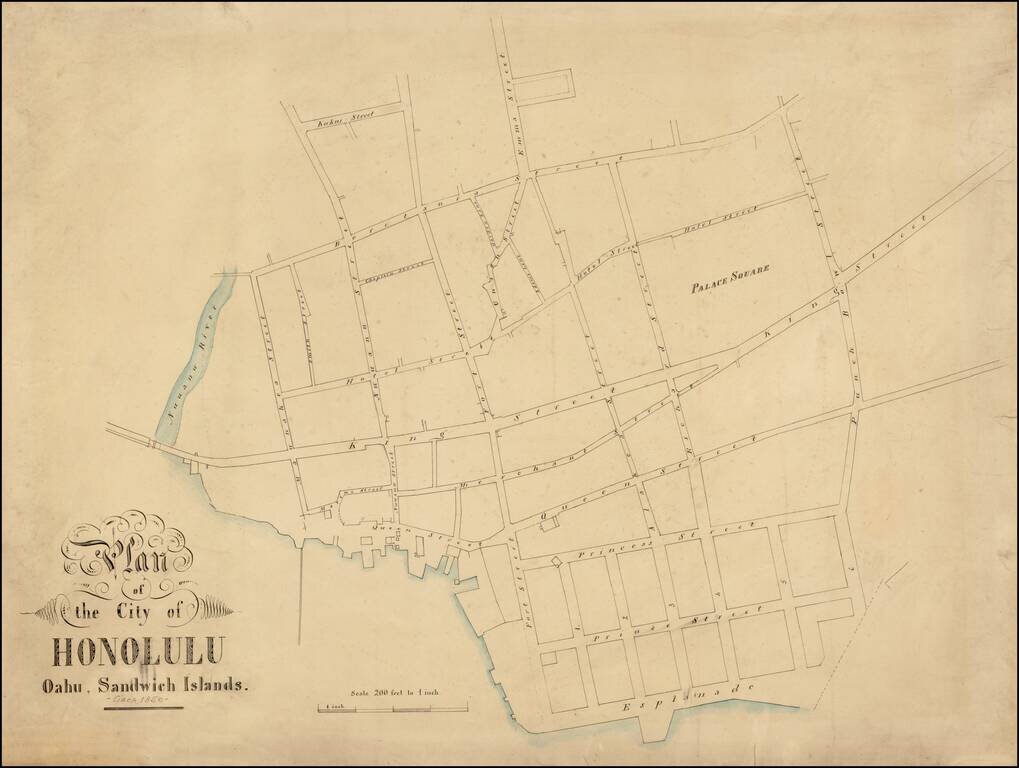
A Remarkable and Previously Unknown Early Manuscript Survey of Honolulu Highly important early manuscript map of Honolulu, Hawaii, likely dating from the late 1850s, and most likely the work of Hawaii's most important early surveyor William C....
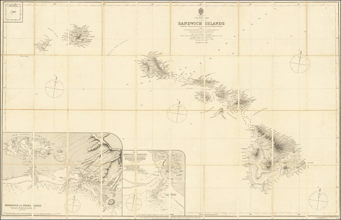
Fine and Rare Admiralty Chart of the Sandwich Islands from the First Government Survey of Hawaii Good example of Admiralty chart of the Hawaiians Islands, then known as the Sandwich Islands, with input from the first trigonometric survey of the...
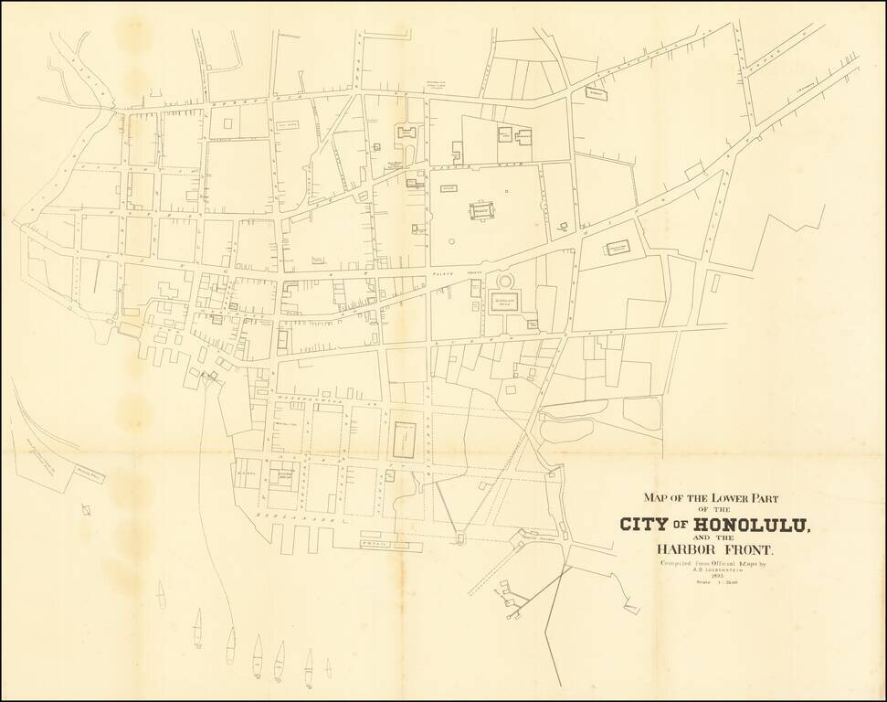
A highly detailed map of downtown Honolulu, one of the finest plans of the city made in the twilight years of the independent Hawaiian Kingdom. This fine map is a detailed engineer's plan of downtown Honolulu, done to very precise standards of...
![[Pearl Harbor] Pearl River and Lochs From The United States Government Plan of 1899 . . .](/map/small/67434.jpg)
Finely detailed chart of the Pearl River and "Lochs", illustrating the environs of Pearl Harbor, published by the British Admiralty. First issued in 1901, this chart includes major revisions to 1920 and smaller revisions to 1931. The use of the term...
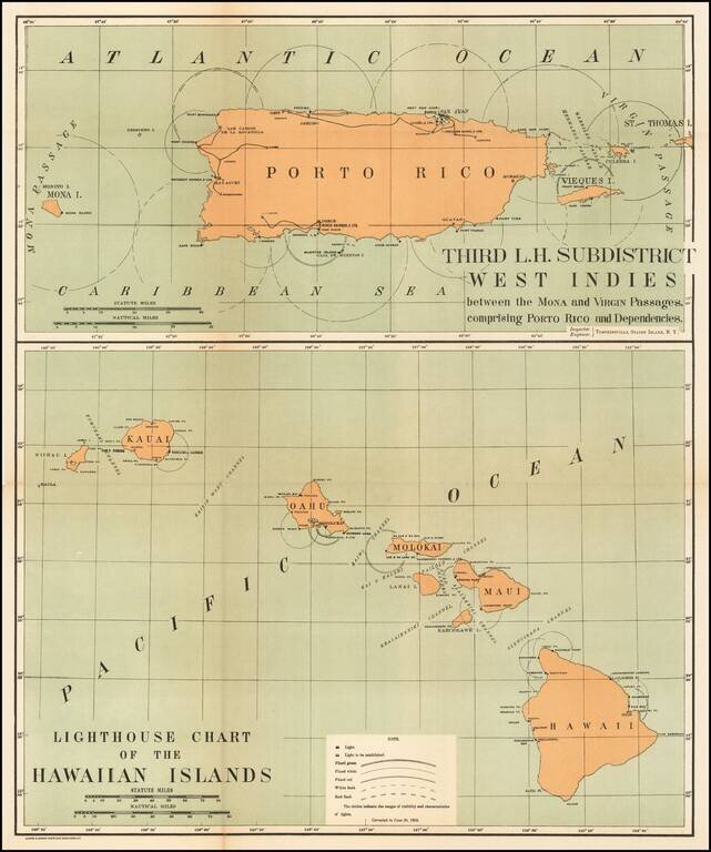
Rare pair of maps showing the lighthouses in Hawaii and the Puerto Rico areas, including proposed light houses, fog lights, light vessels, lighted buoys and a host of other navigational details within the state. This is the first time we have ever...
![(Maui). Harbours and Anchorages in the Hawaiian or Sandwich Islands. [Maalaea Bay and Kahului Harbor and Approaches]](/map/small/69674.jpg)
Maui Harbors Rare British Admiralty Chart, showing Kahului Harbor and Maalaea Bay, on the island of Maui Maalaea Bay includes a number of early placenames, including Kihei. Kahului Harbor shows the breakwaters, town plan, etc., extending north to...
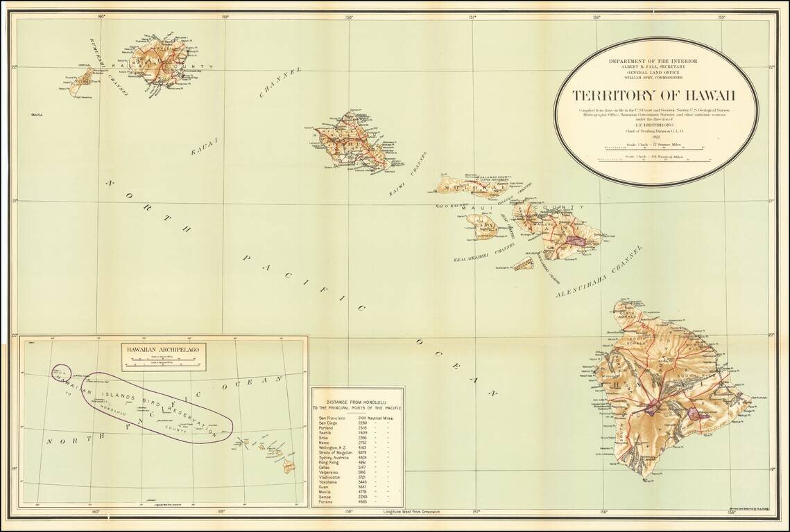
Detailed large format map of the Hawaiian Islands, published by the General Land Office. Finely detailed map, showing counties, towns, bays, points, mountain, rivers, elevations, volcanoes, volcano houses, halfway houses and Lava flows from various...
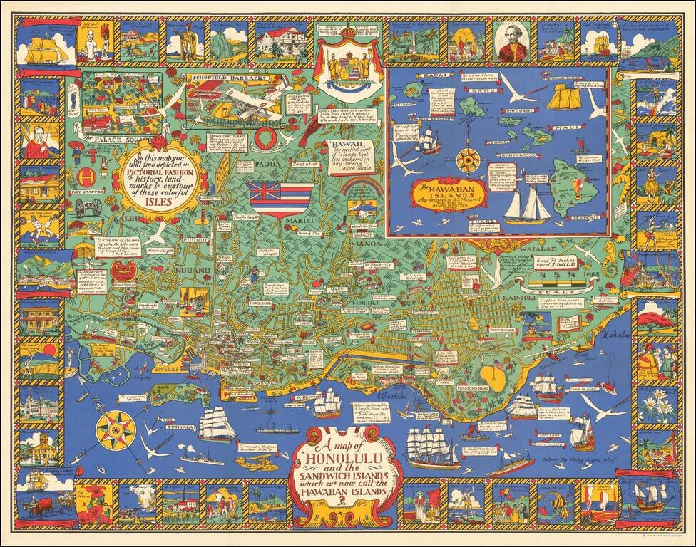
Marvelous rare pictorial map of Honolulu with inset of the Hawaiian Islands. The map includes pictorial features on the map and in vignettes surrounding the map, noting that, "In this map you will find depicted in pictorial fashion the history,...