Map size in jpg-format: 77.0756MiB
Click to open in high resolution (open in new tab).
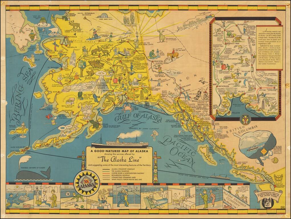
Nice example of the first edition of this decorative pictorial map of Alaska, first drawn by Edward Camy for the Alaska Steamship Company in 1934.
A fine pictographic map of Alaska, with a large inset of the Alaska Railways Route from Seward to Fairbanks.
Includes a fine array of whimsical caricatures of the Territory of Alaska, including a Siberian figure looking across the Behring Straits with the caption "Hi Ya Sam?."
Along the bottom of the map there are a series of views showing passengers enjoying the cruise amenities aboard the Alaska Line, which was then traveling between Seattle and Kodiak.
A fine map of Alaska from this remarkable series.
If you are a student, write to us in telegram: @antiquemaps and indicate what material you need and for what work you need a map in high detail. We are ready to provide material on special terms. For students only!
![America [Manuscript Map Showing the Sea of the West!]](/map/small/41297dm.jpg)

![[Atlantis?] Ristretto Delle Carte presentate all' Academia delle Scienze di Parigi negli anni 1737 e 1752 dal Sig di Buache](/map/small/58667.jpg)