Map size in jpg-format: 4.32642MiB
Click to open in high resolution (open in new tab).
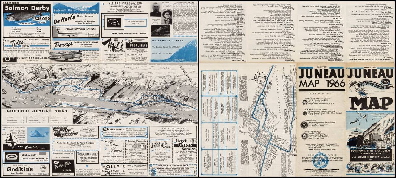
Decorative and detailed view of Juneau Alaska by Alaskan Artist Rudy J. Ripley, with a map of Juneau, local advertising and promotional information.
The primary view shows the Gastinaeu Channel, Juneau and its Harbor and the surrounding mountainas and Ice Fields, looking to the north.
If you are a student, write to us in telegram: @antiquemaps and indicate what material you need and for what work you need a map in high detail. We are ready to provide material on special terms. For students only!
![America [Manuscript Map Showing the Sea of the West!]](/map/small/41297dm.jpg)

![[Atlantis?] Ristretto Delle Carte presentate all' Academia delle Scienze di Parigi negli anni 1737 e 1752 dal Sig di Buache](/map/small/58667.jpg)