Map size in jpg-format: 94.5372MiB
Click to open in high resolution (open in new tab).

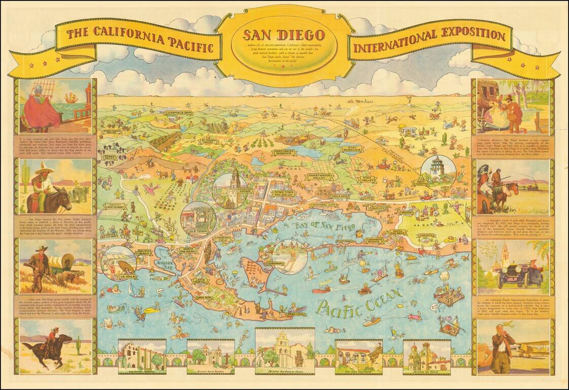
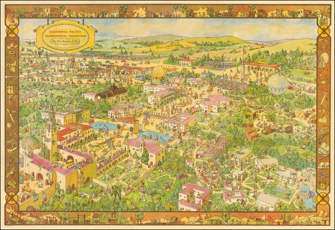
Decorative illustrated map of San Diego on one side and Balboa Park on the verso, prepared by Shell Oil Company for the 1935 California Pacific International Exposition.
One of the great California caricature maps. The map was drawn by Don Bloodgood, a noted illustrator of maps, postcards and similar ephemera during the period.
If you are a student, write to us in telegram: @antiquemaps and indicate what material you need and for what work you need a map in high detail. We are ready to provide material on special terms. For students only!
![[Signed Political Satire Artwork] Vietnam ... Vietnam ... Vietnam ...](/map/small/68726.jpg)

