
Rare old maps of the United States.
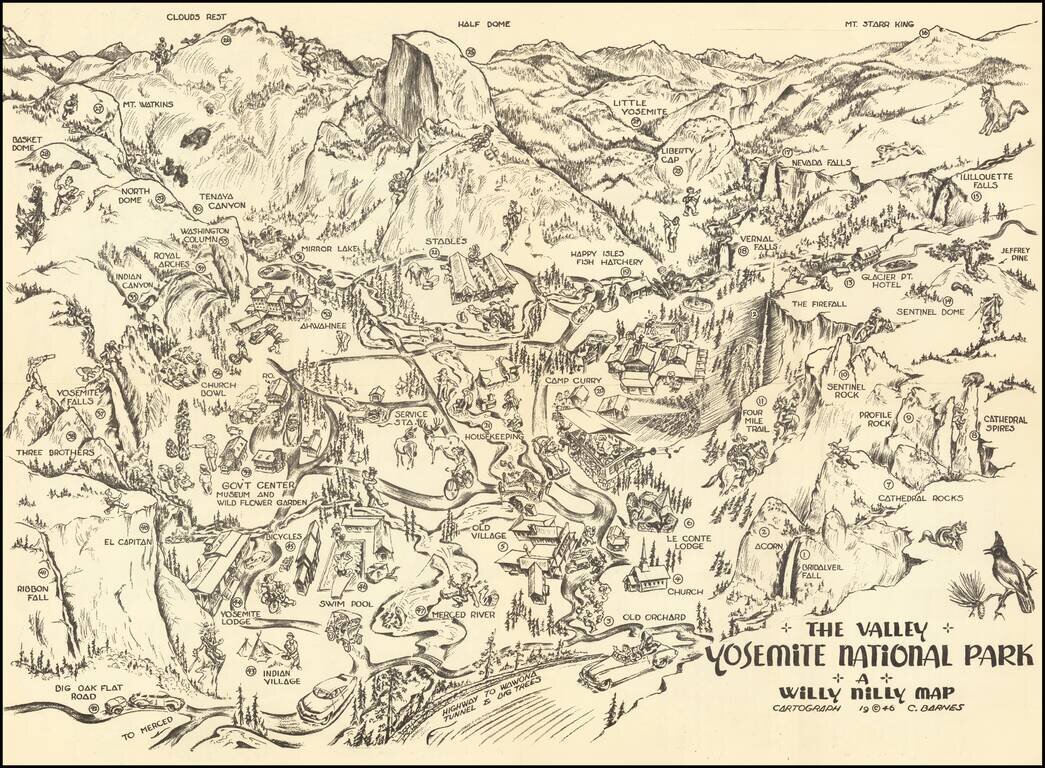
Yosemite Pictorial Rarity Rare self mailing map of Yosemite, published in 1946 by the Willy Nilly Map Company. The map is centered on Camp Curry, with an indoor venue below it having its roof blown off with music and dance. Extends to Clouds Rest,...
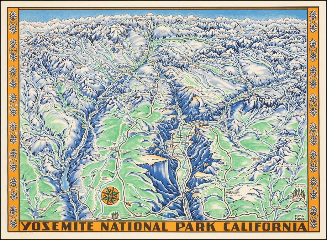
Fine example of the Della Hoss view of Yosemite National Park, published for the Yosemite Park and Curry Co. in 1955. The map provides a fine caricature view of Yosemite, locating many of its major attractions and a few not so famous, such as the...
![СѢВЕРНАЯ АМЕРИКА въ Санктпетербургъ. 1788. [North America (published) in St. Petersburg. 1788.]](/map/small/56512.jpg)
One of the First Russian Maps of the United States. Stating the Pacific Northwest was "acquired by Bering [and] Chirikov [in] 1741". Superb, separately issued engraved map of North America, published in Saint Petersburg in 1788. The map represents...
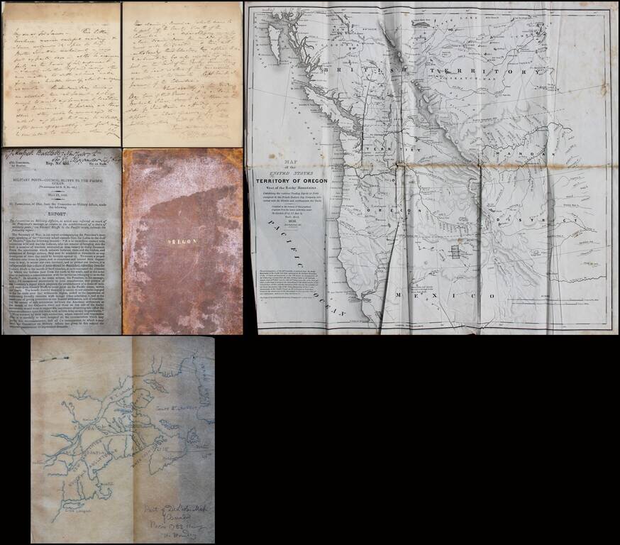
Interesting small archive relating to the Oregon Question, Involving Significant British and American Characters. The present offering consists of the following A letter from Sir George Augustus Wetherall (Deputy Adjutant General of Canada) to Sir...
![Map of Oregon, Washington, Idaho and part of Montana [Early appearance of Montana]](/map/small/70803.jpg)
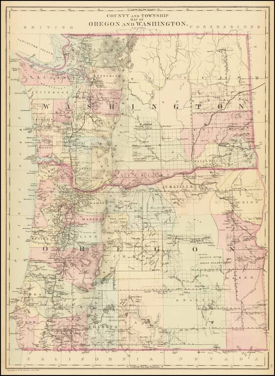
Interesting early map of the Northwest, hand-colored by counties or territories. The map is copyright-dated 1860, and has counties in eastern Oregon but not in Idaho or Montana. The existence of Montana dates the publication to 1864 or later. A fine...
![[Pacific Northwest] Cape Mendocino to Vancouver Id. From Cape Flattery Southward, From The United States to 1886, with corrections and additions to 1920 . . .](/map/small/70829.jpg)
This is a detailed navigational chart showing the whole of the Pacific Northwest, stretching from northern California to southern British Columbia. Many minor coastal and riverine towns are labeled, including some that would become major cities, such...
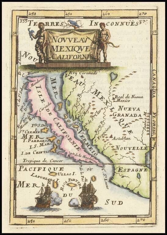
Fine, Distinct Map of the Island of California Striking and exciting map of California as an island, one of the few maps to focus so closely on the California region. First published in Paris in 1683, Mallet’s map is notable because it follows...
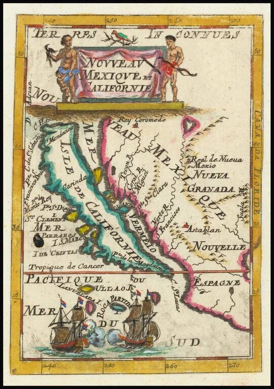
Fine, Distinct Map of the Island of California Striking and exciting map of California as an island, one of the few maps to focus closely on the California region exclusively. First published in Paris in 1683, Mallet’s map is notable because it...
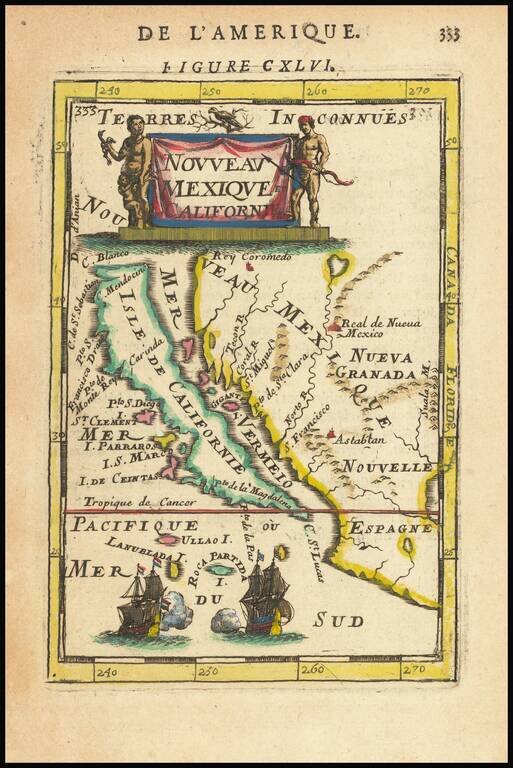
Fine, Distinct Map of the Island of California Striking and exciting map of California as an island, one of the few maps to focus closely on the California region exclusively. First published in Paris in 1683, Mallet’s map is notable because it...
![Reconnaissance of the Western Coast of the United States From Monterey To The Columbia River in three sheets. Sheet No. 3. [Columbia River to Umpquah River]](/map/small/42733.jpg)
Interesting early coastal chart of the Oregon Coastline, the northern most of 3 charts published to cover the region by the US Coast Survey.
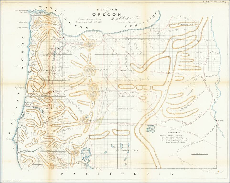
One of the earliest obtainable maps showing the progress of the public surveys in the State of Oregon. The map includes townships surveyed to 1863, towns, early roads, topographical details, Fort Boise, Mountains and other details.
Detailed map of Washington and Oregon, which appeared in a late edition of Mitchell's General Atlas, pubished by William Bradley. The map is colored by counties and showing towns, roads, railroads, rivers, lakes, and a host of other details. SA...
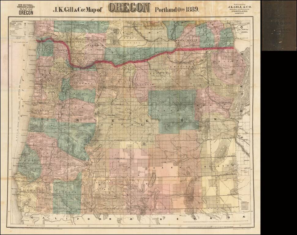
The Most Popular Separately Published Map of Oregon of Its Time -- Portland Publisher Scarce separately issued map of Oregon by J.K. Gill, the leading local seller of books and stationary in Portland at the time. Gill's maps were frequently updated....
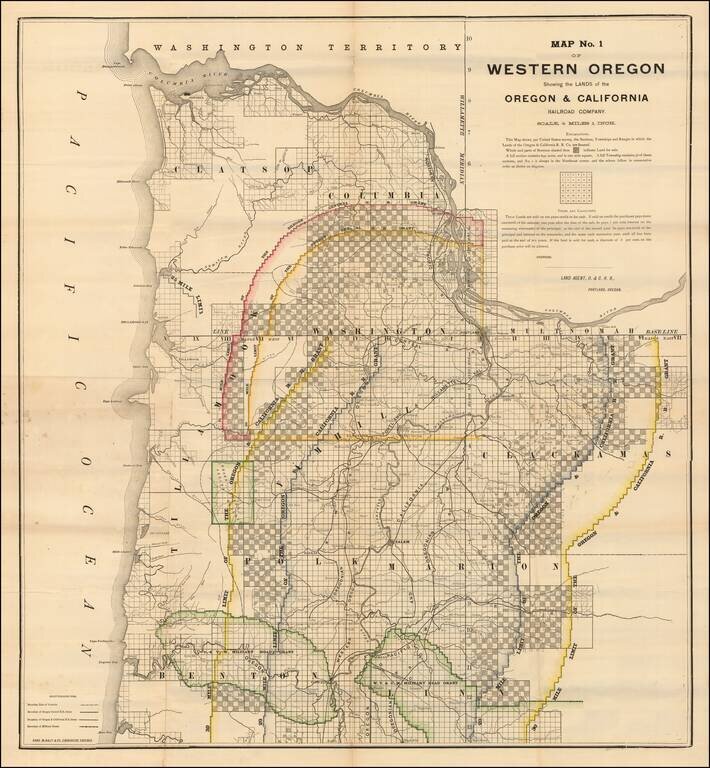
Lands Granted to the Oregon & California Railroad Rare separately published map of northwestern Oregon, printed by Rand McNally & Co. for the Oregon & California Railroad Company. The map extends from the Columbia River to Yaquina Bay and...
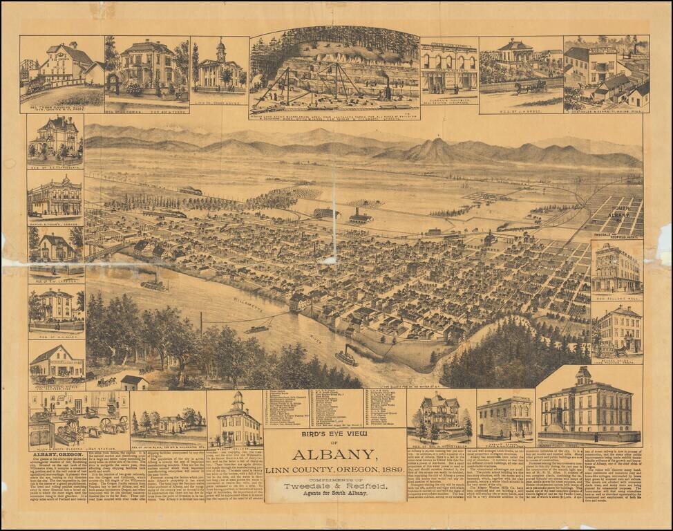
One of the Earliest Settlements in Oregon Rare separately published view of Albany, in Linn County, Oregon. Includes an interesting smaller view of the Albany Sand Stone Quarry and Allen & Goff's Electric Light Stations, along with the unusual...
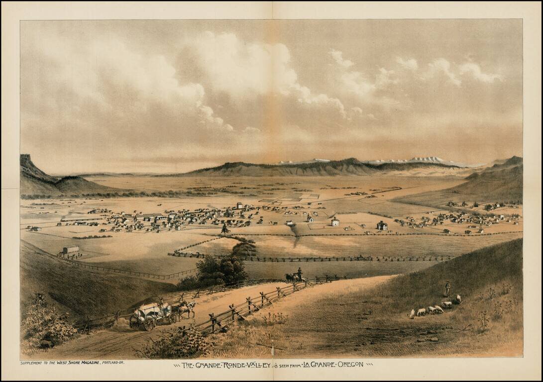
Fine early view of the Le Grande Ronde Valley, in Oregon, from West Shore Magazine. The Astor Expedition passed through the Le Grande Valley in 1811. Thereafter, it became a waypoint along the Oregon Trail. Since the 1840s, settlers headed toward the...