Map size in jpg-format: 50.804MiB
Click to open in high resolution (open in new tab).

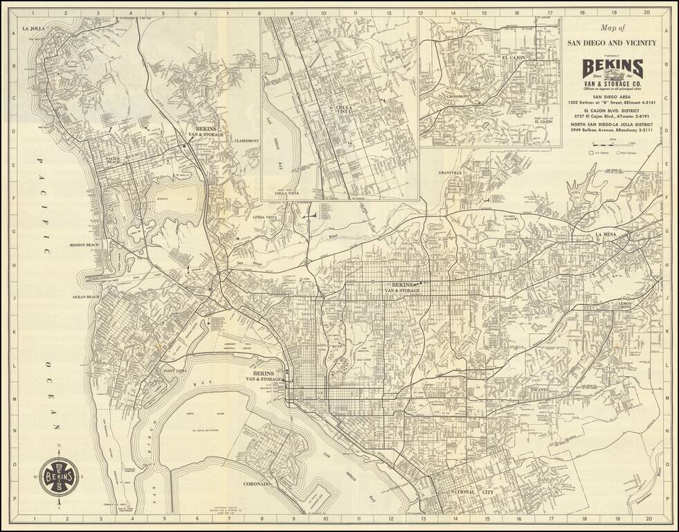
Detailed vintage map of San Diego, by the famous Bekins Van & Storage Co., published in 1958.
The map shows Mission Bay before it was fully dredged and developed into the recreational area it is today.
La Jolla has considerably more development in the Muirlands and Mount Soledad areas than what you would see on a map of a decade or two earlier. Likewise, Clairemont has its first areas of development as well.
The map has insets of Chula Vista and El Cajon in the upper-right corner.
If you are a student, write to us in telegram: @antiquemaps and indicate what material you need and for what work you need a map in high detail. We are ready to provide material on special terms. For students only!
![(California-Mexico Border Survey) Datos de los trabajos astronómicos y topográficos. [bound with:] Variedades de la civilizacion, nueva epoca (Tomo I)](/map/small/70777.jpg)