logo

1964. La Jolla Street Map

  • La Jolla Street Map

Map size in jpg-format: 7.756MiB

Download "La Jolla Street Map", in high resolution.

La Jolla Street Map information:

Year of creation: 
Resolution size (pixels): 
 5564x7701 px
Disk Size: 
 7.756MiB
Number of pages: 
 1
Place: 
 La Jolla, California
Author: 

Print information. Print size (Width x height in inches):
Printing at 72 dpi 
  77.28 х 106.96
Printing at 150 dpi 
 37.09 х 51.34
Printing at 300 dpi 
 18.55 х 25.67

An example of detailing the file of this map of in a printable high-resolution:

Click to open in high resolution (open in new tab).
Attention! this is just the central piece (central area 960x960 px) of the map file!
This is an example, so that you can see and study the level of detail of a given map. The entire Map will be fully available after payment!

La Jolla Street Map

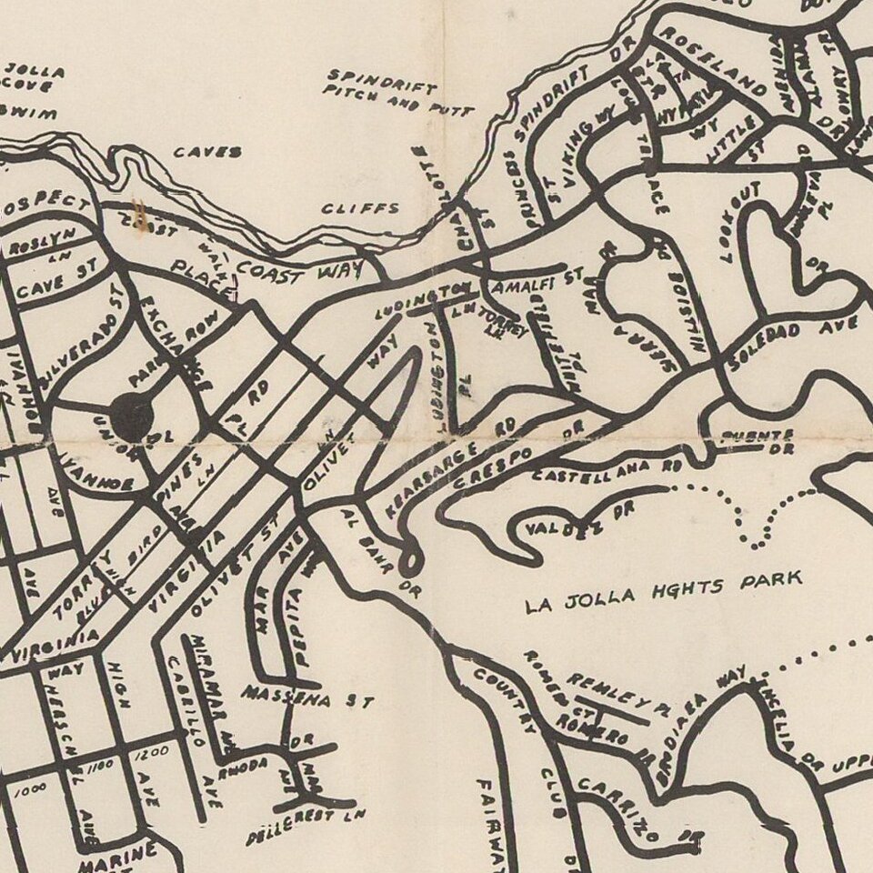
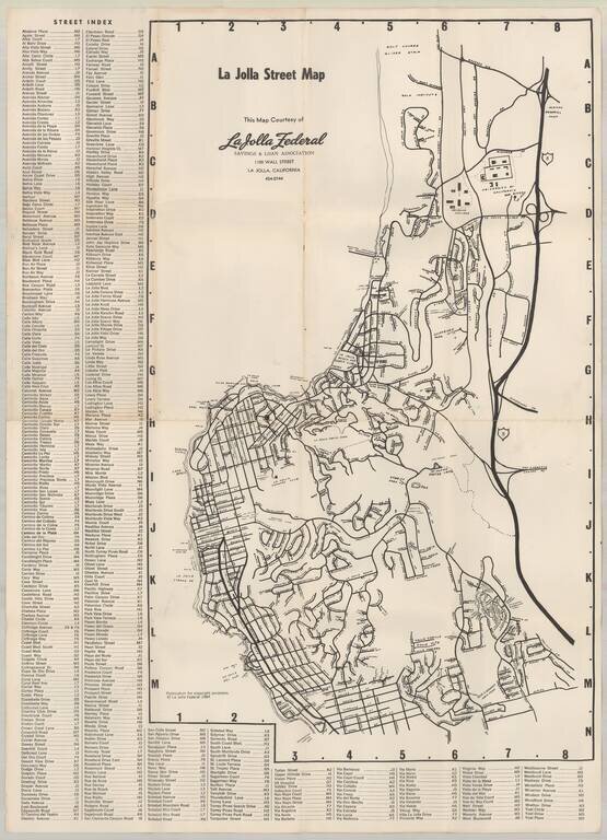
Early map of La Jolla, published by La Jolla Federal Savings.

Early points of interest include:

  • UC San Diego
  • Revelle College
  • Mt. Soledad Easter Cross
  • Salk Institute
  • Scripps Institute of Oceanography
  • Spindrift Pitch & Putt (LJ Beach & Tennis Club)
  • Casa Beach
  • Scripps Clinic

This is on of the earliest maps to locate Revelle College, following the founding of UCSD in 1960. By 1963, new facilities on the mesa had been finished for the School of Science and Engineering, and new buildings were under construction for Social Sciences and Humanities. The undergraduate program accepted its first class of 181 freshman at Revelle College in 1964. Muir College (1966, was not yet present).


Special conditions for students!

If you are a student, write to us in telegram: @antiquemaps and indicate what material you need and for what work you need a map in high detail. We are ready to provide material on special terms. For students only!

Item information:

Year of creation:
Size:
5564x7701 px
Disk:
7.756MiB
Number of pages:
1
Place:
La Jolla, California
Author:
La Jolla Light.
$14.99

Related item