Map size in jpg-format: 107.867MiB
Click to open in high resolution (open in new tab).
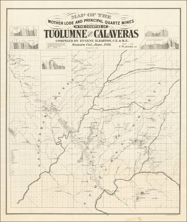
Mother Lode in Calaveras and Tuolumne Counties
An interesting and little known map, centered on the Stanislaus River in Gold Country.
The map is quite exceptional, "covering 860 square miles of territory and showing location of 500 different mines.
A fabulous separately issued map covering one of the most historically important mining regions of California.
The map is also of note as being a very late Britton & Rey imprint.
If you are a student, write to us in telegram: @antiquemaps and indicate what material you need and for what work you need a map in high detail. We are ready to provide material on special terms. For students only!


