logo

1931. Historical Map of Oklahoma

  • Historical Map of Oklahoma

Historical Map of Oklahoma information:

Year of creation: 
Resolution size (pixels): 
 15072x8724 px
Disk Size: 
 20.0465MiB
Number of pages: 
 1
Place: 
 n.p.
Author: 

Print information. Print size (Width x height in inches):
Printing at 72 dpi 
  209.33 х 121.17
Printing at 150 dpi 
 100.48 х 58.16
Printing at 300 dpi 
 50.24 х 29.08

An example of detailing the file of this map of in a printable high-resolution:

Click to open in high resolution (open in new tab).
Attention! this is just the central piece (central area 960x960 px) of the map file!
This is an example, so that you can see and study the level of detail of a given map. The entire Map will be fully available after payment!

Historical Map of Oklahoma

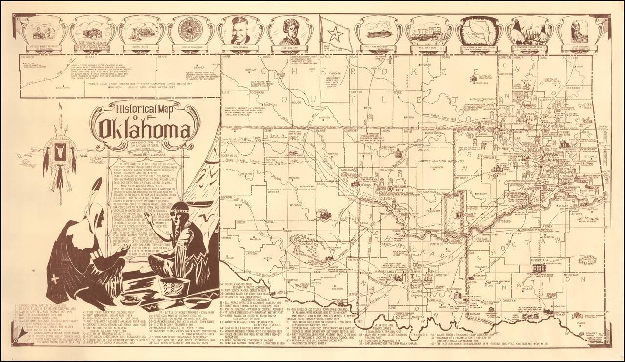
Fine pictorial map of Oklahoma, drawn by H.Z. Sanders for the Oklahoma Natural Gas Company.

The map is decorated with small pictorial images showing some of the historical landmarks around the state and famous people. Also included is a legend with brief descriptions for 60 different numbered historical points of interest shown on the map and a decorative boarder across the top of the map.


Special conditions for students!

If you are a student, write to us in telegram: @antiquemaps and indicate what material you need and for what work you need a map in high detail. We are ready to provide material on special terms. For students only!

Item information:

Year of creation:
Size:
15072x8724 px
Disk:
20.0465MiB
Number of pages:
1
Place:
n.p.
Author:
H. Z. Sanders.
$14.99

Related item