Map size in jpg-format: 12.0111MiB
Click to open in high resolution (open in new tab).
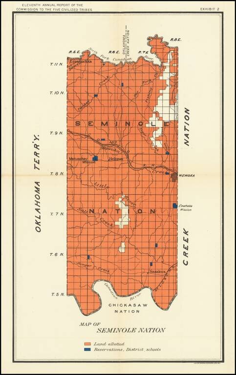
Nice map of the Seminole Map in Indian Territory, showing the coal regions for the Department of the Interior.
The map shows Lands Allotted and the location of Reservation District Schools.
If you are a student, write to us in telegram: @antiquemaps and indicate what material you need and for what work you need a map in high detail. We are ready to provide material on special terms. For students only!


