Map size in jpg-format: 47.9636MiB
Click to open in high resolution (open in new tab).

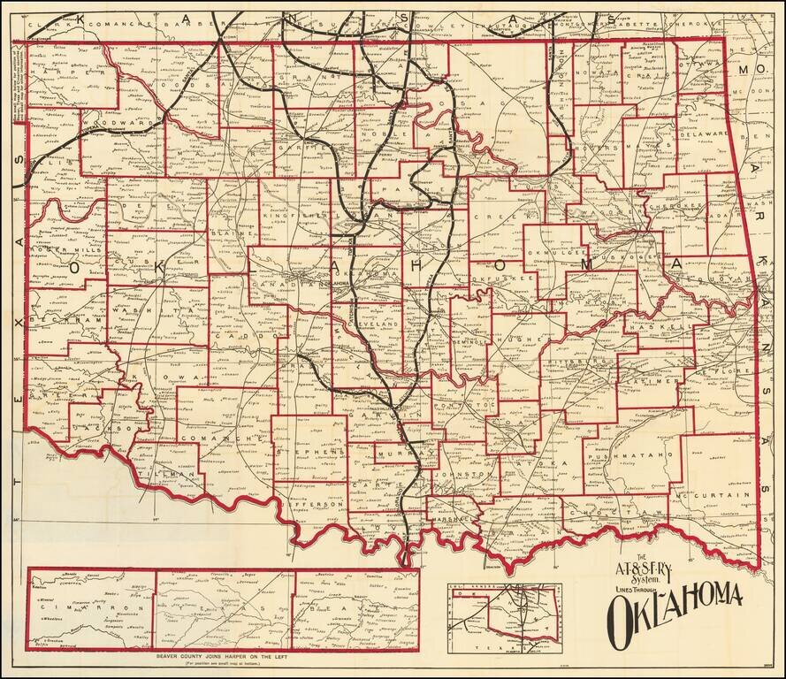
Fine map of Oklahoma, shortly after it obtained statehood on September 17, 1907, and published by the Atchison Topeka & Santa Fe Railroad.
Fine map of the state, with the lines of the Santa Fe Railroad running up the center and a number of other lines illustrated.
If you are a student, write to us in telegram: @antiquemaps and indicate what material you need and for what work you need a map in high detail. We are ready to provide material on special terms. For students only!


