Map size in jpg-format: 947772B
Click to open in high resolution (open in new tab).
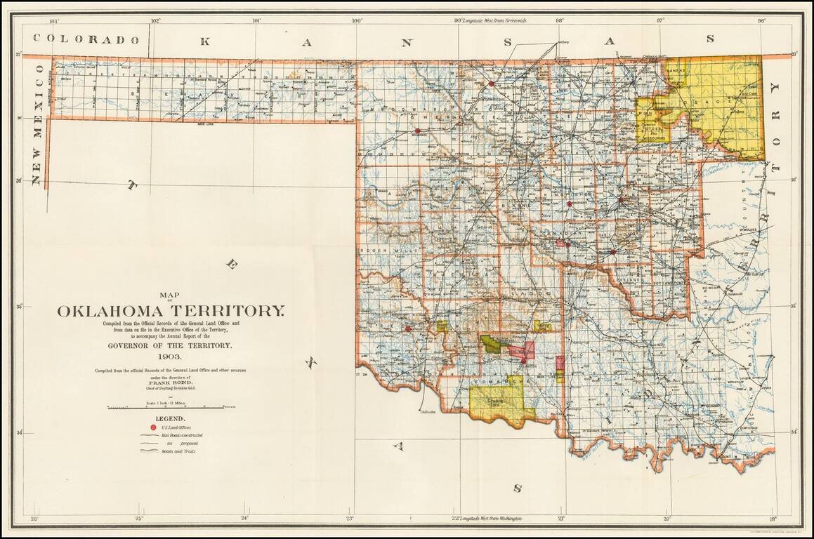
Rare Oklahoma Territory Map -- Pre-Dating Merger with Indian Territory.
Rare map of Oklahoma Territory, issued by the Territorial Governor, during the brief period when Oklahoma and Indian Territory were separate Territories of the United States.
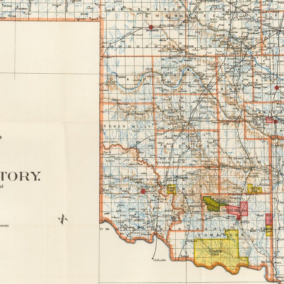
The map shows towns, railroads, Indian Tribal Lands, reservations, the Wichita Forest & Game Reserve and several Military Reserves, along with the township surveys and topographical information. The Capital is Guthrie.
While Oklahoma Territory existed as a separate Territory of the United States for about 17 years, maps focusing just on Oklahoma Territory and not including Indian Territory are quite scarce on the market.
Oklahoma Territory
The Territory of Oklahoma existed from May 2, 1890, until November 16, 1907, when it was joined with the Indian Territory under a new constitution and admitted to the Union as the State of Oklahoma.
The 1890 Oklahoma Organic Act organized the western half of Indian Territory and a strip of country known as No Man's Land into Oklahoma Territory. Reservations in the new territory were then opened to settlement in land runs later that year and in 1891 and 1893.
Seven counties were defined upon the creation of the territory. Although they were designated by number, they would eventually become Logan County, Cleveland County, Oklahoma County, Canadian County, Kingfisher County, Payne County and Beaver County. The Land Run of 1893 led to the addition of Kay County, Grant County, Woods County, Garfield County, Noble County, and Pawnee County. The territory acquired an additional county through the resolution of a boundary dispute with the U.S. state of Texas, which today is split into Greer County, Jackson County, Harmon County, and part of Beckham County.
If you are a student, write to us in telegram: @antiquemaps and indicate what material you need and for what work you need a map in high detail. We are ready to provide material on special terms. For students only!


