Map size in jpg-format: 117.973MiB
Click to open in high resolution (open in new tab).
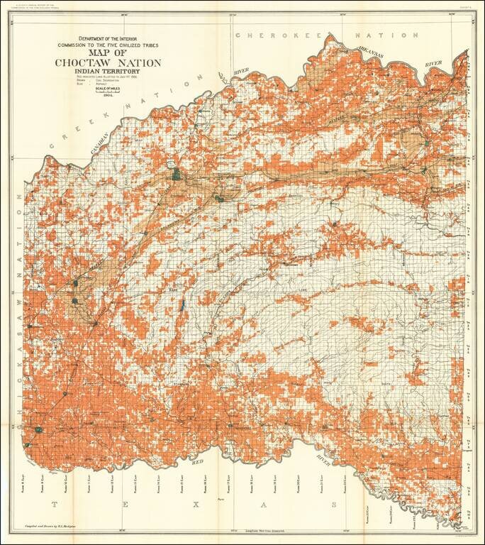
Detailed allotment map of the Choctaw Nation lands in Indian Territory, showing land allotted to July 1st, 1904, as well as coal and asphalt segregation.
The map covers the Choctaw Reservation between Red, Canadian, and Arkansas Rivers.
If you are a student, write to us in telegram: @antiquemaps and indicate what material you need and for what work you need a map in high detail. We are ready to provide material on special terms. For students only!


