
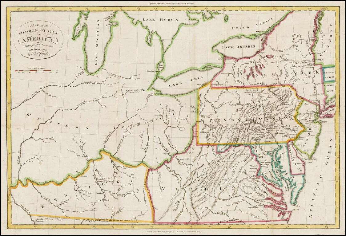
Rare map of Western Territory and the Mid-Atlantic regions of the United States in the last decade of the 18th Century. The map extends to the Illinois & Wabash Rivers, Lake Michigan and the confluence of the Ohio and Cumberland Rivers in western...
![[Midwest & Northeastern States]](/map/small/45969.jpg)
Detailed map extending from the Mississippi and the Great Lakes to the Chesapeake and Lake Champlain. The map appeared in Darby's A Tour from the City of New-York, to Detroit, in the Michigan Territory, made between the 2d of May and the 22d of...
![The Cities of Pittsburgh and Allegheny with Parts of Adjacent Boroughs [with] The City of Cincinnati Ohio.](/map/small/39410.jpg)
Two nice town maps on a single sheet, each with excellent detail and colored by ward. Early Pittsburgh maps are scarce. Decorative border. A terrific map, from JH Colton, one of the most prolific American mapmakers of the mid-19th century.
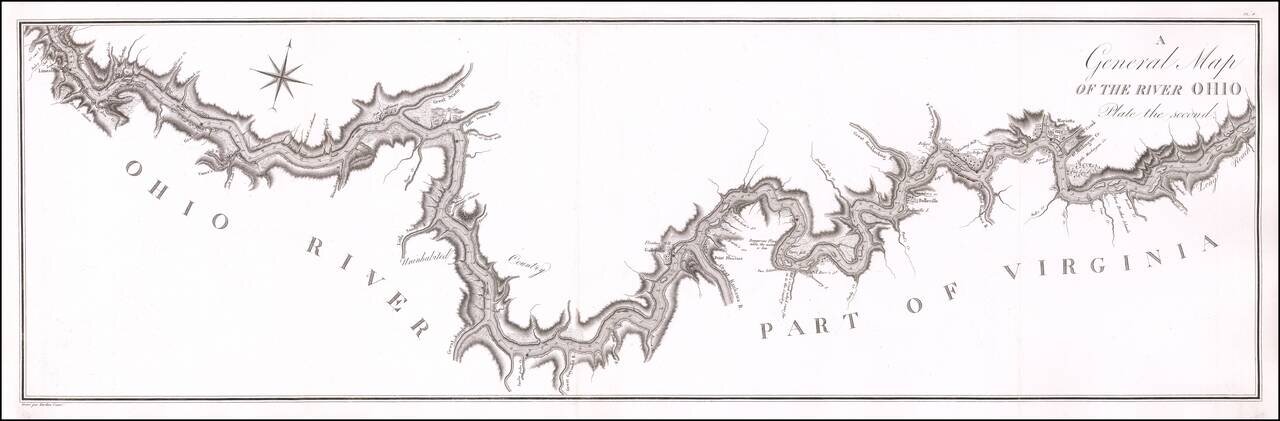
Antique Map of a Section of the Ohio River Prepared By A French Spy Important early map of the Ohio River from Maysville, Kentucky to just south of Wheeling, West Virginia, prepared by the French military officer and spy George Henri Victor Collot,...
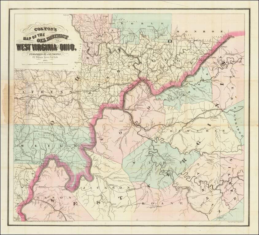
Scarce First State of Colton's Map of Some of the Earliest Oil Fields in the United States. Hand-colored lithographed map of the West Virginia oil region off the Little Kanawha River. Colton published the map in New York in 1865. The map shows a...

Jacques Le Moyne's Landmark Map of Florida & The Southeast, Based On The Expedition of Laudonniere to Florida in 1564 Jacques Le Moyne's map of Florida and the Southeastern portion of the United States is one of the most important 16th Century...
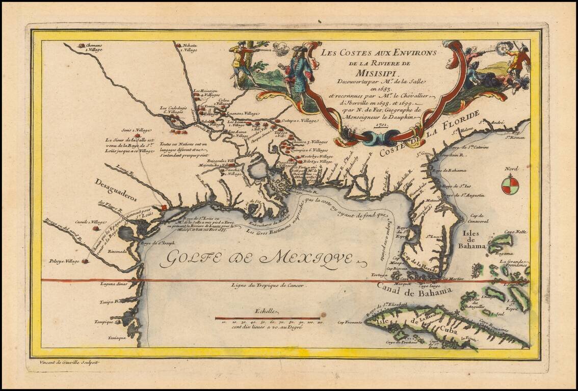
Rare 1701 First Edition Nice example of this historically important and fascinating map of the Gulf Coast and Mississippi River region, from Nicolas De Fer's Atlas Curieux. In preparing this fine map, the leading French cartographer Nicolas De Fer...
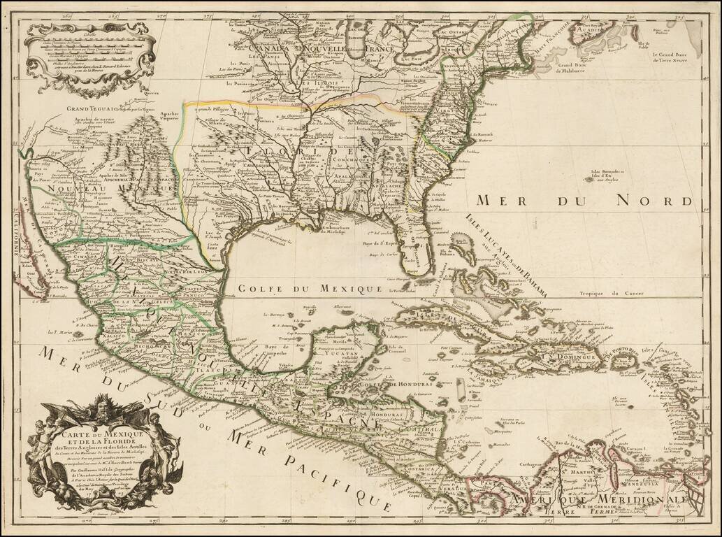
Rare Second State. Fine example of the second state of Guillaume De L'Isle's landmark map, the first printed map to accurately depict the course and mouth of the Mississippi River. De L'Isle's Carte du Mexique . . . is drawn from the reports brought...
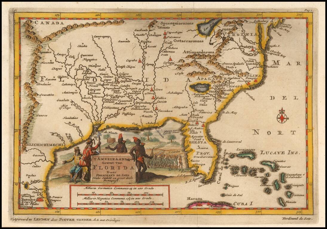
Fascinating map of the Southeastern part of the future United States, based largely upon Sanson's map of Florida from 1657. The map is intended to illustrate the expedition of Ferdinand de Soto in 1534, based upon his original accounts. Fine...
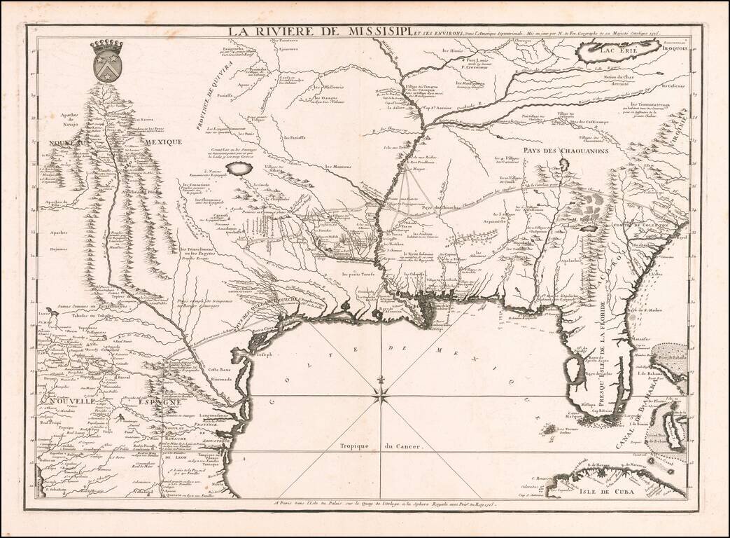
Nicolas De Fer's Landmark 1715 Map of the Mississippi River Valley and the French Regions in the Interior of North America. Fine example of De Fer's rare map of the southern part of the French regions in North America, one of the most important maps...
De Fer's Landmark Map of the Mississippi River Valley and the French Regions in interior of North America. Fine example of De Fer's rare map of the southern part of the French regions in North America, prepared by De Fer for the French Company of...
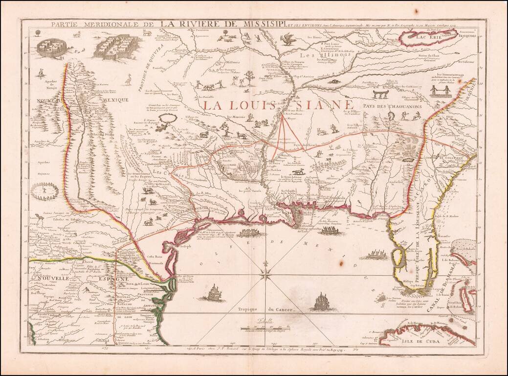
![Carte De La Louisiane Et Du Cours Du Mississipi . . . Juin 1718 [1st State!]](/map/small/62086.jpg)
"The Mother and Main Source of All the Later Maps" of the Mississippi River and Interior Parts of the United States and The First Map to Name Texas First state of De L'Isle's seminal map, one of the most important and influential maps of the 18th...
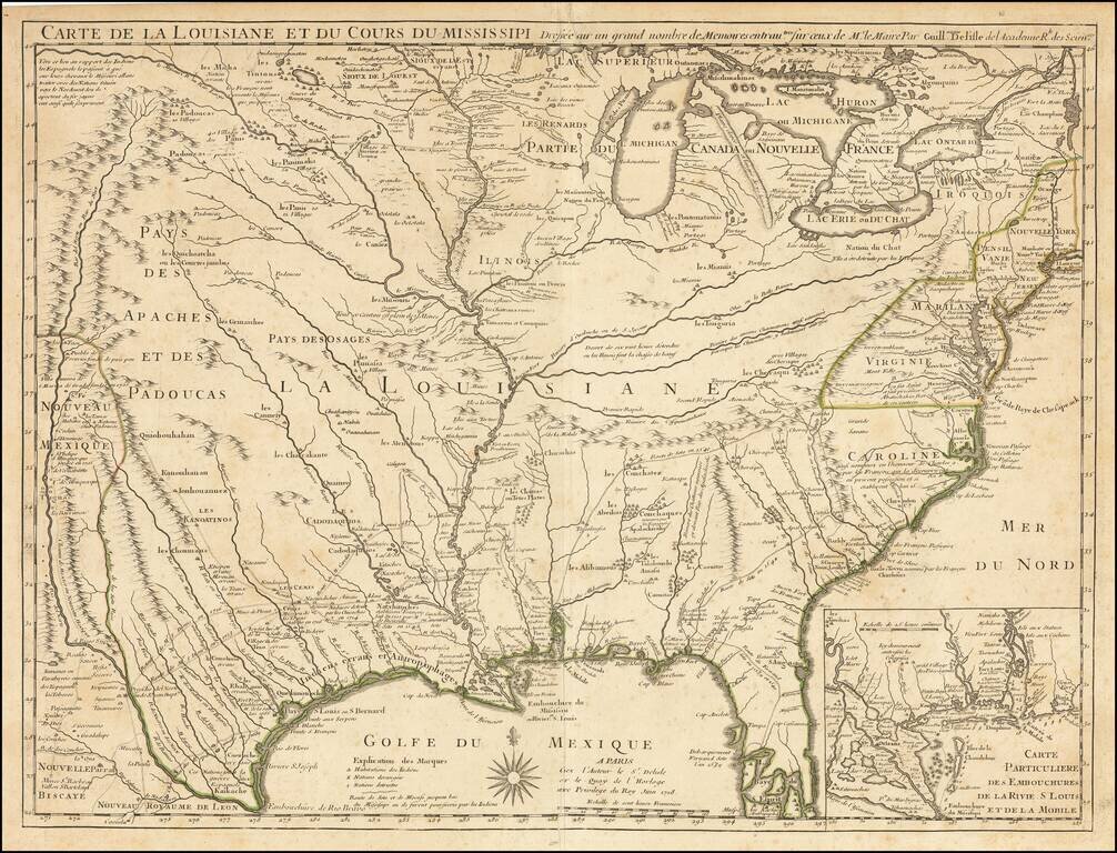
First Map To Name New Orleans -- "The Mother and Main Source of All the Later Maps" of the Mississippi River and Interior Parts of the United States and The First Map to Name Texas Second state of De L'Isle's seminal map, one of the most important and...
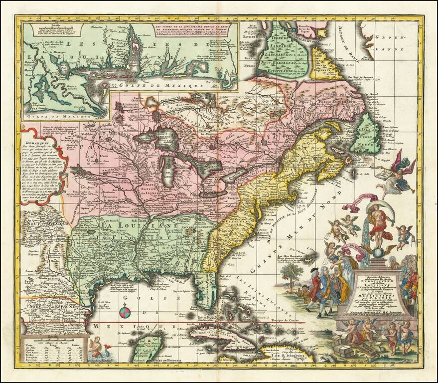
18th-century Map of Eastern North America with a Satirical Cartouche A finely colored example of Seutter's so-called Mississippi Bubble map, depicting the short-lived French financial-colonial scheme masterminded by Scottish financier John Law. The...
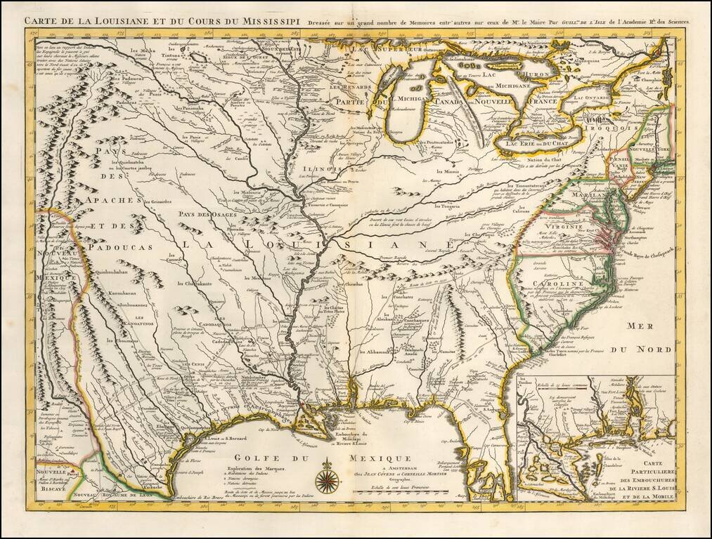
One of the Earliest Appearances of New Orleans Nice old color example of Covens & Mortier's fine edition of Guillaume De L'Isle's seminal map, the most significant map of the Mississippi Valley and Great Lakes published in the early part of the...
Rare Variant edition of Bellin's map of Mississippi River Valley and environs, with the name "Floride" in the title. The normal title for this map is Carte De La Louisiane et Pays Voisins. Fabulous map of most of the US, based upon De L'Isle's...