
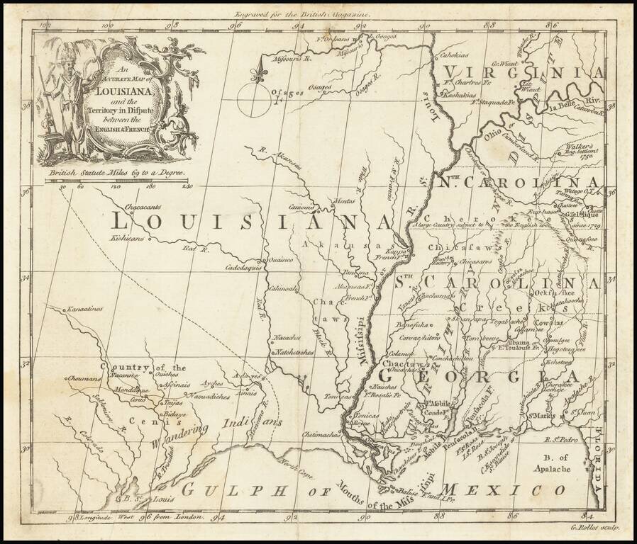
The "Territory In Dispute East" of The Mississippi River Rare map centered on the Mississippi River, showing the "Territory in Dispute" between France and England. The map is centered on the Mississippi River valley and the Gulf Coast, showing the...
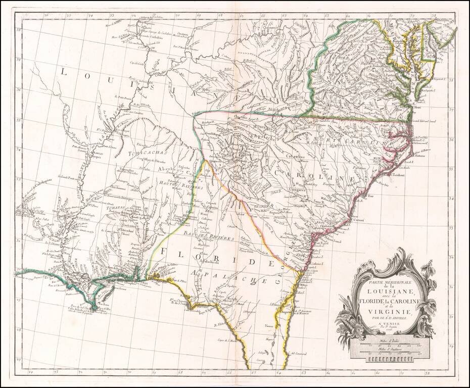
Scarce Italian Map of the Southern Colonies in Colonial America at the Outset of the American Revolution A marvelous map the Southern part of Colonial America, published by Paolo Santini in Venice. The map covers most of Florida, then extending west...
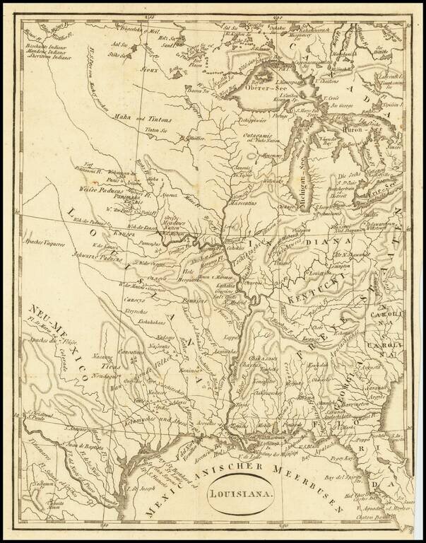
An Early Louisiana Purchase Map Extremely rare little map centered on the Mississippi, apparently based upon the map used to illustrate Berquin-Duvallon's Vue de la Colonie Espagnole du Mississippi, ou des Provinces de Louisiane et Floride...
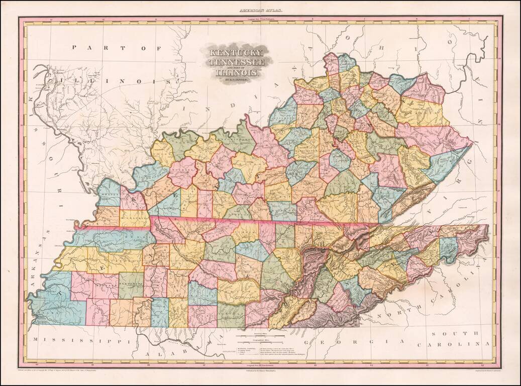
The Best Kentucky, Tennessee & Southern Illinois Regional Atlas Map of the First Half of the 19th Century -- Early Edition with 9 Unnamed Counties in Western Tennessee Gorgeous example of this rare early edition of Tanner's Map of Kentucky,...

The Neutral Lands and the Race To Construct Railroad Lines from Northern Kansas to Indian Territory Unrecorded railroad map of Texas, the Southern and Mdiwestern States, published by the Missouri River, Fort Scott & Gulf Railroad and the...
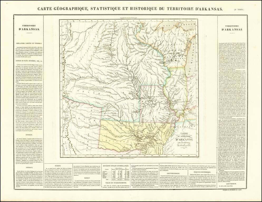
French edition of Stephen Long's seminal map of the region drained by the Arkansas, Kansas, Missouri and Mississippi Rivers, one of the most important maps of the American West. Stephen H. Long led a government expedition to the Rocky Mountains in...
![[Early Ohio River Promotional Map] Plan Des Achats Des Compagnies de L'Ohio et du Scioto](/map/small/58635.jpg)
Rare Early Real Estate Speculation in the Ohio Valley (Manuscript Additions!) Rare first state of this important map for the early development of the Ohio Valley, promoting the lands of the Scioto Company. The present example is a rare early state,...
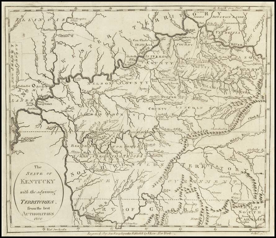
Early Map of Kentucky, Tennessee and Southern Ohio Important early map of Kentucky, Tennessee (then still Southwestern Territory) and the Ohio Valley, with marvelous early information. Kentucky includes about a dozen early counties, plus towns,...
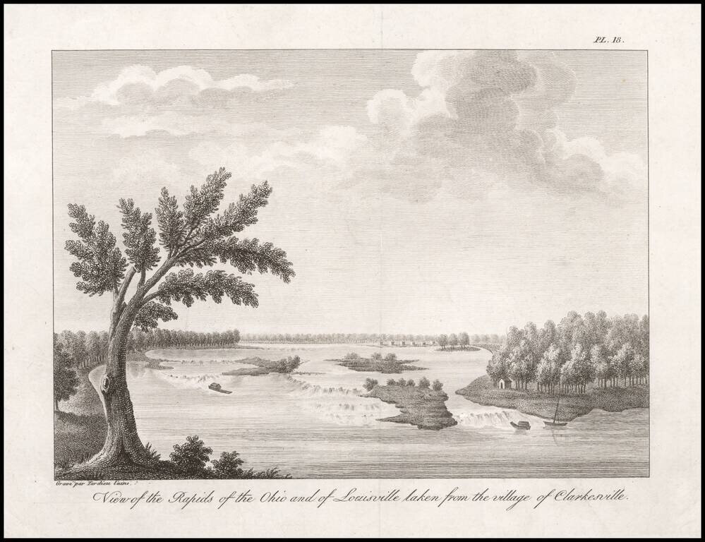
One of the Earliest Views of Louisville, Made Shortly After It Was Founded by Col. George Rogers Clark. An 18th century French Spy's View of the Rapids of the Ohio. Fine engraved view of the Rapids of the Ohio River, taken from "Clarkesville" (now...
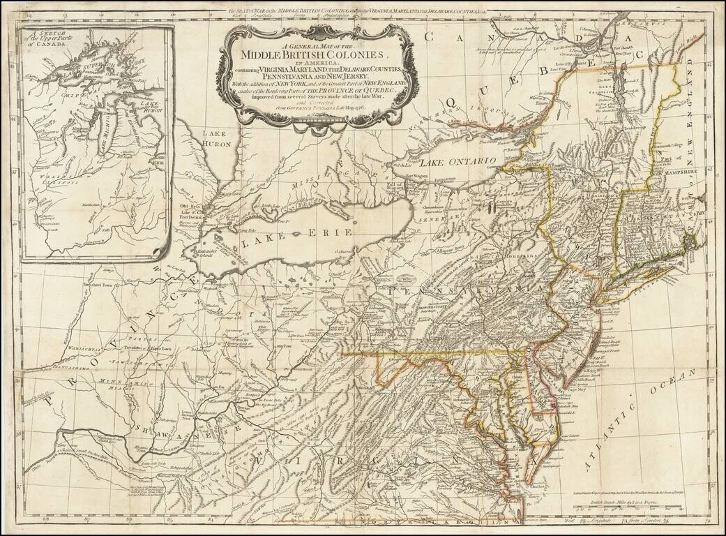
The scarce "Holster Atlas" edition of Lewis Evans' highly important map of the Middle British Colonies, at the start of the American Revolution. This edition of the map was prepared specifically for the American Military Pocket Atlas, an atlas...
![Americque Septentrionale Par le Sr. Sanson d'Abbeville Geographe du Roy . . . 1705 [Rare Peninsular California edition, with unusual Mississippi River depiction]](/map/small/61024.jpg)
Antique Map of North America -- California as an Island Old color example of Sanson's revised map of North America. In 1705, Pierre Moullart Sanson radically revised this map of North America, modifying perhaps the three most significant features of...
![Nuovo Messico appartiene alla Spagna [with] A. Luisiana Inglese B. Luisiana Francese](/map/small/7075.jpg)
Extremely rare pair of miniature maps on one sheet, from a miniature Italian Atlas. The first example we have ever seen. The upper map extends from Baja California and the Pacific to Texas, centered on the Rio Grande. Full of very curious place names....
An Extremely Rare German Emigrant Guide to California, Oregon, Texas, Iowa and the Midwest -- Especially So With All Maps & Plans Second extended German edition, adding the view of St. Louis and with the often missing maps of Iowa and the United...
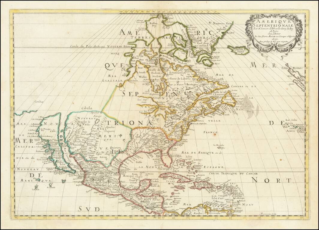
One of the Most Influential American Maps of the 17th Century. Nice old color example of Sanson's landmark map of North America. One of the most influential American maps of the 17th Century Sanson is regarded as the founder of the 'French School' of...
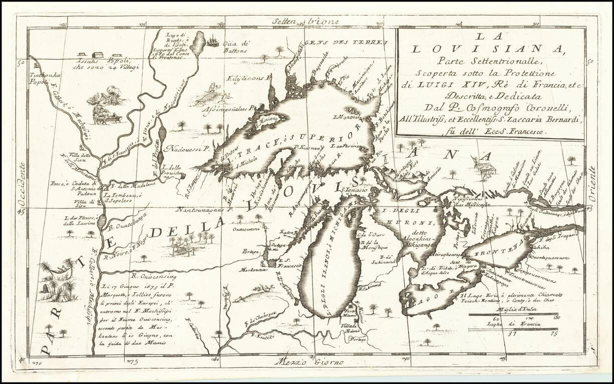
Important 17th Century Map of the Great Lakes and Upper Mississippi River Nice example of Coronelli's highly important map of the Great Lakes and Upper Mississippi region. Coronelli's map is widely regarded as one of the most important maps of the...
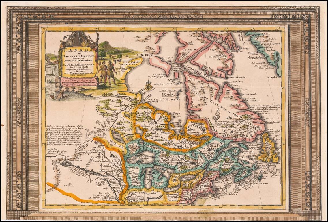
Decorative example of Vander Aa's map of Canada and the Great Lakes. Nice example, with the picture frame border, which appeared in Vander Aa's Nouvelle Theatre Du Monde, published in 1713. The map extends south to the Chesapeake and west to the...