Map size in jpg-format: 34.2942MiB
Click to open in high resolution (open in new tab).

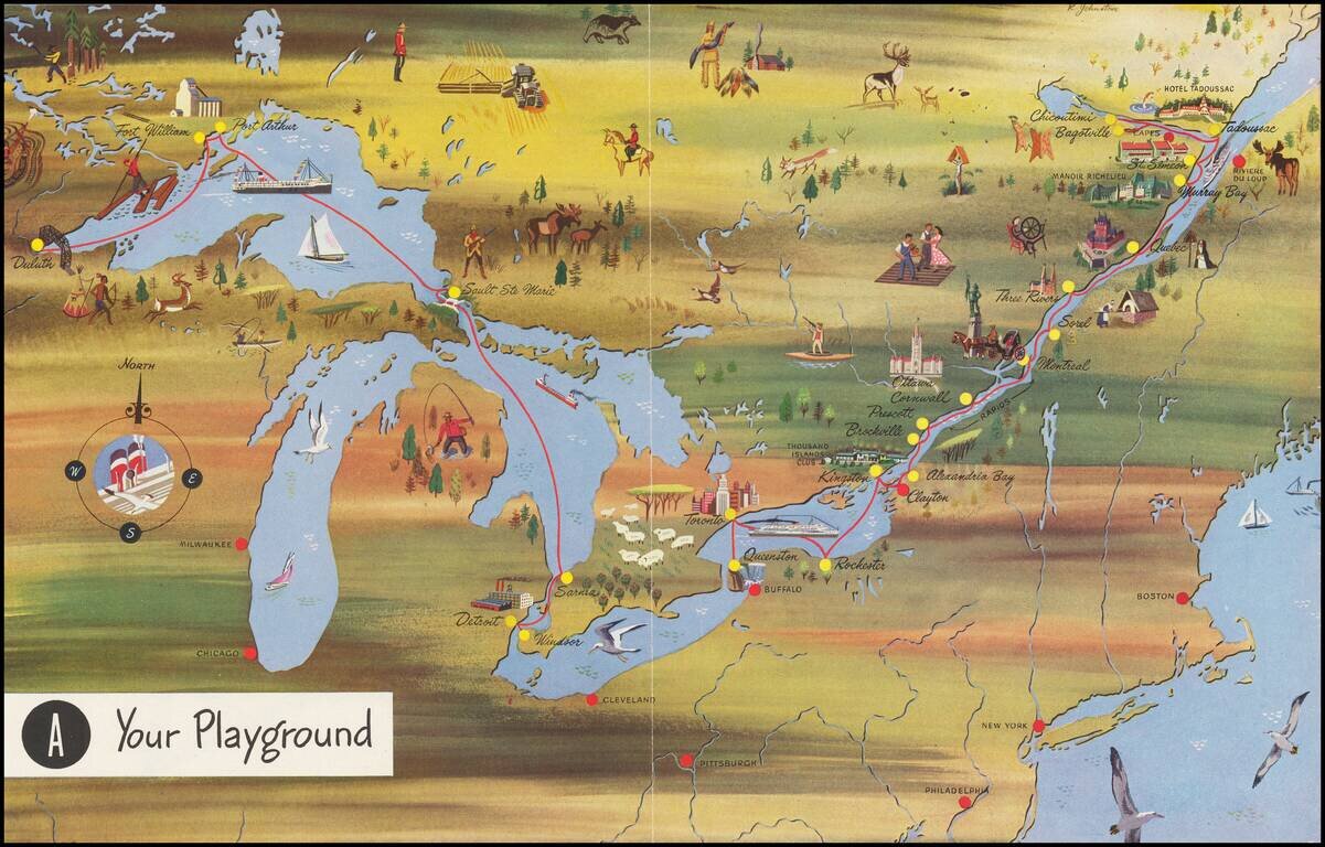
Interesting pictorial map, advertising for Canada Steamship Lines.
The route shown goes from Duluth, Fort William and Port Arthur to Sault Ste Marie, Darnia, Detroit and Windsor, with a second route from Buffalo and Toronto to the mouth of the St. Lawrence.
An unusual pictorial map.
If you are a student, write to us in telegram: @antiquemaps and indicate what material you need and for what work you need a map in high detail. We are ready to provide material on special terms. For students only!
![[The First Maps in a la poupée Printed Color] Cartes en Couleur des Lieux Sujets aux tremblements de Terre Dans toutes les parties du Monde Selon le Sisteme de l’impulsion Solaire](/map/small/52293op.jpg)