Map size in jpg-format: 850459B
Click to open in high resolution (open in new tab).
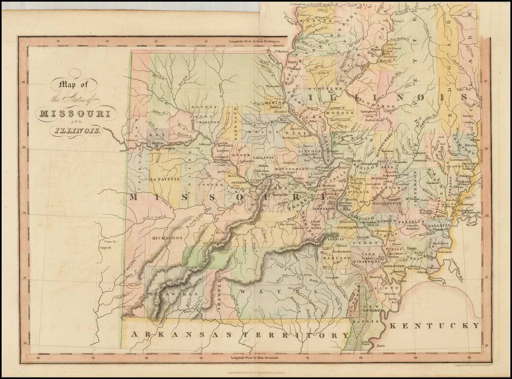
Scarce early map of Missouri and Illinois, hand colored by counties.
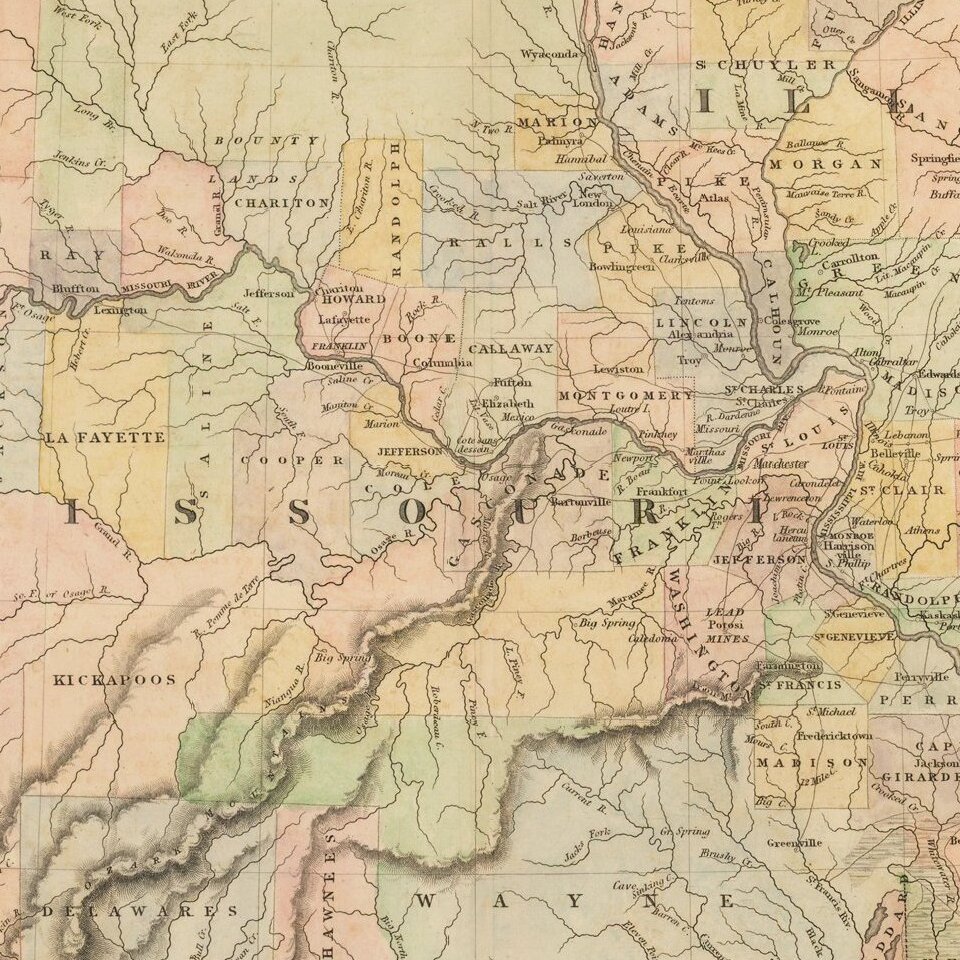
Many of the western counties are Indian Lands, such as Kickapoo, Delawares, Shawnees, etc. The Boundy Lands are shown in the North. A massive Wayne County dominates the south.
A number of early towns are shown, primarily along the Missouri and Mississippi Rivers, although no sign of Kansas City. Liberty, Ft. Osage, Buffton, Lexington, Jefferson, Charitson, Franklin and Boone are all shown on the western part of the Missouri, as is Ft. Osage. The northern portion of Illinois is dominated by early primitive counties, including Clark, Edgar, Fayette and Peoria. While the road system is better established in Illinois, the predominance of the state is still sparsely settled.
One of the earliest separate maps of the state published outside of America, and a fascinating map of the state, shortly after statehood.
This map is a curious marriage of the Missouri map, in exact scale, which was also separately issued in the same work.
If you are a student, write to us in telegram: @antiquemaps and indicate what material you need and for what work you need a map in high detail. We are ready to provide material on special terms. For students only!