Map size in jpg-format: 55.5325MiB
Click to open in high resolution (open in new tab).
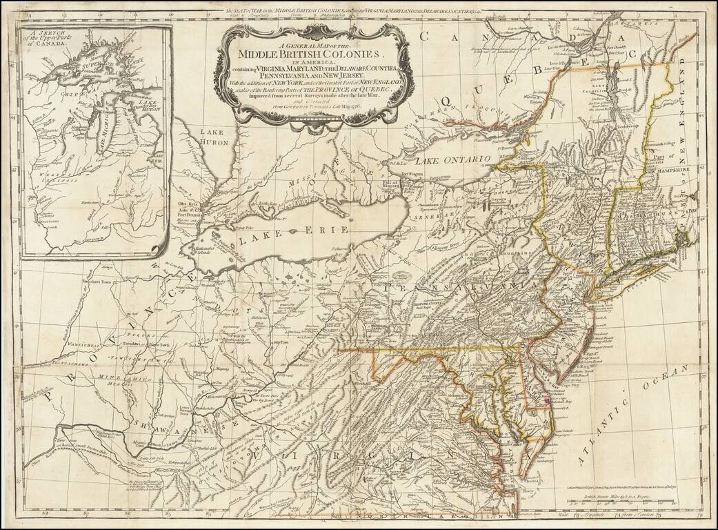
The scarce "Holster Atlas" edition of Lewis Evans' highly important map of the Middle British Colonies, at the start of the American Revolution. This edition of the map was prepared specifically for the American Military Pocket Atlas, an atlas published for use by British Military Officers during the American Revolution in a size which would fit into the saddlebags of a mounted British Officer.
Along with John Mitchell's map of North America, the Evans map is considered the most important American map of the 18th Century. Both maps were intended to spur western expansion into the Trans-Allegheny, Ohio Valley and regions westward and in response to French encroachments. Evans' map became the standard for nearly 50 years, being re-issued in this and other pirated editions by Jefferys, Bowles, Kitchen and others.
The map is a milestone both for its political significance and extension of cartographic knowledge in the region. Governor Pownall re-issued an updated edition of the map taken from the original Evans plate, with and addition of New England and a group of tables, naming townships in the Colonies. Pownall had been a great supporter of Evans and pledged the proceeds from the map to Evans' daughter. The cartographic importance of the map and its place in the history of cartography are substantial. An essay on this map is available by emailing us a request.
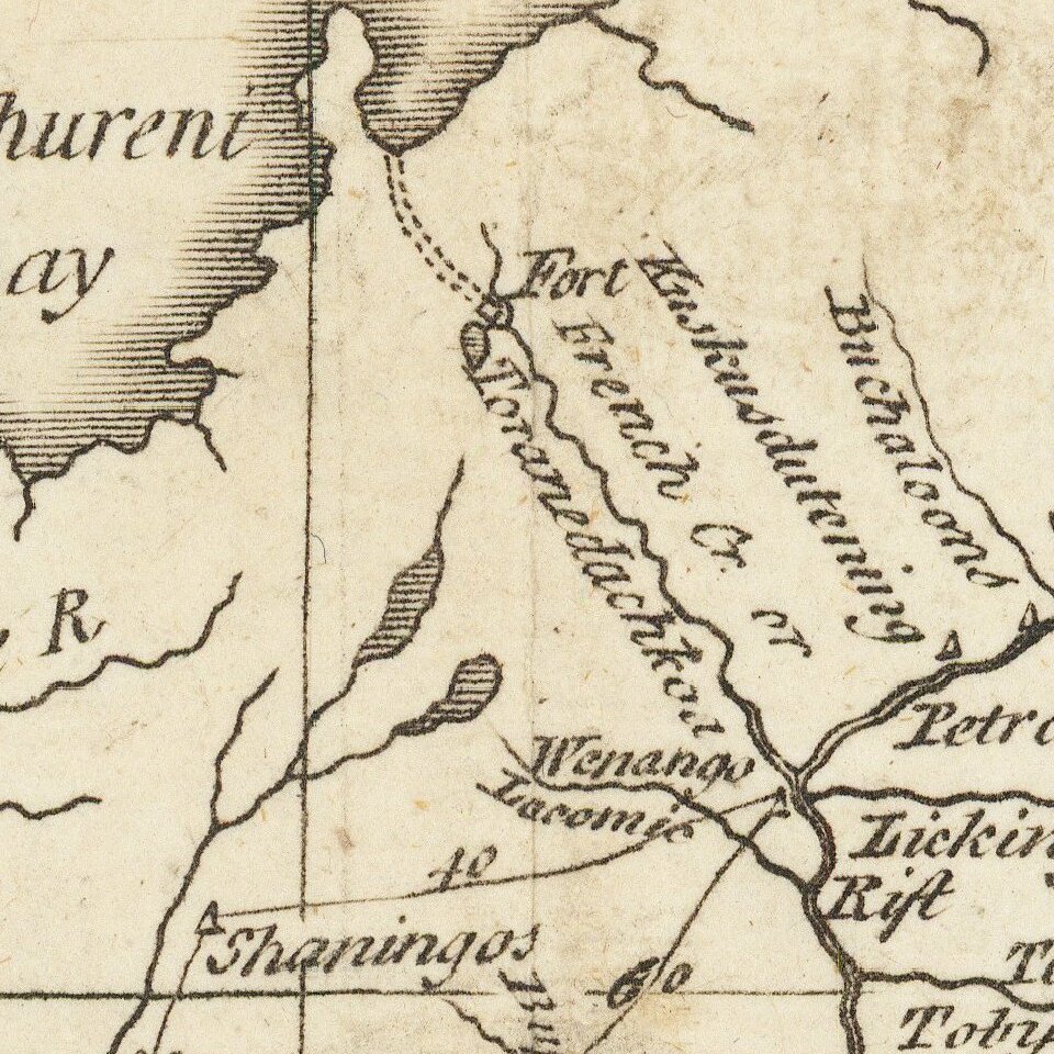
The detail on this map is extensive, and the notes are fascinating. The dense settlements of the coast give way to the various mountain ranges of the Appalachian to the west. Notes relate to treaties made with Native American tribes, the passability of mountain ranges, or anything else that might be of use to an explorer or mounted officer.
Includes an inset map of the northern midwest to Lake Superior, labeled as the "upper parts of Canada."
This example is from Jeffery's American Military Pocket Atlas, otherwise known as the Holster Atlas, having been carried into battle by British Officers. Because of its use as a primary battlefield source, it is among the most interesting and historically important of the later editions of Evans' map.
If you are a student, write to us in telegram: @antiquemaps and indicate what material you need and for what work you need a map in high detail. We are ready to provide material on special terms. For students only!


![[The First Maps in a la poupée Printed Color] Cartes en Couleur des Lieux Sujets aux tremblements de Terre Dans toutes les parties du Monde Selon le Sisteme de l’impulsion Solaire](/map/small/52293op.jpg)