
![[Franklinia] A Map of the States of Virginia, North Carolina, South Carolina and Georgia; Comprehending the Spanish Provinces of East and West Florida: Exhibiting the Boundaries as fixed by the late Treaty of Peace . . .](/map/small/67980.jpg)
One of the Earliest Appearances of the State of Franklin (Franklinia) Nice example of Purcell's map of the Southern States (and Midwest), which includes an early reference to the New State of Franklin in the center part of North Carolina. This map...
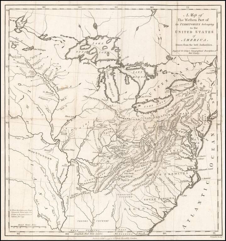
Nice example of this scarce regional map of the United States, which appeared in A Topographical Description of the Western Territory of North America ... by Gilbert Imlay. The map covers the region from the Great Lakes through Georgia and from the...
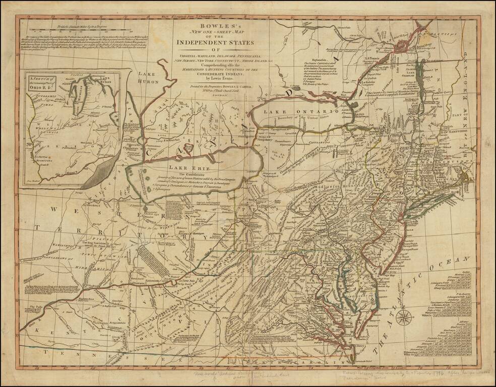
Rare Map of the Mid-Atlantic Issued Shortly After The 1783 Treaty of Peace. A nice example of the Bowles & Carver post-Revolutionary War edition of Lewis Evans' seminal map of the British Colonies in North America, including early references to...
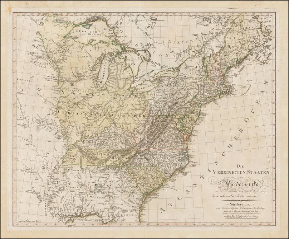
Rare separately issued map of the United States by Daniel Freidrich Sotzmann, engraved for Christoph Daniel Ebeling's Beschreibung. The present example has wide uncut deckled edges, similar to Sotzmann's individual maps of the states. The words "No....
![Charte von Den Vereinigten Staaten von Nord-America nebst Louisiana . . . 1805 [Rare 1st State of Gussefeld's Louisiana Purchase Map]](/map/small/63496.jpg)
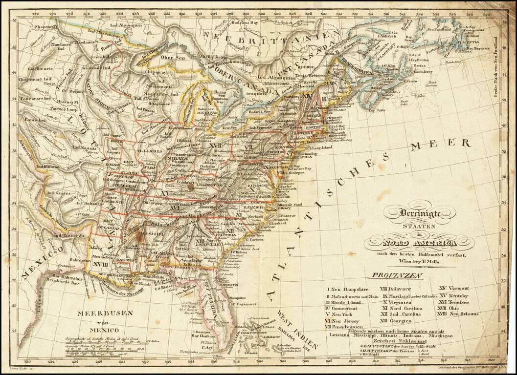
Rare first state of Gussefeld's map of the United States, published in the same year as the Louisiana Purchase and highlighting Jefferson's United States on the eve of the expedtitions of Lewis & Clark, Zebulon Pike, etc. Following the Louisiana...
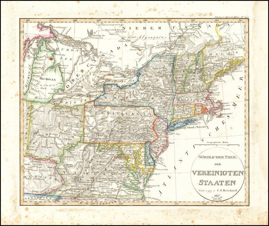
Rare early map of a portion of the Midwest and regions to the East, from Lake Michigan to Kentucky and Virginia to Maine. Early depiction of Michigan Territory.
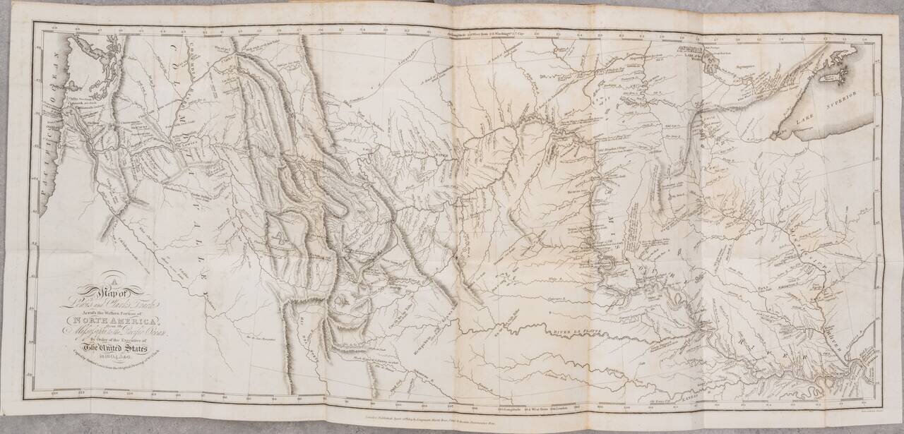
London edition of Lewis & Clark's map of the Northwestern US, based upon William Clark's original manuscript map of the expedition, along with the complete 3 volume text and maps of the 1817 London edition of Lewis & Clark's Travels to the...
Scarce & interesting map of the United States, published in the decade following the Louisiana purchase. Among the more notable features of the map are the many interesting mountain ranges in the Plains regions, the early appearance of Michigan...
![[Missouri named Jefferson] Etats-Unis par A.M. Perrot](/map/small/69488.jpg)
Missouri as the state of Jefferson Fascinating early map of the United States, which names the present state of Missouri as Jefferson. The outline color clearly delineates Missouri, as formed in 1821. Other features include a 54-40 or fight boundary...
Shows Huron Territory -- The Future Wisconsin Territory Scarce map of the United States, showing a massive Missouri Territory, Huron Territory and Texas. The map provides fine details in the Northwestern part of the map, corresponding to the old...
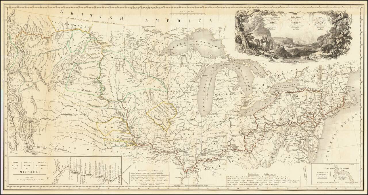
One of the Finest Early Maps of The Missouri Valley & American Plains Nice example of this remarkable map illustrating the account of the travels of Prince Alexander Phillip Maximilian, of Wied's, in the Plains and Rocky Mountain regions, in the...
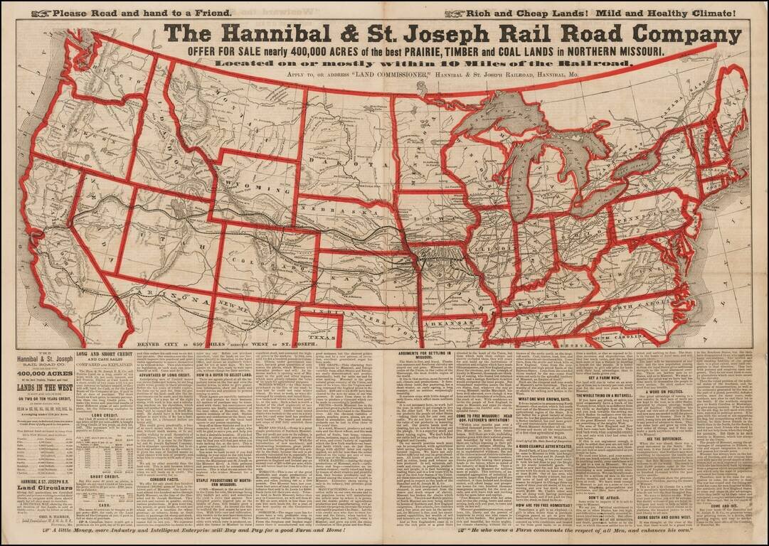
Advertising broadsheet map published by the Hannibal & St. Joseph Railroad, promoting land in Northern Missouri. The map notes the Railroad offering more than 400,000 acres of land for sale along the Hannibal & St. Joseph Railroad in...
![[The Mississippi-Missouri: A Geographical Blunder -- An Illustrated Argument For Renaming The Lower Mississippi River Put Forth By A Prominent American Educator To The Author of a Best Selling American School Geography]](/map/small/56241.jpg)
"The Geographer who shall first have the boldness to teach the truth . . . will be opposed for a time by interested book publishers and conservative pedagogues, but will triumph as Galileo did in the end." The Mississippi-Missouri: A Geographical...
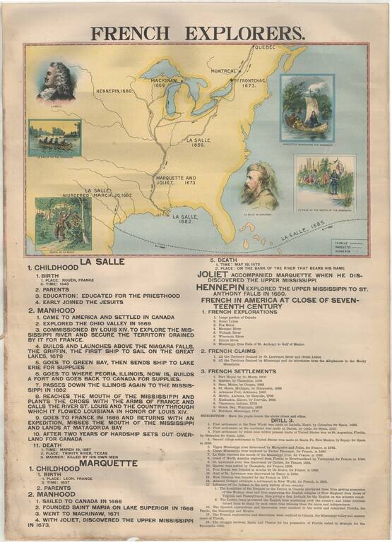
Rare Large Educational Map, With Pictorial Map Illustrating French Exploration of America and Illustrated Historical Chart of the United States. Decorative large format image, printed in color on both sides, almost certainly for educational purposes....
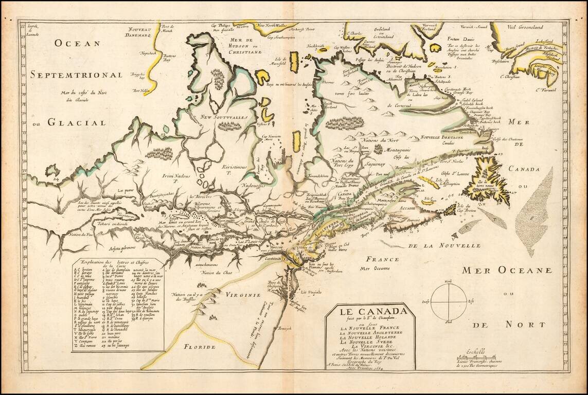
One of the Most Important Early Maps of Canada and the Great Lakes. Fine example of this highly important map of Canada, the Great Lakes and Northeastern United States, originally engraved for Samuel de Champlain's 1619 Les Voyages. Du Val's Le...
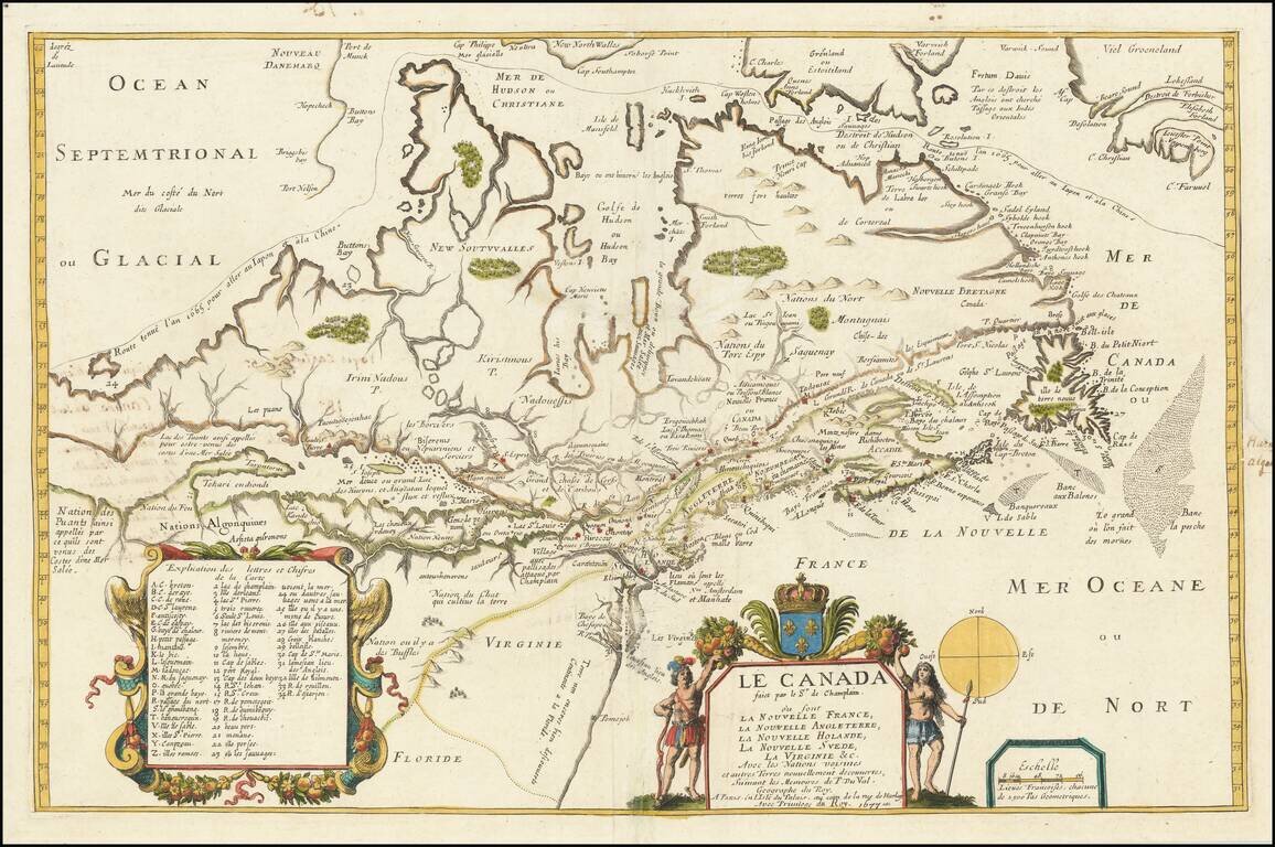
Fine example of this highly important map of Canada, the Great Lakes and Northeastern United States, originally engraved for Samuel de Champlain's 1619 Les Voyages. Du Val's Le Canada facit par le Sr. de Champlain . . . is unquestionably one of the...