
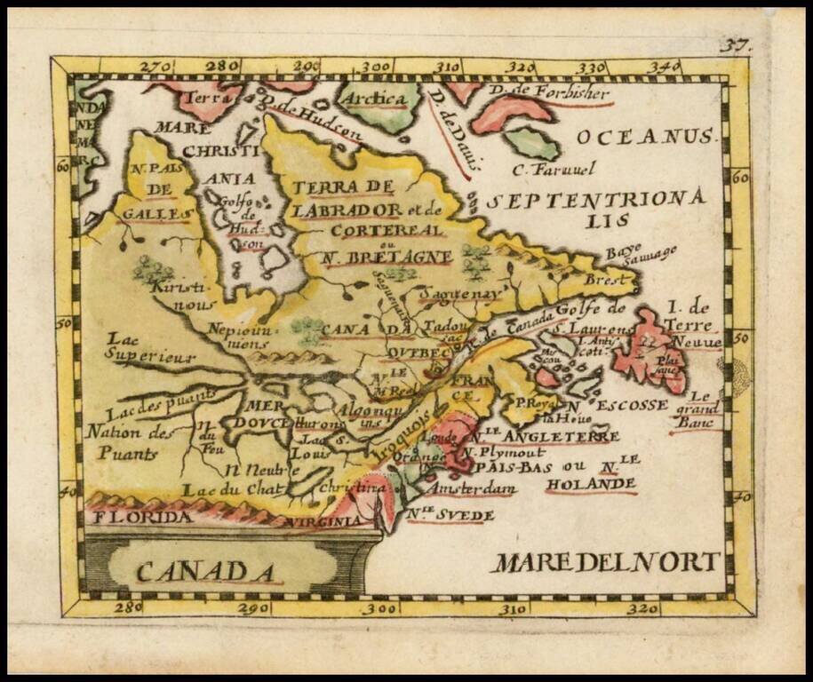
Rare JC Beer edition of Du Val's map of Canada, the Great Lakes and Northeast, based upon Sanson's earlier maps of the region. Excellent example of the open ended Great Lakes to the West. Clearly shows a Northwest Passage through Hudson's Bay. Extends...
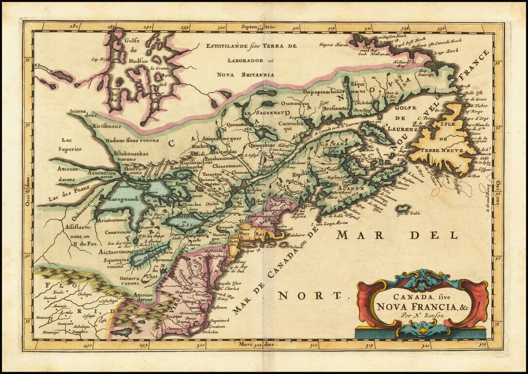
First state of the Frankfurt edition of Nicolas Sanson's map of Canada and the Great Lakes (first issued in Paris in 1657), which would influence regional cartography for the next 100 years. Along with Sanson's larger map issued in 1656, this map...
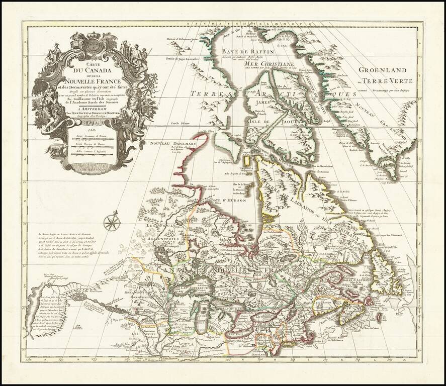
Fine example of Covens & Mortier's edition of De L'Isle's seminal map of Canada, the Great Lakes and Upper Midwest, and one of the most important and influential maps of Canada published in the 18th Century. De L'Isle's map is of seminal...
![Partie De L'Amerique Septent? Qui comprend La Nouvelle France ou Le Canada . . . [Large Great Lakes Inset]](/map/small/57758.jpg)
Decorative and highly detailed map of New England and Part of Canada, extending east to Newfoundland, with a large inset map of the Great Lakes. The large inset of the Great Lakes is based upon Bellin's map, and provides one of the best large format...
Detailed map of the British Colonies in North America during the French & Indian War. The map is based on Robert de Vaugondy's folio map of the same period and is filled with detail of early settlement, Indian villages and topography. The colonies...
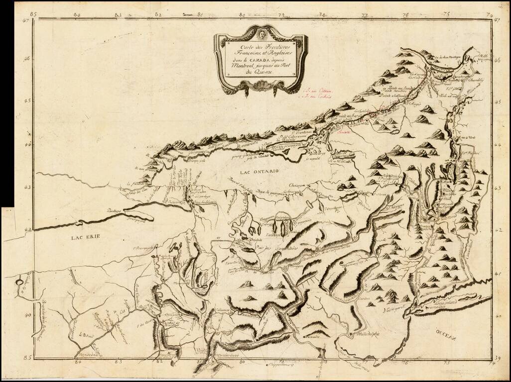
Rare French & Indian War era map of the region between Montreal and Fort Duquesne (Pittsburgh), including all of New York and New Jersey, and most of Pennsylvania. It exhibits a portion of the Theater of War, from Pierre Pouchot's Memoires sur le...
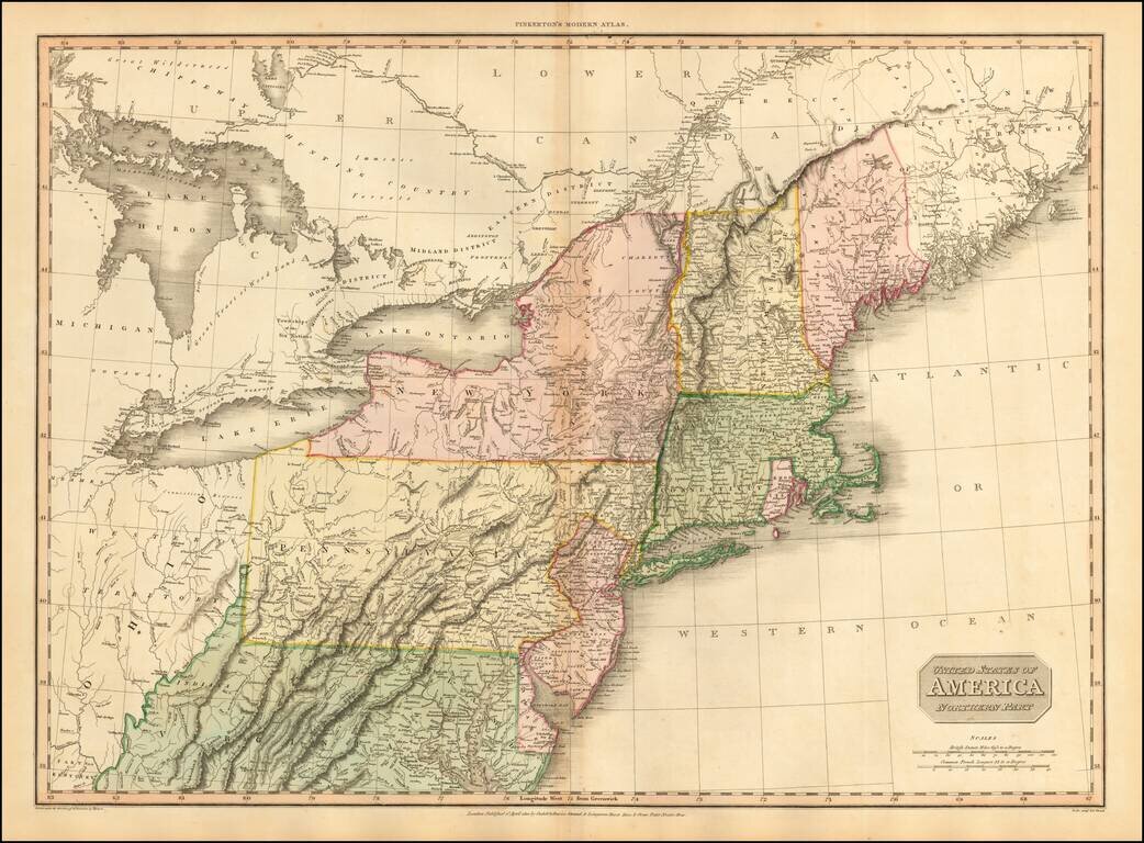
Fine large format map of the Northeast, at the end of the War of 1812, published by Pinkerton. Large detailed map of the Northeastern United States, from the District of Main to Michigan, Ohio, Virginia and Delaware, including most of the Upper...
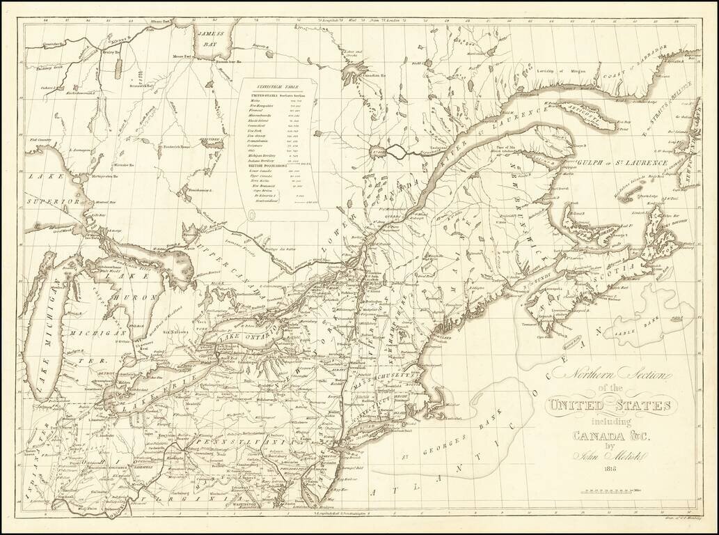
Rare map of the Northeastern United States, which first appeared in John Melish's Traveller's Directory… published in Philadelphia. This Northern Sheet, previously titled Map of the Seat of War…extends from the Great Lakes to Nova Scotia, New...
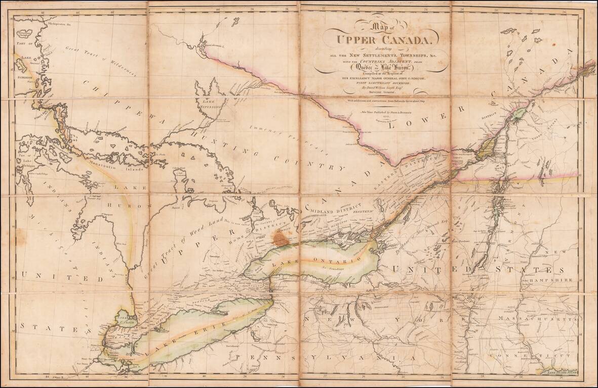
An Early Upper Canada Rarity - Sent To Thomas Jefferson During the War of 1812 Extremely rare separately published map of Upper Canada, Lake Huron, Lake Erie, Lake Ontario and contiguous parts of New York, Michigan, Vermont and Pennsylvania, published...

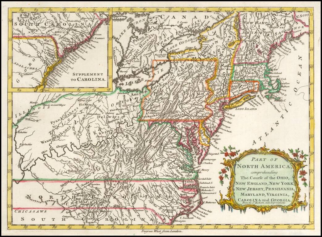
Detailed map of the Ohio Valley and regions to the East Nice example of Robert de Vaugondy's map of the Northern British Colonies, French interests to the North of the Great Lakes, and contested "Back Settlements," including a fine detailed treatment...
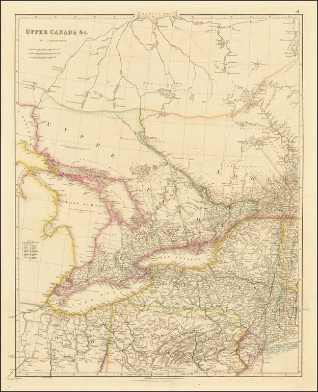
Early state of John Arrowsmith's map of Upper Canada and the Eastern Great Lakes, including Lake Huron, Lake Erie and Lake, Ontario, with parts of Lake Michigan and Lake Superior. The present map is drawn directly from the work of James Chewett and...
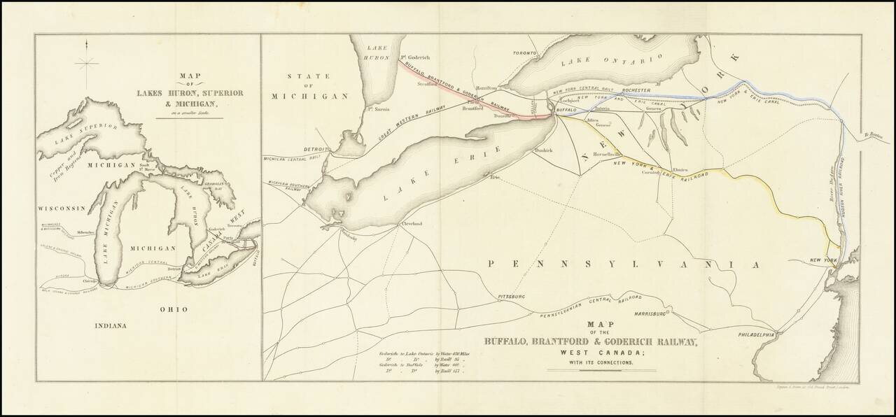
Interesting map of the Buffalo, Brantford and Goderich Railway, likely published either in its earliest incarnations in 1852 or at the time of its reorganization in 1856. The Buffalo, Brantford & Goderich Railway operated between 1852 and 1856,...

Detailed road map of the Great Lakes Region, constructed by Canada's Department of the Interior. Includes Provincial Routes, Federal Routes and State Routes.
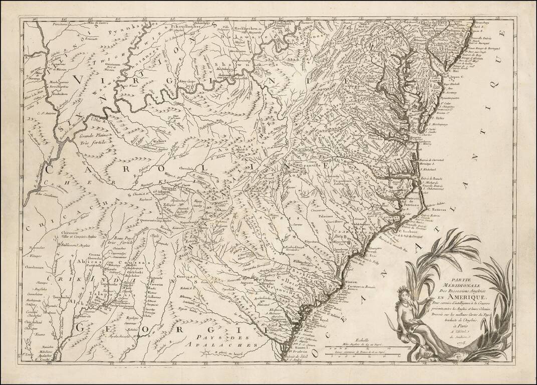
One of the Earliest Regional Maps of The Southern Theater of War Published in Paris. Rare separately published map of the Southern British Colonies, shown at a time when the French were just beginning to actively join the American Rebel cause in...
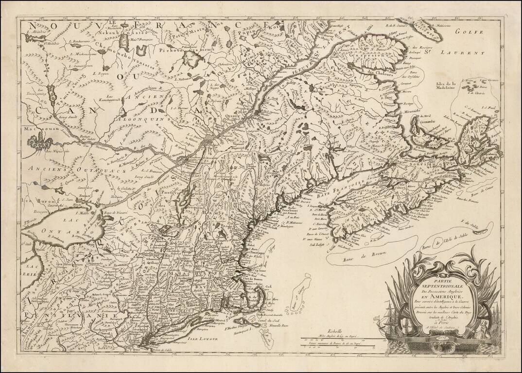
One of the Earliest Regional Maps of The Northern Theater of the Revolutionary War Published in Paris. Rare separately published map of the Northern British Colonies, shown at a time when the French were just beginning to actively join the American...
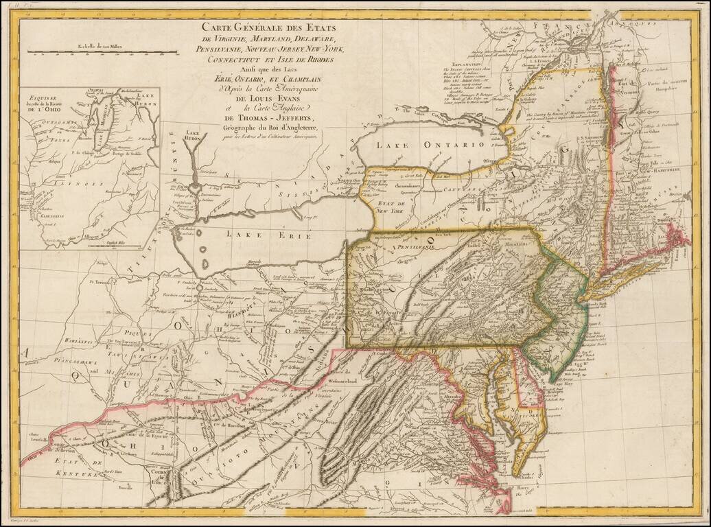
Nice example of the French edition of the scarce Lewis Evans' map of the Middle British Colonies, one of the most important maps of the British Colonies published in the 18th Century. Evans' map provides a dramatic update in the region covered, based...