Map size in jpg-format: 12.6211MiB
Click to open in high resolution (open in new tab).
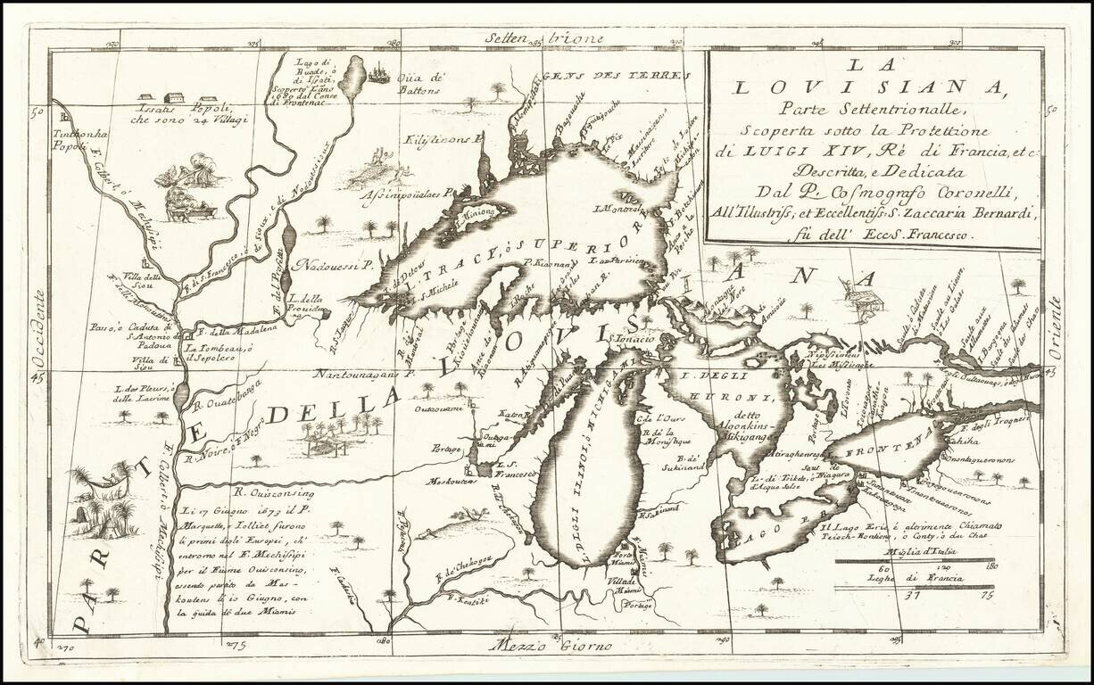
Important 17th Century Map of the Great Lakes and Upper Mississippi River
Nice example of Coronelli's highly important map of the Great Lakes and Upper Mississippi region.
Coronelli's map is widely regarded as one of the most important maps of the Great Lakes and Upper Mississippi. Based upon reports of La Salle, Hennepin, Marquette, Jolliet and other French Jesuits who were actively exploring and conducting missionary expeditions from Quebec, throughout the Great Lakes region and down the Mississippi River in the late 17th Century. The map is one of the earliest to depict the results of these early explorations and the first detailed map to focus on the region.
A number of the Jesuit Missions are noted as churches along the coastline of the Great Lakes. Fort Miamis is also noted. The Great Lakes delineation is considered the most accurate rendering of the Lakes published in the 18th Century and was the foundation for maps of the region for a number of years thereafter. Bellin's later fictitious islands in Lake Superior do not yet appear.
Included are a number of illustrations within the body of the map, showing indigenous peoples and activities. One of the Great Lakes cartographic milestones of the late 17th Century.
If you are a student, write to us in telegram: @antiquemaps and indicate what material you need and for what work you need a map in high detail. We are ready to provide material on special terms. For students only!
![[The First Maps in a la poupée Printed Color] Cartes en Couleur des Lieux Sujets aux tremblements de Terre Dans toutes les parties du Monde Selon le Sisteme de l’impulsion Solaire](/map/small/52293op.jpg)