logo

1831. Part of the State of Indiana From actual Survey on file in the General Land Office January 13th 1831.

  • Part of the State of Indiana From actual Survey on file in the General Land Office January 13th 1831.

Part of the State of Indiana From actual Survey on file in the General Land Office January 13th 1831. information:

Year of creation: 
Resolution size (pixels): 
 1460x1700 px
Disk Size: 
 346226B
Number of pages: 
 1
Place: 
 Washington, D.C.

Print information. Print size (Width x height in inches):
Printing at 72 dpi 
  20.28 х 23.61
Printing at 150 dpi 
 9.73 х 11.33
Printing at 300 dpi 
 4.87 х 5.67

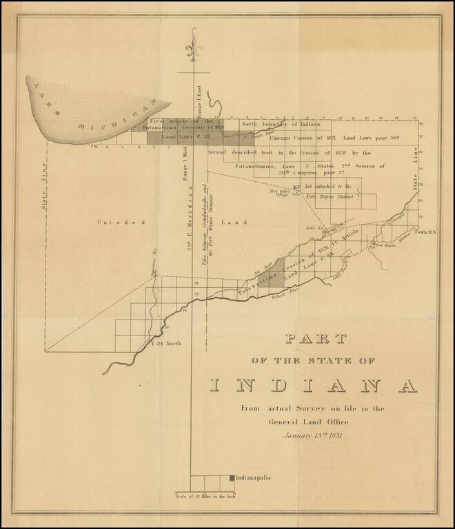
Important early survey map of Indiana, published by the General Land Office.

Shows the area from Indianapolis north to Lake Michigan.

The map identifies on a regional basis a number of early Indian Treaties and the lands impacted thereby, along with the line between the Crawfordsville and Fort Wayne Land Districts.


Special conditions for students!

If you are a student, write to us in telegram: @antiquemaps and indicate what material you need and for what work you need a map in high detail. We are ready to provide material on special terms. For students only!

Item information:

Year of creation:
Size:
1460x1700 px
Disk:
346226B
Number of pages:
1
Place:
Washington, D.C.
$9.99

Related item