Map size in jpg-format: 6.72809MiB
Click to open in high resolution (open in new tab).
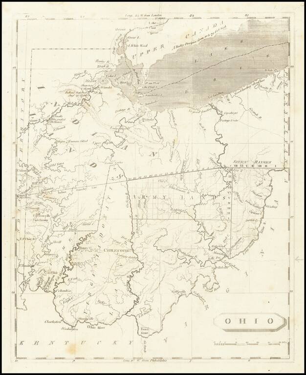
One of the First Printed Maps of Ohio -- Published Just Months After Ohio Statehood
Important early map of Ohio from Arrowsmith & Lewis' New and Elegant General Atlas.
The map appeared only months after Ohio became a state on March 1, 1803.
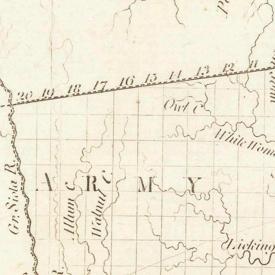
The map shows early waterways, some topography, forts, battle sites, and towns appear on this map.
The map does not show any county subdivisions, but rather illustrates the larger land divisions made by Congress, while the outline of lands held by the Ohio Company and the Connecticut Company are entirely omitted.
This map also locates the important battlefields of Indian Wars from 1790 - 1795 and even marks the location where Captain Alexander Trueman was killed by Indians in 1792 while on a peace mission.
A large section of the map is shaded blue and marked Army Lands while much of the Northwestern part of the state is marked Indian Lands. This important map of Ohio was published in two separate popular geographies and appeared in many editions of atlases by Arrowsmith and Lewis. It was through this map that many people received their first impression of Ohio.
If you are a student, write to us in telegram: @antiquemaps and indicate what material you need and for what work you need a map in high detail. We are ready to provide material on special terms. For students only!