Map size in jpg-format: 809681B
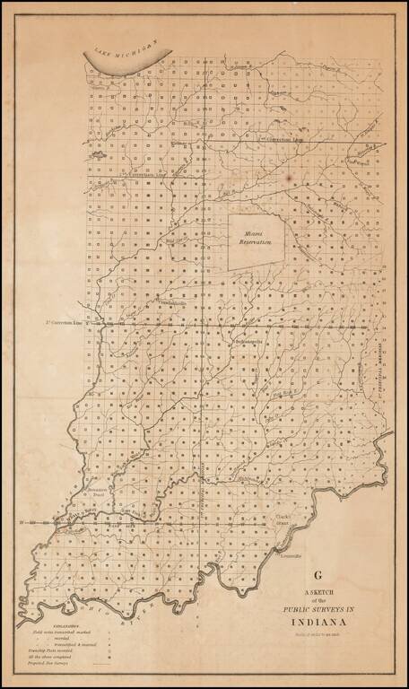
One of the earliest obtainable government survey maps of Indiana.
The map is divided into surveyed townships and includes notes as to whether the field notes of the survey have been transcribed and/or recorded, township plats recorded and proposed new surveys. The river system is shown, as is the Miami Reservation, Clark's Grant, Jeffersonville, Vincennes Indianapolis, Crawfordsville and a number of early surveyor's features.
An essential map for Indiana collectors.
If you are a student, write to us in telegram: @antiquemaps and indicate what material you need and for what work you need a map in high detail. We are ready to provide material on special terms. For students only!