
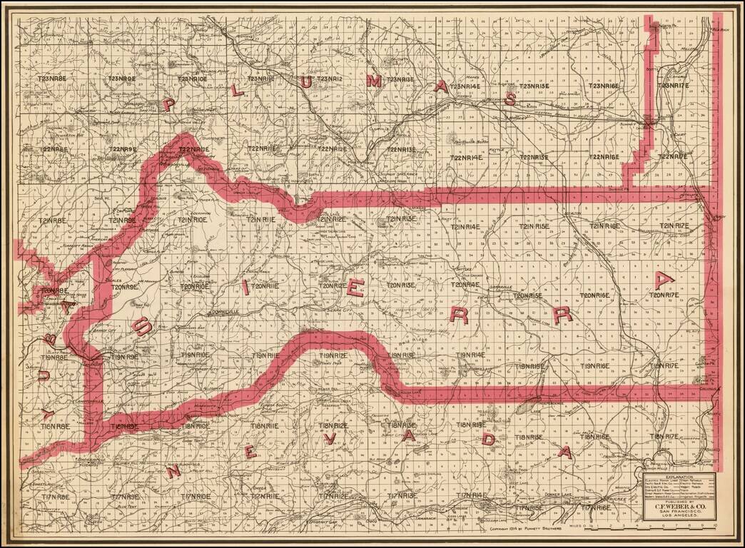
Highly detailed pocket map of Calaveras County, published by C.F. Weber. The map shows early railroads, roads, wagon roads, mines, lakes, mills, and many other details. Calaveras County was one of the original counties of the state of California,...
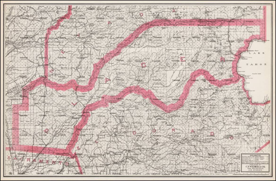
Separately issued unfolded map of Lake Tahoe, El Dorado County, Placer County, etc., published by C.F. Weber. The map shows early railroads, roads, wagon roads, mines, lakes, mills, and many other details.
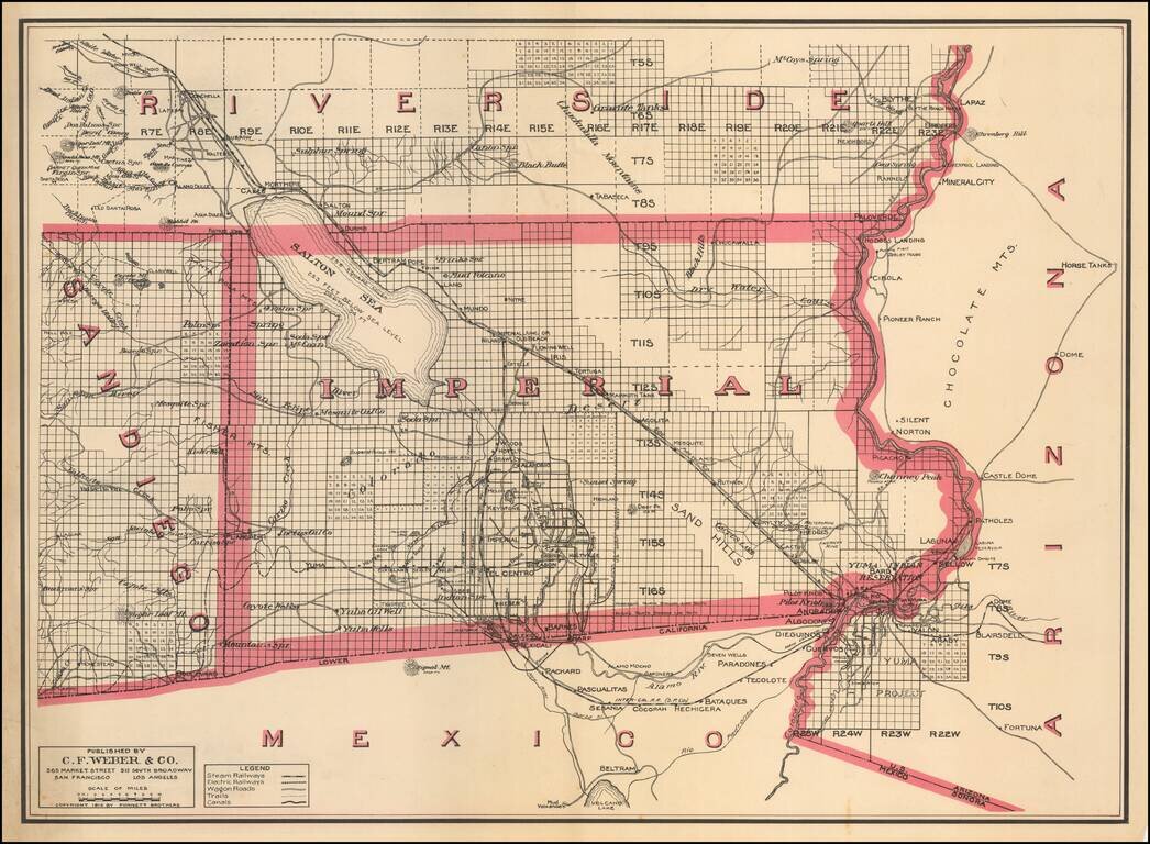
One of the Earliest Separate Maps of Imperial County Scarce separately issued map of Imperial County, published by C.F. Weber & Co. The map was issued just 7 years after the formation of the county and 9 years after the Salton Sea was created by...
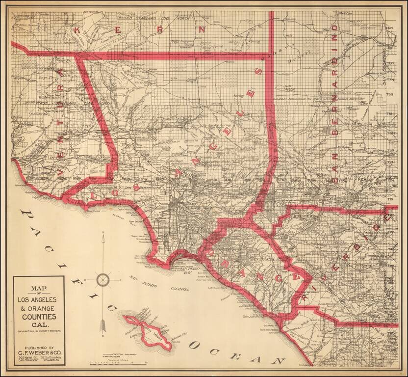
Highly detailed map of Los Angeles and Orange Counties, published by C.F. Weber. The map shows early railroads, roads, wagon roads, mines, lakes, mills, and many other details. A number of early ranchos are shown. There is additional detail of...
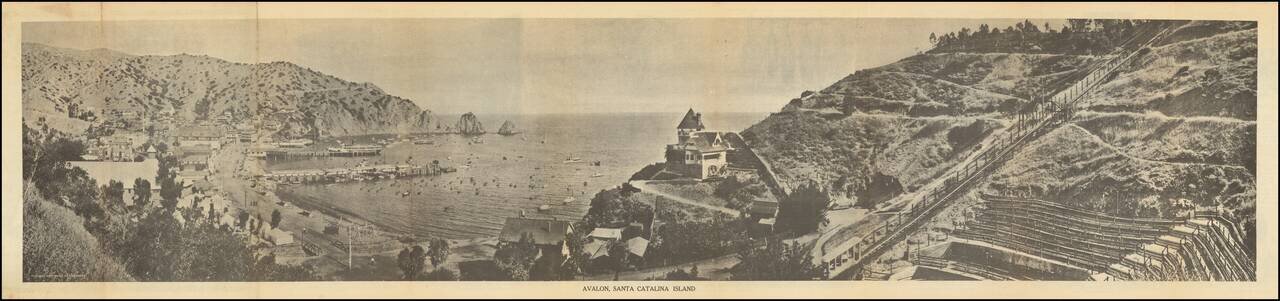
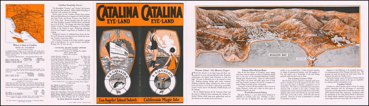
Scarce early Catalina Island promotional brochure, issued by the Wilmington Transportation Co. The brochure opens to reveal a panoramic view of Avalon, Santa Catalina Island, served by Steamers of Wilmington Transportation Line, Banning Line, the...
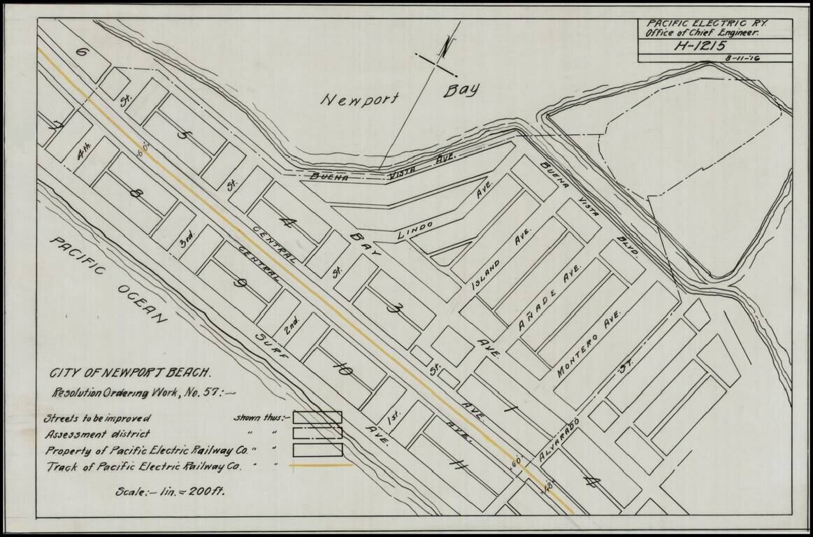
Detailed map of a portion of Newport Beach, bounded by Surf Avenue, Buena Vista Avenue, 4th Street and Alvarado Street. Shows the tracks of the Pacific Electric Railway and other details.
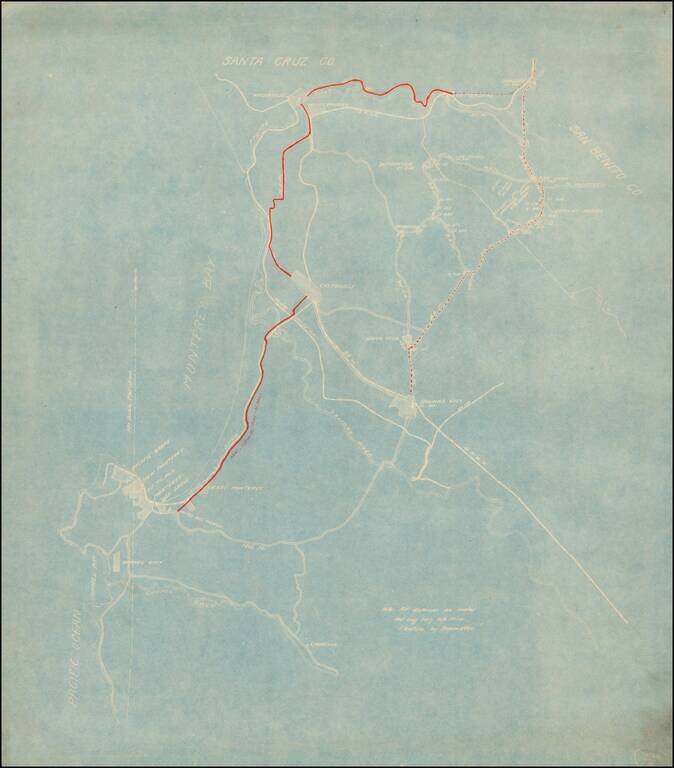
Detailed map of the area between Watsonville and Parjaro in the north and the Carmel River and Laureles in the south. The focus of the map is the New Castroville Road from Monterey to Castroville, Watsonville and Chittendens, with the road tentatively...
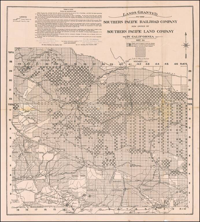
Rare promotional map showing the lands owned by the Southern Pacific Land Company in Southern California, focusing on the northern part of Los Angeles County. The map extends north to beyond Rancho Tejon and shows a number of Ranchos in Los Angeles...
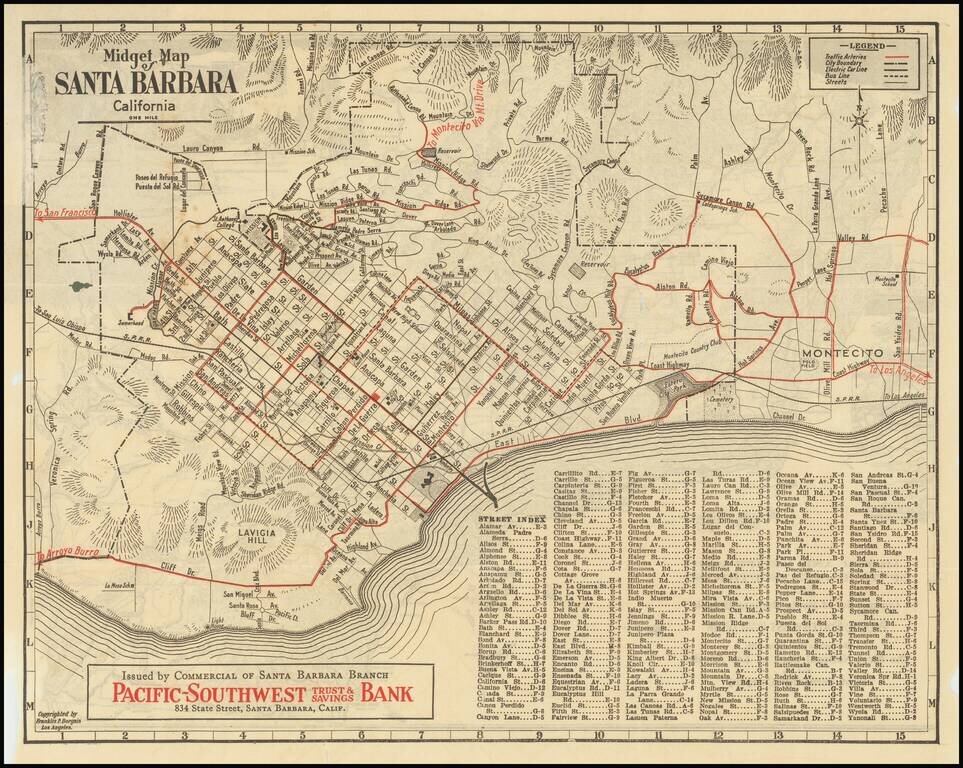
Rare early "midget" series map of Santa Barbara, published as a promotional map for Pacific-Southwest Trust & Savings Bank. Includes a birdseye view style "Motor and Relief Map" of Southern and Central California (extending to San Francisco) on...
![[Pictorial Road Maps] Motoring to Yosemite and the Mariposa Big Trees](/map/small/70985.jpg)
Finely illustrated promotional booklet, consisting of 16 pages and 7 color maps, published by the Yosemite Park and Curry Co., Yosemite National Park, California, and printed by H. S. Crocker Co., San Francisco. While the maps and pamphlet are...
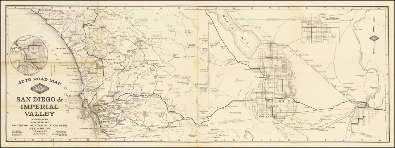
American Automobile Owners Association Rare separately published map of San Diego and Imperial Counties, published by the American Automobile Owners Association (not AAA). At one point, AAA and AAOA were involved in copyright litigation over their...
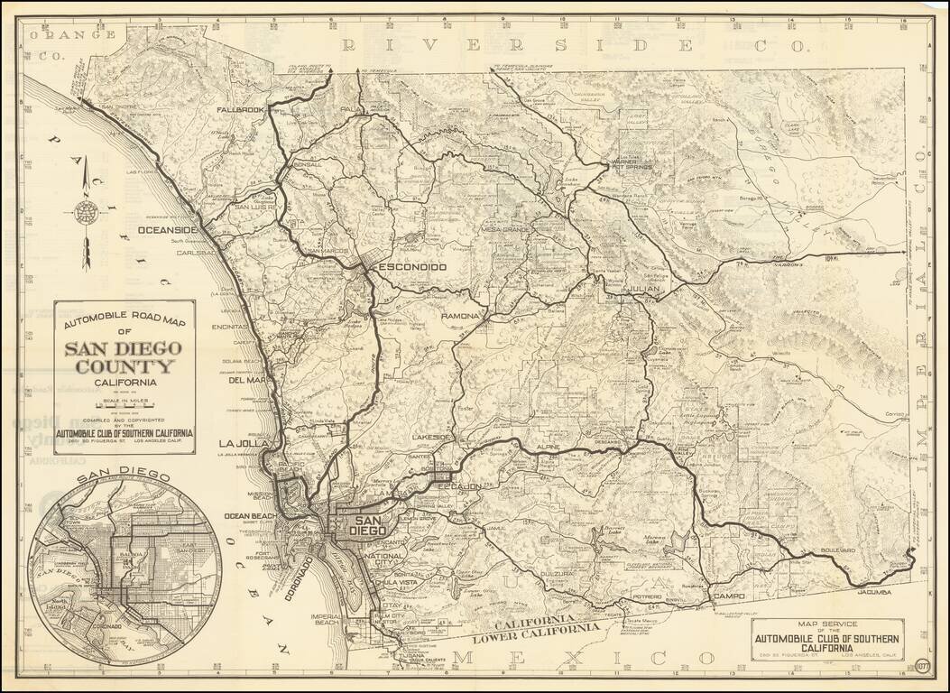
Detailed map of the Roads of San Diego County, published by the Automobile Club of Southern California. Includes a large inset map of the city of San Diego.
Decorative promotional pamphlet promoting Catalina Island, with a marvelous birdseye view of Avalon Bay, including 2 piers. Interesting early promotional pamphlet with many photographs and early descriptions of the best of Catalina's tourist industry...
![[Los Angeles & Orange Counties] Status of Lands Survey Conducted During 1926 Central Portion of Coastal Plain . . .](/map/small/66323.jpg)
Detailed Irrigation map of a portion of the Los Angeles Basin, published by the California Department of Public Works, Division of Water Rights. A color key identifies: Irrigated areas (green) Unirrigated areas (yellow) Subdivided (urban) areas...
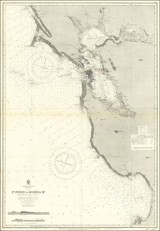
Scarce separately issued sea chart of San Francisco Bay and Vicinity, extending from Monterey Bay to Bodega Bay, with large revisions up to 1926. First issued in the mid-19th century, this map was regularly updated well into the 20th century.
![[Southern California] Map of Automobile Roads Banning California](/map/small/45357.jpg)
Illustratrated promotional pamphlet for Banning, California, with a fine Automobile map of Southern California. The map is drawn by Paul M. Entenman. Topography shown with hachures. The pamphlet includes 15 pages of text. Interior illustrations...