
![[Imperial & Coachella Valley Advertising Map -- Valerie Jean Date Shop]](/map/small/69651.jpg)
Interesting advertising map, promoting Valerie Jean's Date Shop, the first retail establishment to sell dates produced in the Coachella Valley, beginning in about 1935. The map is also of note for its location of Hilton's Art Studio, the workshop of...

"The Palm of God's Hand" (Harold Bell Wright) Rare tourist promotional map, focused on tourism in the Imperial Valley. Centered on Brawley, California, the map includes vignettes highlighting tourist attractions, including the Salton Sea, Painted...
![[California] Panorama of Progress -- California State Fair America's Largest Ten Day State Fair](/map/small/69899.jpg)
Fascinating pictorial map of California, prepared for the 87th Annual California State Fair, held between August 29, 1941 to September 7, 1941. The map presents a fascinating image of California, partitioned in 58 "color-laden" counties, each looking...
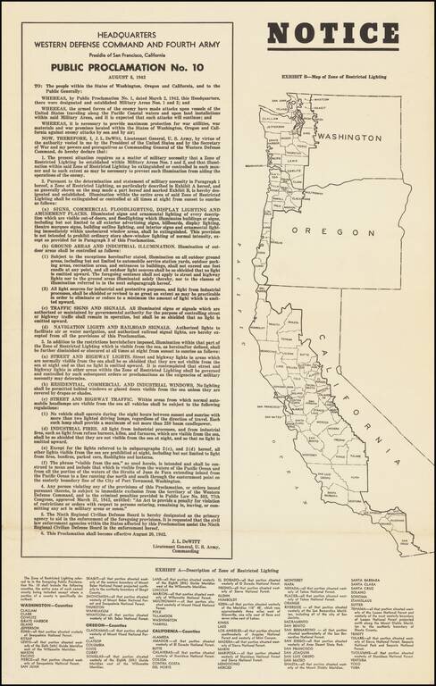
Lights Out Across the Pacific Coast. World War II broadside declaring the institution of Public Proclamation No. 10, which heavily controlled the use of artificial lighting on the West Coast, so as to inhibit nighttime attacks by Japanese warships and...
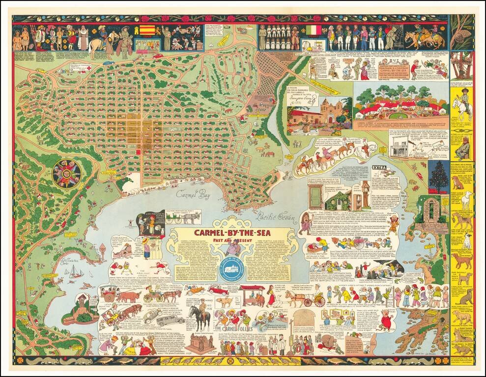
Fine example of Jo Mora's marvelous map of Carmel and the location of Mora's art studio. The map includes a detailed and whimsical look at the area around Carmel, with marvelous vignettes of the major landmarks, past and present, a town plan and a...

Detailed geological survey map from the WW II Period, centered on Lower Otay Reservoir, Jamul, Proctor Valley and the Jamul Mountains. Extends from Sweetwater Reservoir and Spring Valley in the Northwest to Lawson Valley, Mellor Ranch and Lyons Peak...
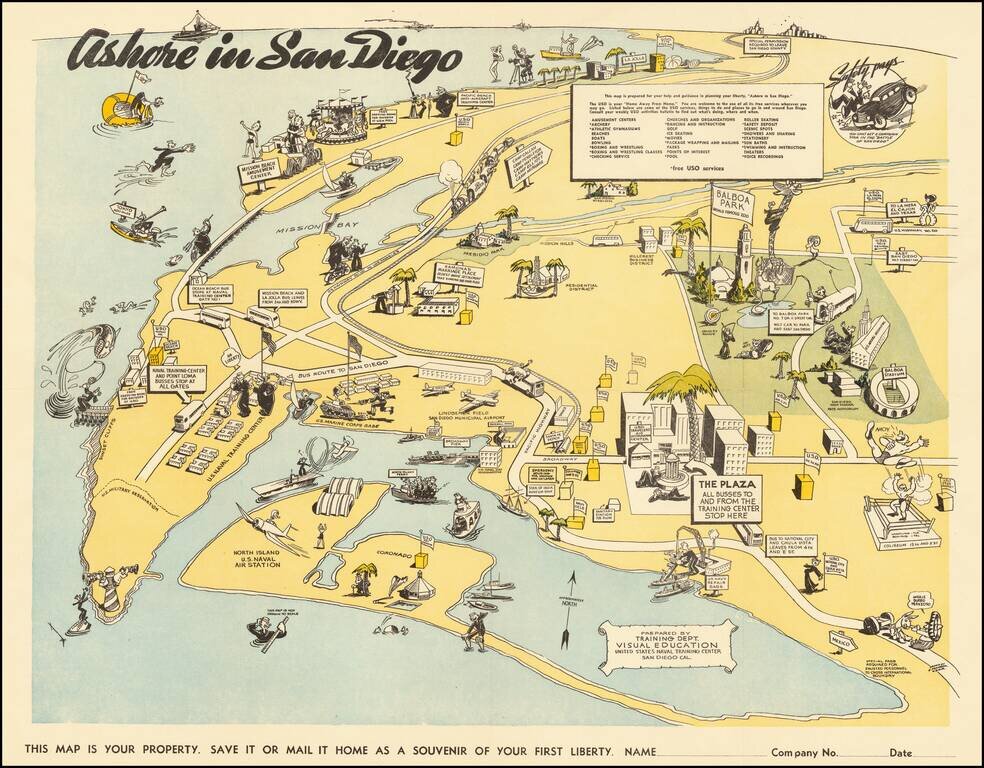
Lively pictorial map of San Diego, prepared for soldiers on leave from the Naval Training Center during WWII. The map extends north to La Jolla, showing the USO facility at 7776 Eads Avenue, and East Balboa Park. The map is centered on Lindbergh...
![[WWII War Bonds] As Bond Away Finishes Its Tour](/map/small/63461.jpg)
Fourth Air Force Aviation Engineers Camouflage Bond Show -- Northern California 1944 Rare promotional pamphlet and map, supporting the sale of bonds to support the war effort. Issued in the winter of 1944, the map illustrates the different places...
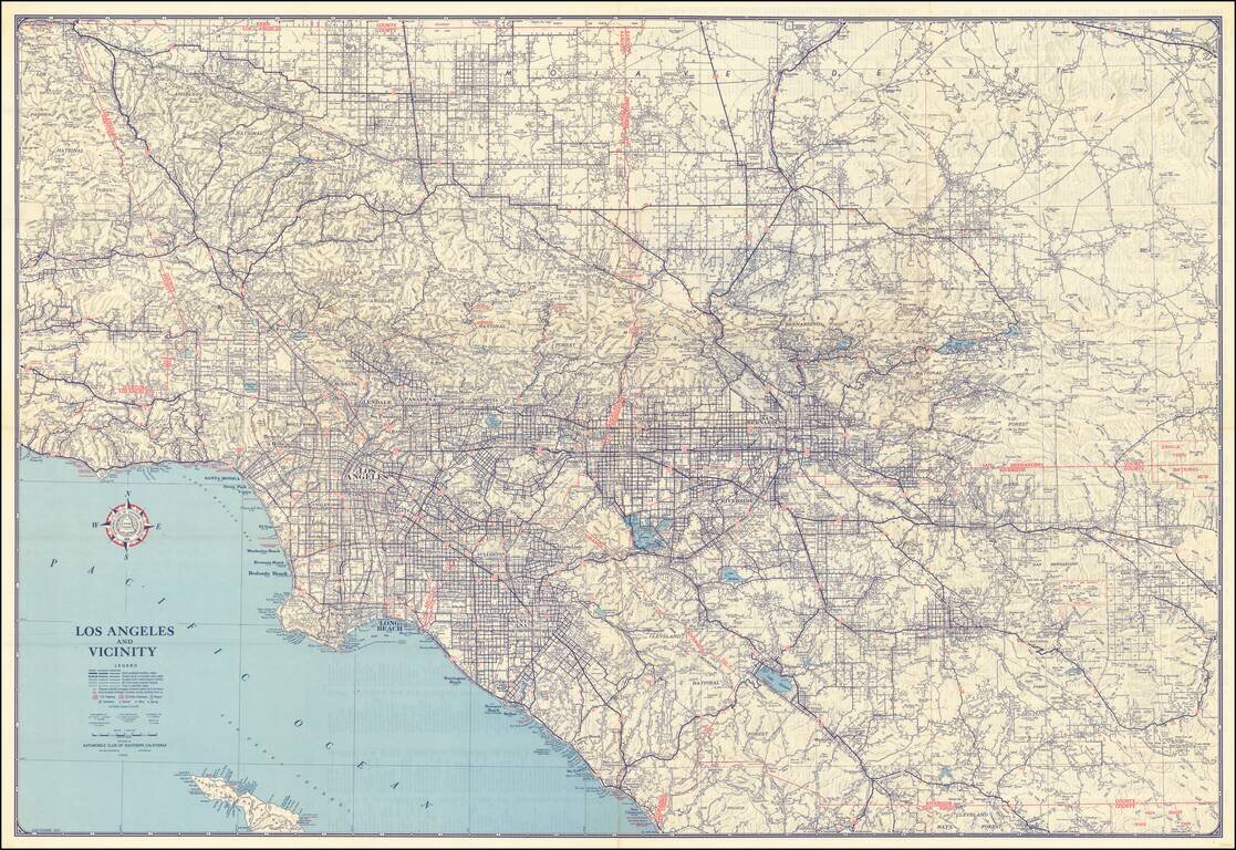
A large detailed map of Southern California, focused on its system of roads and highways. Produced by the Automobile Club of Southern California, the map covers Los Angeles County, Orange County and the western parts of Riverside and San Bernardino...
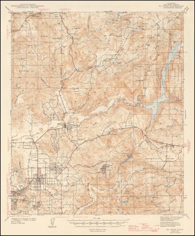
Detailed geological survey map from the WW II Period, extending from El Cajon and Fletcher HIlls in the southwest to Warner Ranch and Vallecitos in the northwest, Gower Truck Trail, Capitan Reservoir and Indian Reservation in the northeast, and Sequan...
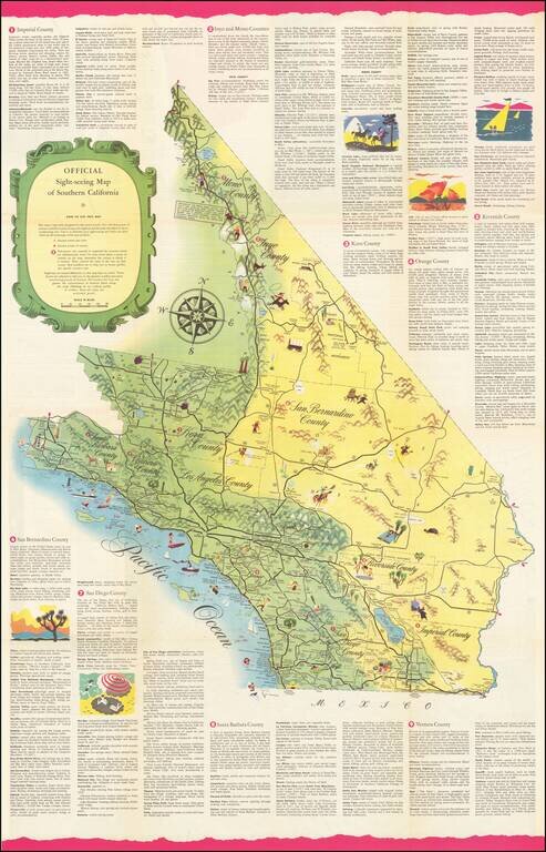
Rare Sightseeing Map of Southern California. The map combines pictorial vignettes with a tourist road map of the region, with text describing tourist opportunities in each of Southern California's counties. On the verso, a sightseeing map of Los...
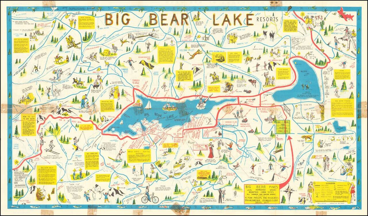
Rare Big Bear Lake Pictorial map, published by the Recreational Publishing Company. The main map shows the area around Big Bear Lake, with emphasis on recreational activities, both winter and summer, including Moonridge Ski Run Snow Valley...
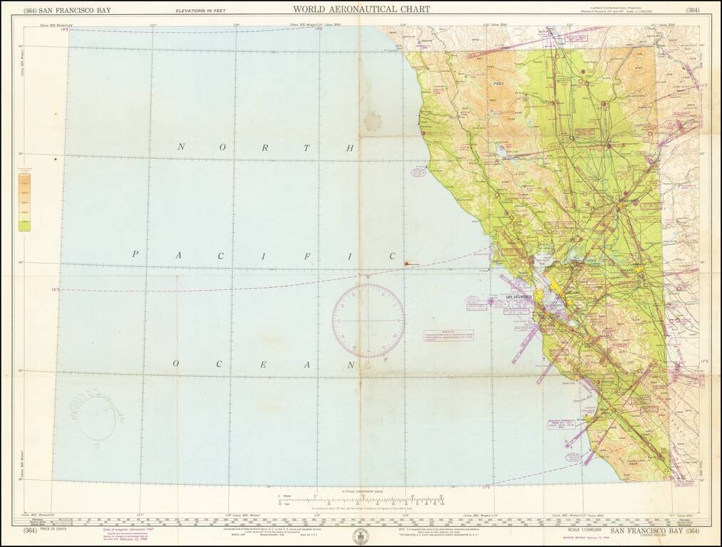
Detailed aeronautical map of the area around San Francisco Bay, and the Northwestern part of California. The chart is a font of information about civil and military aviation in postwar Northern California. It was intended for civil aviators flying by...
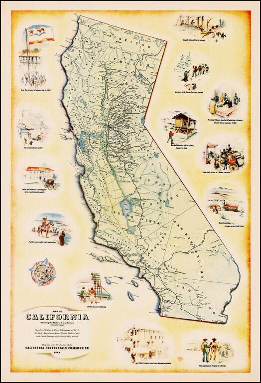
Decorative map of California, prepared under the direction of the California Centennial Commission to celebrate 100 years of California statehood. The map shows California as it was in 1848 and includes illustrations of the Bear Flag Revolt, San...
![[California] Honor Roll Foresters of America May 1, 1947 to May 1, 1948](/map/small/63016.jpg)
Previously unrecorded map of California, promoting the growth of the Foresters of America within California from May 1947 to May 1948. Includes the following information: 27 Courts Initiated 582 Re-instated 5 Net Gain 12 Courts Total - 59...
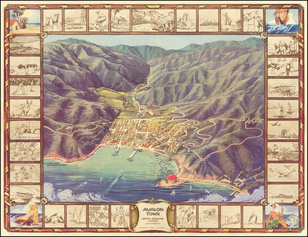
Pictorial Map of Avalon, During the Catalina Golden Age Decorative birdseye view of the town of Avalon on Santa Catalina Island, off the coast of Southern California. Includes a striking birdseye view of the town, Casino, harbor and vicinity, showing...