
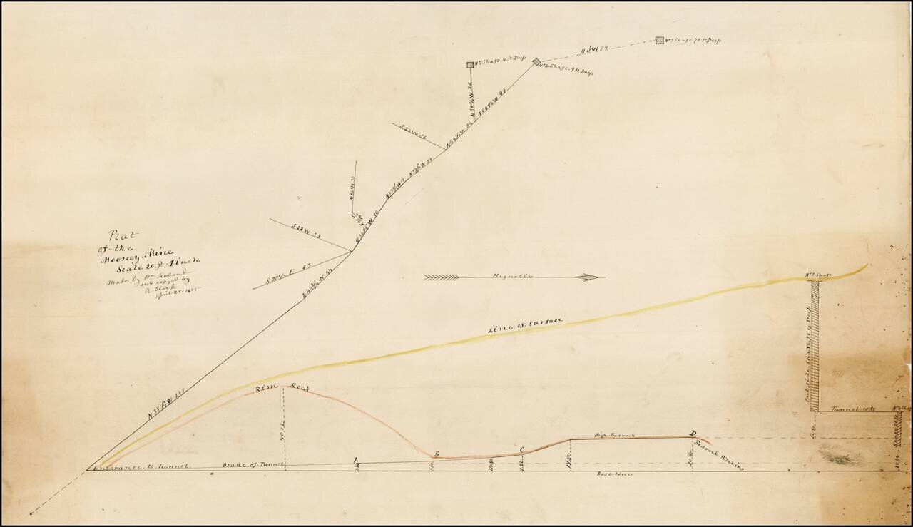
Plat of the Mooney Mine in El Dorado County, California, about 2 miles northeast of the town of Newton. In the Mines of El Dorado County by Doug Noble (2002), it is reported that this mine was only worked from 1894 to 1895. There are several other...
![Wm. T. Coleman & Co.'s Map of the State of California [and] Wm. T Coleman& Co's. Skeleton Map of Columbia River Canneries, Showing Their Location.](/map/small/69974.jpg)
Exceptional Chromolithographic Promotional Maps Rare promotional maps of California the Columbia River Basin one verso, promoting the shipping business of pioneer California Businessman William Tell Coleman. The California map locates several...

Detailed map of California, colored by Counties. The map pre-dates Orange, Riverside and Imperial Counties.
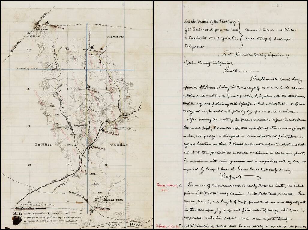
Interesting manuscript map of a part of Yuba County, Northeast of Yuba City and Northwest of Grass Valley, extending from the Yuba River in the south, beyond Sicard Flat and extending north toward Oroville along the Smith Valley. The map and...
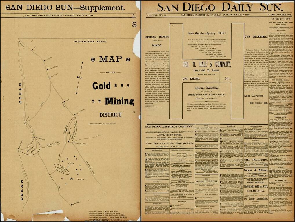
Rare map of the gold mining regions southeast of Ensenada near the Santa Clara Valley, published in the San Diego Sun in March 1889. The map shows the roads south from Tijuana to Ensenada and Santa Tomas, including the region identified as having Gold...
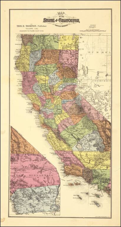
Scarce map of California, colored by counties. which appeared in Thompson's Atlas of Tulare County. The map shows California with completed township surveys. Orange County is present, but Riverside and Imperial Counties are still not yet formed....
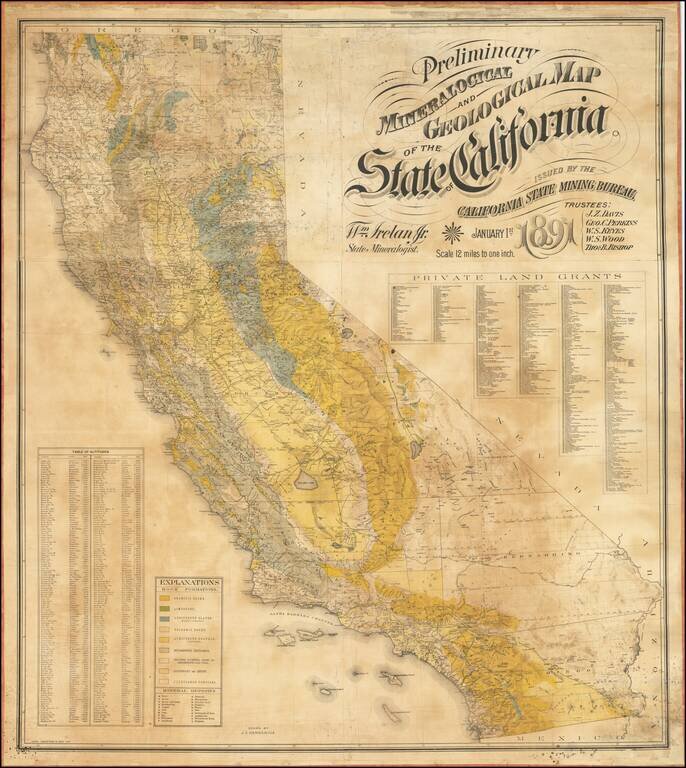
The First Comprehensive Geological Map of California Fine large mineralogical map of California, published by the California State Mining Bureau. The map was the result of an effort by the Trustees of the Mining Bureau, Harry I. Willey, as the former...
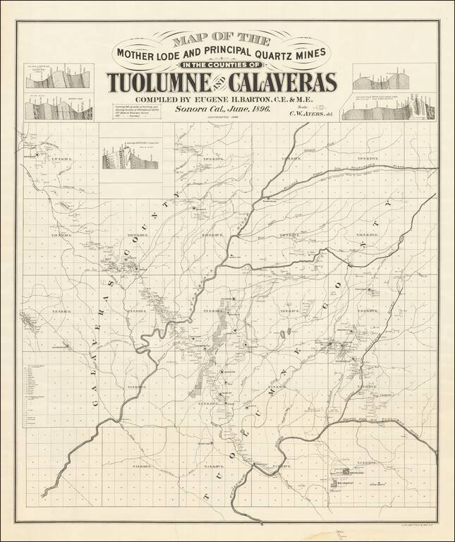
Mother Lode in Calaveras and Tuolumne Counties An interesting and little known map, centered on the Stanislaus River in Gold Country. The map is quite exceptional, "covering 860 square miles of territory and showing location of 500 different mines....
![The Map of Maps -- Alaska and British Columbia Showing the Yukon, Cariboo Cassiar, with a Portion of the Kootenay Gold Fields . . . Feb. 1898 [with inset showing Lake Routes to Dawson]](/map/small/40495.jpg)
Scarce separately issued map of Alaska and British Columbia, showing the various routes to the Klondyke Gold Fields, including a separate large format map showing the Lake Routes to Dawson. Rare Gold Rush Guide Map. Eberstadt (163:20, 1964, priced at...
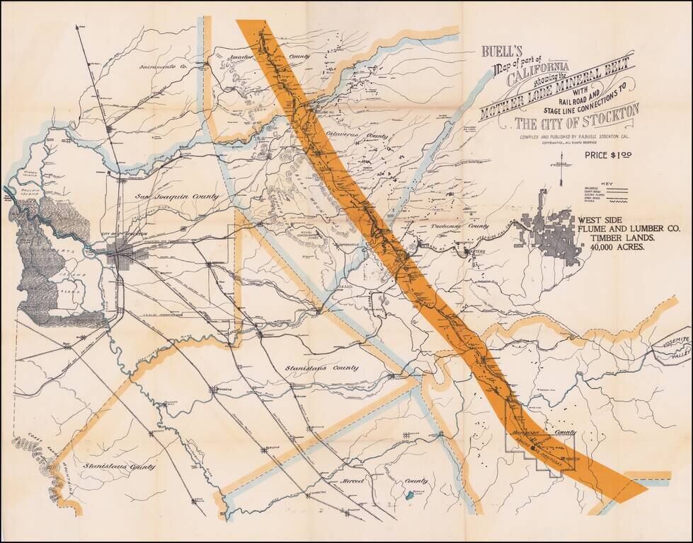
Electric Flumes! Detailed map of a portion of the mining regions of California, showing the area from Bouldin Island (just west of the City of Stockton) to Yosemite and from Amador County south to the Merced River. The map includes remarkable detail...
![[California in Miniature] Bird's-Eye View Map Showing Its Prominent Topographical Features, Location of Principal Cities, Towns and Points of Note, Also Lines of the Southern Pacific Company. 1898.](/map/small/63460.jpg)
A Synopsis of Resorts and other attractions worth visiting . . . Interesting birdseye view map of California, published by the Southern Pacific Company. The map is oriented with East at the top, looking from the Pacific Ocean to the Sierra Nevada...
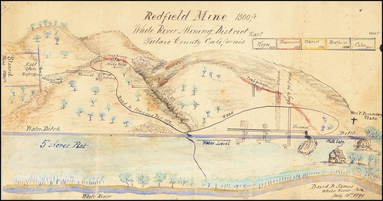
Manuscript View of Mining District By California Inventor David Bice James. Highly detailed rendering of the area around the White River, Mining District, drawn by David B. James, who would then have been serving as Mining Superintendent. James story...
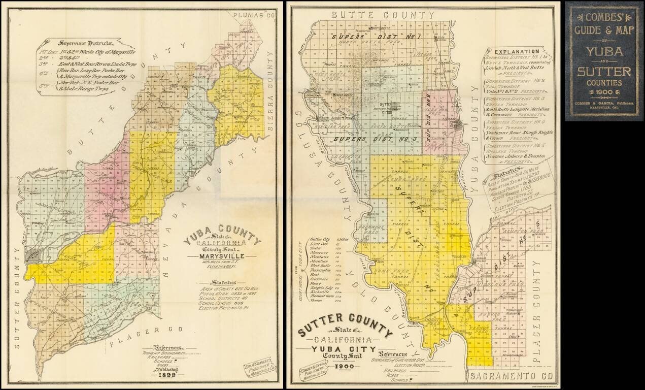
Highly detailed pair of pocket maps of Yuba County and Sutter County, published in Marysville and lithographed and printed by Britton & Rey in San Francisco. The maps are divided into townships and colored by County Supervisor districts, noting...
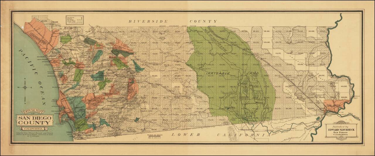
Colored By Ranchos! Fine early map of San Diego County, published by Edward M. Burbeck. the map shows the progress of township subdivisions, but is most noteworthy for its illustration of ranchos in color, an unusual feature for printed maps. Dozens...
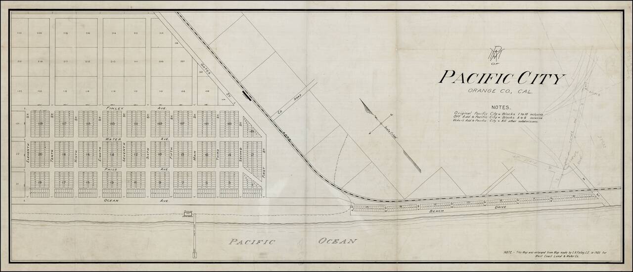
Rare Pacific Electric Railway working map of Pacific City, the first name used for the community which is now Huntington Beach, California, prior to its incorporation in 1909. The map is enlarged from the map made by S.H. Finley, Civil Engineer, in...
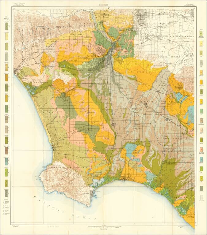
Colorful and highly detailed map of the Los Angeles Basin, drawn from maps by the United States Geological Survey. The map extends from the Sana Monica Mountains to Azusa in the north, to Rancho Las Bolsas (Huntington Beach, area) and Palos Verdes....