Map size in jpg-format: 109.918MiB
Click to open in high resolution (open in new tab).
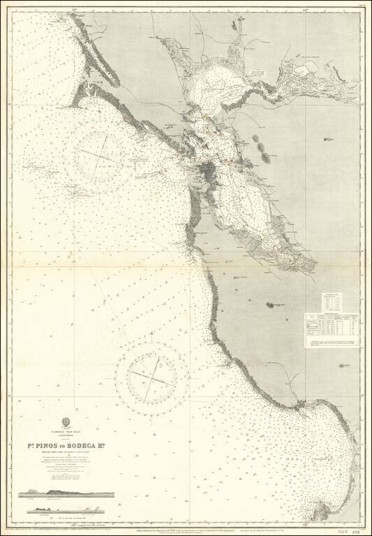
Scarce separately issued sea chart of San Francisco Bay and Vicinity, extending from Monterey Bay to Bodega Bay, with large revisions up to 1926.
First issued in the mid-19th century, this map was regularly updated well into the 20th century.
If you are a student, write to us in telegram: @antiquemaps and indicate what material you need and for what work you need a map in high detail. We are ready to provide material on special terms. For students only!


