
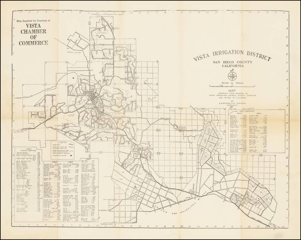
Early San Diego County water map, focusing on the cities of Vista and San Marcos in the North County region. The map was made by C.W. Watson for the Vista Chamber of Commerce. The map shows the initial subdivisions of what is now a major suburb of...
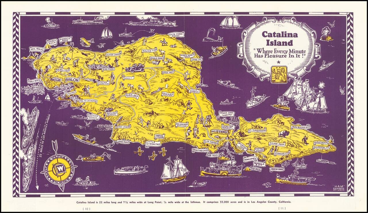
Decorative map of Catalina Island, appearing at the centerpiece of this interesting tourist brochure. The map is scarce. This is the first example we have offered for sale.
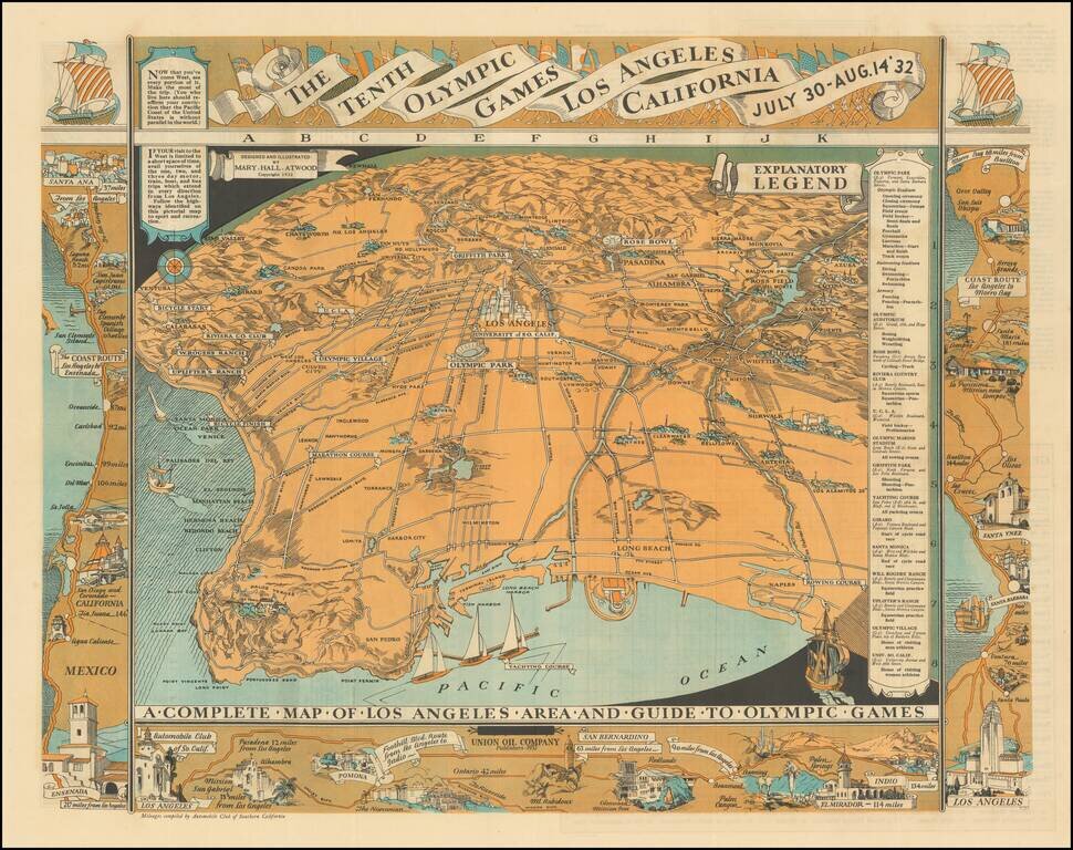
Highly detailed pictographic map, depicting Los Angeles, with a number of maps around the outer portion of the map illustrating various coastal and inland routes. The verso of the map extends from Riviera Country Club and USC and the Coliseum to City...
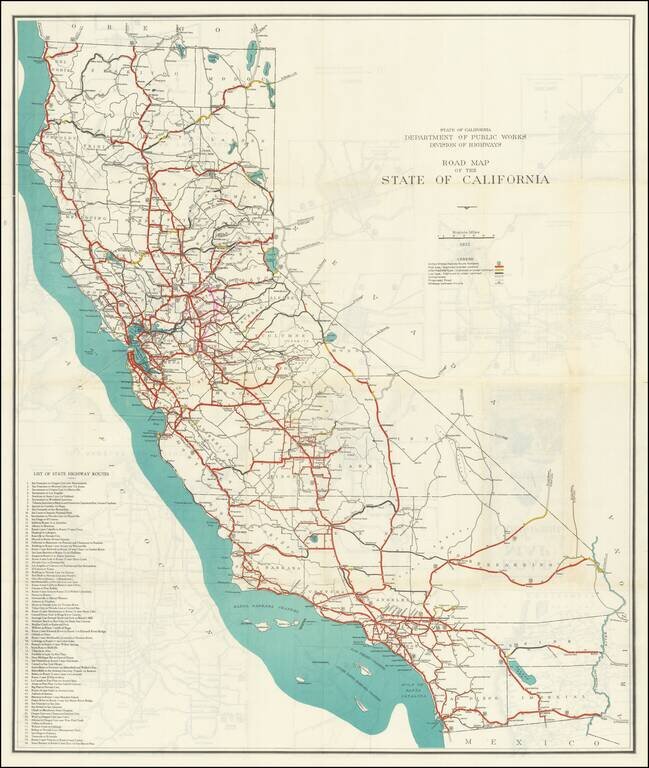
Large color-printed folding map of the roads in California in 1932, produced by the State of California, Department of Public Works, Division of Highways. The legend shows the following: United States Highway Route Numbers High type, improved or...
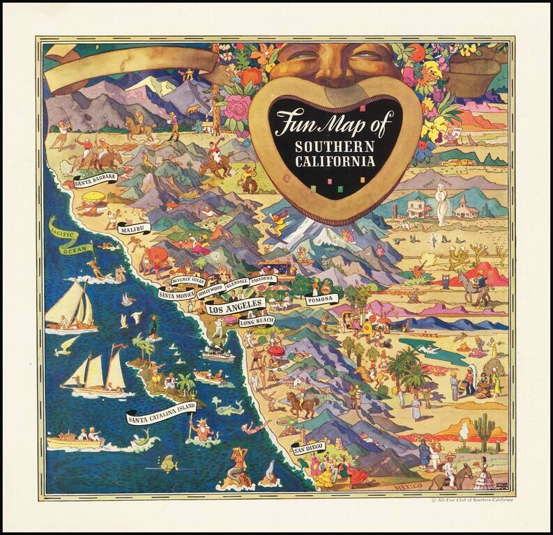
Striking pictorial advertising map, drawn by Raymond Winters in 1935. The map was originally published for the All-Year Club of Southern California and was issued both as a separate map and an advertising insert. Raymond Winters was a noted Western...
![[Imperial Valley]](/map/small/69292.jpg)
America's Winter Garden Fine promotional map and pamphlet, promoting the benefits of the Imperial Valley as an agricultural opportunity for farmers. The map provides a fine pictorial overview of Imperial County, with pictorial vignettes highlighting...
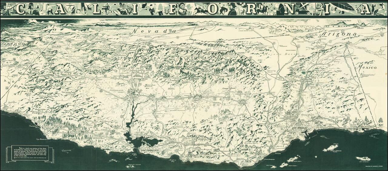
"While attractions for tourists are unlimited in California, it is necessary to advise persons seeking employment not to come here at this time. When opportunity arises California will gladly make it known." A striking Depression Era birds-eye view...
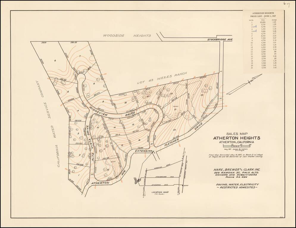
The First Subdivision Map of Atherton Heights - With Price List! Rare Subdivision Sales map for Atherton Heights, in Atherton, California, dated May 1937, prepared for Hare, Brewer and Clark, Inc., the owners and subdividers of Atherton Heights. The...
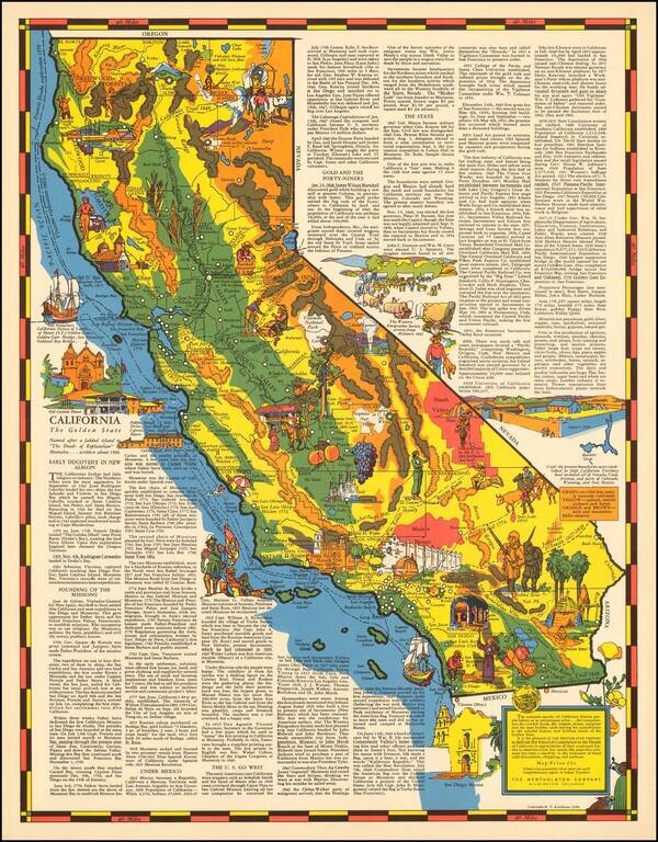
Rare pictorial map of California by R.T. Aitchison, published by the The Mentholatum Company. The map includes decorative vignettes illustrating California and a detailed text history of the state. R.T. Aitchison was a Wichita, Kansas illustrator....
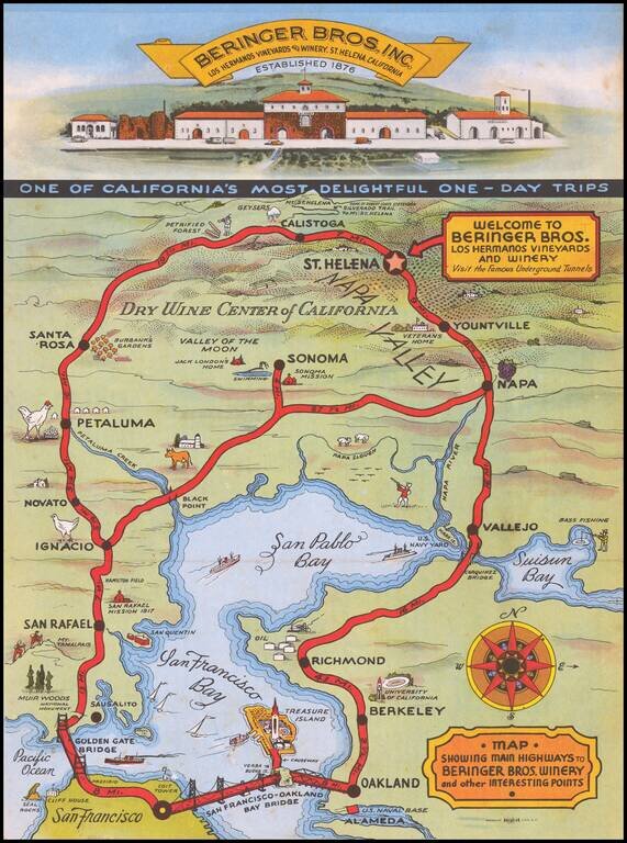
Striking map of the route from San Francisco to the Beringer Winery, with a decorative vignette of the front of the Winery.
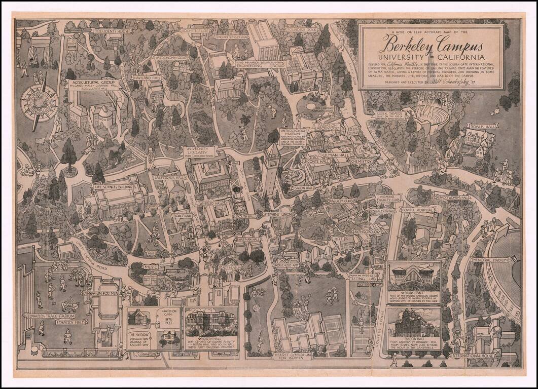
Showing The Berkeley Radiation Laboratory in 1939 Rare pictorial map of the Berkeley campus, by Artist Milt Schenkovsky (UC Berkeley class of 1937). The map provides a detailed treatment of Berkeley and the University of California Campus in the...

An attractive tourist map of Sacramento produced for the city's 1939 centennial. The recto is centered on a map of Sacramento itself and the immediate vicinity, while the verso shows a map of the greater "Golden Empire" area from Mt. Shasta to Tuolumne...
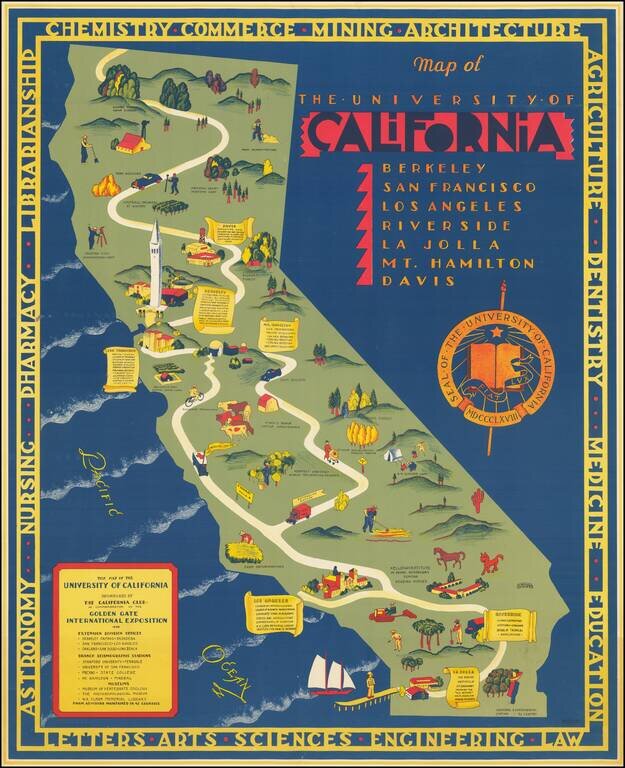
Rare map of California, published by the California Club. The map identifies the existing University of California Campuses and labels a number of regional places where off campus educational and research programs were being conducted. Berkeley...
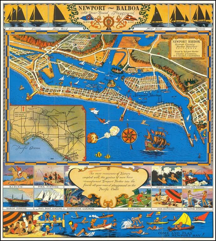
An early pictorial map of Newport Beach. Decorative promotional map of Newport Harbor and Newport Beach, California, issued by the Newport Harbor Chamber of Commerce. Includes a number of lively vignettes.
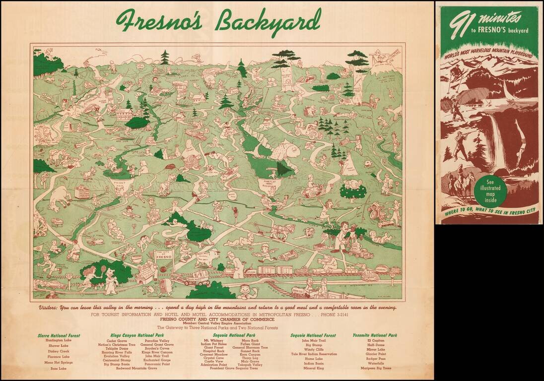
Rare promotional pictorial map of the National Parks and Recreational Opportunities to the east and northeast of Fresno California, published by the Fresno Chamber of Commerce. The map provides a whimsical look at the region, with lots of hunting,...
![[Sonoma] Hyde Ranch](/map/small/66631.jpg)
Detailed map of the Hyde Ranch Development, in the southeast part of Sonoma. The area shown is immediately east of Sonoma Skypark and south of Vineburg. The map was likely utilized by a real estate agent to track lot sales. Hyde Ranch was established...