
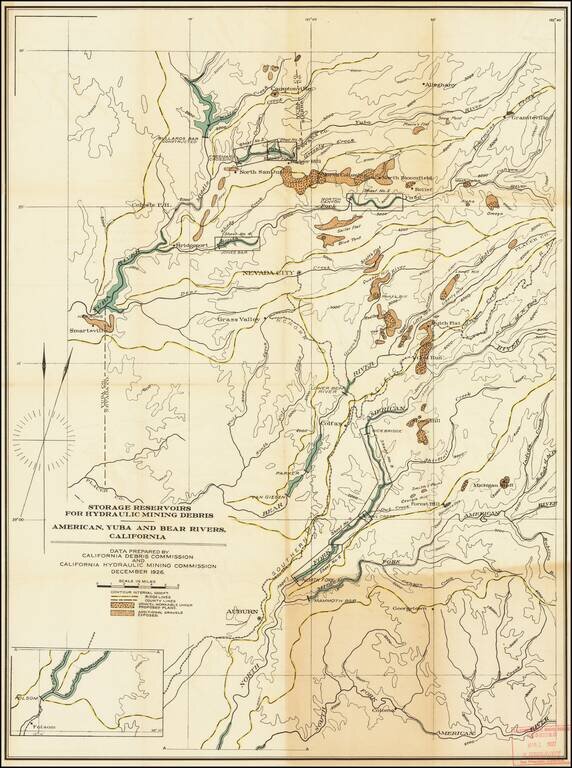
Report of the Hydraulic Mining commission and large regional map illustrating the region where the restart of hydraulic mining was being contemplated in California in the 1920s. The report was prepared at a time period when California was considering...
![[Los Angeles Urban Planning] . Suggested Treatment For Local Business Centers Along Main Thorofares](/map/small/54561.jpg)
A detailed urban planning model for a commercial street in Los Angeles, prepared by the City Planning Department. The map names Gordon Whitnall as Director of the Board of City Planning Commissioners, Jack W. Simons on behalf of the City Planning...
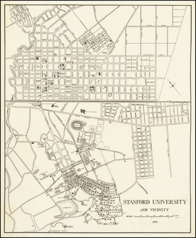
Detailed map of the Stanford University Campus, as it appeared in 1928. The map was likely created for a guide book, although we do not know the source. The map shows a portion of campus in academic use and street map of Palo Alto. The map is very...
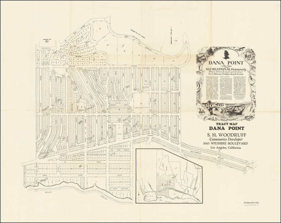
Remarkable oversized tract map of Dana Point, almost certainly the earliest large format subdivision map of Dana Point. The present map, which locates a number of ambitious future improvements, including a country club, polo field, hotel site,...
![[Berkeley] This Is The Map of Berkeley Town Its Streets Go Winding Up & Down An Oak-Covered Camputs It Wears For A Crown With People & Places of Renown](/map/small/69776.jpg)
Rare pictorial map of the area around the campus of the University of California, Berkeley, published in about 1928 by Thomas Brothers and drawn by Virginia Tooker. The map is centered on the Campanile, with California Memorial Stadium at the east,...
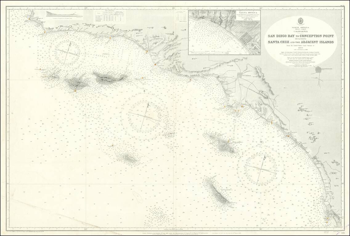
Fine large British sea chart of the Southern California Coastline, published in 1928, with small corrections to 1957. The chart extends from San Diego to Point Conception and Arguello Point, centered on Santa Monica and the LA Basin. Offshore islands...
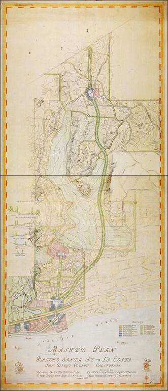
Unrecorded map showing the original Master Plan for the area between La Costa / Solana Beach and the Rancho Santa Fe Covenant Lands, by Charles H. Cheney, one of the most important city planners of the 20th century. Charles H. Cheney, was the father...
![[Downtown San Diego]](/map/small/43211.jpg)
Highly detailed plan of Downtown San Diego, between A Street in the North to F Street in the South and between State Street in the West to 8th Street in the East, published by Nirenstein. This finely detailed map shows downtown San Diego at the height...
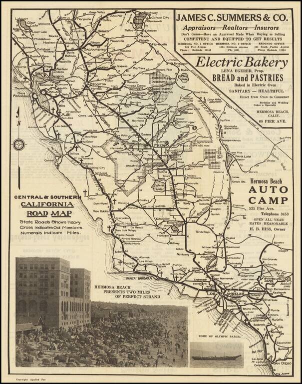
Promoting Hermosa Beach Rare promotional road map for Southern California, packed full of regional advertising. Includes a large photograph of Hermosa Beach and a smaller photo of "Olympic Barges." The promotional details relate to Hermosa Beach and...
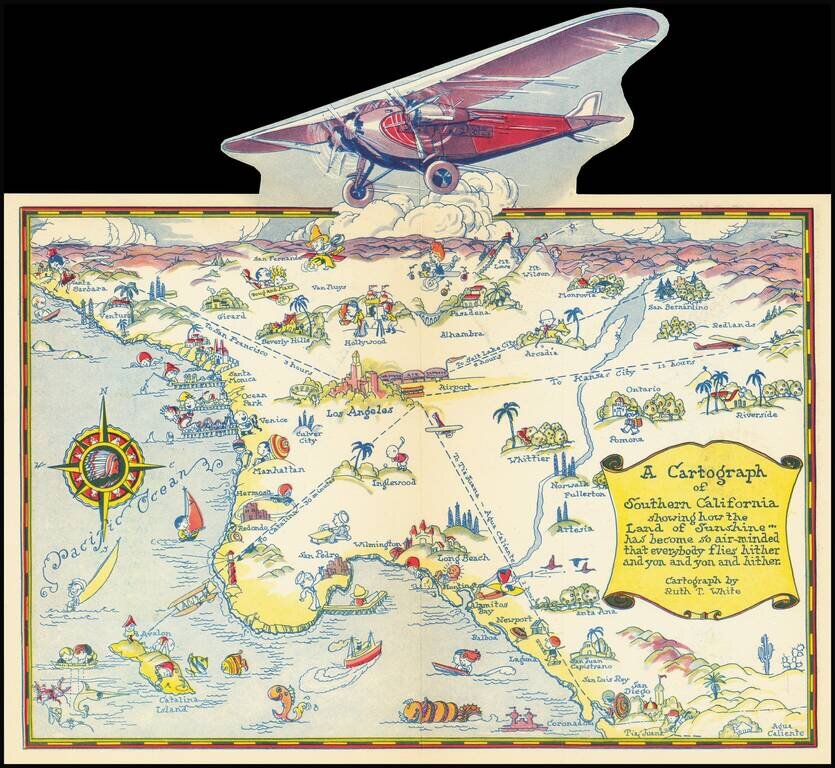
Rare pictographic map of Southern California with pop-up illustration of propeller plane. The map illustrates the routes of Western Air Express, with flights to Kansas City (12 hours), Tia Juana (1 hour), Catalina (30 minutes) and San Francisco (3...
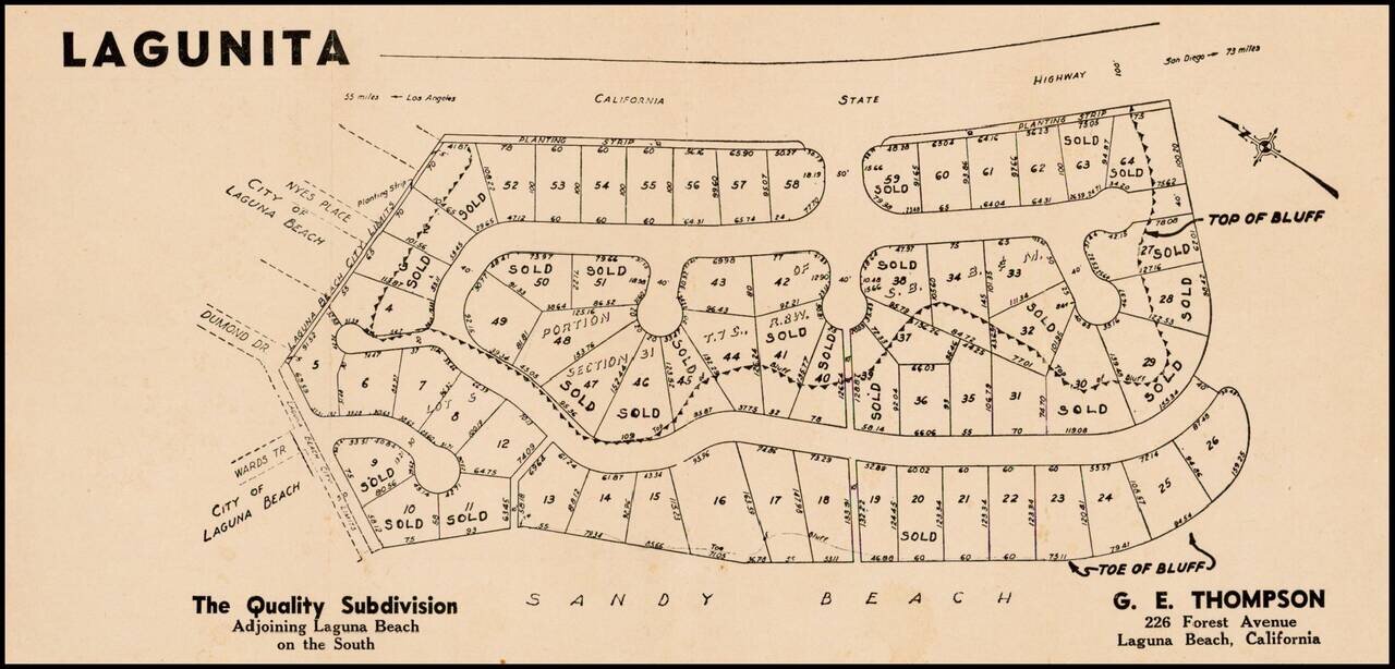
Fine example of this early subdivision map of Lagunita, in Orange County.
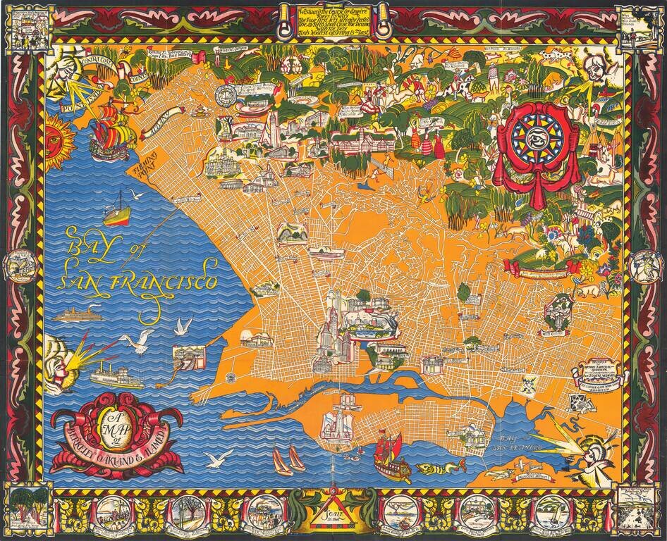
A Monumental Pictorial Map of Berkeley & The East Bay, With Original Decorative Folder Fabulous Art Deco style map by Michael Baltekal Goodman, notable for its brilliant color and striking design. The minimalist design of the street layout at...
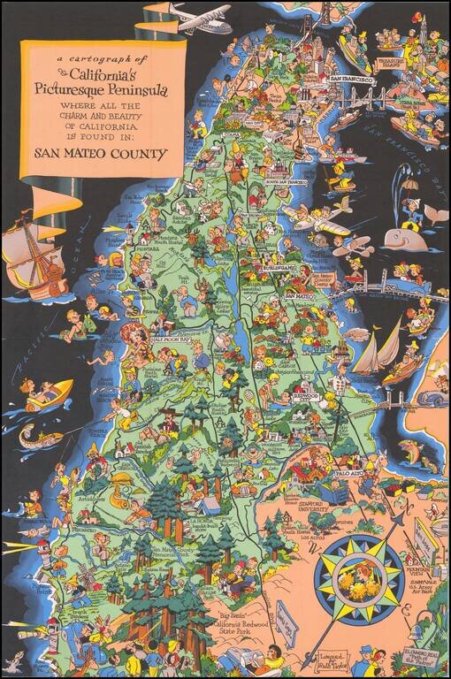
Marvelous whimsical map of San Mateo County by Ruth Taylor White one of the most famous pictograph artists of the period. Ruth Taylor White was among the most prolific makers of pictographic maps. Her whimsical style combines her artistic skills with...
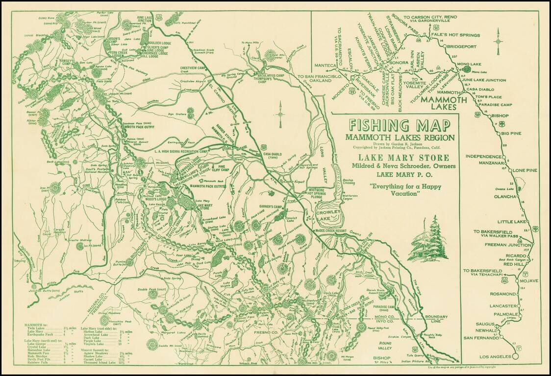
Everything For A Happy Vacation Interesting map of the area centered on Mammoth Lakes and Crowley Lake, published for the Lake Mary Store. The map covers parts of Mono, Inyo, Fresno and Madera Counties, focusing on the locations of the lakes and...
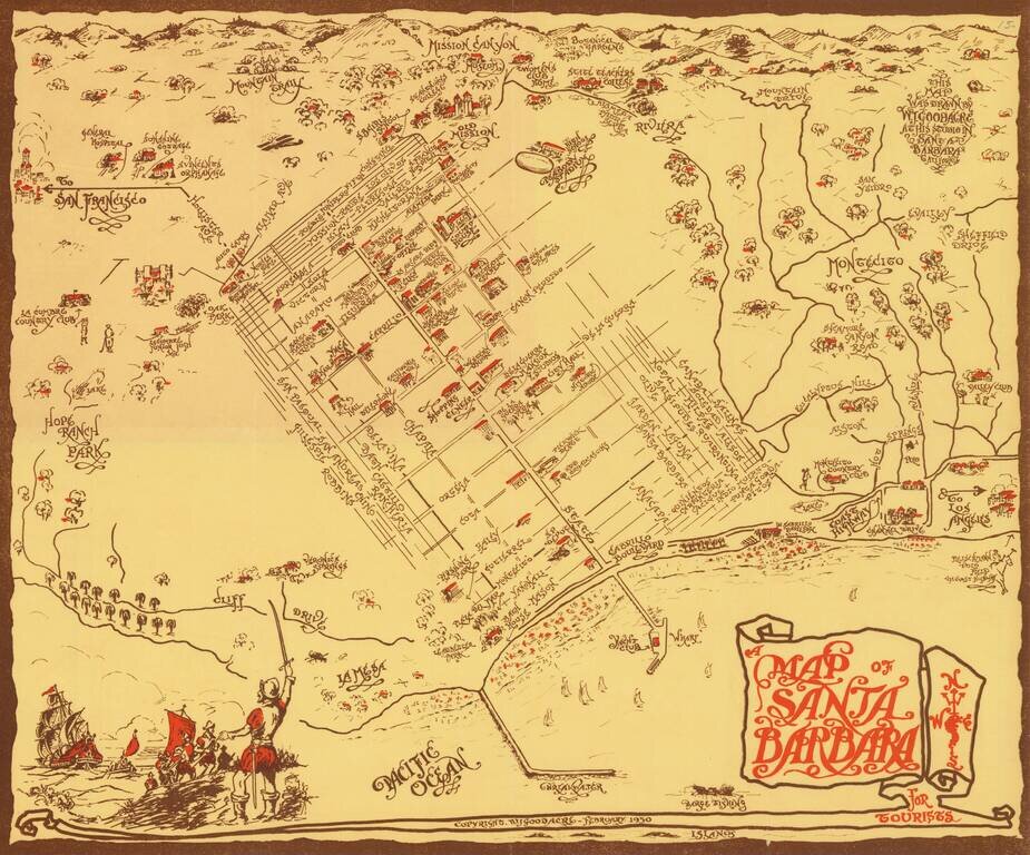
Rare pictorial map of Sant Barbara, drawn by William Johnson Goodacre. The map offers other interesting historical facts about the state of California. William Johnson Goodacre was a commercial artist who came to Santa Barbara from England in 1924....
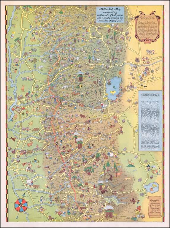
Scarce Pictorial Map of California's Gold Regions, including Lake Tahoe Area. The map extends from the Central Valley to the Comstock Lode, Nevada. A rare map -- the first example we have ever seen on the market.