
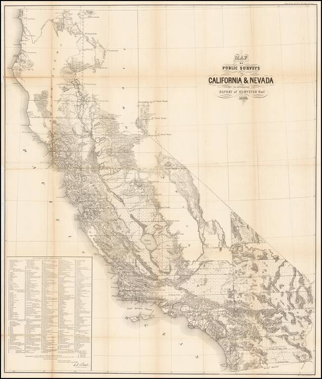
Remarkable large format map of California (along with some information in the Lake Tahoe area of Nevada), reporting the extent of the Land Office Surveys through 1863. The most notable feature is the list of 433 private land grants for which final...
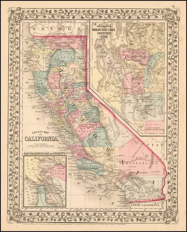
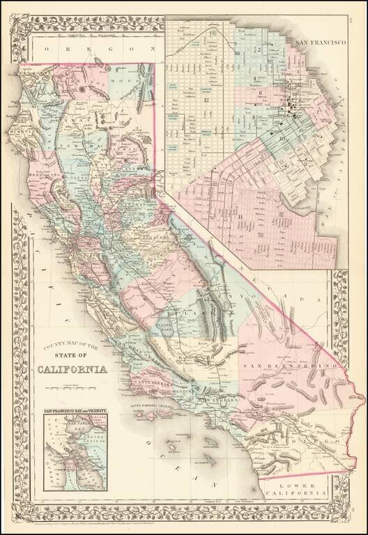
Fine early example of Mitchell's map of California, colored by county. Shows towns, railroads, roads, mountains, lakes, dry lakes, rivers, forts, etc. Insets of San Francisco Bay and the area around Salt Lake, with counties. Decorative border....
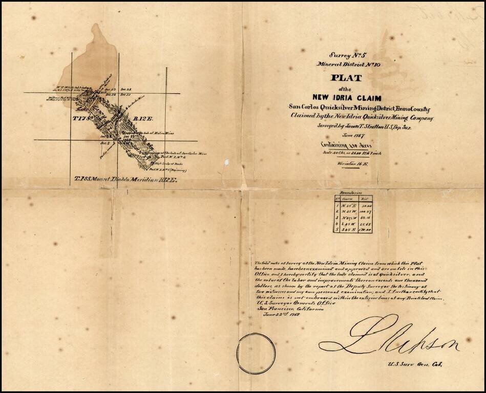
New Idria is an unincorporated town in San Benito County, California, which was named for a quicksilver (cinnabar) mine of the same name. The mine itself was named in honor of the world's second largest quicksilver mine in Idrija, Slovenia. The...
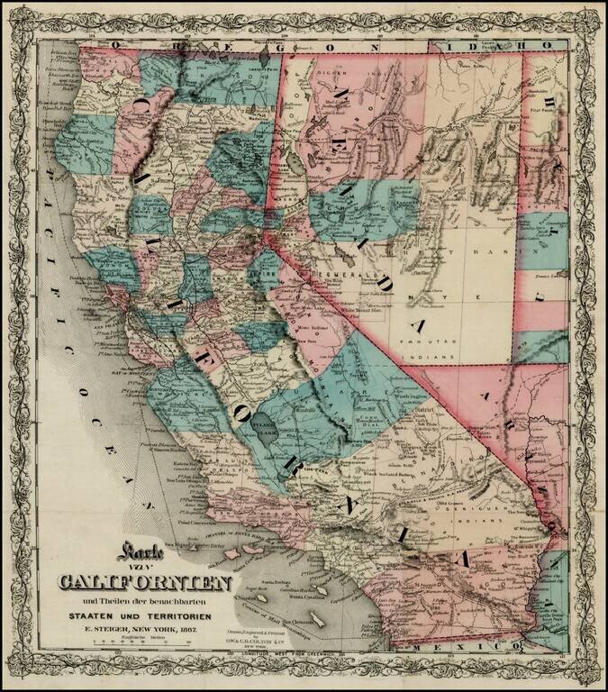
Rare separately issued map of California, published in New York City by Colton. Includes excellent detail throughout the map, including counties, roads, rivers, lakes, mountains, railroads, stations, gold mines, dry lakes, extinct volcano craters,...
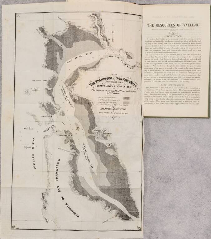
Rare Early Promotional Tract For The City of Vallejo Rare early pamphlet and maps on the prospects of the "up-bay" city of Vallejo, initially published by the local newspaper and later issued as a separate pamphlet. The two folding maps are San...
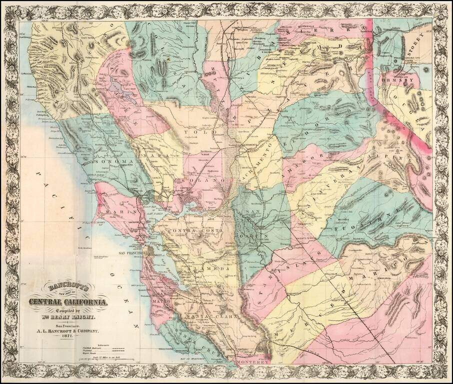
A Handsome Separately-Issued California Map Rare separately issued map of Central California and the Virginia City-Comstock Mining Region, compiled by William Knight and published by the San Francisco firm of A. L. Bancroft & Co. William Knight's...
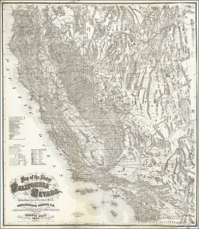
First state of this fine large format map of California and Nevada by Charles Drayton Gibbes, probably the best and most authoritative map of the region published in the 1870s. Charles Gibbes first issued his large format map of California and Nevada...
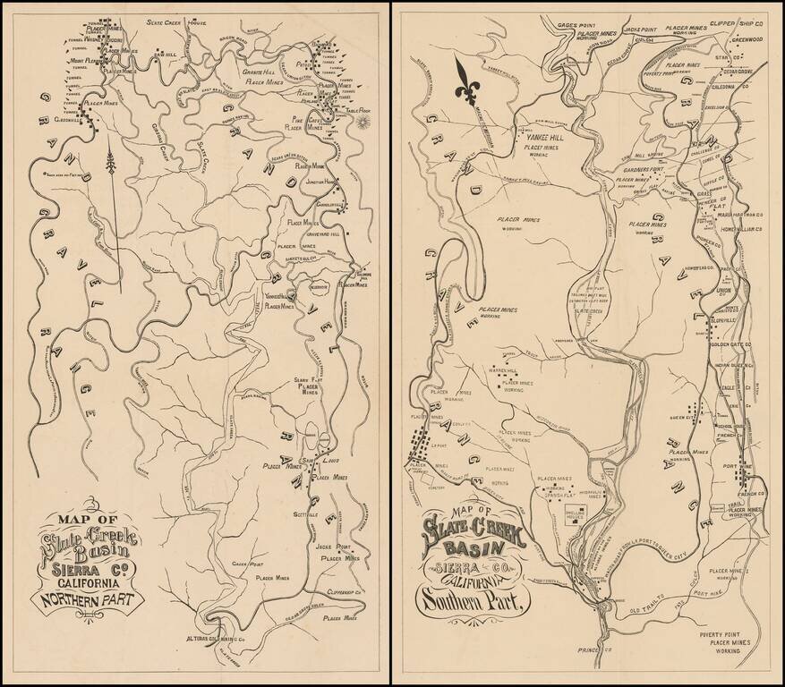
Fine Pair of California Gold Country Maps. Scarce pair of maps showing a portion of Sierra County, in California's Gold Region, with valuable information on individual mines and tunnels.
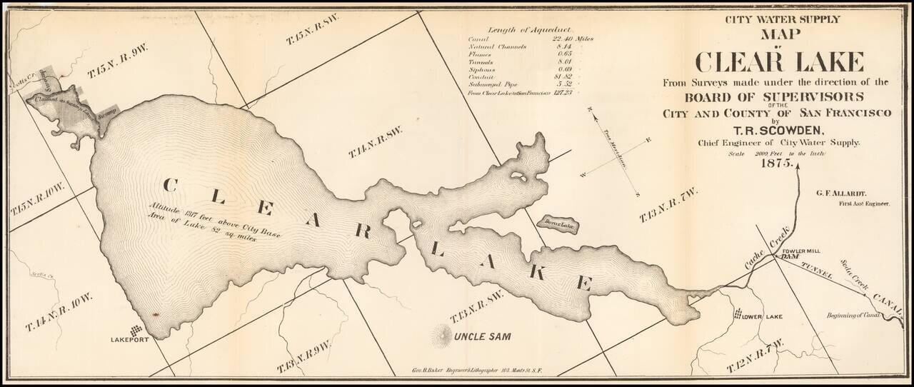
Fine early map of the Clear Lake Area, by George H. Baker, acknowledged as one of early California's leading artists and lithographers whose pioneering work documented California's earliest history. The map would seem to have been prepared for a...
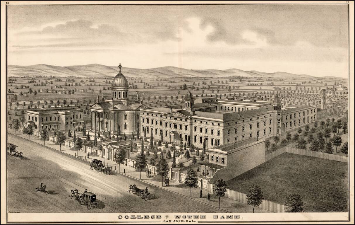
Fine early birdseye View of the original location of Notre Dame de Namur University (originally called the College of Notre Dame), from Thomson & West's Historical atlas map of Santa Clara County, California. Compiled, drawn and published from...
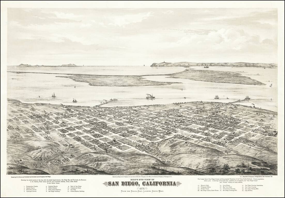
Fine Early Birdseye View of San Diego Extremely rare two-stone tinted-lithograph view of San Diego, made by California's greatest view maker, Eli Sheldon Glover, in 1876. The view was published by Schneider and Kueppers of San Diego and lithographed...
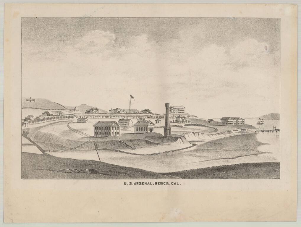
Rare separately issued lithographic view of Benicia, California, drawn by H. Straus. The view of Benecia and the Arsenal appeared in Thompson & West's Atlas of Solano County, but the present example is a rare separately published version, intended...
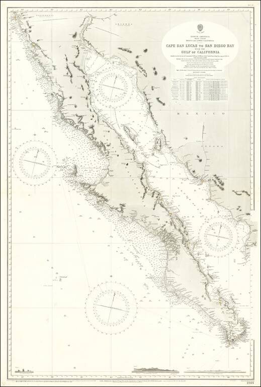
Large Sea Chart of Baja California and the Sea of Cortez / Gulf of California A fine example of the British Admiralty chart of Baja California and the Gulf of California, first engraved and published from London in 1879, and updated numerous times...
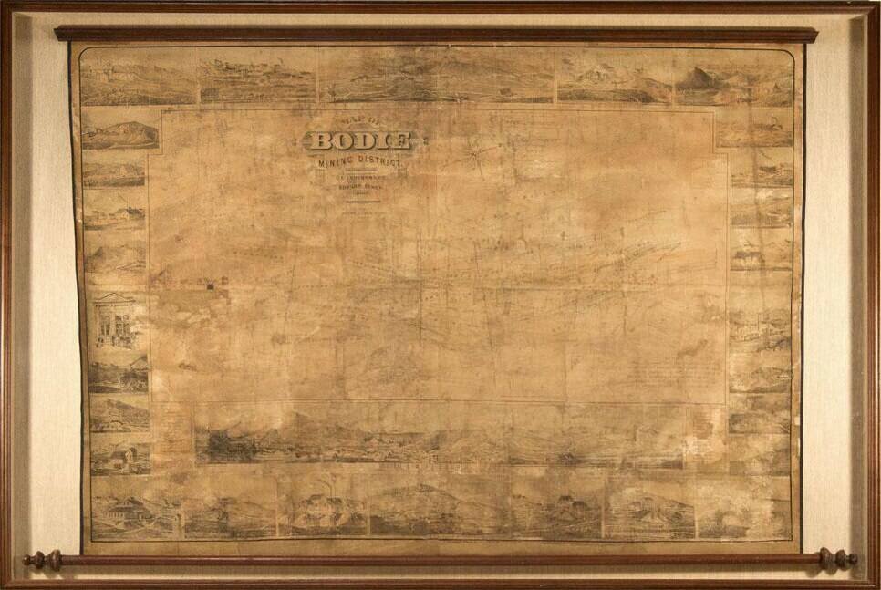
Edward Eysen's Mammoth View of Bodie, California. Remarkable view of Bodie, California, published by Edward Eysen in 1880. This spectacular wall map is arguably one of the most sought-after pieces from Bodie. The main body is a plan view map of...
Attractive map of California, colored by county. Predates a number of Southern California Counties. Includes a detailed inset plan of San Francisco, colored by wards. Shows towns, roads, railroads, rivers, lakes, mountains, missions, etc. Decorative...
![Map Showing the Summer Resorts on the Pacific Coast, adjacent to the lines of the Central and Southern Railroads. [California Tourist. Yosemite, The Big-Tree Groves Geysers, Monterey and other Popular Summer Resorts of Californa]](/map/small/41461.jpg)
Detailed railroad map of the area around San Francisco Bay, extending to Virginia City, Nelson, Willows, Cloverdale, Clear Lake, Monterey, Madera, and Yosemite. The map shows the various railroad lines servicing the above listed destinations, via the...