
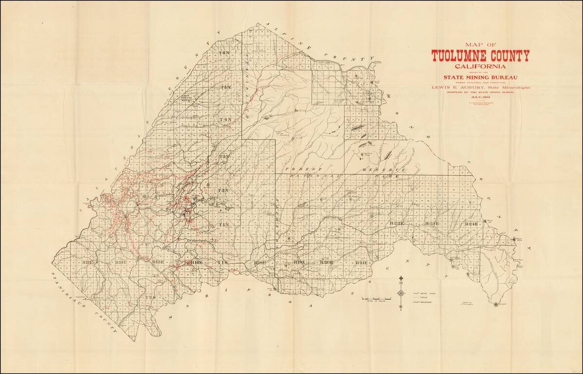
Scarce mining map of Tuolomne County, prepared by the California State Mining Bureau. The map identifies by number the active mining claims in the county, along with towns, roads, rivers, mountains, etc. The first time we have ever seen maps from this...
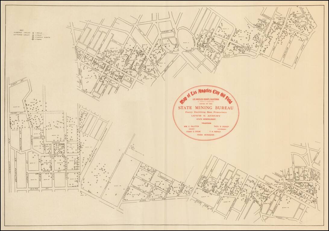
Rare early map of the Los Angeles Oil fields. The map shows many oil wells in the heart of Los Angeles, along with the tanks, pumping plants, and traps.
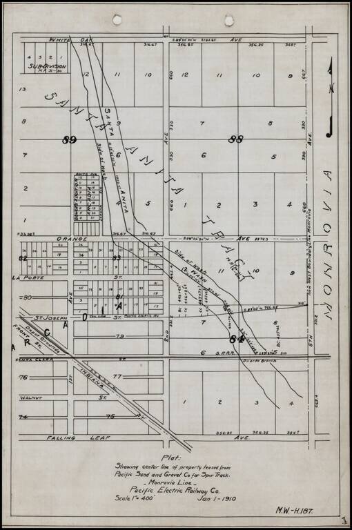
Detailed internal sketch map of the Pacific Electric Railway lines in Arcadia, California. Shows Depot Grounds of the ATS&F, Southern Pacific Railroad's Duarte Branch, a portion of the Santa Anita River and a street plan, centered on 2nd Avenue...
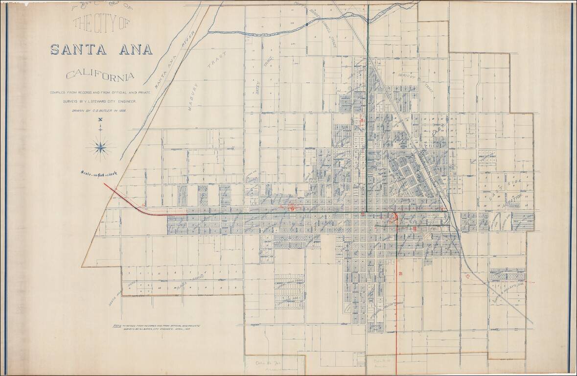
Excellent early map of Santa Ana, compiled by its City Engineer, W.L. Steward in 1906 and drawn by C.D. Butler, and later updated by G.L. Bates, the City Engineer in 1907. A reduced size edition of the map was printed by George L. Bates in Santa Ana,...
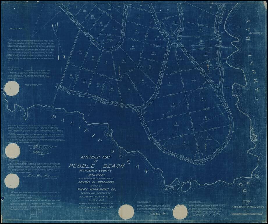
Rare early subdivision map showing a portion of Pebble Beach, California, the earliest map of Pebble Beach we have ever handled (all others were in the mid 1920s)., following Samuel Morse's acquisition and re-development of the area in 1919. A note in...
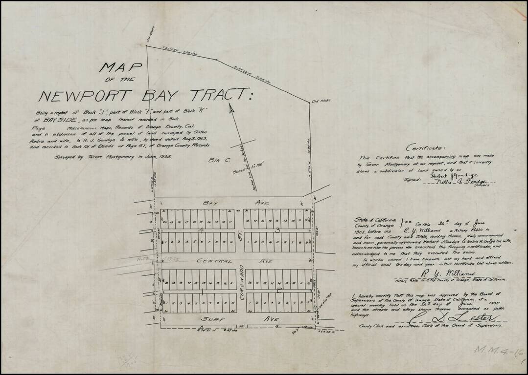
Detailed map of the "Newport Bay Tract," between Surf Avenue and Bay Avenue, centered on Coronado Street. Surf Avenue is now East Ocean Front. Central Avenue is now Balboa Boulevard. Bay Avenue is unchanged. Alvarado Street also appears. The land...

California's Redwood Belt Unrecorded Edward Denny wall map of a portion of Northern California, illustrating the so-called Redwood Belt. The map, in two strips, covers the California Coastline from Sonoma County to the Oregon border. The so-called...
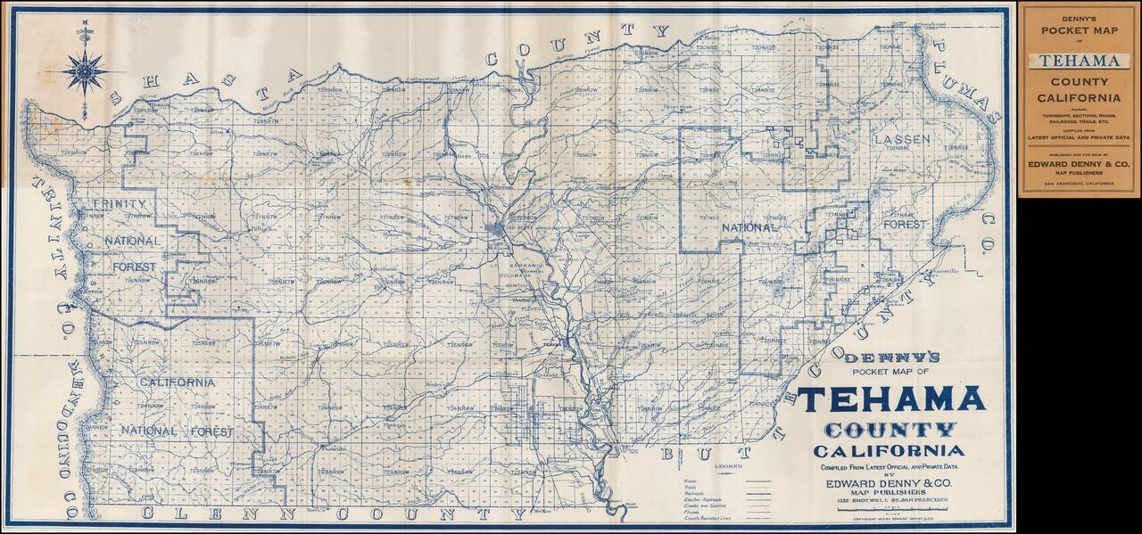
Rare Pocket Map of Tehama County. Scarce pocket map of Tehama County, California, published by Edward Denny. The map is centered on Red Bluff.
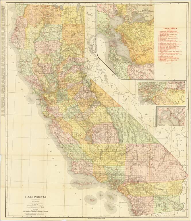
Highly detailed separately issued pocket map of California, published by Rand McNally & Co. The map locates over 30 railroads within the state and includes a large inset of San Francisco Bay and smaller insets of San Diego and Los Angeles. Orange...
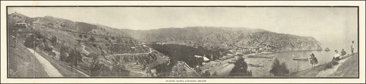
Scarce early Catalina Island promotional brochure, issued by the Wilmington Transportation Co. The brochure opens to reveal a panoramic view of Avalon, Santa Catalina Island, served by Steamers of Wilmington Transportation Line, Banning Line, the...
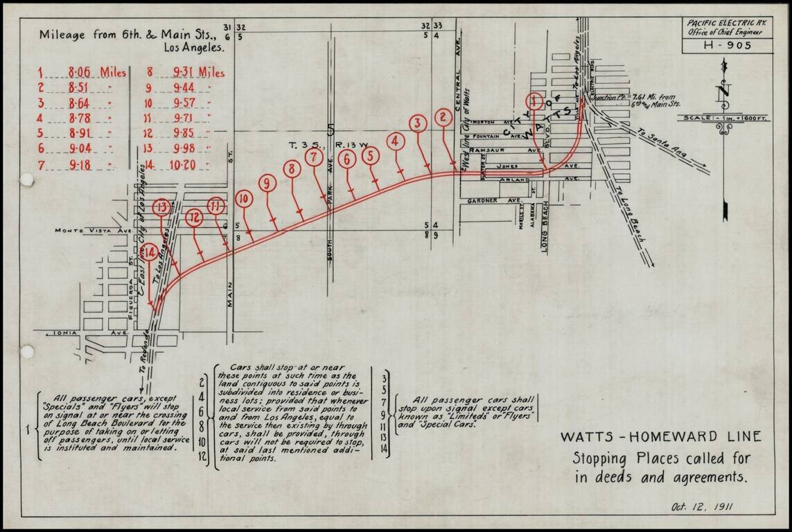
Detailed engineering map showing the various proposed stops on the Pacific Electric Railway line on the Watts-Homeward line, as prepared by the Pacific Electric Railway Company engineers. Includes a lengthy explanation of the various grant and deed...
![[Fruit Crate Label Advertising Map] Star of California Brand](/map/small/41396.jpg)
Decorative Fruit Crate Label map of California, promoting Exeter Orange Growers.
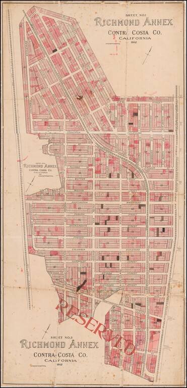
Early Richmond Annex / El Cerrito Real Estate Promotional Map Large separately published map of Richmond Annex, issued in 1912. The map would seem to have been used by a local real estate promoter, with pencil annotations and color shading, neither...
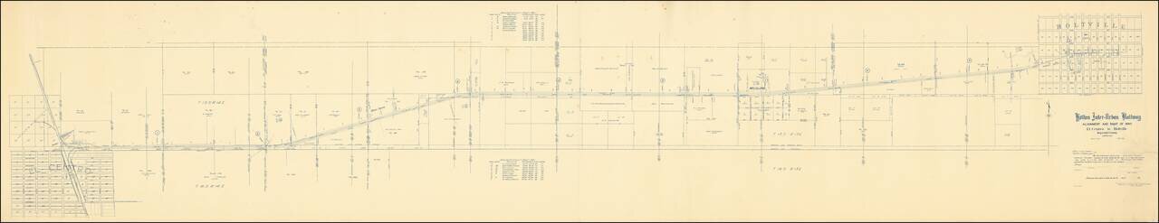
The Holton Inter-Urban Railway Company was incorporated W. F. Holt in December, 1903. The line connects El Centro with Holtville (a distance of about eleven miles) using standard gauge construction. The company carried both freight and passenger...
![[Section of Newport Beach]](/map/small/33577df.jpg)
Detailed map of part of Newport Beach, showing the route of the Pacific Electric Railway from 11th Street to 16th Street, along Ocean Avenue and Central Avenue, showing the water lines on both the Newport Bay and Pacific Ocean sides of the peninsula,...
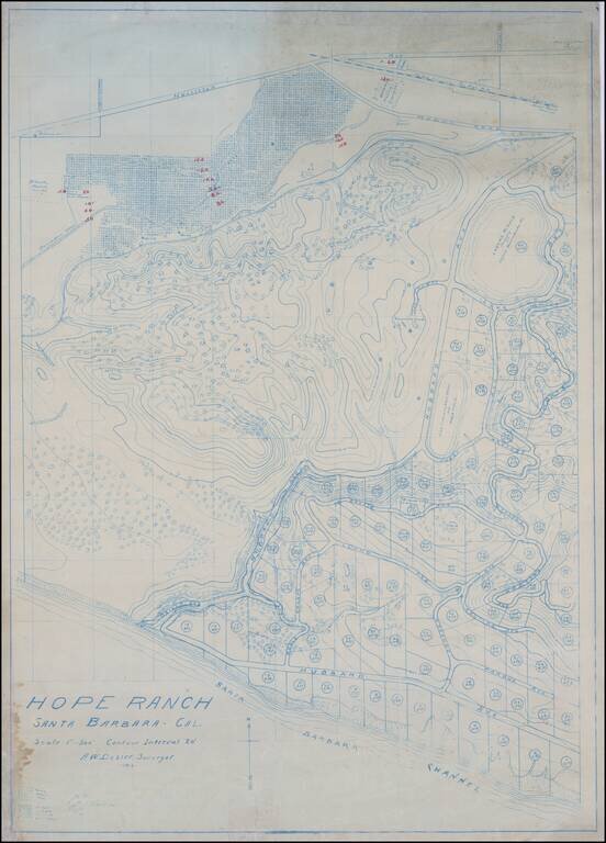
The Original Dozier Plan for Development of Hope Ranch Fine blue line contour map of Hope Ranch, executed by A.W. Dozier. This is the survey of Hope Ranch which would ultimately form the basis for its development by Harold Chase in 1923, illustrating...