Map size in jpg-format: 66.64MiB
Click to open in high resolution (open in new tab).

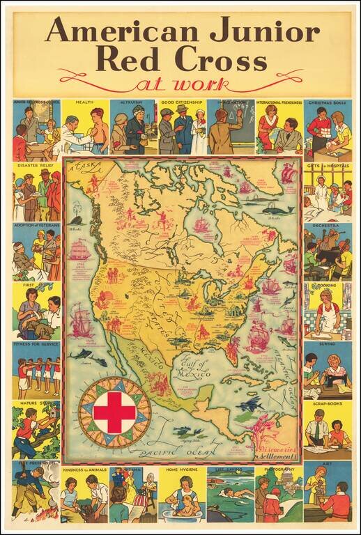
Attractive vintage pictorial map of North America, published by the American Junior Red Cross and with art by H.M. Leslie Rundle.
The central map of North America shows early European Settlements (in blue) and Discoveries (in pink) including "Norsemen discovered Vinland" in 1000.
The map includes 24 vignettes around the border featuring scenes of the Junior Red Cross's good works such as "Live Saving", "Home Hygiene", "Kindness to Animals", etc.
If you are a student, write to us in telegram: @antiquemaps and indicate what material you need and for what work you need a map in high detail. We are ready to provide material on special terms. For students only!

![[Signed Political Satire Artwork] Vietnam ... Vietnam ... Vietnam ...](/map/small/68726.jpg)
