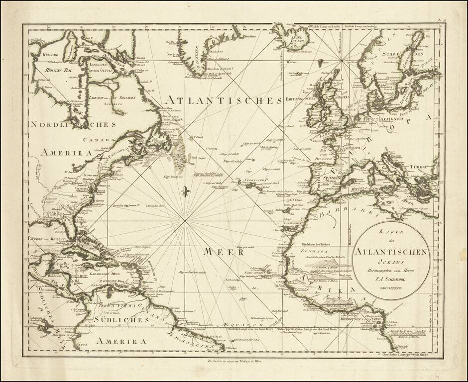
A detailed antique map of the North Atlantic from just south of the equator to southern Greenland. The map shows coastal settlements, geopolitical boundaries, navigational features, and more. Names are given either in German or in their local...
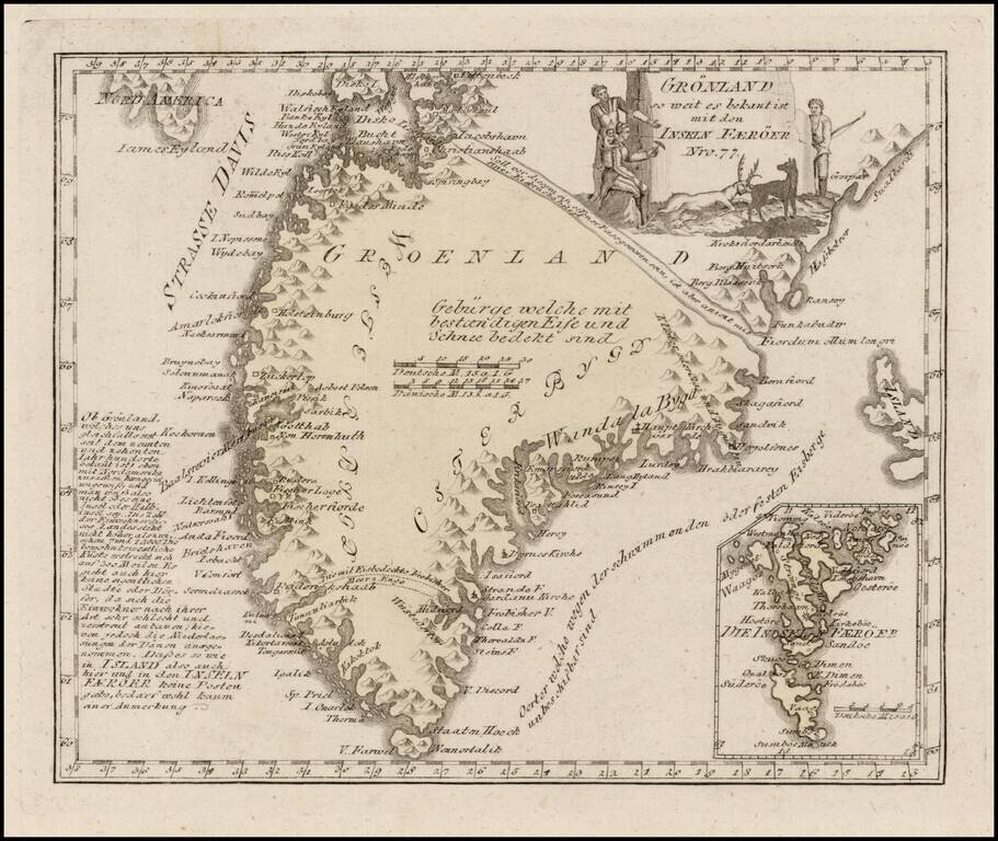
Scarce map of Greenland, with an inset map of the Faroes. The map is quite detailed, and shows several settlements and a number of coastal features.
![[ Atlantic Ocean / Triangular Trade / Negroland ]](/map/small/65187.jpg)
Interesting hand drawn sea chart of the North Atlantic, illustrating the region covered by the Triangular Trade. The chart focuses on the major trading ports in America (Charleston, Boston, New York, Baltimore and Philadelphia), with a very curious...

Fine Example of a Norie Blueback Chart of the Atlantic and Indian Oceans Impressive, rare example of a blueback chart of the southern Atlantic and Indian Oceans, showing the major shipping routes around the Cape of Good Hope. The chart, twice...
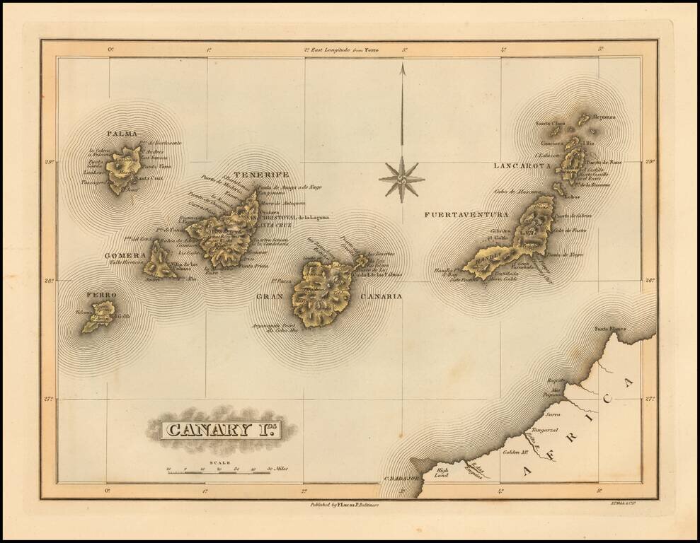
Scarce map of the Canary Islands by Fielding Lucas Jr., which appeared in his General Atlas, as well as his A New General Atlas of the West India Islands. Lucas's map is one of the first detailed commercial maps of the Canary Island published in...
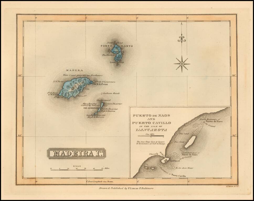
Scarce map of the Madeira Islands (with large inset map of Naos and Cavillo on Lanzarote Island) by Fielding Lucas Jr., which appeared in his General Atlas, as well as his A New General Atlas of the West India Islands. Lucas's map is one of the first...
![Amer. Sep. No. 19 & 20 [Partie du Groenland and Groenland Orientale]](/map/small/19107.jpg)
Highly detailed pair of charts showing the coastal and inland features of Greenland on a highly detailed scale. Vandermaelens' atlas is a landmark in the history of cartography, being the first atlas of the world published on a uniform scale, with the...
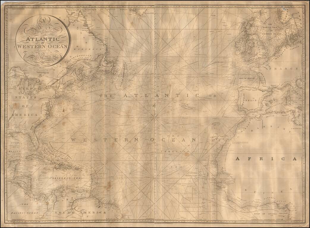
Nice example of William Heather's scarce chart of the Atlantic Ocean, offered here in a "New Edition" by John W. Norie and dated 1828. One of the best large format charts of the Atlantic published in the first half of the 19th Century, Heather's chart...
French Naval Chart of the Atlantic Depicting a Storied Naval Career, Including the November 1861 Voyages of the Foudre and the SS Arago – Major Diplomatic Missions at the Outset of the American Civil War Spectacular, heavily annotated chart of the...
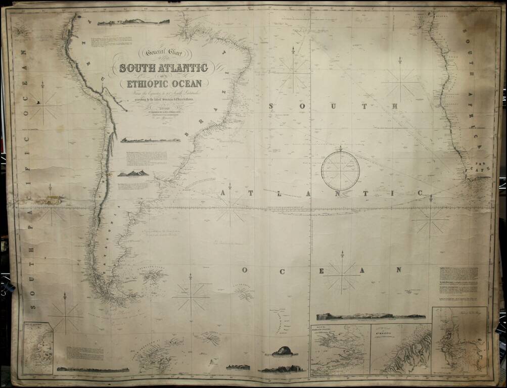
Fine working sea chart of the South Atlantic, showing the parts of South America and Africa in the Southern Hemisphere. Includes insets of the Falklands, Table Bay and St. Helena, along with several profile views.
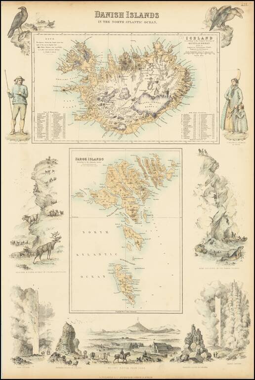
Two detailed maps (Iceland and the Faroe Islands) surrounded by decorative vignettes
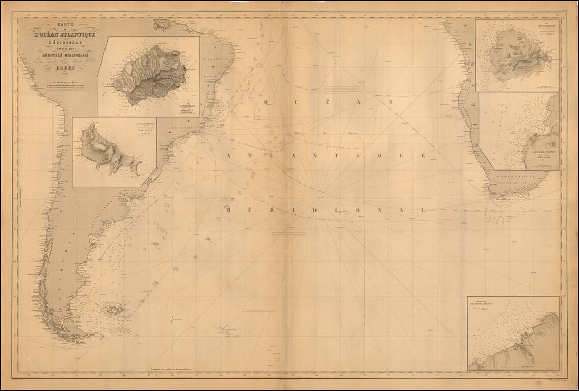
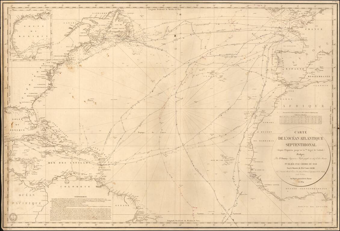
Scarce French sea chart of the South Atlantic, published by Aime Robiquet. The chart covers most of South America, the southern part of Africa and insets of Sainte Helene, the Island of Trinidad, the Island of Ascencion and the area around Georgetown,...

Excellent "NavWar" pictorial map of the North Atlantic and Western European Theaters during World War II. The map is a very effective persuasive piece, which sweeping arcs depicting Allied naval power in the Atlantic combined with its air power over...
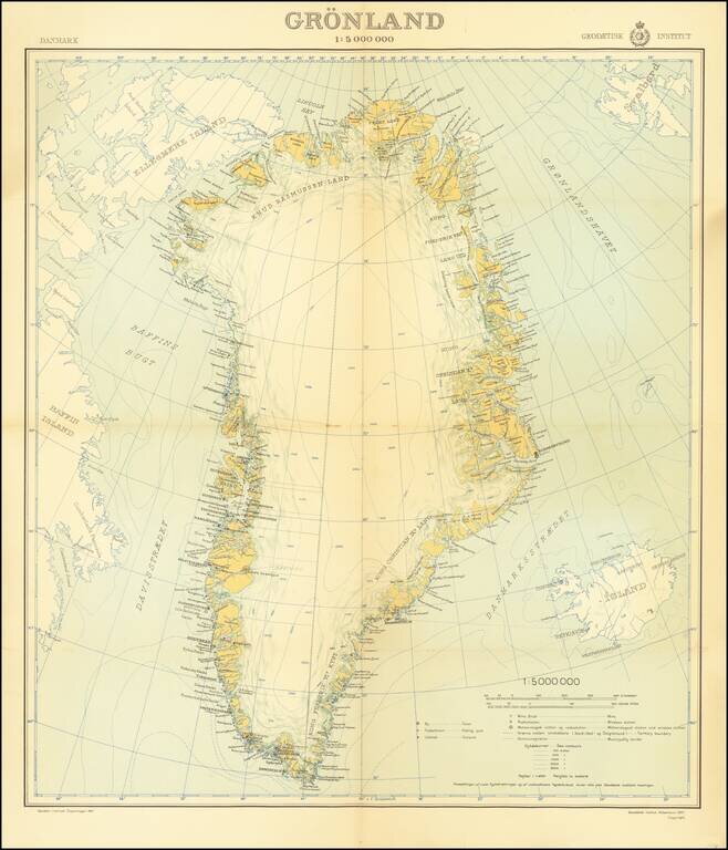
An attractive mid-century map of Greenland published by the Danish state-run cartographic institute. Greenland is shown in detail, and parts of Iceland, Baffin Island, and Svalbard are also shown. A legend is included, and the insignia of the...
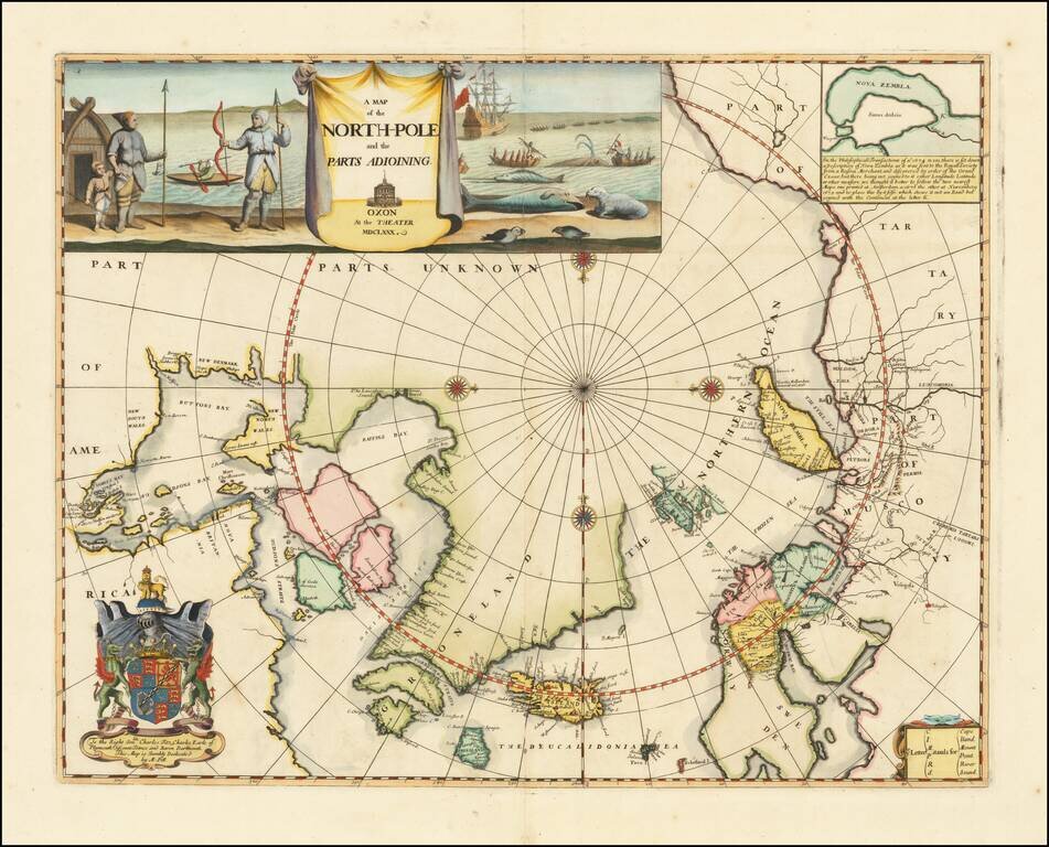
Remarkable Early English Map of the North Polar Regions Fine example of Moses Pitt's original map of the North Pole and surrounding lands. Moses Pitt initially set out to produce an expanded edition of Jansson's Atlas Maior with his partner Jacob Van...
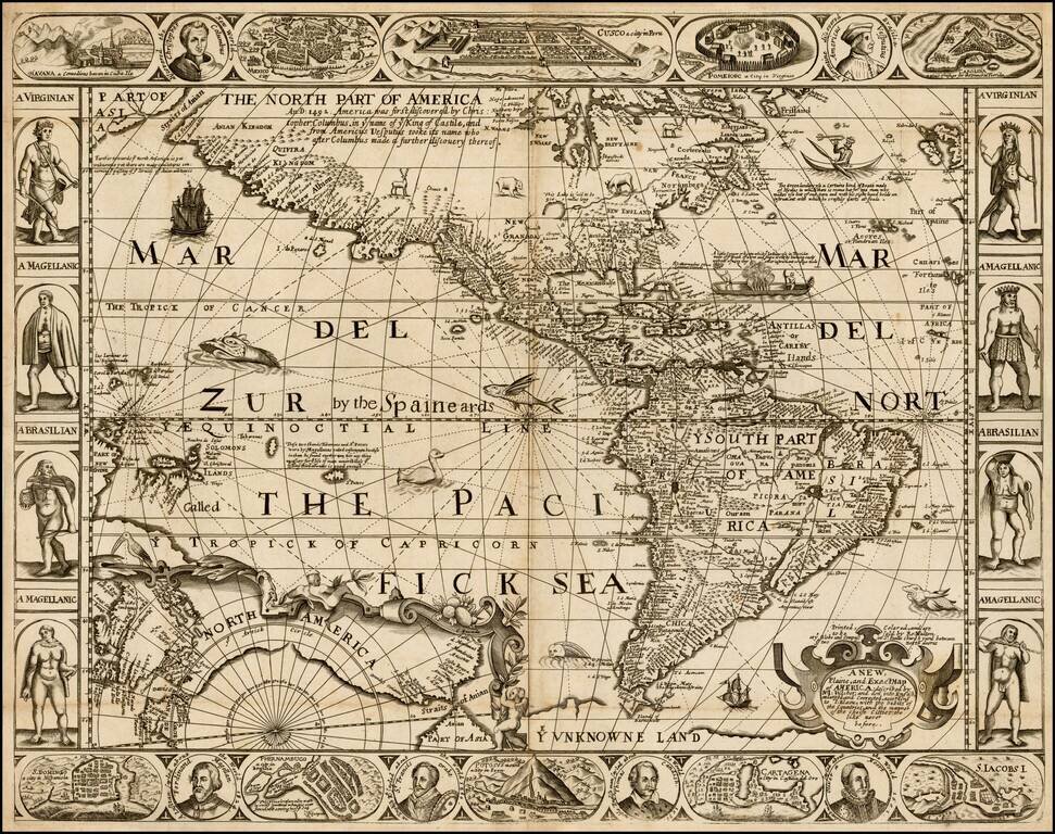
Eye-catching Seventeenth-Century Carte-à-Figure Map of the Americas—An English Rarity Rare, separately-issued English map of the Americas, published in London by Robert Walton. This remarkable map is Walton's version the carte-à-figures style...